Category:Information boards in Cornwall
Jump to navigation
Jump to search
Ceremonial counties of England: Berkshire · Cornwall · Cumbria · Devon · East Riding of Yorkshire · East Sussex · Gloucestershire · Greater London · Hampshire · Isle of Wight · Kent · Norfolk · North Yorkshire · Shropshire · Warwickshire · West Sussex · West Yorkshire ·
City-counties:
Former historic counties:
Other former counties:
City-counties:
Former historic counties:
Other former counties:
Media in category "Information boards in Cornwall"
The following 47 files are in this category, out of 47 total.
-
 Baker's Pit Nature Reserve information board.jpg 3,024 × 4,032; 4.9 MB
-
 Ballowall Barrow Information.jpg 2,799 × 3,732; 3.73 MB
-

-
 Bosigran Smelting Works (23).jpg 2,670 × 3,560; 4.49 MB
-
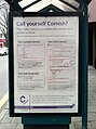 Call yourself Cornish.jpg 517 × 694; 97 KB
-
 Cape Cornwall information board.jpg 3,024 × 4,032; 2.36 MB
-
 Cape Cornwall Information Board.jpg 3,024 × 4,032; 3.03 MB
-
 Chysauster2.jpg 1,600 × 1,092; 619 KB
-
 Cornish Pilot Gig Rowing.jpg 1,308 × 1,745; 617 KB
-
 Creeg Tol notice board.jpg 3,024 × 4,032; 3.83 MB
-
 Degibna Information Board.jpg 3,024 × 4,032; 4.27 MB
-
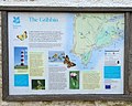
 Entrance to Golitha Woods - geograph.org.uk - 6061.jpg 474 × 544; 87 KB
-
 Entrance to Hustyn Wood - geograph.org.uk - 727593.jpg 640 × 480; 104 KB
-
 Falmouth Docks Information Board.jpg 2,455 × 1,983; 1.2 MB
-
 Gribben Head Information Board.jpg 1,940 × 1,552; 979 KB
-
 Helford Voluntary Marine Conservation Area information board.jpg 2,815 × 2,947; 2.71 MB
-

-
 Information board at Treen - geograph.org.uk - 1241881.jpg 480 × 640; 65 KB
-
 Information boards, St Ives station, Cornwall, July 2023.jpg 4,608 × 3,456; 9.19 MB
-
 Kemyel Crease.jpg 3,536 × 2,150; 2.61 MB
-
 Kenidjack Valley - Water a friend and an enemy.jpg 3,024 × 4,032; 3.05 MB
-
 Kenidjack Valley information.jpg 3,024 × 4,032; 3.46 MB
-
 Mylor Churchtown information board.jpg 3,024 × 4,032; 4.93 MB
-
 Penhale Sands information board.jpg 3,024 × 4,032; 5.48 MB
-
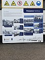 Penzance Harbour.jpg 2,915 × 3,886; 2.57 MB
-
 Penzance Promenade 01.jpg 4,032 × 3,024; 4.4 MB
-
 Penzance Promenade 02.jpg 3,762 × 2,416; 2.18 MB
-
 Penzance Promenade 03.jpg 3,444 × 1,891; 1.58 MB
-
 Penzance Promenade 04.jpg 3,628 × 2,240; 2.2 MB
-
 Penzance Promenade 05.jpg 3,252 × 1,787; 1.45 MB
-
 Penzance Promenade 06.jpg 3,612 × 2,185; 2.1 MB
-
 Penzance Promenade 07.jpg 3,614 × 2,231; 2.25 MB
-
 Perransands - looking west.jpg 3,024 × 4,032; 3.82 MB
-
 Polkerris Lifeboat History.jpg 3,019 × 2,238; 1.81 MB
-
 Porthcurno - footpath map.jpg 2,777 × 3,703; 3.44 MB
-
 Rinsey information board (July 2020).jpg 2,904 × 3,872; 2.19 MB
-
 Rosewall Hill Information Board.jpg 2,718 × 2,765; 3.35 MB
-
 Sancreed Beacon Information Board.jpg 3,024 × 4,032; 3.08 MB
-

-
 St Clement 04.jpg 1,046 × 3,267; 1.34 MB
-
 St Gothian Sands Local Nature Reserve.jpg 2,474 × 1,729; 1.46 MB
-
 St Piran's Church information board.jpg 4,032 × 3,024; 6.01 MB
-
 The Robartes Monument information board, Truro Cathedral, Cornwall - April 2023.jpg 4,083 × 3,062; 1.57 MB
-
 Trebah Beach Information Board.jpg 2,744 × 2,031; 1.61 MB
-
 Trethevy Information Board.jpg 2,704 × 1,947; 1.41 MB
-
 White Downs information board (01).jpg 3,024 × 4,032; 5.47 MB
-
 White Downs information board (02).jpg 3,024 × 4,032; 4.79 MB


.jpg)


.jpg)


.jpg)
.jpg)