Category:Indiana Historical Bureau Historical Marker Program
Jump to navigation
Jump to search
website on historical markers in Indiana maintained by the Indiana Historical Bureau | |||||
| Upload media | |||||
| Instance of | |||||
|---|---|---|---|---|---|
| Main subject | |||||
| Country of origin | |||||
| Publisher |
| ||||
| Language of work or name | |||||
| Operator |
| ||||
| official website | |||||
| |||||
Subcategories
This category has the following 26 subcategories, out of 26 total.
C
E
F
G
- Godfroy Reserve (3 F)
H
I
- Indian Hill, Indiana (4 F)
- Indiana Territory Boundary Line (10 F)
L
N
- Nappanee Cartoonist (3 F)
S
- Sycamore Row (Michigan Rd) (11 F)
Media in category "Indiana Historical Bureau Historical Marker Program"
The following 162 files are in this category, out of 162 total.
-
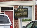 1st Chartered Bank 19-10-16 400.jpg 4,457 × 3,436; 1.39 MB
-
 Abraham S. Fulton historical marker.jpg 6,016 × 4,000; 6.4 MB
-
 Armiesburg historical marker.jpg 640 × 480; 173 KB
-
 Auburn Auto Historic Marker.jpg 214 × 206; 39 KB
-
 Battle of Corydon July 9, 1863 historical marker.jpg 6,016 × 4,000; 7.16 MB
-
 Benton County Courthouse marker.png 1,800 × 1,800; 4.48 MB
-
 Birthplace of Roger D. Branigin.jpg 1,600 × 1,200; 320 KB
-
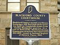
 Blackford County Courthouse Historic Marker.JPG 3,968 × 2,976; 2.93 MB
-
 Brookville Carnegie Library from southwest.jpg 6,016 × 4,000; 6.45 MB
-
 Building over River P4240079.jpg 3,072 × 2,304; 1.57 MB
-
 Building over River P4240080.jpg 3,072 × 2,304; 1.1 MB
-
 Building over River P4240083.jpg 3,072 × 2,304; 1.54 MB
-
 Cairo Skywatch Tower.png 2,000 × 2,650; 8.42 MB
-
 Camp Hughes historical marker near Gosport.jpg 6,016 × 4,000; 6.41 MB
-
 Chief Cornstalk P1300119.jpg 3,072 × 2,304; 4 MB
-
 Chief Cornstalk's Village historical marker.jpg 2,816 × 1,584; 2.19 MB
-
 Corydon united methodist church marker.jpg 2,032 × 1,524; 1 MB
-
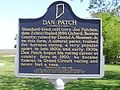 Dan Patch P5160190.jpg 2,048 × 1,536; 695 KB
-
 Dan Patch P5160191.jpg 2,048 × 1,536; 615 KB
-
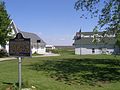 Dan Patch P5160192.jpg 3,072 × 2,304; 1.12 MB
-
 Daniel Voorhees historical marker.png 3,000 × 1,800; 8.64 MB
-
 Dennis Hall historical marker.jpg 2,816 × 2,112; 1.94 MB
-
 Eel River tribe1.jpg 1,792 × 1,200; 341 KB
-
 Embankment 2017-05-17 143.jpg 3,264 × 2,176; 2.95 MB
-
 Embankment 2017-05-17 149.jpg 3,264 × 2,176; 2.77 MB
-
 Englishton Park historical marker.jpg 2,816 × 2,112; 2.43 MB
-
 Esther Test Wallace historical marker.jpg 640 × 480; 170 KB
-
 Evansville YMCA.jpg 2,816 × 2,112; 3.13 MB
-
 Ford and Bridge P4240085.jpg 3,072 × 2,304; 4.65 MB
-
 Freeman's Corner historical marker.jpg 2,816 × 2,112; 2.26 MB
-
 Fremont Indiana historical marker.jpg 2,816 × 2,112; 2.82 MB
-
 Gladiolus historical marker in Goshen.jpg 2,816 × 2,112; 1.9 MB
-
 Grovenour Lock location.JPG 3,072 × 2,304; 1.12 MB
-
 Hannah Toliver historical marker.jpg 2,816 × 2,112; 2.9 MB
-
 Harrison’s Crossing.jpg 3,024 × 4,032; 2.44 MB
-
 Hartsville town square, southeastern corner.jpg 2,816 × 2,112; 1.72 MB
-
 Hartsville town square, southwestern corner.jpg 2,816 × 2,112; 1.68 MB
-
 Hist Marker 19-12-13 161.jpg 4,608 × 3,072; 4.35 MB
-
 Hist Marker 19-12-13 162.jpg 4,608 × 3,072; 3.87 MB
-
 Hist Marker 19-12-13 163.jpg 4,608 × 3,072; 3.72 MB
-
 Hist Marker 3549.jpg 4,608 × 3,072; 5.31 MB
-
 Hist Marker 3551.jpg 4,608 × 3,072; 4.03 MB
-
 Hist Marker 3552.jpg 4,608 × 3,072; 4.6 MB
-
 Hist Marker P6300054.jpg 3,072 × 2,304; 1.5 MB
-
 Hist Marker P6300055.jpg 3,072 × 2,304; 1.43 MB
-
 Hist Marker P6300120.jpg 2,048 × 1,536; 525 KB
-
 Hist Marker P6300122.jpg 2,048 × 1,536; 493 KB
-
 Hist markers 2017-05-17 140.jpg 3,264 × 2,176; 3.19 MB
-
 Historical marker and advertising near Francesville.jpg 2,816 × 2,112; 2 MB
-
 Hst Marker 03-16-2018 056.jpg 3,072 × 4,608; 5.48 MB
-
 Hst Marker 03-16-2018 057.jpg 4,608 × 3,072; 4.79 MB
-
 Hst Marker 03-16-2018 059.jpg 4,608 × 3,072; 4.05 MB
-
 Hst Marker 8243.jpg 4,608 × 3,072; 5.28 MB
-
 Hst Marker 8254.jpg 4,608 × 3,072; 4.31 MB
-
 Hst Marker P6240033.jpg 3,072 × 2,304; 1.57 MB
-
 Hst Marker P6240034.jpg 3,072 × 2,304; 1.42 MB
-
 Hst Marker PB030022.jpg 3,072 × 2,304; 1.12 MB
-
 Hst Marker PB030024.jpg 3,072 × 2,304; 1.11 MB
-
 Indiana Capitol historical marker.jpg 6,016 × 4,000; 5.9 MB
-
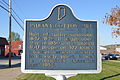 Indiana Cotton Mill historical marker.jpg 6,016 × 4,000; 7.2 MB
-
 Indiana State Prison marker in Clarksville.jpg 2,816 × 1,584; 1.76 MB
-
 Indiana's First Woman's Rights Convention Sign.jpg 1,024 × 408; 354 KB
-
 Indiana's Glacier Lakes historical marker.jpg 2,816 × 2,112; 2.66 MB
-
 Indianapolis Motor Speedway historical marker.png 2,000 × 3,000; 9.71 MB
-
 Irene Dunne 19-10-16 229.jpg 3,072 × 4,608; 3.83 MB
-
 Irene Dunne 19-10-16 230.jpg 4,608 × 3,072; 3.32 MB
-
 Iron Brigade (east) 0386.jpg 4,608 × 3,072; 3.6 MB
-
 Iron Brigade (west) 0384.jpg 4,608 × 3,072; 3.7 MB
-
 Iron Brigade (west) 0385.jpg 4,608 × 3,072; 3.45 MB
-
 Iron Brigade marker P3290001.jpg 3,072 × 2,304; 1.46 MB
-
 Iron Brigade marker P3290002.jpg 3,072 × 2,304; 1.38 MB
-
 James F.D. Lanier historical marker.jpg 6,016 × 4,000; 7.14 MB
-
 John Work House.jpg 2,816 × 2,112; 3.13 MB
-
 Junction of Dixie and Lincoln Highways.jpg 2,816 × 1,584; 1.78 MB
-
 Kilsoquah Headstone Roanoke Indiana Glenwood Cemetery 01.jpg 3,024 × 4,032; 6.18 MB
-
 Kilsoquah Headstone Roanoke Indiana Glenwood Cemetery 02.jpg 3,024 × 4,032; 6.15 MB
-
 Kilsoquah Headstone Roanoke Indiana Glenwood Cemetery 03.jpg 2,928 × 3,858; 5.77 MB
-
 Kilsoquah Historic Sign Roanoke Indiana Glenwood Cemetery 01.jpg 2,432 × 2,758; 2.02 MB
-
 Kilsoquah Historic Sign Roanoke Indiana Glenwood Cemetery 02.jpg 2,963 × 3,024; 3 MB
-
 Kilsoquah Historic Sign Roanoke Indiana Glenwood Cemetery 03.jpg 3,024 × 4,032; 3.7 MB
-
 Kilsoquah Historic Sign Roanoke Indiana Glenwood Cemetery 04.jpg 2,488 × 3,108; 2.74 MB
-
 Levi Coffin Historic home sign.jpg 2,592 × 1,944; 1.16 MB
-
 Levi Coffin House, front and southern side.jpg 2,816 × 2,112; 2.53 MB
-
 Lincoln State Park with historical marker.jpg 6,016 × 4,000; 6.49 MB
-
 Little Cedar Grove Baptist Church historical marker.jpg 2,816 × 2,112; 3.01 MB
-
 Little Syria On The Wabash Indiana Historic Bureau Marker.jpg 3,024 × 4,032; 3.56 MB
-
 Little Wabash River bridge at Huntington.jpg 2,816 × 1,584; 1.87 MB
-
 Location 2282.jpg 3,264 × 2,176; 1.88 MB
-
 Lock location P6240036.jpg 3,072 × 2,304; 1.13 MB
-
 Lock location P6240037.jpg 3,072 × 2,304; 1.49 MB
-
 Lyles Station.jpg 714 × 476; 118 KB
-
 Madison from Wilson in Napoleon.jpg 2,816 × 2,112; 1.34 MB
-
 Mansfield circa 1820 historical marker.jpg 640 × 480; 141 KB
-
 Marengo Academy site.jpg 2,816 × 2,112; 1.55 MB
-
 Memphis IN Jeff Davis Marker.jpg 380 × 427; 50 KB
-
 Mich Rd over Tippecanoe River 2.jpg 5,744 × 1,603; 2.3 MB
-
 Michigan Rd 2017-05-17 136.jpg 3,264 × 2,176; 2.69 MB
-
 Michigan Rd 2017-05-17 137.jpg 3,264 × 2,176; 2.5 MB
-
 Michigan Rd 2017-05-17 138.jpg 3,264 × 2,176; 2.14 MB
-
 Michigan Road 090.jpg 4,608 × 3,072; 4.66 MB
-
 Michigan Road 091.jpg 4,608 × 3,072; 4.35 MB
-
 Michigan Road historical marker near Zionsville.jpg 1,024 × 946; 700 KB
-
 MJ Gen Lew Wallace P4180009.jpg 3,072 × 2,304; 1.45 MB
-
 MJ Gen Lew Wallace P4180010.jpg 2,048 × 1,536; 508 KB
-
 Monon Caboose Monon Indiana.jpg 1,024 × 768; 127 KB
-
 Morgan's Raid historical marker in Lexington.jpg 2,816 × 2,112; 3.86 MB
-
 Morgan's raid marker at Morvin's Landing near Mauckport Indiana in July 2009.JPG 1,338 × 1,362; 245 KB
-
 New Albany Tornado, 1917 historical marker.jpg 6,016 × 4,000; 6.4 MB
-
 New Purchase Boundary (Treaty of St. Mary's) historical marker.jpg 2,816 × 2,112; 2.78 MB
-
 New Purchase historical marker near Fowler.jpg 640 × 480; 144 KB
-
 Old 31 2017-05-17 133.jpg 3,264 × 2,176; 2.25 MB
-
 Papakeechie's Reserve 1979.jpg 4,608 × 3,072; 3.91 MB
-
 Papakeechie's Reserve 1980.jpg 4,608 × 3,072; 3.35 MB
-
 Pigeon Roost Historical marker.JPG 4,288 × 3,216; 2.08 MB
-
 Pigeon Roost IN information.JPG 4,288 × 3,216; 2.01 MB
-
 Pivot Point historical marker.jpg 2,816 × 2,112; 3.31 MB
-
 Pulaski County natural gas marker.png 1,200 × 1,600; 3.53 MB
-
 Rhodes Family Incident historical marker.jpg 2,816 × 2,112; 2.67 MB
-
 Riley Historical Marker - Greenfield.jpg 1,141 × 1,199; 424 KB
-
 Robert H. Milroy 20-10-17 009.jpg 3,072 × 4,608; 5.01 MB
-
 Rockport Tavern site.jpg 6,016 × 4,000; 6.45 MB
-
 ROW - Hist markers 2017-05-17 134.jpg 3,264 × 2,176; 2.71 MB
-
 Scottsburg Carnegie P5230002 Hst Plaque.jpg 800 × 600; 93 KB
-
 Scottsburg Carnegie P5230003 Hst Plaque.jpg 800 × 600; 130 KB
-
 Secrest Ferry Bridge, southern end and western side.jpg 2,816 × 2,112; 3.24 MB
-
 Secrest Ferry Bridge, southern end.jpg 2,112 × 2,816; 2.81 MB
-
 Seventh Street West 930, Banneker School, Bloomington West Side HD.jpg 2,816 × 2,112; 2.69 MB
-
 Site of the battle of Corydon along the old mauckport road.jpg 3,472 × 2,604; 3.39 MB
-
 Southern Indiana Railroad Freighthouse in Seymour, southern side.jpg 2,816 × 1,584; 1.93 MB
-
 State Historic marker (obverse) PB190312.JPG 3,072 × 2,304; 1.51 MB
-
 State Historic marker (reverse) PB190313.JPG 3,072 × 2,304; 1.52 MB
-
 Steel Plant 0367.jpg 4,608 × 3,072; 3.85 MB
-
 Steel Plant 0368.jpg 4,608 × 3,072; 4.28 MB
-
 Steel Plant 0369.jpg 4,608 × 3,072; 3.76 MB
-
 Steel Plant 0370.jpg 4,608 × 3,072; 3.94 MB
-
 Sycamore Row (Deer Creek) P4250227.jpg 3,072 × 2,304; 1.7 MB
-
 Tecumseh Trail historical marker.jpg 2,816 × 2,112; 3.19 MB
-
 Text north 2284.jpg 3,264 × 2,176; 1.9 MB
-
 Text south 2286.jpg 3,264 × 2,176; 1.93 MB
-
 The Propylaeum Historical Marker - 2013 01.jpg 4,000 × 3,000; 2.66 MB
-
 The Propylaeum Historical Marker - 2013 02.jpg 4,000 × 3,000; 2.62 MB
-
 The Propylaeum Historical Marker - 2013 03.jpg 4,000 × 3,000; 2.92 MB
-
 Tippecanoe, Indiana Cemetery Sign.jpg 4,032 × 3,024; 7.59 MB
-
 Towpath Trl- sign P4250250.jpg 3,072 × 2,304; 1.67 MB
-
 Towpath Trl- sign P4250251.jpg 3,072 × 2,304; 1.57 MB
-
 Towpath Trl- sign P4250252.jpg 3,072 × 2,304; 1.68 MB
-
 Towpath Trl- sign P4250253.jpg 3,072 × 2,304; 1.53 MB
-
 Towpath Trl- sign P4250254.jpg 3,072 × 2,304; 1.29 MB
-
 Wabash and Erie Canal historical marker in Montezuma.jpg 640 × 480; 135 KB
-
 Warren Carnegie Library P4020345.jpg 3,072 × 2,304; 1.43 MB
-
 Warren Carnegie Library P4020346.jpg 3,072 × 2,304; 1.62 MB
-
 WC Confrontation 4408.jpg 4,608 × 3,072; 5.98 MB
-
 WC Confrontation 4409.jpg 4,608 × 3,072; 4.92 MB
-
 West Ward School in Gas City.jpg 2,816 × 2,112; 3.58 MB
-
 Western Eagle historical marker.jpg 2,816 × 1,584; 1.88 MB
-
 Whitewater Canal historical marker at Connersville.jpg 2,816 × 2,112; 2.09 MB
-
 Will Cuppy Historical Marker(A).jpg 720 × 960; 282 KB
-
 Will Cuppy Historical Marker(B).jpg 720 × 960; 308 KB
-
 Williamsport, Indiana Marker.png 1,200 × 1,600; 2.89 MB
-
 Worthington central park from west.jpg 2,816 × 1,584; 832 KB
-
 WW 1 Aviation Repair Depot historical marker - June 2022 - Sarah Stierch 01.jpg 4,032 × 3,024; 7.15 MB
-
 WW 1 Aviation Repair Depot historical marker - June 2022 - Sarah Stierch 02.jpg 4,032 × 3,024; 2.66 MB


_0386.jpg)
_0384.jpg)
_0385.jpg)


_historical_marker.jpg)


_PB190312.JPG)
_PB190313.JPG)


_P4250227.jpg)


.jpg)
.jpg)


