Category:Images by Philip Pankhurst
Jump to navigation
Jump to search

Media in category "Images by Philip Pankhurst"
The following 84 files are in this category, out of 84 total.
-
 Alight here for Stanner Rocks (geograph 2497219).jpg 3,456 × 2,592; 3.89 MB
-
 All Saints Brantingham - geograph.org.uk - 652201.jpg 640 × 480; 67 KB
-
 All Saints Church, Brantingham - geograph.org.uk - 652188.jpg 640 × 480; 68 KB
-
 All Saints, Brantingham - geograph.org.uk - 652195.jpg 640 × 480; 72 KB
-
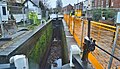 An empty York Street Lock, Stourport - geograph.org.uk - 6369506.jpg 3,575 × 2,053; 2.38 MB
-
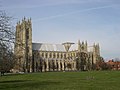 Beverley Minster.jpg 640 × 480; 68 KB
-
 Blossom's Café, York Street Bridge, Stourport - geograph.org.uk - 4730892.jpg 2,062 × 1,289; 1.25 MB
-
 Blossom's Tea Rooms, York Street Lock - geograph.org.uk - 6118193.jpg 3,323 × 2,209; 1.38 MB
-
 Boats at Hull Bridge.jpg 640 × 479; 58 KB
-
 Bridstow St Bridget eastward GeoUK 3319191.jpg 3,323 × 2,414; 1.31 MB
-
 Browns of Heslington - geograph.org.uk - 985258.jpg 640 × 480; 81 KB
-
 Central Hall, York University - geograph.org.uk - 989116.jpg 640 × 284; 34 KB
-
 Central Hall, York University - geograph.org.uk - 989169.jpg 640 × 480; 74 KB
-
 Colwall St James GeoUK 5240985.jpg 3,254 × 2,306; 1.88 MB
-
 Cornwall House, Monnow Street (cropped).jpg 2,334 × 1,892; 850 KB
-
 Cornwall House, Monnow Street (geograph 5488141).jpg 3,268 × 2,080; 1.24 MB
-
 Eardington station, Severn Valley Railway (geograph 2618225).jpg 3,146 × 2,028; 5.3 MB
-
 Glendower House - 2 (geograph 5488183).jpg 3,259 × 2,483; 1.89 MB
-
 Glendower House, Monmouth (geograph 5488180).jpg 2,348 × 3,281; 1.17 MB
-
 Goods Shed, Tetbury branch, GWR (geograph 4815671).jpg 3,459 × 2,103; 1.69 MB
-
 GWR 28xx 2807 passes Hayles Abbey Halt (geograph 5522641).jpg 3,301 × 1,612; 1.42 MB
-
 Hayles Abbey Halt, GWSR (geograph 5522651).jpg 3,248 × 2,160; 1.96 MB
-
 Hayles Abbey Halt, GWSR (geograph 5522655).jpg 3,248 × 2,160; 2.53 MB
-
 Hayles Abbey Halt, GWSR (geograph 5522664).jpg 3,248 × 2,160; 2.17 MB
-
 Hayles Abbey Halt, GWSR (geograph 5522670).jpg 3,248 × 2,160; 2.14 MB
-
 Hayles Abbey Halt, GWSR (geograph 5522676).jpg 3,248 × 2,160; 2.01 MB
-
 Hayles Abbey Halt, GWSR (geograph 5522688).jpg 3,248 × 2,160; 2.12 MB
-
 Heslington Hall - geograph.org.uk - 985242.jpg 640 × 325; 53 KB
-

-
 Holme Lacy Station - geograph.org.uk - 634680.jpg 640 × 480; 138 KB
-
 St Peter's, Howden - geograph.org.uk - 653876.jpg 480 × 640; 70 KB
-
 Kemerton, St Nicholas from NW GeoUK 5844710.jpg 3,323 × 2,209; 1.96 MB
-
 Kemerton, St Nicholas nave + aisles GeoUK 5844726.jpg 3,323 × 2,209; 1.82 MB
-
 Lyonshall railway station - geograph.org.uk - 786177.jpg 640 × 445; 102 KB
-
 Mapledurham St Margaret eastward GeoUK 6127047.jpg 2,818 × 2,605; 1.31 MB
-
 Methodist Chapel, 1837 (geograph 5445975).jpg 2,116 × 3,276; 1.49 MB
-
 Moorhampton caravan site (geograph 2586424).jpg 3,456 × 2,592; 3.87 MB
-
 Moreton on Lugg station and signal box (geograph 3794449).jpg 3,439 × 2,153; 1.55 MB
-
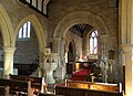
 Much Marcle St Bartolomew chancel GeoUK 5695580.jpg 3,323 × 2,209; 1.66 MB
-
 Narrowboat Osiris at York Street Lock - 2 - geograph.org.uk - 4731407.jpg 2,179 × 1,222; 1.32 MB
-
 Narrowboat Osiris enters York Street lock - geograph.org.uk - 4731358.jpg 2,188 × 1,230; 1.56 MB
-
 Newent Station (geograph 4293695).jpg 5,114 × 3,400; 4.83 MB
-
 Newent Station (geograph 4293719).jpg 5,715 × 3,800; 6.25 MB
-
 North aisle, St Weonards - geograph.org.uk - 4116139.jpg 6,016 × 4,000; 2.38 MB
-
 Odyssey leaves York Street lock, Stourport - geograph.org.uk - 4730915.jpg 1,985 × 1,320; 1.53 MB
-
 Parade House, Monmouth (geograph 5431656).jpg 3,255 × 2,164; 1.43 MB
-

-
 Poplar Street, Poppleton - geograph.org.uk - 4359758.jpg 2,118 × 1,350; 472 KB
-
 Princes's Quay, Kingston upon Hull - geograph.org.uk - 635607.jpg 640 × 497; 67 KB
-
 Remains of Withington station (geograph 6335875).jpg 3,411 × 2,152; 3.29 MB
-
 St Briavels railway station (geograph 5419387).jpg 3,248 × 2,160; 2.24 MB
-
 St Briavels railway station - the goods shed (geograph 5419557).jpg 3,248 × 2,160; 2.25 MB
-
 St George, Woolhope - geograph.org.uk - 3392714.jpg 3,422 × 2,455; 1.64 MB
-
 St Johns, Glendower Street (geograph 5488175).jpg 3,296 × 2,212; 1.62 MB
-
 St Marys Roman Catholic church, Monmouth (geograph 5446211).jpg 2,267 × 3,274; 1.35 MB
-
 St Nicholas, Kemerton (geograph 5846961).jpg 2,275 × 3,226; 2.14 MB
-
 St Peters, Howden - The Minster - geograph.org.uk - 653872.jpg 640 × 491; 79 KB
-
 St Weonard eastward GeoUK 5241241.jpg 3,248 × 2,160; 1.77 MB
-
 Stanner station, New Radnor branch (geograph 2497150).jpg 3,444 × 2,175; 5.8 MB
-
 Sunset at East Clough (geograph 4361149).jpg 2,208 × 1,655; 460 KB
-
 Syntan at Grovehill - geograph.org.uk - 660596.jpg 640 × 480; 56 KB
-
 Tetbury branch GWR goods shed (geograph 4815714).jpg 3,459 × 2,137; 2.04 MB
-
 Tetbury Goods Shed. (geograph 4815705).jpg 3,459 × 2,103; 1.53 MB
-
 The Beck, Beverley - geograph.org.uk - 647536.jpg 640 × 480; 67 KB
-
 The Old Church, Penallt (geograph 5131355).jpg 3,289 × 2,186; 2.03 MB
-
 The Old Dispensary, St James Square (geograph 5435281).jpg 3,278 × 2,317; 1.46 MB
-
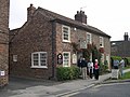
 The Rhydspence Inn - geograph-3996722-by-Philip-Pankhurst.jpg 5,459 × 2,977; 2.89 MB
-
 The site of Tetbury station, GWR (geograph 4815937).jpg 3,446 × 2,291; 3 MB
-

-
 Victoria Pier, Kingston upon Hull - geograph.org.uk - 660593.jpg 640 × 447; 48 KB
-
 Weighbridge hut, former Kingsland railway station (geograph 6340807).jpg 3,480 × 2,109; 2.01 MB
-
 Welshpool & Llanfair Railway, Llanfair Caereinion (geograph 3607874).jpg 2,898 × 2,298; 1.83 MB
-
 Wentworth College, University of York - geograph.org.uk - 989182.jpg 640 × 334; 36 KB
-
 West Bay GWR station (geograph 4100037).jpg 5,037 × 3,428; 2.37 MB
-
 West Bay GWR station (geograph 4100064).jpg 4,795 × 3,155; 2.43 MB
-
 West Bay station (geograph 4100029).jpg 5,153 × 3,365; 2.25 MB
-
 York railway station (geograph 7180593).jpg 2,272 × 1,704; 1.12 MB
-
 York Street bridge, Stourport - geograph.org.uk - 4728785.jpg 2,136 × 1,223; 1.3 MB
-
 York Street Lock - geograph.org.uk - 4730907.jpg 2,032 × 1,269; 1.45 MB
-
 York Street Lock under repair, Stourport - geograph.org.uk - 6369480.jpg 3,323 × 2,209; 1.89 MB
-
 York Street Lock, Stourport - geograph.org.uk - 6118179.jpg 3,621 × 2,027; 1.41 MB
-
 York Street, Stourport - geograph.org.uk - 4731684.jpg 2,365 × 1,572; 1.33 MB
-
 York Street, Stourport - geograph.org.uk - 4731696.jpg 2,030 × 1,340; 3 MB
-
 York Street, Stourport - geograph.org.uk - 4731703.jpg 1,922 × 1,301; 2.47 MB
.jpg)


.jpg)
.jpg)
.jpg)
.jpg)
.jpg)
.jpg)
.jpg)
.jpg)
.jpg)
.jpg)
.jpg)
.jpg)
.jpg)


.jpg)
.jpg)
.jpg)


.jpg)
.jpg)


.jpg)
.jpg)


.jpg)
.jpg)
.jpg)

.jpg)
.jpg)
.jpg)


.jpg)
.jpg)

.jpg)
.jpg)

.jpg)
.jpg)

.jpg)


.jpg)
.jpg)

.jpg)
.jpg)
.jpg)
.jpg)


