Category:Images by Kim Traynor
Jump to navigation
Jump to search

Media in category "Images by Kim Traynor"
The following 200 files are in this category, out of 1,468 total.
(previous page) (next page)-
 'Hutton's Rock', Salisbury Crags.jpg 640 × 480; 84 KB
-
 'Louisfield', Willowbrae Road - geograph.org.uk - 1620458.jpg 640 × 480; 111 KB
-
 16thC doocot, Lochend Park - geograph.org.uk - 1607049.jpg 480 × 640; 59 KB
-

-

-

-
-

-

-

-
-
 17thC tombstone in Greyfriars Kirkyard - geograph.org.uk - 1351602.jpg 1,174 × 1,583; 1.59 MB
-
 18thC gravestone, Eddleston - geograph.org.uk - 1326101.jpg 480 × 640; 129 KB
-
 18thC gravestone, Eddleston - geograph.org.uk - 1342566.jpg 475 × 640; 99 KB
-
 18thC house, Limekilns - geograph.org.uk - 1516198.jpg 640 × 480; 78 KB
-
-
 18thC tomb sculpture, Dalkeith - geograph.org.uk - 1417464.jpg 480 × 640; 104 KB
-

-

-
-
 18thC tombstone, Dalkeith kirkyard - geograph.org.uk - 1417469.jpg 480 × 640; 81 KB
-
 18thC tombstone, Liberton Kirk - geograph.org.uk - 1406420.jpg 480 × 640; 91 KB
-
 18thC tombstone, Liberton Kirk - geograph.org.uk - 1406426.jpg 480 × 640; 97 KB
-
 18thC tombstone, Liberton Kirk - geograph.org.uk - 1406429.jpg 480 × 640; 111 KB
-
 18thC tombstone, Liberton Kirk - geograph.org.uk - 1406437.jpg 480 × 640; 99 KB
-
 18thC tombstone, Restalrig Kirkyard - geograph.org.uk - 1606864.jpg 480 × 640; 85 KB
-
 18thC tombstone, Restalrig Kirkyard - geograph.org.uk - 1606867.jpg 480 × 640; 90 KB
-

-
 19thC tombstones in Greyfriars Kirkyard - geograph.org.uk - 1629009.jpg 640 × 480; 102 KB
-
 Abbey Mount - geograph.org.uk - 1336622.jpg 640 × 480; 71 KB
-
 Abbey Strand buildings - geograph.org.uk - 1336710.jpg 640 × 480; 60 KB
-
 Abbey Strand, Holyrood Palace - geograph.org.uk - 1342576.jpg 640 × 480; 95 KB
-
-
-
 Acheson House windows - geograph.org.uk - 1336801.jpg 640 × 480; 103 KB
-
 Acheson House, Bakehouse Close - geograph.org.uk - 1336797.jpg 480 × 640; 114 KB
-
 Acheson House.jpg 480 × 640; 79 KB
-
 Acupuncture Clinic, Mandela Street - geograph.org.uk - 1561196.jpg 640 × 480; 69 KB
-
 Adam Mausoleum, Greyfriars Kirkyard - geograph.org.uk - 1351679.jpg 471 × 640; 71 KB
-
-
 Advocate's Close doorways - geograph.org.uk - 1338550.jpg 480 × 640; 88 KB
-
 Advocate's Close lintels - geograph.org.uk - 1338562.jpg 640 × 480; 88 KB
-
 Advocate's Close, High Street - geograph.org.uk - 1338547.jpg 480 × 640; 69 KB
-
-
 Albert Memorial, Charlotte Square - geograph.org.uk - 1406223.jpg 480 × 640; 72 KB
-
 Albert Memorial, Charlotte Square - geograph.org.uk - 1406230.jpg 640 × 480; 98 KB
-

-
 Alva Place - geograph.org.uk - 1522381.jpg 640 × 480; 95 KB
-
 Alva Place, Abbeyhill - geograph.org.uk - 1738049.jpg 640 × 480; 80 KB
-
 Ambulance in Home Street, Tollcross - geograph.org.uk - 1322043.jpg 640 × 467; 85 KB
-
 Anchor Close, High Street - geograph.org.uk - 1338592.jpg 480 × 640; 81 KB
-
 Anderson shelter, Shaw's Street - geograph.org.uk - 1537547.jpg 640 × 480; 133 KB
-
 Angel sculpture, Morningside Cemetery - geograph.org.uk - 1462351.jpg 480 × 640; 117 KB
-

-
 Anglican Prayer-Book, Royal Scottish Museum, Chambers Street - geograph.org.uk - 1538547.jpg 1,554 × 1,198; 1.48 MB
-

-
 Anne Street , western end - geograph.org.uk - 1532555.jpg 640 × 480; 85 KB
-

-

-
 Archers' Hall entrance doorway - geograph.org.uk - 1316159.jpg 480 × 640; 79 KB
-
 Archers' Hall, Causewayside - geograph.org.uk - 1316156.jpg 640 × 480; 80 KB
-

-
 Armstrongs window, Clerk Street - geograph.org.uk - 1517996.jpg 640 × 480; 106 KB
-

-

-
 Artisan Bar, London Road - geograph.org.uk - 1725013.jpg 640 × 480; 75 KB
-
 Artisan Bar, London Road - geograph.org.uk - 1725018.jpg 640 × 480; 94 KB
-
 Artisan Bar, London Road - geograph.org.uk - 1725019.jpg 640 × 480; 106 KB
-
 Astronaut's suit - geograph.org.uk - 1341208.jpg 480 × 640; 68 KB
-
 Auld Toll Bar pub sign - geograph.org.uk - 1532567.jpg 480 × 640; 70 KB
-
 Auld Toll, Tollcross - geograph.org.uk - 1316494.jpg 640 × 480; 72 KB
-
 Bakehouse Close, Canongate - geograph.org.uk - 1336784.jpg 480 × 640; 96 KB
-
 Bakehouse Close, Canongate - geograph.org.uk - 1336788.jpg 480 × 640; 97 KB
-
 Bannerman's Bar, Cowgate - geograph.org.uk - 1349917.jpg 640 × 480; 87 KB
-

-
 Bannockburn Monument plaque - geograph.org.uk - 1538086.jpg 480 × 640; 94 KB
-
 Bar notice board, Delancey Street - geograph.org.uk - 1560702.jpg 480 × 640; 77 KB
-
 Barber's pole, Drummond Street - geograph.org.uk - 1352847.jpg 470 × 640; 70 KB
-
 Barber's Shop, Bruntsfield - geograph.org.uk - 1316502.jpg 480 × 640; 95 KB
-
 Barber's shop, Drummond Street - geograph.org.uk - 1352837.jpg 640 × 480; 67 KB
-

-

-
 Barclay Church from Glengyle Terrace - geograph.org.uk - 1419499.jpg 480 × 640; 80 KB
-
 Barclay Church from Leven Street - geograph.org.uk - 1419505.jpg 492 × 640; 63 KB
-

-
 Barclay Church tower - geograph.org.uk - 1419937.jpg 480 × 640; 72 KB
-
 Barclay Place - geograph.org.uk - 1302377.jpg 439 × 640; 64 KB
-
 Barclay Place tenements - geograph.org.uk - 1419509.jpg 640 × 480; 81 KB
-

-
 Battlefield at Bannockburn - geograph.org.uk - 1538216.jpg 640 × 480; 52 KB
-
 Bedlam Theatre, Bristo Place - geograph.org.uk - 1349956.jpg 640 × 496; 69 KB
-
 Beehive Inn, Grassmarket - geograph.org.uk - 1349754.jpg 640 × 497; 113 KB
-
-

-
 Big TV at the Gathering, 2009 - geograph.org.uk - 1416647.jpg 640 × 480; 41 KB
-
 Binns Clock, West End - geograph.org.uk - 1325552.jpg 640 × 480; 51 KB
-
 Binns Clock, West End - geograph.org.uk - 1325556.jpg 480 × 640; 32 KB
-

-
 Bishop's tombstone, Restalrig Kirkyard - geograph.org.uk - 1606876.jpg 480 × 640; 106 KB
-
 Bittern on the Bridge 1 - geograph.org.uk - 2959945.jpg 640 × 480; 52 KB
-
 Black Bull, Calton Road - geograph.org.uk - 1353740.jpg 434 × 640; 82 KB
-
 Black Bull, Leith Street - geograph.org.uk - 1353744.jpg 468 × 640; 72 KB
-
 Black wall in York Place - geograph.org.uk - 2626102.jpg 640 × 463; 51 KB
-
 Black Watch Memorial sculpture - geograph.org.uk - 1343663.jpg 640 × 466; 105 KB
-
 Black Watch Memorial, the Mound - geograph.org.uk - 1343654.jpg 465 × 640; 135 KB
-
 Blackfriars Street doorway - geograph.org.uk - 1339605.jpg 480 × 640; 87 KB
-
 Bollards, Anchor Close - geograph.org.uk - 1530054.jpg 480 × 640; 81 KB
-
 Bonnington old and new - geograph.org.uk - 1315499.jpg 640 × 480; 66 KB
-
 Bonnington Primary School - geograph.org.uk - 1315520.jpg 640 × 480; 86 KB
-
 Borestone, Morningside Road - geograph.org.uk - 1302383.jpg 480 × 640; 111 KB
-
 Boroughmuir High School - geograph.org.uk - 1462519.jpg 480 × 640; 64 KB
-
-

-
-
 Boroughmuir High School, Viewforth - geograph.org.uk - 1462511.jpg 640 × 480; 76 KB
-
 Boroughmuirhead, Bruntsfield - geograph.org.uk - 1462573.jpg 640 × 480; 74 KB
-
 Bothwell House, Bothwell Street - geograph.org.uk - 1522189.jpg 640 × 480; 89 KB
-
 Bothwell Street drying area - geograph.org.uk - 1522197.jpg 480 × 640; 108 KB
-
 Bothwell Street drying area - geograph.org.uk - 1522200.jpg 480 × 640; 104 KB
-
 Bothwell Street tenements - geograph.org.uk - 1522207.jpg 640 × 480; 84 KB
-
 Bothwell Street, off Easter Road - geograph.org.uk - 1522202.jpg 640 × 480; 91 KB
-
 Bowling green, Leith Links - geograph.org.uk - 1537351.jpg 640 × 480; 55 KB
-
 Braid Burn - geograph.org.uk - 1462478.jpg 640 × 480; 139 KB
-
 Braid Burn - geograph.org.uk - 1462496.jpg 640 × 480; 147 KB
-
 Bread Street Lane - geograph.org.uk - 1321558.jpg 480 × 640; 92 KB
-
-
 Bronze cast of Greyfriars Bobby - geograph.org.uk - 1341315.jpg 465 × 640; 50 KB
-
 Bronze sculpture, The Shore - geograph.org.uk - 1537201.jpg 640 × 480; 102 KB
-
 Brown's Place, The Vennel - geograph.org.uk - 1538492.jpg 640 × 480; 105 KB
-
 Bruntsfield Avenue - geograph.org.uk - 1462581.jpg 640 × 480; 80 KB
-
 Bruntsfield House arch - geograph.org.uk - 1738244.jpg 480 × 640; 89 KB
-
 Bruntsfield House arch - geograph.org.uk - 1738247.jpg 640 × 480; 96 KB
-
 Bruntsfield House entrance - geograph.org.uk - 1738254.jpg 640 × 480; 79 KB
-
 Bruntsfield House wall tablets - geograph.org.uk - 1738260.jpg 640 × 480; 97 KB
-
 Bruntsfield House windows - geograph.org.uk - 1738241.jpg 640 × 480; 98 KB
-
 Bruntsfield House, Whitehouse Loan - geograph.org.uk - 1738193.jpg 640 × 480; 79 KB
-
 Bruntsfield House, Whitehouse Loan - geograph.org.uk - 1738216.jpg 640 × 480; 73 KB
-
 Bruntsfield House, Whitehouse Loan - geograph.org.uk - 1738225.jpg 640 × 480; 88 KB
-
 Bruntsfield House, Whitehouse Loan - geograph.org.uk - 1738233.jpg 480 × 640; 87 KB
-
 Bruntsfield House, Whitehouse Loan - geograph.org.uk - 1738236.jpg 640 × 480; 73 KB
-
 Bruntsfield House, Whitehouse Loan - geograph.org.uk - 1738239.jpg 480 × 640; 82 KB
-
 Bruntsfield Links - geograph.org.uk - 1315605.jpg 640 × 480; 55 KB
-
-
-

-
 Buccleuch Place - geograph.org.uk - 1316146.jpg 640 × 480; 71 KB
-

-
 Builder's tablet, Marchmont Street - geograph.org.uk - 1738375.jpg 480 × 640; 77 KB
-

-
 Building site, off Gardeners Crescent - geograph.org.uk - 1342463.jpg 640 × 437; 101 KB
-

-
 Burlington Arcade at night - geograph.org.uk - 1713282.jpg 640 × 480; 78 KB
-
 Burlington Arcade at night - geograph.org.uk - 1713289.jpg 640 × 480; 73 KB
-
 Burn at Ford - geograph.org.uk - 1516456.jpg 480 × 640; 129 KB
-
 Burns Monument, Regent Road - geograph.org.uk - 1516735.jpg 480 × 640; 61 KB
-
 Bus Museum tea room - geograph.org.uk - 1316862.jpg 640 × 430; 56 KB
-

-
 Butchers shop in Marchmont - geograph.org.uk - 1315139.jpg 640 × 499; 87 KB
-
 Bute House, Charlotte Square - geograph.org.uk - 1325869.jpg 640 × 480; 90 KB
-
 Cable car tracks, Waterloo Place - geograph.org.uk - 1516785.jpg 480 × 640; 89 KB
-
 Cable car tracks, Waterloo Place - geograph.org.uk - 1516788.jpg 480 × 640; 101 KB
-
 Caledonia Works - geograph.org.uk - 1326067.jpg 571 × 602; 78 KB
-
 Caledonian Hotel from Rutland Street - geograph.org.uk - 1321743.jpg 480 × 640; 88 KB
-
 Caledonian Station entrance - geograph.org.uk - 1321726.jpg 640 × 480; 83 KB
-
 Camden estate agent's office - geograph.org.uk - 1560694.jpg 640 × 480; 90 KB
-
 Camden High Street - geograph.org.uk - 1560691.jpg 640 × 480; 107 KB
-
 Camden High Street south end - geograph.org.uk - 1712852.jpg 640 × 480; 79 KB
-
 Camden Lock - geograph.org.uk - 1712675.jpg 640 × 480; 70 KB
-
 Camden Lock - geograph.org.uk - 1712699.jpg 640 × 480; 71 KB
-
 Camden Lock lion - geograph.org.uk - 1712692.jpg 640 × 480; 103 KB
-
 Camden Lock lion head - geograph.org.uk - 1712696.jpg 480 × 640; 81 KB
-
 Camden Market - geograph.org.uk - 1712701.jpg 640 × 480; 88 KB
-
 Camden Market - geograph.org.uk - 1712704.jpg 640 × 480; 104 KB
-
 Camden Market mannekin - geograph.org.uk - 1712708.jpg 480 × 640; 89 KB
-
 Camden Stables horse ramp - geograph.org.uk - 1712717.jpg 640 × 480; 114 KB
-
 Camden Stables horse ramp - geograph.org.uk - 1712719.jpg 480 × 640; 94 KB
-
 Camden Stables No. 853 - geograph.org.uk - 1712729.jpg 640 × 480; 103 KB
-
 Canal lock at Camden - geograph.org.uk - 1712671.jpg 640 × 480; 85 KB
-
 Candlemaker Row - geograph.org.uk - 1402180.jpg 640 × 480; 101 KB
-
 Candlemakers Hall from Greyfriars - geograph.org.uk - 1629038.jpg 640 × 480; 89 KB
-
 Candlemakers Hall, Candlemakers Row - geograph.org.uk - 1629032.jpg 640 × 480; 82 KB
-
 Canning Street Lane - geograph.org.uk - 1321796.jpg 640 × 510; 68 KB
-
 Canning Street Lane - geograph.org.uk - 1321805.jpg 640 × 480; 67 KB
-
 Canongate coach and horses - geograph.org.uk - 1339858.jpg 640 × 457; 67 KB
-
 Canongate Kirk - geograph.org.uk - 1336760.jpg 480 × 640; 95 KB
-
 Canongate Kirk pews - geograph.org.uk - 1344066.jpg 640 × 480; 53 KB
-
 Canongate Manse - geograph.org.uk - 1336727.jpg 640 × 480; 73 KB
-
 Canongate Mercat Cross - geograph.org.uk - 1336753.jpg 480 × 640; 113 KB
-
 Canongate Tolbooth - geograph.org.uk - 1336771.jpg 640 × 486; 85 KB
-
 Canongate Tolbooth clock - geograph.org.uk - 1339785.jpg 480 × 640; 77 KB
-
 Canongate Tolbooth windows - geograph.org.uk - 1336778.jpg 640 × 480; 72 KB
-
 Canongate War Memorial - geograph.org.uk - 1336927.jpg 640 × 480; 101 KB
-
 Car in Clockmill Lane - geograph.org.uk - 1725152.jpg 480 × 640; 78 KB
-
 Car transporter, London Road - geograph.org.uk - 1725010.jpg 640 × 480; 59 KB
-

-

-
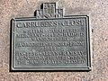 Carruber's Close plaque, High Street - geograph.org.uk - 1529899.jpg 640 × 480; 120 KB
-
 Castle from Johnston Terrace - geograph.org.uk - 1347939.jpg 640 × 480; 94 KB
-
 Castle from King's Stables Road - geograph.org.uk - 1777100.jpg 640 × 480; 113 KB
-
 Castle from King's Stables Road - geograph.org.uk - 1777103.jpg 640 × 480; 100 KB


