Category:Images by James T M Towill
Jump to navigation
Jump to search

Media in category "Images by James T M Towill"
The following 200 files are in this category, out of 487 total.
(previous page) (next page)-
 'Arthur' Dish - geograph.org.uk - 1241465.jpg 427 × 640; 45 KB
-
 'Freshwater Shark' Remains - geograph.org.uk - 1397974.jpg 480 × 640; 123 KB
-

-
 'No Rubbish' Indeed - geograph.org.uk - 1397919.jpg 640 × 480; 95 KB
-
 275 kV Forth Crossing - geograph.org.uk - 1717154.jpg 480 × 640; 27 KB
-
 275 kV Forth Crossing - North Pylon - geograph.org.uk - 1717177.jpg 480 × 640; 53 KB
-

-
 A Loch Venachar Autumn Afternoon - geograph.org.uk - 1401414.jpg 480 × 640; 95 KB
-
 A Tangle Of Branches - geograph.org.uk - 1577482.jpg 640 × 480; 147 KB
-
 A380 At Edinburgh Airport - geograph.org.uk - 1477858.jpg 640 × 480; 34 KB
-

-

-
 Abington ROC Post - geograph.org.uk - 1363604.jpg 640 × 480; 97 KB
-
 Access Road To Barshill Farm - geograph.org.uk - 1703968.jpg 640 × 480; 66 KB
-
 Access Track Near High Townhead - geograph.org.uk - 1704023.jpg 640 × 480; 118 KB
-
 Adult Oystercatcher and chick - geograph.org.uk - 1343478.jpg 640 × 480; 106 KB
-
 Ailsa Craig Helipad - geograph.org.uk - 1375610.jpg 640 × 480; 94 KB
-
 Ailsa Craig Lighthouse - geograph.org.uk - 1363818.jpg 640 × 480; 41 KB
-

-
 Ailsa Craig Nature Reserve - geograph.org.uk - 1363831.jpg 640 × 480; 80 KB
-
 Ailsa Craig North Foghorn - geograph.org.uk - 1375456.jpg 480 × 640; 98 KB
-
 Ailsa Craig South Foghorn - geograph.org.uk - 1363628.jpg 640 × 480; 93 KB
-
 Ailsa Craig Summit - geograph.org.uk - 1363796.jpg 640 × 480; 55 KB
-
 Ailsa Craig Summit - geograph.org.uk - 1363806.jpg 640 × 480; 70 KB
-
 Allershaw Burn And Daer Pipeline - geograph.org.uk - 1691687.jpg 640 × 480; 85 KB
-
 Allison Avenue, Bargarran, Erskine - geograph.org.uk - 1978266.jpg 1,200 × 1,600; 512 KB
-
 Alloa From The Air - geograph.org.uk - 1440457.jpg 473 × 487; 46 KB
-
 Allt Tolaghan - geograph.org.uk - 1577587.jpg 640 × 480; 58 KB
-

-

-

-

-

-
 Anti-Tank Blocks, Aberlady Bay - geograph.org.uk - 1582180.jpg 480 × 640; 84 KB
-
 Ashkirk ROC Post - geograph.org.uk - 1385386.jpg 640 × 480; 134 KB
-
 Awe Barrage - geograph.org.uk - 1241572.jpg 640 × 427; 77 KB
-
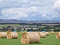 Bales And Turbines - geograph.org.uk - 1444512.jpg 640 × 480; 70 KB
-
 Baling Silage in Glen Dochart - geograph.org.uk - 1399346.jpg 640 × 427; 76 KB
-
 Baling straw - geograph.org.uk - 1241316.jpg 640 × 427; 81 KB
-
 Ballantrae ROC Post - geograph.org.uk - 1363589.jpg 480 × 640; 71 KB
-
 Ballevoulin Farm - geograph.org.uk - 1535730.jpg 640 × 480; 72 KB
-
 Ballo Reservoir - geograph.org.uk - 1496070.jpg 640 × 480; 59 KB
-
 Barley at Powfoot - geograph.org.uk - 1410627.jpg 640 × 480; 80 KB
-
 Barley Harvest - geograph.org.uk - 1241136.jpg 640 × 480; 121 KB
-
 Barley Under Thunder Clouds - geograph.org.uk - 1354060.jpg 640 × 480; 58 KB
-
 Beattock Summit - geograph.org.uk - 1691603.jpg 640 × 480; 123 KB
-
 Beech Boundary - geograph.org.uk - 1706550.jpg 480 × 640; 115 KB
-
 Beech Shadows - geograph.org.uk - 1691532.jpg 480 × 640; 81 KB
-
 Beech Woodland - geograph.org.uk - 1703955.jpg 480 × 640; 105 KB
-
 Beeches Near Watch Water Reservoir - geograph.org.uk - 1601050.jpg 640 × 480; 88 KB
-
 Beinn a' Chaisteil - geograph.org.uk - 1577532.jpg 640 × 480; 77 KB
-
 Beinn Dorain - geograph.org.uk - 1577544.jpg 480 × 640; 70 KB
-
 Beinn Odhar - geograph.org.uk - 1577563.jpg 640 × 480; 95 KB
-
 Bennan Moss - geograph.org.uk - 1401021.jpg 640 × 480; 47 KB
-
 Bentpath ROC Post - geograph.org.uk - 1410559.jpg 640 × 480; 99 KB
-
 Black Hill Transmitter - geograph.org.uk - 1241453.jpg 480 × 640; 47 KB
-
 Blustery Day At Loch Skeen - geograph.org.uk - 1398083.jpg 640 × 427; 71 KB
-
 Bluther Burn - geograph.org.uk - 1401523.jpg 480 × 640; 158 KB
-

-

-
-
 Boreland ROC Post - geograph.org.uk - 1407874.jpg 480 × 640; 89 KB
-
 Boundary Stone On The Scots' Dike - geograph.org.uk - 1707306.jpg 640 × 480; 162 KB
-
 Bridge Over The River Clyde - geograph.org.uk - 1632064.jpg 480 × 640; 47 KB
-
-
 Bulldozer Remains at Ailsa Craig Quarry - geograph.org.uk - 1375407.jpg 640 × 480; 104 KB
-
 Burn Near Quarry Park - geograph.org.uk - 1410624.jpg 480 × 640; 137 KB
-
 Canonbie ROC Post - geograph.org.uk - 1407890.jpg 480 × 640; 147 KB
-
 Cart Water-River Clyde Confluence - geograph.org.uk - 1432350.jpg 640 × 480; 63 KB
-
 Carter Bar View - geograph.org.uk - 1628766.jpg 640 × 480; 69 KB
-
 Castlehill Reservoir - geograph.org.uk - 1630912.jpg 640 × 480; 64 KB
-

-
-

-
 Catcleugh Reservoir - geograph.org.uk - 1628727.jpg 640 × 480; 92 KB
-
 Catcleugh Reservoir - geograph.org.uk - 1628740.jpg 640 × 480; 109 KB
-
-
 Chimney Breast, Station Masters House (geograph 3746756).jpg 3,448 × 4,592; 3.63 MB
-
 Chopping grass for silage - geograph.org.uk - 1241307.jpg 640 × 427; 95 KB
-
 Chopping Grass for Silage - geograph.org.uk - 1343401.jpg 640 × 480; 96 KB
-
 Christmas Eve At Glenbuck Loch - geograph.org.uk - 1399535.jpg 640 × 480; 35 KB
-

-

-

-

-
 Claas And Cambridge Rollers - geograph.org.uk - 1548253.jpg 640 × 480; 78 KB
-
-
 Claas Markant Baler - geograph.org.uk - 1398049.jpg 640 × 427; 105 KB
-
 Clackmannanshire Bridge - geograph.org.uk - 1717058.jpg 640 × 480; 47 KB
-
-
-
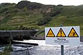
 Clackmannanshire Bridge Signage - geograph.org.uk - 1717106.jpg 640 × 480; 54 KB
-
 Coastal Scenery Near Dowlaw - geograph.org.uk - 1399609.jpg 640 × 480; 76 KB
-
 Coire Leitir-achain - geograph.org.uk - 1639658.jpg 480 × 640; 53 KB
-
-
 Combining Beans - geograph.org.uk - 1509143.jpg 640 × 480; 77 KB
-
 Combining Near Ashentree Farm - geograph.org.uk - 1444472.jpg 640 × 480; 90 KB
-
 Connel Bridge - A View From Downstream - geograph.org.uk - 1763329.jpg 640 × 480; 146 KB
-
 Connel Bridge - A View From Upstream - geograph.org.uk - 1763308.jpg 640 × 480; 83 KB
-
-
 Country Lane At Bankhead Of Tinwald - geograph.org.uk - 1703928.jpg 640 × 480; 120 KB
-
 Country Lane Junction - geograph.org.uk - 1703934.jpg 640 × 480; 69 KB
-
 Covered Reservoir At Ednam - geograph.org.uk - 1547239.jpg 640 × 480; 86 KB
-
 Covered Reservoir On Bauchle Hill - geograph.org.uk - 1410616.jpg 480 × 640; 123 KB
-
 Craig and The Esk Valley - geograph.org.uk - 1410618.jpg 640 × 480; 66 KB
-
-
 Creagan Station (geograph 6216706).jpg 1,600 × 1,200; 683 KB
-
 Cruachan Reservoir Inlet Conduit - geograph.org.uk - 1399335.jpg 427 × 640; 84 KB
-
 Cumbrian Stubble - geograph.org.uk - 1538369.jpg 640 × 480; 87 KB
-
 Cummertrees ROC Post - geograph.org.uk - 1410565.jpg 640 × 480; 101 KB
-
 Cummertrees Village - geograph.org.uk - 1410576.jpg 640 × 480; 76 KB
-
 Cutting Hay - geograph.org.uk - 1444484.jpg 640 × 480; 86 KB
-
 Daer Pipelines - geograph.org.uk - 1691679.jpg 640 × 480; 94 KB
-
 Daer Reservoir Spillway - geograph.org.uk - 1398542.jpg 640 × 427; 49 KB
-
 Daer Water - geograph.org.uk - 1691627.jpg 640 × 480; 67 KB
-
 Daer Water Treatment Works - geograph.org.uk - 1398550.jpg 640 × 427; 54 KB
-
 Dalswinton Mission Church - geograph.org.uk - 1295069.jpg 480 × 640; 111 KB
-
 Deer Shooting Chair - geograph.org.uk - 1706542.jpg 480 × 640; 143 KB
-
 Desolate Mountainscape - geograph.org.uk - 1391038.jpg 640 × 427; 57 KB
-
 Detail Of The Falls Of Lora - geograph.org.uk - 1763351.jpg 640 × 480; 103 KB
-
 Drainage Ditch Near Scots' Dike - geograph.org.uk - 1706559.jpg 480 × 640; 121 KB
-
 Drainage Ditch Near Water Of Ae - geograph.org.uk - 1703916.jpg 480 × 640; 92 KB
-
 Drainage Plough - geograph.org.uk - 1398037.jpg 640 × 480; 64 KB
-
 Drilled Arable Land - geograph.org.uk - 1542486.jpg 640 × 480; 88 KB
-
 Drilling at Balgownie Mains - geograph.org.uk - 1241353.jpg 640 × 480; 103 KB
-
 Drizzly Dowlaw - geograph.org.uk - 1601010.jpg 640 × 480; 43 KB
-
 Drystane Wall Junction On Rorie Hill - geograph.org.uk - 1703992.jpg 640 × 480; 92 KB
-
 Dusk At Muir Park Reservoir - geograph.org.uk - 1398359.jpg 640 × 427; 27 KB
-
 Dusk On Aylesbeare Common - geograph.org.uk - 1390590.jpg 640 × 427; 35 KB
-
 Dusk Over East Loch Lomondside - geograph.org.uk - 1398371.jpg 640 × 427; 28 KB
-
 Early Morning On Aylesbeare Common - geograph.org.uk - 1390582.jpg 640 × 427; 68 KB
-

-
-
 East Kilpatrick Braes Woodland - geograph.org.uk - 1405534.jpg 386 × 640; 79 KB
-
-
 Eastroundel Wood - geograph.org.uk - 1542460.jpg 640 × 480; 61 KB
-
 Ednam Village - geograph.org.uk - 1547236.jpg 640 × 480; 61 KB
-
 End of the Road (Geograph 3592091) by James T M Towill (XAM-E1).jpg 3,448 × 4,592; 4.5 MB
-
 Endrick Water, Loch Lomond NNR - geograph.org.uk - 1398500.jpg 640 × 480; 52 KB
-

-
 Erskine Harbour - geograph.org.uk - 1432384.jpg 640 × 480; 60 KB
-

-
 Eskdalemuir ROC Post - geograph.org.uk - 1407852.jpg 480 × 640; 126 KB
-
 Explosives Container - geograph.org.uk - 1363654.jpg 480 × 640; 129 KB
-
 Falls Of Lora - geograph.org.uk - 1763316.jpg 640 × 480; 73 KB
-
 Falls Of Lora From Connel Bridge - geograph.org.uk - 1763343.jpg 640 × 480; 87 KB
-
 Farmland Near Folly Loch - geograph.org.uk - 1635010.jpg 640 × 480; 58 KB
-
 Farmland Near Longhaugh Point - geograph.org.uk - 1432546.jpg 640 × 480; 61 KB
-
 Faslane MOD Base - geograph.org.uk - 1535738.jpg 640 × 480; 42 KB
-
 Field Boundaries Near Eastfield Farm - geograph.org.uk - 1632054.jpg 640 × 480; 77 KB
-
 Field Boundary Near Muirhouselaw Wood - geograph.org.uk - 1542477.jpg 640 × 480; 116 KB
-
 Field Boundary On Rorie Hill - geograph.org.uk - 1704004.jpg 480 × 640; 93 KB
-
 Field Entrance - geograph.org.uk - 1542498.jpg 480 × 640; 129 KB
-
 Field Entrance Near Mains Of Burnbank - geograph.org.uk - 1636414.jpg 640 × 480; 107 KB
-
 Fish Farming on Loch Awe - geograph.org.uk - 1399330.jpg 640 × 427; 79 KB
-
 Flood Damage Near Elshieshields - geograph.org.uk - 1704460.jpg 640 × 480; 77 KB
-
 Flourishwalls Plantation - geograph.org.uk - 1555610.jpg 640 × 480; 123 KB
-
 Fodder Beet harvesting - geograph.org.uk - 1241327.jpg 640 × 480; 84 KB
-
 Fog Lifting From Talla Reservoir - geograph.org.uk - 1401443.jpg 640 × 480; 24 KB
-
 Foggy Fields - geograph.org.uk - 1401424.jpg 640 × 480; 68 KB
-
 Foggy Forests - geograph.org.uk - 1401450.jpg 640 × 480; 27 KB
-
 Forager close-up - geograph.org.uk - 1343413.jpg 640 × 480; 96 KB
-

-
 Forestry Near Loch Goil - geograph.org.uk - 1398007.jpg 640 × 480; 102 KB
-
 Former Gasworks, Ailsa Craig - geograph.org.uk - 1363669.jpg 640 × 480; 98 KB
-
 Former Route Of The East Coast Main Line, Penmanshiel - geograph.org.uk - 3803208.jpg 3,448 × 4,592; 3.81 MB
-
 Forth Embankment - geograph.org.uk - 1398383.jpg 640 × 427; 73 KB
-
 Galashiels In The Snow - geograph.org.uk - 1628662.jpg 640 × 480; 75 KB
-
 Game Cover Copse - geograph.org.uk - 1704466.jpg 640 × 480; 93 KB
-
 Garraloo, Ailsa Craig - geograph.org.uk - 1363783.jpg 640 × 480; 68 KB
-
 Garshake Reservoir - Drained - geograph.org.uk - 1404806.jpg 640 × 280; 45 KB
-
 Gas Tanks on Ailsa Craig - geograph.org.uk - 1375623.jpg 640 × 480; 72 KB
-
 Gasometer Remains, Ailsa Craig - geograph.org.uk - 1363702.jpg 640 × 480; 93 KB
-
 Gateshead In The Snow - geograph.org.uk - 1628700.jpg 640 × 480; 68 KB
-
 Girvan ROC Post - geograph.org.uk - 1363591.jpg 640 × 480; 105 KB
-
 Gleann Ach'-Innis Chailein - geograph.org.uk - 1577515.jpg 640 × 480; 67 KB
-
 Glen Croe - geograph.org.uk - 1639678.jpg 640 × 480; 76 KB
-
 Glen Eagles - geograph.org.uk - 1577429.jpg 640 × 480; 81 KB
-
 Glen Fruin in Autumn - geograph.org.uk - 1535724.jpg 640 × 480; 63 KB
-
 Going Round The Bend - geograph.org.uk - 1536862.jpg 640 × 480; 75 KB
-
 Goodie Water - Downstream View - geograph.org.uk - 1636441.jpg 640 × 480; 102 KB
-
 Goodie Water - Upstream View - geograph.org.uk - 1636447.jpg 480 × 640; 65 KB
-
 Goodie Water And Earland Farm - geograph.org.uk - 1636457.jpg 640 × 480; 64 KB
-
 Gordon ROC Post - geograph.org.uk - 1756468.jpg 640 × 480; 77 KB
-
 GPO Telegraph Pole at Bentpath ROC Post - geograph.org.uk - 1410568.jpg 480 × 640; 152 KB
-
 Grassland Near Longhaugh Point - geograph.org.uk - 1432563.jpg 640 × 480; 93 KB
-
 Grazings At Ramshope Farm - geograph.org.uk - 1628751.jpg 640 × 480; 65 KB
-
 Greenlaw Moor - geograph.org.uk - 1551217.jpg 640 × 480; 78 KB
-
 Greenlaw Moor - geograph.org.uk - 1551228.jpg 640 × 480; 88 KB
-

-
 Gritting the A823 - geograph.org.uk - 1399554.jpg 640 × 480; 49 KB
-
 Habitat Management On Aird Meadow - geograph.org.uk - 1398402.jpg 640 × 418; 101 KB
-
-
 Haw Craig Looking Down^ - geograph.org.uk - 1404804.jpg 402 × 640; 167 KB
-
 Hay Lining - geograph.org.uk - 1444481.jpg 640 × 480; 103 KB
-
 Hay Lining Beside Poldar Moss - geograph.org.uk - 1444495.jpg 640 × 480; 98 KB
-
 Hay Turner At Rest - geograph.org.uk - 1444474.jpg 480 × 640; 108 KB
-
 Hay Turning - geograph.org.uk - 1444478.jpg 640 × 480; 98 KB
-
 Hemlock Water Dropwort - geograph.org.uk - 1343454.jpg 480 × 640; 148 KB
-
 Hendersyde Farm - geograph.org.uk - 1547243.jpg 640 × 480; 69 KB


_And_Steven%27s_Croft_Biomass_Power_Station_-_geograph.org.uk_-_1538074.jpg)


_Stand_-_geograph.org.uk_-_1412863.jpg)


.jpg)


.jpg)


_by_James_T_M_Towill_(XAM-E1).jpg)


