Category:Images by G Laird
Jump to navigation
Jump to search

Media in category "Images by G Laird"
The following 200 files are in this category, out of 798 total.
(previous page) (next page)-
 'Old' Larkhall Academy - geograph.org.uk - 1372274.jpg 640 × 480; 90 KB
-
 'Switchback' on the A68 - geograph.org.uk - 1409562.jpg 640 × 480; 101 KB
-
 2 Leaning Trees on Turnhouse Hill - geograph.org.uk - 1429641.jpg 640 × 480; 121 KB
-

-
 20 mph All Lines - geograph.org.uk - 903530.jpg 640 × 480; 126 KB
-
 A 702 Trunk Road - geograph.org.uk - 943018.jpg 640 × 480; 62 KB
-
 A 71 - geograph.org.uk - 906634.jpg 640 × 480; 84 KB
-
 A 723 - geograph.org.uk - 900917.jpg 640 × 480; 69 KB
-

-
-
 A68 south of Ridsdale - geograph.org.uk - 1409544.jpg 640 × 480; 85 KB
-
 A719 Coast Road at Dunure - geograph.org.uk - 1312808.jpg 640 × 480; 73 KB
-
 A72 at Five Mile Bridge - geograph.org.uk - 1041950.jpg 640 × 480; 88 KB
-
 A721 at Bogside - geograph.org.uk - 1712305.jpg 640 × 480; 58 KB
-
 A73 - A71 Road Junction - geograph.org.uk - 1712368.jpg 640 × 480; 79 KB
-
 A73 North of Carluke - geograph.org.uk - 1712155.jpg 640 × 480; 77 KB
-
 A73, approaching Bogside - geograph.org.uk - 1712274.jpg 640 × 480; 73 KB
-
 A739 North of the Clyde Tunnel - geograph.org.uk - 1281397.jpg 640 × 480; 75 KB
-
 A752 - A8 Road Junction - geograph.org.uk - 1775802.jpg 4,000 × 3,000; 3.36 MB
-
 A85 east of Crianlarich - geograph.org.uk - 1542387.jpg 640 × 480; 95 KB
-
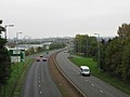
 A90 (Queensferry Road) - geograph.org.uk - 1400534.jpg 640 × 480; 88 KB
-
 Abington Motorway Services - geograph.org.uk - 1402777.jpg 640 × 480; 74 KB
-
 Aiseag Rinn Friù 1279910.jpg 640 × 480; 76 KB
-
 Albert Street, Longtown (A6071) - geograph.org.uk - 1414044.jpg 640 × 480; 78 KB
-
 Alexander Hamilton Memorial Park - geograph.org.uk - 1801375.jpg 4,000 × 3,000; 4 MB
-
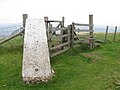 Allermuir Hill Trig Point - geograph.org.uk - 943175.jpg 640 × 480; 83 KB
-
 Applecross Street Basin - geograph.org.uk - 1203565.jpg 640 × 480; 81 KB
-

-

-
 Approaching the summit of Ben Lomond - geograph.org.uk - 1320399.jpg 640 × 480; 77 KB
-

-

-
 Approaching Waterloo along the A71 - geograph.org.uk - 1712405.jpg 640 × 480; 74 KB
-

-
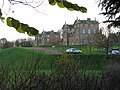
 Ardvorlich House - geograph.org.uk - 1395713.jpg 640 × 480; 109 KB
-
 Arthur's Seat - geograph.org.uk - 925018.jpg 640 × 480; 104 KB
-

-
 Ascent of Stùc a' Chroin - geograph.org.uk - 1395802.jpg 640 × 480; 104 KB
-
 Auchincruive Holdings - geograph.org.uk - 1295054.jpg 640 × 480; 61 KB
-
 Auchineden Hill Trig Point - geograph.org.uk - 956041.jpg 640 × 480; 73 KB
-
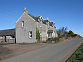 Auchnotroch Farmhouse - geograph.org.uk - 1235478.jpg 640 × 480; 58 KB
-
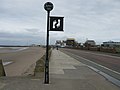 Ayr Esplanade - geograph.org.uk - 1122365.jpg 640 × 480; 45 KB
-
 Ayr Harbour Entrance - geograph.org.uk - 935305.jpg 640 × 480; 62 KB
-
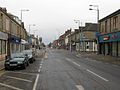
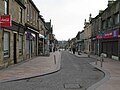
 Ayr High Street - geograph.org.uk - 935367.jpg 640 × 480; 95 KB
-
 Ayr Race Course - geograph.org.uk - 936857.jpg 640 × 480; 73 KB
-
 Ayr Sea Front (North of Ayr Harbour) - geograph.org.uk - 1112665.jpg 640 × 480; 67 KB
-
 B 797 - geograph.org.uk - 910409.jpg 640 × 480; 91 KB
-
 B7029 where it passes Dalziel Park - geograph.org.uk - 1276222.jpg 640 × 480; 81 KB
-
 B924 Bridge over the A90 - geograph.org.uk - 1305523.jpg 640 × 480; 90 KB
-
 Baillieston Interchange - geograph.org.uk - 1775652.jpg 640 × 480; 80 KB
-
 Baillieston Railway Station - geograph.org.uk - 1775502.jpg 640 × 480; 97 KB
-
 Ballo Reservoir from Balgothrie - geograph.org.uk - 1368916.jpg 640 × 480; 64 KB
-
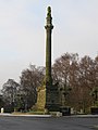 Battlefield Monument - geograph.org.uk - 1098221.jpg 480 × 640; 57 KB
-
 Bavelaw Castle Gates - geograph.org.uk - 1426977.jpg 640 × 480; 141 KB
-
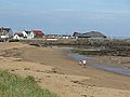 Beach at North Berwick - geograph.org.uk - 1327937.jpg 640 × 480; 65 KB
-
 Bealach-eadar-dha Beinn. - geograph.org.uk - 1542684.jpg 640 × 480; 86 KB
-
 Bells Bridge over the River Clyde - geograph.org.uk - 1431851.jpg 640 × 480; 73 KB
-
 Bellshill Bypass (A725) - geograph.org.uk - 1541795.jpg 640 × 480; 54 KB
-
 Bellshill Main Street.jpg 640 × 480; 91 KB
-
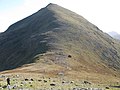
 Ben Cleuch - geograph.org.uk - 971645.jpg 640 × 480; 87 KB
-
 Ben More Trig Point - geograph.org.uk - 1542677.jpg 640 × 480; 70 KB
-
 Ben Vorlich Trig Point - geograph.org.uk - 1395804.jpg 640 × 480; 75 KB
-
-
 Bend on the River Ayr - geograph.org.uk - 1294650.jpg 640 × 480; 130 KB
-
 Bend on the River Clyde - geograph.org.uk - 1164249.jpg 640 × 480; 88 KB
-
 Bend on the River Clyde - geograph.org.uk - 1210111.jpg 640 × 480; 97 KB
-
 Bend on the South Calder Water - geograph.org.uk - 1253678.jpg 640 × 480; 136 KB
-
 Benmore Glen - geograph.org.uk - 1542575.jpg 640 × 480; 82 KB
-
 Bennan Hill - geograph.org.uk - 1392697.jpg 640 × 480; 61 KB
-
 Between Minch Moor and Hare Law - geograph.org.uk - 1282930.jpg 640 × 480; 96 KB
-
-
 Birkenshaw Trading Estate - geograph.org.uk - 1775864.jpg 640 × 480; 91 KB
-
 Black Hill Trig Point - geograph.org.uk - 906760.jpg 640 × 480; 116 KB
-
 Blackford Hill Trig Point - geograph.org.uk - 1025272.jpg 640 × 480; 82 KB
-
 Blantyre Industrial Estate - geograph.org.uk - 1719294.jpg 640 × 480; 62 KB
-
 Blantyre Railway Station - geograph.org.uk - 1670343.jpg 640 × 480; 103 KB
-
 Blythswood Square - geograph.org.uk - 936781.jpg 640 × 480; 61 KB
-
 Bold Burn - geograph.org.uk - 1284769.jpg 640 × 480; 153 KB
-
 Bootham Bar, York - geograph.org.uk - 5762368.jpg 640 × 480; 81 KB
-
 Bothwell Bridge - geograph.org.uk - 1617957.jpg 640 × 480; 78 KB
-
 Bothwell Bridge Hotel - geograph.org.uk - 1617903.jpg 640 × 480; 70 KB
-

-
 Bothwell Service Area - geograph.org.uk - 1617764.jpg 640 × 480; 55 KB
-
 Boulder Field on the Schiehallion Ridge - geograph.org.uk - 1498709.jpg 640 × 480; 102 KB
-
 Bourtreebush Farmhouse - geograph.org.uk - 1123888.jpg 640 × 480; 52 KB
-
 Bowdenmoor Reservoir - geograph.org.uk - 974811.jpg 640 × 480; 103 KB
-
 Brackenhill Farm - geograph.org.uk - 1719912.jpg 640 × 480; 69 KB
-
 Braes of Foss Car Park - geograph.org.uk - 1498531.jpg 640 × 480; 134 KB
-
 Braid Hills Trig Point - geograph.org.uk - 1087302.jpg 640 × 480; 75 KB
-

-

-
 Brannock High.jpg 640 × 480; 98 KB
-
 Bridge over the Craignethan Burn - geograph.org.uk - 1233920.jpg 640 × 480; 150 KB
-
 Bridge over the Douglas Water - geograph.org.uk - 932467.jpg 640 × 480; 107 KB
-
 Bridge over the Logan Burn - geograph.org.uk - 1427009.jpg 640 × 480; 102 KB
-

-
 Bridge over the River Cree - geograph.org.uk - 1434103.jpg 640 × 480; 93 KB
-
 Bridge over the South Calder Water - geograph.org.uk - 921815.jpg 640 × 480; 122 KB
-
 Bridges on a Minor Road near Larkhall - geograph.org.uk - 1801453.jpg 640 × 480; 102 KB
-
 Bridges over the River Ayr - geograph.org.uk - 946602.jpg 640 × 480; 67 KB
-
 Bridgeton Cross - geograph.org.uk - 1079913.jpg 640 × 480; 73 KB
-
-
 Broomelton Farm - geograph.org.uk - 1741787.jpg 640 × 480; 61 KB
-
 Burn on the lower slopes of Ben Ledi - geograph.org.uk - 955907.jpg 640 × 480; 121 KB
-
 Burnhead Parish Church Viewpark.jpg 640 × 480; 108 KB
-
 Burns Cottage, Alloway - geograph.org.uk - 935430.jpg 640 × 480; 89 KB
-
 Burnshot Gate - geograph.org.uk - 1304927.jpg 640 × 480; 103 KB
-

-
 Cairn on Hillside Hill - geograph.org.uk - 1236863.jpg 640 × 480; 89 KB
-
 Cairn on Stùc a' Chroin - geograph.org.uk - 1396778.jpg 640 × 480; 94 KB
-
 Cairn on The Law - geograph.org.uk - 913958.jpg 640 × 480; 123 KB
-

-
 Cairn on the path up Ben Venue - geograph.org.uk - 1330726.jpg 640 × 480; 143 KB
-
 Cairn on the Path up Ben Vorlich - geograph.org.uk - 1395767.jpg 640 × 480; 62 KB
-
 Cairn on the summit of Benyellary - geograph.org.uk - 1392758.jpg 640 × 480; 83 KB
-
 Cairn on the summit of Bishop Hill - geograph.org.uk - 1367475.jpg 640 × 480; 85 KB
-
 Cairn on the summit of Brown Knowe - geograph.org.uk - 1274951.jpg 640 × 480; 83 KB
-
 Cairn on Turnhouse Hill - geograph.org.uk - 1428368.jpg 640 × 480; 75 KB
-
 Calderbraes Golf Club - Clubhouse - geograph.org.uk - 1775370.jpg 4,000 × 3,000; 3.86 MB
-
 Calton Hill Trigpoint - geograph.org.uk - 910622.jpg 640 × 480; 69 KB
-

-
 Canderside Toll - geograph.org.uk - 906667.jpg 640 × 480; 71 KB
-
 Canonmills Clock - geograph.org.uk - 1099554.jpg 640 × 480; 73 KB
-
 Capel Cleuch - geograph.org.uk - 1402897.jpg 640 × 480; 82 KB
-
 Car Park at Rowardennan - geograph.org.uk - 1320100.jpg 640 × 480; 111 KB
-
 Carlisle Railway Station - geograph.org.uk - 1440233.jpg 640 × 480; 102 KB
-
 Carluke banner Castlehill.jpg 2,800 × 400; 466 KB
-
 Carluke Golf Course Clubhouse - geograph.org.uk - 1210052.jpg 640 × 480; 66 KB
-
 Carluke Tesco.jpg 640 × 480; 62 KB
-
 Carluke Town Centre - geograph.org.uk - 1208443.jpg 640 × 480; 77 KB
-
 Carmyle Railway Station - geograph.org.uk - 1685166.jpg 640 × 480; 115 KB
-
 Carnethy Hill - geograph.org.uk - 1428294.jpg 640 × 480; 104 KB
-
 Carnethy Hill - geograph.org.uk - 943092.jpg 640 × 480; 84 KB
-
 Carntyne Railway Station - geograph.org.uk - 1707060.jpg 640 × 480; 103 KB
-
 Carscallan - geograph.org.uk - 1744866.jpg 640 × 480; 78 KB
-
 Castlehill Bridge over the Garrion Burn - geograph.org.uk - 1712183.jpg 4,000 × 3,000; 5.81 MB
-
 Chapel Gate - geograph.org.uk - 1305542.jpg 640 × 480; 82 KB
-
 Chatelherault - geograph.org.uk - 1058524.jpg 640 × 480; 92 KB
-

-
 Clifford's Tower, York - geograph.org.uk - 5762001.jpg 640 × 480; 81 KB
-
 Cliftonhill Stadium - geograph.org.uk - 3033764.jpg 640 × 480; 70 KB
-
 Clintmains - geograph.org.uk - 977847.jpg 640 × 480; 67 KB
-
 Clock in Victoria Park - geograph.org.uk - 1281434.jpg 480 × 640; 102 KB
-
 Clovenfords Roundabout - geograph.org.uk - 976520.jpg 640 × 480; 81 KB
-
 Clyde Valley High School - geograph.org.uk - 1164581.jpg 640 × 480; 136 KB
-
 Clyde Walkway - geograph.org.uk - 903549.jpg 640 × 480; 117 KB
-

-
 Clyde Walkway near Hazelbank - geograph.org.uk - 1236773.jpg 640 × 480; 158 KB
-

-
 Clydeport Control Tower - geograph.org.uk - 1006481.jpg 640 × 480; 40 KB
-
 Clydeside Expressway and Railway - geograph.org.uk - 1431896.jpg 640 × 480; 77 KB
-
 Coanwood - geograph-3981335-by-G-Laird.jpg 640 × 480; 154 KB
-
 Coastal Cliff south of Dunure - geograph.org.uk - 1312821.jpg 640 × 480; 63 KB
-
 Coire a' Bhathaich - geograph.org.uk - 1320282.jpg 640 × 480; 88 KB
-
 Coltness Bridge - geograph.org.uk - 1279773.jpg 640 × 480; 101 KB
-
 Compensation Reservoir - geograph.org.uk - 1236918.jpg 640 × 480; 82 KB
-

-

-
 Corbridge Bridge - geograph.org.uk - 1409768.jpg 640 × 480; 98 KB
-
 Corbridge Market Place - geograph.org.uk - 1409746.jpg 640 × 480; 78 KB
-
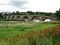
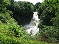 Corra Linn - geograph.org.uk - 911836.jpg 640 × 480; 142 KB
-
 Cottages at Long Green - geograph.org.uk - 1304908.jpg 640 × 480; 94 KB
-
 Country Lane beside Mainholm Holdings - geograph.org.uk - 1294820.jpg 640 × 480; 114 KB
-
 Crag Lough - geograph.org.uk - 1410949.jpg 640 × 480; 94 KB
-
 Craigmead Car Park - geograph.org.uk - 1366274.jpg 640 × 480; 126 KB
-
 Crofthead Farm and Kittymuir Farm - geograph.org.uk - 1801414.jpg 640 × 480; 62 KB
-
 Crosshill railway station in 2008.jpg 640 × 480; 99 KB
-
 Crossroads at Baillieston - geograph.org.uk - 1707227.jpg 640 × 480; 93 KB
-
 Crossroads at Hallhill - geograph.org.uk - 1235415.jpg 640 × 480; 78 KB
-
 Crossroads at Quarter - geograph.org.uk - 1743580.jpg 640 × 480; 60 KB
-

-
 Crossroads on the A721 near Fallside - geograph.org.uk - 1617678.jpg 640 × 480; 76 KB
-
 Crowwood Roundabout - geograph.org.uk - 1433922.jpg 640 × 480; 58 KB
-
 Cycle Path beside the A90 - geograph.org.uk - 1304936.jpg 640 × 480; 90 KB
-
 Dalmeny House - geograph.org.uk - 1304793.jpg 640 × 480; 50 KB
-
 Dalmeny Main Street - geograph.org.uk - 1005021.jpg 640 × 480; 68 KB
-
 Dalmeny Railway Station - geograph.org.uk - 1305658.jpg 640 × 480; 90 KB
-
 Dalzell Park Entrance - geograph.org.uk - 935461.jpg 640 × 480; 121 KB
-
 Dalziel Park Hotel and Clubhouse.jpg 640 × 480; 95 KB
-
 Dean Bridge - geograph.org.uk - 990590.jpg 640 × 480; 139 KB
-
 Deil's Dyke - geograph.org.uk - 956150.jpg 640 × 480; 68 KB
-
 Dere Street A68 Dargues Northumberland 003.jpg 640 × 480; 91 KB
-

-

-
 Dingleton Road - geograph.org.uk - 977808.jpg 640 × 480; 85 KB
-
 Disused Railway Lines near Bogside - geograph.org.uk - 1712327.jpg 640 × 480; 81 KB
-
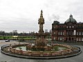 Doulton Fountain - geograph.org.uk - 1079974.jpg 640 × 480; 62 KB
-
 Drumlanrig Bridge - geograph.org.uk - 1403190.jpg 640 × 480; 157 KB
-
 Dunbar Harbour - geograph.org.uk - 964627.jpg 640 × 480; 68 KB
-
 Dunoon Ferry - geograph.org.uk - 1542279.jpg 640 × 480; 48 KB
-
 Dunsapie Loch - geograph.org.uk - 929946.jpg 640 × 480; 71 KB
-
 Dunure Castle and Dovecot - geograph.org.uk - 1312897.jpg 640 × 480; 96 KB
-
 Dunure Harbour - geograph.org.uk - 1312942.jpg 640 × 480; 101 KB
-
 East Kip - geograph.org.uk - 1427116.jpg 640 × 480; 84 KB
-
 East Lomond Path - geograph.org.uk - 1365784.jpg 640 × 480; 75 KB
-
 East Lomond Trig Point - geograph.org.uk - 1365831.jpg 640 × 480; 97 KB
-
 East Mount Lowther Viewpoint - geograph.org.uk - 910462.jpg 640 × 480; 103 KB
-
 Eddlewood Glen - geograph.org.uk - 1752322.jpg 3,000 × 4,000; 6.11 MB
-
 Electricity Pylons near Hamilton - geograph.org.uk - 1719790.jpg 4,000 × 3,000; 2.82 MB
-
 Ellismuir Farm - geograph.org.uk - 1775594.jpg 640 × 480; 77 KB


_-_geograph.org.uk_-_1400534.jpg)


_-_geograph.org.uk_-_1414044.jpg)


_-_geograph.org.uk_-_1112665.jpg)


_-_geograph.org.uk_-_1541795.jpg)


