Category:Images by Chris Downer
Jump to navigation
Jump to search

Subcategories
This category has only the following subcategory.
N
Media in category "Images by Chris Downer"
The following 200 files are in this category, out of 4,637 total.
(previous page) (next page)-
 "Incident - slow down, 40" - geograph.org.uk - 540929.jpg 640 × 480; 61 KB
-
 'W W' is for Wessex Way - geograph.org.uk - 617853.jpg 640 × 480; 89 KB
-
 14th century prison door - geograph.org.uk - 470706.jpg 429 × 640; 101 KB
-
 "oo"ps^ - geograph.org.uk - 571527.jpg 640 × 475; 61 KB
-
 2008, first sunset of the year - geograph.org.uk - 646457.jpg 640 × 480; 48 KB
-
 27 miles from everywhere - geograph.org.uk - 650828.jpg 640 × 480; 64 KB
-
 3 hours and 2 minutes of bell-ringing - geograph.org.uk - 495230.jpg 429 × 640; 80 KB
-
 5 o'clock on a winter's evening - geograph.org.uk - 626377.jpg 640 × 480; 39 KB
-
 7 miles from the nearest land... - geograph.org.uk - 447925.jpg 640 × 348; 28 KB
-
 8-figure grid reference on bridge - geograph.org.uk - 550593.jpg 640 × 480; 81 KB
-
 A bitterly cold night in Telford - geograph.org.uk - 636261.jpg 640 × 480; 37 KB
-
 A buoys' day out - geograph.org.uk - 550708.jpg 640 × 480; 64 KB
-
 A busy Christmas Eve at Tesco - geograph.org.uk - 639210.jpg 640 × 480; 73 KB
-
 A car's undercarriage - geograph.org.uk - 1142998.jpg 640 × 359; 36 KB
-
 A happy Christmas^ - geograph.org.uk - 1091471.jpg 640 × 480; 109 KB
-
 A patchwork of fields - geograph.org.uk - 611922.jpg 640 × 480; 46 KB
-

-
 A powerboat passes The Needles - geograph.org.uk - 508847.jpg 640 × 480; 43 KB
-
 A tumulus punctuates the landscape - geograph.org.uk - 533582.jpg 640 × 336; 44 KB
-
 A120, M11 sliproads - geograph.org.uk - 611415.jpg 640 × 357; 62 KB
-
 A37 at Wrackleford - geograph.org.uk - 550512.jpg 640 × 480; 86 KB
-

-
 Abbotsbury, the Abbey Barn - geograph.org.uk - 500342.jpg 640 × 429; 106 KB
-

-
 Aberdeen, Art Gallery - geograph.org.uk - 598082.jpg 640 × 480; 85 KB
-
 Aberdeen, Arts Centre - geograph.org.uk - 598065.jpg 480 × 640; 40 KB
-
 Aberdeen, Duthie Park - bandstand - geograph.org.uk - 597996.jpg 640 × 480; 50 KB
-
 Aberdeen, Edward VII statue - geograph.org.uk - 598096.jpg 480 × 640; 101 KB
-
 Aberdeen, graffitied trig point - geograph.org.uk - 598012.jpg 640 × 480; 64 KB
-
 Aberdeen, Great Western Road - geograph.org.uk - 598114.jpg 640 × 480; 82 KB
-
-
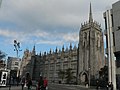
 Aberdeen, King's College - geograph.org.uk - 597963.jpg 640 × 480; 64 KB
-
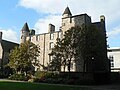
 Aberdeen, Marischal College - geograph.org.uk - 598071.jpg 640 × 480; 65 KB
-
 Aberdeen, Mitchell's Hospital - geograph.org.uk - 597969.jpg 480 × 640; 103 KB
-
 Aberdeen, Pittodrie Stadium - geograph.org.uk - 598024.jpg 640 × 480; 63 KB
-
 Aberdeen, Provost Skene's House - geograph.org.uk - 598076.jpg 640 × 480; 80 KB
-
 Aberdeen, Queen Street Church - geograph.org.uk - 598062.jpg 640 × 480; 61 KB
-
 Aberdeen, Robert Gordon's College - geograph.org.uk - 598080.jpg 480 × 640; 76 KB
-
 Aberdeen, St. Andrew's Cathedral - geograph.org.uk - 598057.jpg 480 × 640; 60 KB
-

-
 Aberdeen, St. Fittick's church - geograph.org.uk - 598105.jpg 640 × 480; 39 KB
-
 Aberdeen, St. Machar's Cathedral - geograph.org.uk - 597967.jpg 640 × 480; 60 KB
-
 Aberdeen, the beach - geograph.org.uk - 598032.jpg 640 × 480; 46 KB
-
 Aberdeen, Town House - geograph.org.uk - 481280.jpg 441 × 640; 61 KB
-
 Aberdeen, Trinity Cemetery at sunset - geograph.org.uk - 598010.jpg 640 × 480; 56 KB
-
 Aberdeen, Triple Kirks - geograph.org.uk - 598103.jpg 480 × 640; 81 KB
-

-
 Aberdeen, Union Street - geograph.org.uk - 598098.jpg 640 × 480; 71 KB
-
 Aberdeen, Union Terrace Gardens - geograph.org.uk - 598091.jpg 640 × 480; 110 KB
-
 Aberdeen, yellow cross - geograph.org.uk - 598042.jpg 640 × 480; 69 KB
-
 Achiltibuie, the post office - geograph.org.uk - 596747.jpg 640 × 480; 70 KB
-
 Acton, field and Isle of Wight view - geograph.org.uk - 1365420.jpg 640 × 480; 48 KB
-
 Acton, postbox № BH19 83 - geograph.org.uk - 1365425.jpg 640 × 480; 74 KB
-

-
-
 After the final - geograph.org.uk - 458005.jpg 640 × 429; 88 KB
-

-

-
-
 Alderholt, inside Telegraph Plantation - geograph.org.uk - 1575205.jpg 640 × 480; 128 KB
-

-
-
 Alderholt, the mill - geograph.org.uk - 1163915.jpg 640 × 480; 99 KB
-

-

-
 Alderney, a tree by the Bourne stream - geograph.org.uk - 1712038.jpg 640 × 480; 104 KB
-
 Alderney, Bourne Bottom - geograph.org.uk - 1712079.jpg 640 × 480; 65 KB
-

-

-
 Alderney, the very top of Bourne Bottom - geograph.org.uk - 1712062.jpg 640 × 480; 123 KB
-
 Alderney, track across Bourne Bottom - geograph.org.uk - 1712088.jpg 640 × 480; 79 KB
-

-

-

-
 Alexandra Palace Park, lawn and view - geograph.org.uk - 823115.jpg 640 × 480; 68 KB
-

-
 Alexandra Palace Park, the lake - geograph.org.uk - 823136.jpg 640 × 480; 93 KB
-
 Alexandra Palace, mast - geograph.org.uk - 823112.jpg 640 × 480; 76 KB
-
 Alexandra Palace, southern frontage - geograph.org.uk - 823116.jpg 640 × 480; 57 KB
-
 Allbrook, a roundabout at sunset - geograph.org.uk - 1410470.jpg 640 × 480; 37 KB
-

-
-
 Alweston, postbox № DT9 45 - geograph.org.uk - 1553861.jpg 480 × 640; 63 KB
-
 Alweston, the post office - geograph.org.uk - 1553858.jpg 640 × 480; 55 KB
-
 Anderson, detail of Red Post - geograph.org.uk - 1752516.jpg 640 × 481; 50 KB
-
 Angling at Keyhaven - geograph.org.uk - 508861.jpg 640 × 480; 71 KB
-
 Ansty, detail of Higher Ansty signpost - geograph.org.uk - 1752222.jpg 640 × 482; 111 KB
-
 Ansty, postbox № DT2 54 - geograph.org.uk - 1374688.jpg 640 × 480; 119 KB
-
 Ansty, postbox № DT2 600 - geograph.org.uk - 1374691.jpg 640 × 480; 68 KB
-
 Ansty, telephone box - geograph.org.uk - 1374685.jpg 640 × 480; 62 KB
-
 Anti-vandalism notice, vandalised - geograph.org.uk - 491176.jpg 640 × 480; 57 KB
-
-
 Approaching the Needles - geograph.org.uk - 498601.jpg 640 × 385; 66 KB
-
 Approaching Wales at night - geograph.org.uk - 695907.jpg 640 × 456; 24 KB
-
 Ardnamurchan, lighthouse mural - geograph.org.uk - 921547.jpg 640 × 480; 128 KB
-
 Ardnamurchan, Loch Mudle - geograph.org.uk - 921660.jpg 640 × 480; 113 KB
-

-
 Ardnamurchan, the lighthouse - geograph.org.uk - 921555.jpg 480 × 640; 116 KB
-

-
 Ardnamurchan, the road to Kilmory - geograph.org.uk - 921466.jpg 640 × 480; 111 KB
-
-
 Ardnamurchan, view south from the tower - geograph.org.uk - 921514.jpg 640 × 480; 117 KB
-
 Ardnamurchan, Visitor Centre - geograph.org.uk - 921511.jpg 640 × 480; 111 KB
-
 Ardnamurchan, westernmost traffic light - geograph.org.uk - 921570.jpg 640 × 480; 121 KB
-
 Ardrishaig, entering from the north - geograph.org.uk - 916067.jpg 640 × 480; 128 KB
-
 Ardrossan, South Beach - geograph.org.uk - 1540514.jpg 640 × 480; 202 KB
-
 Ardvasar, foreshore - geograph.org.uk - 916515.jpg 640 × 480; 121 KB
-
 Ardvasar, telephone box - geograph.org.uk - 916413.jpg 640 × 480; 127 KB
-
 Arisaig, foreshore and Eigg view - geograph.org.uk - 916108.jpg 640 × 480; 124 KB
-
 Arisaig, parish church - geograph.org.uk - 918826.jpg 640 × 480; 142 KB
-
 Armadale, The Shed and Ragamuffin - geograph.org.uk - 917992.jpg 640 × 480; 141 KB
-
 Arne, church steps - geograph.org.uk - 1718966.jpg 640 × 480; 115 KB
-

-
 Arne, view over Arne Farm - geograph.org.uk - 1718972.jpg 640 × 480; 86 KB
-
 Arriving at St. Agnes - geograph.org.uk - 448642.jpg 640 × 429; 82 KB
-
 Artillery gun at Yarmouth Castle.jpg 640 × 480; 71 KB
-

-
 Ashe, churchyard snowdrops - geograph.org.uk - 1162760.jpg 640 × 480; 147 KB
-
 Ashe, view from churchyard - geograph.org.uk - 1162759.jpg 480 × 640; 121 KB
-
 Ashington, Methodist church - geograph.org.uk - 451844.jpg 640 × 415; 66 KB
-

-

-
 Ashmore, finger post at Woodley Lane - geograph.org.uk - 1142603.jpg 480 × 640; 77 KB
-
 Ashmore, geese and heron - geograph.org.uk - 1142577.jpg 640 × 480; 71 KB
-
 Ashmore, pondside seat - geograph.org.uk - 1142581.jpg 640 × 480; 93 KB
-
 Ashmore, Possessions Corner - geograph.org.uk - 1405773.jpg 640 × 480; 79 KB
-
 Ashmore, The Stag's Head cottage - geograph.org.uk - 1142557.jpg 640 × 480; 95 KB
-
 Ashmore, walking on water - geograph.org.uk - 454941.jpg 640 × 429; 80 KB
-

-
 At-ten-TION^ - geograph.org.uk - 537798.jpg 640 × 480; 105 KB
-
 Dovecote, Athelhampton - geograph.org.uk - 473369.jpg 429 × 640; 75 KB
-
 Athelhampton House - geograph.org.uk - 473367.jpg 640 × 429; 63 KB
-
 Athelhampton House, detail - geograph.org.uk - 500388.jpg 640 × 428; 107 KB
-
 Athelhampton House, gardens - geograph.org.uk - 500389.jpg 640 × 429; 104 KB
-
 Athelhampton House, gardens 2 - geograph.org.uk - 500392.jpg 640 × 429; 78 KB
-
 Avebury stone circle - geograph.org.uk - 479540.jpg 640 × 410; 62 KB
-
 Axminster, bunny on the verge - geograph.org.uk - 982503.jpg 640 × 480; 134 KB
-
 B3082, in the avenue of beeches - geograph.org.uk - 522849.jpg 640 × 429; 119 KB
-

-
 Babbacombe, breakwater by beach - geograph.org.uk - 1469651.jpg 640 × 480; 70 KB
-

-
 Babbacombe, the Cary Arms - geograph.org.uk - 1469659.jpg 640 × 480; 57 KB
-
 Back of Keppoch, phone and postbox - geograph.org.uk - 916166.jpg 480 × 640; 134 KB
-
 Bagber, former Methodist chapel - geograph.org.uk - 1436050.jpg 640 × 480; 100 KB
-
 Ballachulish, Ballacuhlish Hotel - geograph.org.uk - 921981.jpg 480 × 640; 125 KB
-
 Ballachulish, distant view of bridge - geograph.org.uk - 921951.jpg 640 × 480; 114 KB
-
 Ballachulish, shore of Loch Linnhe - geograph.org.uk - 921458.jpg 640 × 480; 132 KB
-
 Ballachulish, view east from bridge - geograph.org.uk - 921986.jpg 640 × 480; 102 KB
-
 Ballachulish, view west from bridge - geograph.org.uk - 921976.jpg 640 × 480; 102 KB
-
 Bangor, Eisenhower Pier - geograph.org.uk - 611256.jpg 640 × 480; 53 KB
-
 Bangor, McKee Clock - geograph.org.uk - 611249.jpg 480 × 640; 70 KB
-
 Bangor, railway station - geograph.org.uk - 611268.jpg 640 × 480; 67 KB
-
 Bangor, sunset over North Pier - geograph.org.uk - 611258.jpg 640 × 480; 62 KB
-
 Bangor, the harbour - geograph.org.uk - 612345.jpg 640 × 480; 65 KB
-

-
 Barrier reflections - geograph.org.uk - 639985.jpg 640 × 480; 85 KB
-

-

-

-
 Barrow Haven, railway to infinity - geograph.org.uk - 1293426.jpg 480 × 640; 77 KB
-

-

-
 Barrow Haven, train just departed - geograph.org.uk - 1293444.jpg 640 × 480; 58 KB
-
 Barry Island - archway to the beach - geograph.org.uk - 1188366.jpg 640 × 480; 58 KB
-
 Barry Island, beach tide marks - geograph.org.uk - 1188338.jpg 640 × 480; 49 KB
-
 Barry Island, Nell's Point - geograph.org.uk - 1186993.jpg 640 × 480; 46 KB
-
 Barry Island, number 7 steps - geograph.org.uk - 1188342.jpg 640 × 480; 66 KB
-
 Barry Island, promenade - geograph.org.uk - 1188372.jpg 640 × 480; 54 KB
-
-
-

-
 Bartley, postbox № SO40 331 - geograph.org.uk - 1016006.jpg 640 × 480; 86 KB
-
 Bartley, shop-post office - geograph.org.uk - 1015999.jpg 640 × 480; 76 KB
-
 Barton on Sea, art deco row of shops - geograph.org.uk - 510528.jpg 640 × 480; 60 KB
-
-
 Barton on Sea, coast path closed - geograph.org.uk - 1760081.jpg 640 × 480; 73 KB
-
 Barton on Sea, postbox № BH25 70 - geograph.org.uk - 1760077.jpg 480 × 640; 63 KB
-
 Barton on Sea, Seacroft Avenue - geograph.org.uk - 1248941.jpg 640 × 480; 83 KB
-
 Barton on Sea, white water - geograph.org.uk - 668955.jpg 640 × 435; 69 KB
-

-
 Bath, armoured man on York Street - geograph.org.uk - 1989465.jpg 480 × 640; 91 KB
-
 Bath, the abbey from York Street - geograph.org.uk - 1989460.jpg 640 × 480; 101 KB
-
 Bath, the abbey through an arch - geograph.org.uk - 1989469.jpg 480 × 640; 81 KB
-
 Battle Abbey, dormitory range detail - geograph.org.uk - 560738.jpg 480 × 640; 88 KB
-
 Battle Abbey, novices' chamber - geograph.org.uk - 560743.jpg 480 × 640; 79 KB
-
 Battle, Battle Abbey School - geograph.org.uk - 560489.jpg 640 × 297; 49 KB
-
 Battle, Bull Ring - geograph.org.uk - 560488.jpg 640 × 480; 73 KB
-
 Battle, High Street - geograph.org.uk - 560754.jpg 640 × 480; 72 KB
-
 Battle, St. Martin's Abbey gatehouse - geograph.org.uk - 558698.jpg 640 × 480; 78 KB
-
 Battle, the abbey crypt - geograph.org.uk - 560493.jpg 640 × 480; 88 KB
-
 Beaminster, 50 Fleet Street - geograph.org.uk - 1383343.jpg 480 × 640; 67 KB
-

-
 Beaminster, ford in Woodswater Lane - geograph.org.uk - 1383391.jpg 640 × 480; 84 KB
-

-
 Beaminster, former White Hart Hotel - geograph.org.uk - 1383374.jpg 480 × 640; 65 KB
-
 Beaminster, Horn Hill tunnel - geograph.org.uk - 935831.jpg 640 × 480; 130 KB
-
 Beaminster, Manor Cottage - geograph.org.uk - 1383354.jpg 480 × 640; 76 KB
-
 Beaminster, North Street - geograph.org.uk - 1383356.jpg 640 × 480; 70 KB
-
 Beaminster, parish church of St. Mary - geograph.org.uk - 500401.jpg 640 × 425; 73 KB
-
 Beaminster, the Greyhound - geograph.org.uk - 1383377.jpg 640 × 480; 59 KB


_-_geograph.org.uk_-_500370.jpg)


