Category:Ilston
Jump to navigation
Jump to search
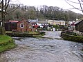
English: Ilston is the name of a village and a local government community in Swansea, southwest Wales. Ilston has its own community council. The population of the community in the United Kingdom Census 2001 was 538. The name of the village is thought to have originated from Saint Illtud.
hamlet and community in Swansea, Wales  | |||||
| Upload media | |||||
| Instance of | |||||
|---|---|---|---|---|---|
| Location | Swansea, Wales | ||||
| Population |
| ||||
| Area |
| ||||
 | |||||
Subcategories
This category has the following 2 subcategories, out of 2 total.
I
- St Illtyd's Church, Ilston (7 F)
N
Media in category "Ilston"
The following 200 files are in this category, out of 370 total.
(previous page) (next page)-
 2010 Wales Swansea Community Ilston map.svg 512 × 472; 632 KB
-
 2024 Wales Swansea Community Ilston map.svg 512 × 472; 651 KB
-

-
 A terrace of houses, Nicholaston - geograph.org.uk - 6179951.jpg 4,000 × 3,000; 2.25 MB
-
 A4118 at Penmaen Church - geograph.org.uk - 4138163.jpg 640 × 481; 78 KB
-

-
 A4118 in Parkmill - geograph.org.uk - 5837798.jpg 1,600 × 1,280; 812 KB
-
 A4118 junction with B4271 - geograph.org.uk - 3957239.jpg 3,648 × 2,736; 1.47 MB
-
 A4118 near Penmaen Farm - geograph.org.uk - 4138171.jpg 640 × 481; 84 KB
-
 A4118 west of Nicholaston - geograph.org.uk - 4138185.jpg 640 × 481; 55 KB
-
 A4118 west of Parkmill - geograph.org.uk - 4136335.jpg 640 × 480; 61 KB
-
 Angel - geograph.org.uk - 2084878.jpg 1,489 × 1,600; 861 KB
-

-
 B4271 approaching a valley on Pengwern Common - geograph.org.uk - 5843145.jpg 1,600 × 800; 444 KB
-
 B4271 crosses Fairwood Common - geograph.org.uk - 3957244.jpg 3,648 × 2,736; 1.2 MB
-
 Beach fishing on Gower - geograph.org.uk - 3434970.jpg 640 × 480; 44 KB
-

-
 Boardwalk beside Pennard Pill - geograph.org.uk - 2211478.jpg 800 × 600; 174 KB
-
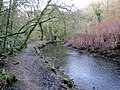
 Braided channel in the Pennard Pill - geograph.org.uk - 2320031.jpg 2,048 × 1,536; 384 KB
-

-
 Burial Chamber - geograph.org.uk - 5266743.jpg 2,311 × 3,082; 2.07 MB
-

-
 Bus shelter - geograph.org.uk - 6085292.jpg 3,264 × 2,448; 2.84 MB
-
 Bus shelter by road junction on Pengwern Common - geograph.org.uk - 5843157.jpg 3,862 × 1,477; 1.51 MB
-
 Bus shelter on the B4271 - geograph.org.uk - 3987595.jpg 1,024 × 680; 252 KB
-
 Bus shelter, Nicholaston Cross - geograph.org.uk - 6179954.jpg 4,000 × 3,000; 2.63 MB
-

-

-
 Carey's Wood - geograph.org.uk - 2084861.jpg 1,600 × 1,096; 465 KB
-
 Carey's Wood - geograph.org.uk - 2084896.jpg 1,600 × 1,151; 1.07 MB
-
 Cat Hole Cave in Park Woods - geograph.org.uk - 2353596.jpg 1,152 × 1,536; 326 KB
-
 Cathole Cave - geograph.org.uk - 2084838.jpg 1,477 × 1,600; 1.36 MB
-
 Cathole Cave - geograph.org.uk - 5266780.jpg 2,346 × 3,130; 2.62 MB
-
 Cattle Grid - geograph.org.uk - 5265942.jpg 3,264 × 2,448; 3.64 MB
-
 Cattle grid on a country road - geograph.org.uk - 3985371.jpg 800 × 531; 152 KB
-
 Cattle grid on the B4271 - geograph.org.uk - 3987107.jpg 1,024 × 680; 369 KB
-
 Cefn Bryn - geograph.org.uk - 3298374.jpg 1,596 × 1,194; 1.26 MB
-
 Cefn Bryn - geograph.org.uk - 3842670.jpg 640 × 480; 84 KB
-
 Cefn Bryn - geograph.org.uk - 3842677.jpg 640 × 480; 105 KB
-
 Cefn Bryn - geograph.org.uk - 4283409.jpg 640 × 480; 79 KB
-
-
 Cliff erosion on Three Cliffs Bay - geograph.org.uk - 2318249.jpg 2,048 × 1,536; 727 KB
-
 Cliffs near Three Cliffs Bay - geograph.org.uk - 4903365.jpg 6,000 × 4,000; 4.5 MB
-
 Cliffs on the western side of Threecliff Bay - geograph.org.uk - 3056842.jpg 3,648 × 2,736; 2.25 MB
-
 Coast path by Nicholaston Burrows - geograph.org.uk - 4902457.jpg 6,000 × 4,000; 7.38 MB
-
 Coast path down to Three Cliffs Bay - geograph.org.uk - 4903401.jpg 6,000 × 4,000; 4.35 MB
-
 Collapsed tree above Nicholaston Burrows - geograph.org.uk - 4902472.jpg 6,000 × 4,000; 6.5 MB
-
 Comin Fairwood Common - geograph.org.uk - 4341482.jpg 640 × 480; 86 KB
-
 Comin Pengwern Common - geograph.org.uk - 4347740.jpg 640 × 480; 77 KB
-
 Comin Pengwern Common - geograph.org.uk - 4347761.jpg 640 × 480; 61 KB
-
 Communication mast by B4271 on Fairwood Common - geograph.org.uk - 5829295.jpg 1,600 × 1,000; 622 KB
-
 Cottages at Parkmill - geograph.org.uk - 4899532.jpg 6,000 × 4,000; 3.25 MB
-
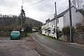
 Country road to Ilston - geograph.org.uk - 3987585.jpg 800 × 531; 102 KB
-
 Cross in the churchyard of St Nicholas, Nicholaston - geograph.org.uk - 4910112.jpg 6,000 × 4,000; 3.5 MB
-
 Cross roads in Nicholaston - geograph.org.uk - 5837821.jpg 1,600 × 1,280; 853 KB
-
 Cwm Llanilltyd Gwyr - Ilston Cwm - geograph.org.uk - 4321907.jpg 640 × 480; 124 KB
-
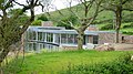 Designer home at Penmaen on Gower - geograph.org.uk - 4019853.jpg 640 × 360; 91 KB
-

-
 Devil's door at St Illtyd's - geograph.org.uk - 1309841.jpg 480 × 640; 129 KB
-
 Drive leading through the woods - geograph.org.uk - 3874109.jpg 640 × 480; 115 KB
-
 Early Purple Orchid - geograph.org.uk - 6228810.jpg 3,000 × 4,000; 2.25 MB
-
 Earthwork on Penmaen Burrows - geograph.org.uk - 4903389.jpg 6,000 × 4,000; 4.64 MB
-
 Entrance to Pengwern Common - geograph.org.uk - 3986017.jpg 1,024 × 680; 318 KB
-
 Entrance to Willoxton Farm - geograph.org.uk - 3987584.jpg 800 × 531; 84 KB
-
 Evergreen tree overshadowing the road junction, Penmaen - geograph.org.uk - 5837805.jpg 1,600 × 1,598; 1.21 MB
-
 Fairwood common - geograph.org.uk - 6085288.jpg 3,264 × 2,448; 4 MB
-
 Falconry display at Perriswood Farm - geograph.org.uk - 3364258.jpg 4,000 × 3,000; 3.91 MB
-
 Falconry display at Perriswood Farm - geograph.org.uk - 3364260.jpg 4,000 × 3,000; 3.48 MB
-
 Farm Buildings, Penmaen - geograph.org.uk - 1492039.jpg 640 × 455; 129 KB
-
 Farm track - geograph.org.uk - 6277944.jpg 3,264 × 2,448; 3.14 MB
-
 Farm track junction - geograph.org.uk - 6277940.jpg 3,138 × 2,353; 2.72 MB
-
 Farmland at Penmaen - 2 - geograph.org.uk - 936621.jpg 640 × 592; 72 KB
-
 Farmland at Penmaen - geograph.org.uk - 936618.jpg 640 × 496; 52 KB
-

-
 Ffarm Wimblewood Isaf Farm - geograph.org.uk - 4089790.jpg 640 × 439; 76 KB
-
 Field near Nicholaston - geograph.org.uk - 4910105.jpg 6,000 × 4,000; 3.62 MB
-

-
 Fields West of Penmaen - geograph.org.uk - 1492021.jpg 640 × 455; 72 KB
-
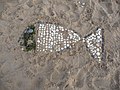 Fish on the sands of Oxwich Bay - geograph.org.uk - 3593325.jpg 640 × 480; 109 KB
-
 Folly gatehouse for Penrice Castle - geograph.org.uk - 5837839.jpg 1,600 × 1,066; 781 KB
-
 Footpath on Cefn Bryn, Gower - geograph.org.uk - 2426309.jpg 640 × 480; 80 KB
-
 Footpath through Nicholaston Burrows - geograph.org.uk - 2417011.jpg 640 × 480; 155 KB
-
 Footpath to Penmaen Burrows - geograph.org.uk - 1492035.jpg 640 × 455; 158 KB
-
 Footpath to Penmaen Burrows - geograph.org.uk - 1492042.jpg 640 × 455; 167 KB
-
 Ford by the Gower Heritage Centre - geograph.org.uk - 5453790.jpg 4,128 × 2,322; 3.83 MB
-
-
 Furzehill Farm - geograph.org.uk - 6085436.jpg 3,264 × 2,448; 1.99 MB
-
 Furzehill to Lunnon - geograph.org.uk - 6085440.jpg 2,448 × 3,264; 4.29 MB
-

-
 Gate on a footpath to Penmaen - geograph.org.uk - 6228807.jpg 4,000 × 3,000; 2.45 MB
-
 Gatehouse Folly - geograph.org.uk - 4858021.jpg 5,472 × 3,648; 7.38 MB
-
 Gatehouse folly to Penrice Castle - geograph.org.uk - 3988472.jpg 1,024 × 680; 263 KB
-
 Ger - Near Cefn Bryn - geograph.org.uk - 4283397.jpg 640 × 480; 134 KB
-
 Ger - Near Ffarm Courthouse Farm - geograph.org.uk - 4341547.jpg 640 × 480; 121 KB
-
 Ger - Near Ffarm Malthouse Farm - geograph.org.uk - 4347714.jpg 640 × 480; 84 KB
-
 Gorse, bracken and grasses - geograph.org.uk - 6085296.jpg 3,264 × 2,448; 4.58 MB
-
 Gower Heritage Centre - geograph.org.uk - 5239375.jpg 2,886 × 1,838; 1.23 MB
-
 Gower Ponies - geograph.org.uk - 381858.jpg 640 × 480; 178 KB
-
 Gower Way - geograph.org.uk - 6188503.jpg 1,536 × 2,048; 1.53 MB
-
 Grand designs at Penmaen - geograph.org.uk - 2426334.jpg 640 × 480; 85 KB
-
 Grazing land near Malthouse Farm - geograph.org.uk - 3986016.jpg 800 × 531; 130 KB
-
 Great Tor - geograph.org.uk - 3842407.jpg 640 × 480; 36 KB
-
 Great Tor - geograph.org.uk - 869897.jpg 640 × 480; 165 KB
-
 Great Tor - geograph.org.uk - 869917.jpg 640 × 480; 149 KB
-
 Great Tor - geograph.org.uk - 869929.jpg 480 × 640; 171 KB
-
 Great Tor - geograph.org.uk - 869952.jpg 640 × 394; 128 KB
-
 Great Tor and Tor Bay on Gower - geograph.org.uk - 2416992.jpg 640 × 480; 66 KB
-
 Great Tor at low tide - geograph.org.uk - 3594201.jpg 640 × 480; 50 KB
-
 Great Tor at low tide - geograph.org.uk - 5831197.jpg 3,806 × 1,928; 1.48 MB
-
 Great Tor from below - geograph.org.uk - 3594209.jpg 640 × 480; 92 KB
-
 Great Tor, Gower - geograph.org.uk - 3593299.jpg 640 × 480; 37 KB
-
 Great Tor, Gower. - geograph.org.uk - 1381224.jpg 490 × 640; 74 KB
-
 Green Cwm Cottage - geograph.org.uk - 5265986.jpg 3,264 × 2,448; 2.07 MB
-
 Grocer ^ Off Licence in Parkmill - geograph.org.uk - 4899539.jpg 6,000 × 4,000; 3.32 MB
-
 Headstones - geograph.org.uk - 2084882.jpg 1,600 × 1,132; 494 KB
-
 Heol werdd Penmaen green road - geograph.org.uk - 3842656.jpg 640 × 480; 70 KB
-
 Holiday chalets on Penmaen Burrows - geograph.org.uk - 6228119.jpg 4,000 × 3,000; 2.85 MB
-
 Horses on Cefn Bryn - geograph.org.uk - 3571366.jpg 3,450 × 2,145; 1.59 MB
-
 Idyllic Ilston - geograph.org.uk - 1310277.jpg 640 × 480; 145 KB
-
 Illston Cwm - geograph.org.uk - 2084900.jpg 1,600 × 1,136; 1.01 MB
-
 Ilston - geograph.org.uk - 1310303.jpg 640 × 480; 126 KB
-
 Ilston Ford - geograph.org.uk - 6142865.jpg 2,939 × 2,353; 2.01 MB
-
 Ilston Stream - geograph.org.uk - 4858009.jpg 3,648 × 5,472; 6.09 MB
-
 Ilston, UK - panoramio.jpg 4,000 × 2,250; 1.94 MB
-

-
 Interior of Ilston church - geograph.org.uk - 3987578.jpg 680 × 1,024; 163 KB
-
 Jellyfish - a medusozoan cnidarian - geograph.org.uk - 6147560.jpg 1,536 × 2,048; 1.4 MB
-
 Jellyfish at Oxwich - geograph.org.uk - 6147586.jpg 2,437 × 1,805; 1.66 MB
-
 Killy Willy - geograph.org.uk - 6085472.jpg 2,448 × 3,264; 3.47 MB
-
 La Charrette the smallest cinema in Wales - geograph.org.uk - 1896092.jpg 2,816 × 1,880; 3.12 MB
-
 Lane to Little Hills, Welsh Moor, Gower - geograph.org.uk - 1092164.jpg 480 × 640; 125 KB
-
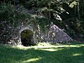 Lime Kiln - geograph.org.uk - 2084846.jpg 1,600 × 1,206; 941 KB
-
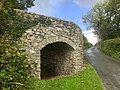
 Lime Kiln - geograph.org.uk - 5265987.jpg 3,264 × 2,448; 3.22 MB
-
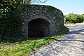
 Lime Kiln - geograph.org.uk - 5479215.jpg 4,000 × 3,000; 4.73 MB
-
 Lime Kiln - geograph.org.uk - 5479221.jpg 4,000 × 3,000; 4.82 MB
-
 Lime kiln - geograph.org.uk - 6278269.jpg 2,048 × 1,536; 1.38 MB
-
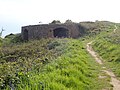 Lime kiln above Tor Bay - geograph.org.uk - 6228163.jpg 4,000 × 3,000; 2.92 MB
-
 Lime kiln above Tor Bay, Gower. - geograph.org.uk - 1490317.jpg 640 × 480; 96 KB
-
 Lime Kiln outside Lunnon - geograph.org.uk - 766590.jpg 640 × 480; 89 KB
-
 Lime kiln, Lunnon - geograph.org.uk - 3987582.jpg 1,024 × 680; 305 KB
-
 Little Tor - geograph.org.uk - 869922.jpg 640 × 480; 145 KB
-
 Little Tor and Great Tor - geograph.org.uk - 3981520.jpg 1,350 × 1,013; 190 KB
-
 Little Valley Bakery - geograph.org.uk - 5266745.jpg 3,264 × 2,448; 2.96 MB
-
 Llanilltyd Gwyr - Ilston - geograph.org.uk - 4218524.jpg 640 × 480; 136 KB
-
 Llethryd - geograph.org.uk - 4347815.jpg 640 × 480; 107 KB
-
 Llwybr Ceffyl Furzehill Bridleway - geograph.org.uk - 4321927.jpg 640 × 480; 118 KB
-

-
 Llwybr Comin Fairwood Common Path - geograph.org.uk - 4341530.jpg 640 × 480; 76 KB
-
 Llwynon - Lunnon - geograph.org.uk - 4221242.jpg 640 × 480; 82 KB
-
 Lodge to Penrice Castle - geograph.org.uk - 5453304.jpg 3,264 × 2,448; 2.3 MB
-
 Lone bush on Fairwood Common - geograph.org.uk - 5829291.jpg 1,600 × 961; 602 KB
-
 Lone cyclist crossing Fairwood Common - geograph.org.uk - 5772649.jpg 4,592 × 3,056; 3.08 MB
-
 Looking towards Penmaen Burrows - geograph.org.uk - 2211849.jpg 800 × 600; 148 KB
-
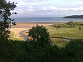
 Looking towards Three Cliffs Bay - geograph.org.uk - 2211876.jpg 800 × 600; 139 KB
-
 Looking towards Threecliff Bay - geograph.org.uk - 4900252.jpg 640 × 480; 143 KB
-

-
 Looking west towards Pobbles Bay and Three Cliffs Bay - geograph.org.uk - 6224605.jpg 4,000 × 3,000; 2.34 MB
-
 Morning sands on Oxwich Bay - geograph.org.uk - 3593989.jpg 640 × 480; 40 KB
-
 Nant Llethryd Stream - geograph.org.uk - 4347807.jpg 640 × 480; 151 KB
-
 National Trust Entrance, Penmaen Burrows - geograph.org.uk - 1492044.jpg 640 × 455; 118 KB
-

-

-

-

-
 Nicholaston Burrows - geograph.org.uk - 1499534.jpg 480 × 640; 111 KB
-
 Nicholaston Burrows - geograph.org.uk - 4902448.jpg 6,000 × 4,000; 4.61 MB
-
 Nicholaston Burrows - geograph.org.uk - 4902536.jpg 6,000 × 4,000; 3.92 MB
-
 Nicholaston Burrows - geograph.org.uk - 6228806.jpg 4,000 × 3,000; 2.88 MB
-
 Nicholaston Burrows - geograph.org.uk - 6228809.jpg 4,000 × 3,000; 2.61 MB
-
 Nicholaston Burrows - geograph.org.uk - 869971.jpg 480 × 640; 167 KB
-

-
 Nicholaston Farm Camping site - geograph.org.uk - 6228808.jpg 4,000 × 3,000; 2.51 MB
-
 Nicholaston Stream - geograph.org.uk - 869976.jpg 480 × 640; 205 KB
-
 Nicholaston Woods at eastern end of Oxwich Bay - geograph.org.uk - 3056886.jpg 3,648 × 2,736; 2.05 MB
-
 Nicholaston Woods with Cefn Bryn beyond - geograph.org.uk - 5832297.jpg 3,583 × 2,049; 2.11 MB
-
 Northill Wood from Pennard Burrows - geograph.org.uk - 2211866.jpg 800 × 600; 202 KB
-

-
 Old lime kiln above Little Tor - geograph.org.uk - 2416985.jpg 640 × 480; 114 KB
-

-
 Olion Eglwys Penmaen Church remains - geograph.org.uk - 2433403.jpg 690 × 518; 233 KB
-

-
 On the road near Parkmill, Gower - geograph.org.uk - 4965121.jpg 640 × 480; 119 KB
-
 On the sands - geograph.org.uk - 4609500.jpg 640 × 480; 29 KB
-
 Ordnance Survey Cut Mark - geograph.org.uk - 4511947.jpg 640 × 480; 125 KB
-
 Ordnance Survey Cut Mark - geograph.org.uk - 4511988.jpg 480 × 640; 103 KB
-
 Ordnance Survey Cut Mark - geograph.org.uk - 4512002.jpg 480 × 640; 134 KB
-
 Ordnance Survey Cut Mark - geograph.org.uk - 4763897.jpg 480 × 640; 96 KB
-
 Ordnance Survey Cut Mark - geograph.org.uk - 4766723.jpg 480 × 640; 116 KB
-
 Ordnance Survey Cut Mark - geograph.org.uk - 4766728.jpg 480 × 640; 112 KB
-
 Ordnance Survey Cut Mark - geograph.org.uk - 4766735.jpg 480 × 640; 103 KB
-
 Ordnance Survey Cut Mark - geograph.org.uk - 5099539.jpg 640 × 551; 100 KB
-
 Ordnance Survey Rivet - geograph.org.uk - 4766740.jpg 480 × 640; 96 KB
-
-
 Ox-bow meander.jpg 800 × 532; 91 KB
-
 Oxwich Bay - geograph.org.uk - 1142023.jpg 640 × 479; 96 KB
-
 Oxwich Bay - geograph.org.uk - 6188348.jpg 6,260 × 2,512; 5.13 MB
-
 Oxwich Bay - geograph.org.uk - 6228173.jpg 4,000 × 3,000; 2.81 MB
-
 Oxwich Bay at low tide - geograph.org.uk - 6147564.jpg 5,777 × 3,031; 3.54 MB
-
 Oxwich Bay from above Little Tor - geograph.org.uk - 2416995.jpg 640 × 480; 79 KB
-
 Oxwich marsh - geograph.org.uk - 2008506.jpg 640 × 480; 98 KB


