Category:Illinois Route 116
Jump to navigation
Jump to search
 | number: | (one hundred sixteen) |
|---|---|---|
| State highways in Illinois: | 96 · 97 · 98 · 99 · 100 · 101 · 102 · 103 · 104 · 105 · 106 · 107 · 108 · 110 · 113 · 115 · 116 · 117 · 119 · 120 · 121 · 122 · 124 · 125 · 126 · 127 · 129 · 130 · 131 · 132 · 133 · 135 · 136 |
East-west state highway in Illinois, US | |||||
| Upload media | |||||
| Instance of | |||||
|---|---|---|---|---|---|
| Location | Illinois | ||||
| Transport network | |||||
| Owned by | |||||
| Maintained by | |||||
| Inception |
| ||||
| Length |
| ||||
 | |||||
Subcategories
This category has the following 2 subcategories, out of 2 total.
S
- Joseph Schertz House (2 F)
Media in category "Illinois Route 116"
The following 32 files are in this category, out of 32 total.
-
 Ashkum Township soybean fields.jpg 6,016 × 4,000; 6.3 MB
-
 Barber pole, Route 116, Farmington, Illinois LCCN2017703928.tif 3,650 × 5,233; 109.35 MB
-
 Clayton Township farmstead with soybeans.jpg 6,016 × 4,000; 5.91 MB
-
 Cullom A-7 Corsair II.jpg 6,016 × 4,000; 7.03 MB
-
 Flanagan old high school.jpg 6,016 × 4,000; 6.39 MB
-
 GermantownHillsWelcome.jpg 1,000 × 667; 865 KB
-
 Graymont from IL116.jpg 6,016 × 4,000; 5.94 MB
-
 IL116eEndRoad-US45signs (39445642074).jpg 2,400 × 1,600; 1.96 MB
-
 IL116wIL78sRoadSigns (38531275805).jpg 2,400 × 1,600; 2.08 MB
-
 IL116wIL78sRoadSignsSplit-Farmington (38701184044).jpg 2,400 × 1,600; 2.18 MB
-
 IL116wRoad-IL41nsSigns (38701221094).jpg 2,400 × 1,600; 2.11 MB
-
 IL116wRoad-IL911-ToInt474sign (24543605007).jpg 2,400 × 1,600; 2.02 MB
-
 IL116wRoad-IL97nsSigns (24543623687).jpg 2,400 × 1,600; 1.89 MB
-
 IL116wRoad-JctIL78sign (38531274945).jpg 2,400 × 1,600; 2.1 MB
-
 IL116wRoadSign-Farmington (38701218994).jpg 2,400 × 1,600; 2.39 MB
-
 IL116wRoadSign-US67BusSign-Roseville (38531280205).jpg 2,400 × 1,600; 2.21 MB
-
 IL116wRoadSignCurve (38531266085).jpg 2,400 × 1,600; 2.13 MB
-
 IL911ReferenceMarker-MaxwellRoadPeoria (34415119491).jpg 2,400 × 1,600; 1.41 MB
-
 Illinois 116 (1950).svg 400 × 600; 6 KB
-
 Illinois 116.svg 481 × 385; 12 KB
-
 Illinois Route 115 and 116 junction.jpg 1,024 × 768; 133 KB
-
 Illinois Route 116 Farmington Road Signs.jpg 2,400 × 1,600; 2.23 MB
-
 IllinoisRoute116.jpg 1,024 × 768; 82 KB
-
 Image Lincoln Branch Peoria Public Library.jpeg 5,423 × 3,604; 3.47 MB
-
 Iroquois County banner Soybean fields.jpg 6,016 × 862; 1.34 MB
-
 Metamora Township farmstead.jpg 6,016 × 4,000; 6.35 MB
-
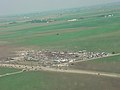
 Metamora, Illinois (5552886233).jpg 600 × 411; 151 KB
-
 Minonk Township wind-and-soybean farm.jpg 6,016 × 4,000; 5.9 MB
-
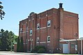
 Peoria Public Library - Lincoln Branch building.jpg 3,024 × 3,024; 7.8 MB
-
 Roanoke Township soybean fields.jpg 6,016 × 4,000; 5.79 MB
-
 Roanoke-tornado-july-04-parsons-after.jpg 640 × 480; 40 KB
-
 Saunemin Elementary School.jpg 6,016 × 4,000; 6.26 MB


.jpg)
.jpg)
.jpg)
.jpg)
.jpg)
.jpg)
.jpg)
.jpg)
.jpg)
.jpg)
.jpg)
.svg)


.jpg)


