Category:Huntshaw
Jump to navigation
Jump to search
village in the United Kingdom  | |||||
| Upload media | |||||
| Instance of | |||||
|---|---|---|---|---|---|
| Location | Torridge, Devon, South West England, England | ||||
 | |||||
Subcategories
This category has the following 2 subcategories, out of 2 total.
H
M
Media in category "Huntshaw"
The following 126 files are in this category, out of 126 total.
-
 Access for wind turbine at Knockworthy Cross - geograph.org.uk - 5318835.jpg 1,600 × 1,200; 769 KB
-
 An odd-shaped parcel of land - geograph.org.uk - 5318170.jpg 1,600 × 961; 587 KB
-
 Arable field near Huntshaw - geograph.org.uk - 6334116.jpg 4,288 × 2,848; 1.27 MB
-
 Brownscombe Farm - geograph.org.uk - 4441702.jpg 800 × 531; 128 KB
-
 Brownscombe Farm - geograph.org.uk - 659980.jpg 640 × 362; 61 KB
-
 Carrier's Lane End - geograph.org.uk - 665845.jpg 640 × 480; 64 KB
-
 Churchyard, Huntshaw (geograph 6508272).jpg 4,288 × 2,848; 1.48 MB
-
 Clearfell at Foxes' Cross - geograph.org.uk - 4444359.jpg 800 × 531; 193 KB
-
 Country road near Huntshaw - geograph.org.uk - 4444388.jpg 800 × 531; 121 KB
-
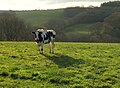 Cow at Huntshaw - geograph.org.uk - 6335102.jpg 2,071 × 1,514; 680 KB
-
 Farmland at Haddacott - geograph.org.uk - 4441711.jpg 800 × 531; 118 KB
-
 Farmland near Delve's Grave Cross - geograph.org.uk - 4440951.jpg 800 × 531; 125 KB
-
 Farmland near Haddacott - geograph.org.uk - 4441771.jpg 800 × 531; 132 KB
-
 Farmland near Huntshaw - geograph.org.uk - 4441779.jpg 800 × 531; 136 KB
-
 Farmland viewed from near Delve's Grave Cross - geograph.org.uk - 4440959.jpg 1,024 × 680; 274 KB
-
 Field entrance, Haddacott Cross - geograph.org.uk - 6335167.jpg 4,182 × 2,736; 1.95 MB
-
 Ford Cottages (geograph 6510028).jpg 3,453 × 2,489; 1.89 MB
-
 Foxes' Cross - geograph.org.uk - 4444355.jpg 800 × 531; 175 KB
-
 Gallops at Carrier's Lane End - geograph.org.uk - 659992.jpg 640 × 480; 54 KB
-
 Haddacott (geograph 6335175).jpg 3,761 × 2,258; 919 KB
-
 Haddacott Cross - geograph.org.uk - 5318150.jpg 1,600 × 968; 482 KB
-
 Haddacott Cross - geograph.org.uk - 659976.jpg 640 × 480; 73 KB
-
 Headstones, Huntshaw - geograph.org.uk - 6335112.jpg 2,553 × 3,799; 1.54 MB
-
 Hedge shaped by the wind on Huntshaw Moor - geograph.org.uk - 3450305.jpg 1,024 × 768; 176 KB
-
 Holiday Homes at Twitchen - geograph.org.uk - 5533785.jpg 4,608 × 3,456; 3.02 MB
-
 Huntshaw , Country Lane - geograph.org.uk - 6349268.jpg 6,000 × 4,000; 7.83 MB
-
 Huntshaw , Country Lane - geograph.org.uk - 6349270.jpg 6,000 × 4,000; 6.72 MB
-
 Huntshaw , Country Lane - geograph.org.uk - 6349272.jpg 6,000 × 4,000; 7.54 MB
-
 Huntshaw , Country Lane - geograph.org.uk - 6349274.jpg 6,000 × 4,000; 7.1 MB
-
 Huntshaw , Country Lane - geograph.org.uk - 6349279.jpg 6,000 × 4,000; 6.39 MB
-
 Huntshaw , Country Lane - geograph.org.uk - 6349280.jpg 6,000 × 4,000; 6.53 MB
-
 Huntshaw , Country Lane - geograph.org.uk - 6349281.jpg 6,000 × 4,000; 6.85 MB
-
 Huntshaw , Country Lane - geograph.org.uk - 6349282.jpg 6,000 × 4,000; 6.94 MB
-
 Huntshaw , Country Lane - geograph.org.uk - 6349283.jpg 6,000 × 4,000; 7.89 MB
-
 Huntshaw , Country Lane - geograph.org.uk - 6349286.jpg 6,000 × 4,000; 6.4 MB
-
 Huntshaw , Country Lane - geograph.org.uk - 6349292.jpg 6,000 × 4,000; 7.57 MB
-
 Huntshaw , Country Lane - geograph.org.uk - 6349293.jpg 6,000 × 4,000; 6.45 MB
-
 Huntshaw , Country Lane - geograph.org.uk - 6349296.jpg 6,000 × 4,000; 6.18 MB
-
 Huntshaw , Country Lane - geograph.org.uk - 6349298.jpg 6,000 × 4,000; 6.67 MB
-
 Huntshaw , Country Lane - geograph.org.uk - 6349299.jpg 6,000 × 4,000; 5.93 MB
-
 Huntshaw , Country Lane - geograph.org.uk - 6349305.jpg 6,000 × 4,000; 7.7 MB
-
 Huntshaw , Country Lane - geograph.org.uk - 6349326.jpg 6,000 × 4,000; 6.8 MB
-
 Huntshaw , Country Lane - geograph.org.uk - 6349329.jpg 6,000 × 4,000; 6.96 MB
-
 Huntshaw , Country Lane - geograph.org.uk - 6349340.jpg 6,000 × 4,000; 5.74 MB
-
 Huntshaw , Country Lane - geograph.org.uk - 6349343.jpg 6,000 × 4,000; 6.94 MB
-
 Huntshaw , Country Lane - geograph.org.uk - 6349346.jpg 6,000 × 4,000; 7.06 MB
-
 Huntshaw , Country Lane - geograph.org.uk - 6349363.jpg 6,000 × 4,000; 6.39 MB
-
 Huntshaw , Country Lane - geograph.org.uk - 6349365.jpg 6,000 × 4,000; 6.52 MB
-
 Huntshaw , Country Lane - geograph.org.uk - 6349366.jpg 6,000 × 4,000; 6.36 MB
-
 Huntshaw , Country Lane - geograph.org.uk - 6349368.jpg 6,000 × 4,000; 6.48 MB
-
 Huntshaw , Country Lane - geograph.org.uk - 6349370.jpg 6,000 × 4,000; 6.5 MB
-
 Huntshaw , Countryside Scenery - geograph.org.uk - 6349301.jpg 6,000 × 4,000; 6.67 MB
-
 Huntshaw , Countryside Scenery - geograph.org.uk - 6349304.jpg 6,000 × 4,000; 4.66 MB
-
 Huntshaw , Countryside Scenery - geograph.org.uk - 6349317.jpg 6,000 × 4,000; 6.36 MB
-
 Huntshaw , Countryside Scenery - geograph.org.uk - 6349341.jpg 6,000 × 4,000; 7.16 MB
-
 Huntshaw , Countryside Scenery - geograph.org.uk - 6349345.jpg 6,000 × 4,000; 6.14 MB
-
 Huntshaw , Countryside Scenery - geograph.org.uk - 6349347.jpg 6,000 × 4,000; 5.83 MB
-
 Huntshaw , Countryside Scenery - geograph.org.uk - 6349351.jpg 6,000 × 4,000; 6.22 MB
-
 Huntshaw , Fairoak - geograph.org.uk - 6349290.jpg 6,000 × 4,000; 5.81 MB
-
 Huntshaw , Fairoak - geograph.org.uk - 6349291.jpg 6,000 × 4,000; 6.94 MB
-
 Huntshaw , Farm Buildings - geograph.org.uk - 6349325.jpg 6,000 × 4,000; 6.91 MB
-
 Huntshaw , Foxes Cross - geograph.org.uk - 6349271.jpg 6,000 × 4,000; 7.14 MB
-
 Huntshaw , Grassy Field - geograph.org.uk - 6341081.jpg 6,000 × 4,000; 7.61 MB
-
 Huntshaw , Grassy Field - geograph.org.uk - 6349330.jpg 6,000 × 4,000; 6.15 MB
-
 Huntshaw , Grassy Field - geograph.org.uk - 6349353.jpg 6,000 × 4,000; 6.94 MB
-
 Huntshaw , Grassy Field - geograph.org.uk - 6350452.jpg 6,000 × 4,000; 4.82 MB
-
 Huntshaw , Huntshaw Barton - geograph.org.uk - 6349336.jpg 6,000 × 4,000; 6.88 MB
-
 Huntshaw , Huntshaw Wood - geograph.org.uk - 6349276.jpg 6,000 × 4,000; 7.74 MB
-
 Huntshaw , Huntshaw Wood - geograph.org.uk - 6349277.jpg 6,000 × 4,000; 6.83 MB
-
 Huntshaw , Lower Huntshaw Barton - geograph.org.uk - 6349357.jpg 6,000 × 4,000; 5.66 MB
-
 Huntshaw , Muddy Field - geograph.org.uk - 6349312.jpg 6,000 × 4,000; 6.23 MB
-
 Huntshaw , Muddy Track - geograph.org.uk - 6349318.jpg 6,000 × 4,000; 6.7 MB
-
 Huntshaw , Muddy Track - geograph.org.uk - 6349319.jpg 6,000 × 4,000; 6.34 MB
-
 Huntshaw , Sheddymoor Heights - geograph.org.uk - 6349361.jpg 6,000 × 4,000; 6.66 MB
-
 Huntshaw , Small Track - geograph.org.uk - 6349362.jpg 6,000 × 4,000; 6.91 MB
-
 Huntshaw , St Mary's Church - geograph.org.uk - 6349338.jpg 6,000 × 4,000; 5.93 MB
-
 Huntshaw , Track - geograph.org.uk - 6349315.jpg 6,000 × 4,000; 7.23 MB
-
 Huntshaw , Village Scenery - geograph.org.uk - 6349334.jpg 6,000 × 4,000; 6.01 MB
-
 Huntshaw , Woodland - geograph.org.uk - 6349255.jpg 6,000 × 4,000; 6.81 MB
-
 Huntshaw , Woodland - geograph.org.uk - 6349256.jpg 6,000 × 4,000; 7.87 MB
-
 Huntshaw , Woodland - geograph.org.uk - 6349267.jpg 6,000 × 4,000; 6.2 MB
-
 Huntshaw , Woodland Path - geograph.org.uk - 6349264.jpg 6,000 × 4,000; 7.62 MB
-
 Huntshaw , Woodland Track - geograph.org.uk - 6349284.jpg 6,000 × 4,000; 7.01 MB
-
 Huntshaw Moor - geograph.org.uk - 3450303.jpg 1,024 × 769; 107 KB
-
 Huntshaw Water (geograph 6335189).jpg 4,244 × 2,365; 2.01 MB
-
 Huntshaw Water - geograph.org.uk - 4441717.jpg 800 × 531; 122 KB
-
 Huntshaw Water - geograph.org.uk - 659982.jpg 640 × 480; 178 KB
-
 Huntshaw Wood and surroundings (geograph 6334075).jpg 3,221 × 2,050; 817 KB
-
 Huntshaw, field of barley - geograph.org.uk - 489221.jpg 640 × 427; 142 KB
-
 Huntshaw, on Huntshaw Moor - geograph.org.uk - 489224.jpg 640 × 427; 161 KB
-
 Junction near Brownscombe Farm - geograph.org.uk - 6335756.jpg 3,646 × 2,193; 1.18 MB
-
 Junction, Huntshaw Water - geograph.org.uk - 6335186.jpg 3,343 × 2,076; 1.47 MB
-
 Knockworthy Cross - geograph.org.uk - 5318830.jpg 1,600 × 1,200; 707 KB
-
 Knockworthy Farm - geograph.org.uk - 659997.jpg 640 × 308; 47 KB
-
 Lane across Huntshaw Moor - geograph.org.uk - 5308103.jpg 3,072 × 2,048; 1.6 MB
-
 Lane at Huntshaw Cross - geograph.org.uk - 5308128.jpg 3,072 × 2,048; 1.17 MB
-
 Lane from Gammaton Moor - geograph.org.uk - 6335772.jpg 4,151 × 2,688; 2.02 MB
-
 Lay-by at Knockworthy - geograph.org.uk - 5318838.jpg 1,600 × 1,066; 551 KB
-
 Narrow country road, Huntshaw - geograph.org.uk - 4444403.jpg 531 × 800; 181 KB
-
 Old school house, Huntshaw - geograph.org.uk - 665852.jpg 640 × 480; 78 KB
-
 Ordnance Survey Cut Mark - geograph.org.uk - 4567009.jpg 480 × 640; 132 KB
-
 Ploughed field near Knockworthy - geograph.org.uk - 4440942.jpg 1,024 × 680; 353 KB
-
 Road at Huntshaw Water - geograph.org.uk - 4441763.jpg 1,024 × 680; 301 KB
-
 Road junction near at Fair Oak - geograph.org.uk - 4444416.jpg 1,024 × 680; 345 KB
-
 Road passing Brownscombe Farm - geograph.org.uk - 4441688.jpg 800 × 531; 147 KB
-
 Solar array at Knockworthy seen from Delve's Grave Cross - geograph.org.uk - 5318858.jpg 1,600 × 1,200; 734 KB
-
 Solar Farm near Huntshaw - geograph.org.uk - 4440949.jpg 800 × 531; 91 KB
-
 Stream near Lower Kingdon - geograph.org.uk - 6335783.jpg 2,848 × 4,288; 2.43 MB
-
 The B3232 on Derracott Moor - geograph.org.uk - 4440961.jpg 800 × 531; 114 KB
-
 The bridge at Haddacott Cottage - geograph.org.uk - 5318162.jpg 1,600 × 1,200; 812 KB
-
 The church of St. Mary Magdalene, Huntshaw - geograph.org.uk - 6368829.jpg 3,648 × 5,472; 4.02 MB
-
 The church of St. Mary Magdalene, Huntshaw - geograph.org.uk - 6368834.jpg 4,882 × 3,989; 4.99 MB
-
 The church of St. Mary Magdalene, Huntshaw - geograph.org.uk - 6368840.jpg 5,472 × 3,648; 4.91 MB
-
 The church of St. Mary Magdalene, Huntshaw - geograph.org.uk - 6368842.jpg 5,130 × 3,612; 6.16 MB
-
 The Huntshaw valley - geograph.org.uk - 665856.jpg 640 × 480; 141 KB
-
 The road to Garnacott Farm - geograph.org.uk - 5318154.jpg 1,600 × 1,200; 810 KB
-
 The road to Twitchen from Twitchen Cross - geograph.org.uk - 5318183.jpg 1,600 × 1,200; 683 KB
-
 The ubiquitous mast at Huntshaw Cross - geograph.org.uk - 4846313.jpg 5,867 × 3,237; 4.43 MB
-
 The valley south of Wayhead Bridge - geograph.org.uk - 5318850.jpg 1,600 × 1,200; 868 KB
-
 Trees beside the road south of Knockworthy - geograph.org.uk - 5318840.jpg 1,600 × 1,200; 734 KB
-
 Twitchen Cross - geograph.org.uk - 5318179.jpg 1,600 × 1,200; 545 KB
-
 View from Huntshaw Mill Bridge - geograph.org.uk - 623712.jpg 640 × 480; 135 KB
-
 View to Haddacott - geograph.org.uk - 4441775.jpg 800 × 531; 109 KB
-
 Wayhead Bridge - geograph.org.uk - 5318846.jpg 1,600 × 1,200; 809 KB
-
 Wind turbines, Durracott Moor - geograph.org.uk - 4440946.jpg 800 × 531; 73 KB
-
 Window, St Mary Magdalene's church, Huntshaw - geograph.org.uk - 6335110.jpg 2,848 × 4,288; 2.04 MB


.jpg)


.jpg)


.jpg)


.jpg)


.jpg)


