Category:Hunsworth, West Yorkshire
Jump to navigation
Jump to search
settlement and former civil parish in Kirklees, West Yorkshire, England | |||||
| Upload media | |||||
| Instance of | |||||
|---|---|---|---|---|---|
| Location | Kirklees, West Yorkshire, Yorkshire and the Humber, England | ||||
| |||||
Subcategories
This category has the following 5 subcategories, out of 5 total.
D
- Drub Lane (3 F)
H
- Hunsworth Lane, Kirklees (13 F)
- Hunsworth Lodge Farm (3 F)
Media in category "Hunsworth, West Yorkshire"
The following 31 files are in this category, out of 31 total.
-
 A58 Whitehall Road, Hunsworth - geograph.org.uk - 5157569.jpg 640 × 479; 51 KB
-

-

-
 Bridleway - Stubs Beck Lane - geograph.org.uk - 2803591.jpg 480 × 640; 66 KB
-
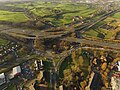 Chainbar Roundabout.jpg 4,000 × 3,000; 3.97 MB
-

-

-
 Green Lane - Hunsworth Lane - geograph.org.uk - 2802413.jpg 640 × 480; 81 KB
-
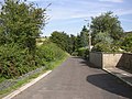 Green Lane, Hunsworth - geograph.org.uk - 548729.jpg 640 × 480; 112 KB
-
 Greenroyd Avenue - Green Lane - geograph.org.uk - 2802416.jpg 640 × 480; 49 KB
-
 Greenroyd Avenue - Hunsworth Lane - geograph.org.uk - 2802409.jpg 640 × 480; 49 KB
-

-
 Hunsworth Lane, Hunsworth - geograph.org.uk - 548717.jpg 640 × 422; 56 KB
-
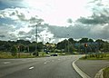 Junction 26, M62 - geograph.org.uk - 1434131.jpg 640 × 459; 57 KB
-
 Kilroyd Avenue - Kilroyd Drive - geograph.org.uk - 2802441.jpg 640 × 480; 58 KB
-

-

-
 Kilroyd Drive - Whitehall Road West - geograph.org.uk - 2802437.jpg 640 × 480; 54 KB
-

-
 Mazebrook Avenue - Drub Lane - geograph.org.uk - 2802606.jpg 640 × 480; 41 KB
-

-

-

-
-
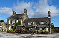 Savile Arms, Hunsworth.jpg 640 × 418; 84 KB
-
 Savile Park Road - Hunsworth Lane - geograph.org.uk - 2802392.jpg 640 × 480; 45 KB
-

-
 The green, Hunsworth - geograph.org.uk - 537910.jpg 640 × 410; 65 KB
-

-
 Waiting to join the M606 motorway - geograph.org.uk - 958121.jpg 640 × 293; 36 KB
-


