Category:Hunger maps of the world
Jump to navigation
Jump to search
Media in category "Hunger maps of the world"
The following 14 files are in this category, out of 14 total.
-
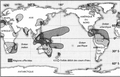 1876-78 el niño Davis.png 888 × 567; 419 KB
-
 Acute food insecurity forecast for 2020 including coronavirus famines.svg 2,754 × 1,398; 1.22 MB
-
 Carte de la faim dans le monde.svg 940 × 415; 1.65 MB
-
 Countries with food scarsity problems.png 1,350 × 625; 60 KB
-
 Depth of the food deficit in kilocalories per person per day, OWID.svg 850 × 600; 144 KB
-
 GHI 2011 Severity Map.jpg 2,207 × 1,550; 679 KB
-
 GHI2010 Severity Map.jpg 2,481 × 1,754; 500 KB
-
 GHI2011.tiff 2,599 × 1,838; 13.67 MB
-
 Global Hidden Hunger Index in pre-school children, OWID.svg 850 × 600; 140 KB
-
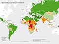
 Global malnutrition.png 1,425 × 625; 41 KB
-
 Mappa dell'indice globale della fame del 2011.jpg 3,280 × 2,161; 1.08 MB
-
 Mappa GHI 2010.jpg 1,216 × 897; 492 KB
-
 Welthunger-Index 2011 Nach Schweregrad.jpg 10,034 × 7,141; 1.45 MB
-
 Welthunger-Index 2012 - Welthunger-Index nach Schweregrad.jpg 4,956 × 3,333; 1,020 KB


