Category:Hung Hom Municipal Services Building
Jump to navigation
Jump to search
| Object location | | View all coordinates using: OpenStreetMap |
|---|
municipal complex in Hong Kong  | |||||
| Upload media | |||||
| Instance of | |||||
|---|---|---|---|---|---|
| Location |
| ||||
 | |||||
Subcategories
This category has the following 3 subcategories, out of 3 total.
H
- Hung Hom Market (7 F)
- Hung Hom Public Library (5 F)
Media in category "Hung Hom Municipal Services Building"
The following 6 files are in this category, out of 6 total.
-
 HK Hung Hom Market 紅磡街市 Ma Tau Wai Road KMBus 115 stop.jpg 2,592 × 1,944; 1.03 MB
-

-
 HK 紅磡 Hung Hom 馬頭圍道 Ma Tau Wai Road 蕪湖街 Wuhu Street 黃昏 evening March 2020 SS2 07.jpg 4,128 × 3,096; 2.68 MB
-
 Hung Hom Market Cooked Food Centre.jpg 2,687 × 1,750; 3.22 MB
-
 Hung Hom Municipal Services Building.JPG 3,648 × 2,736; 2.23 MB
-
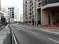 Ma Tau Wai Road near Ka Wai Chuen.JPG 3,648 × 2,736; 2.01 MB


