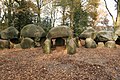
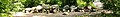
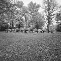
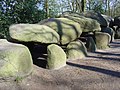
Category:Hunebed D27 in Borger
Jump to navigation
Jump to search
dolmen in the Netherlands  | |||||
| Upload media | |||||
| Instance of | |||||
|---|---|---|---|---|---|
| Part of | |||||
| Location | Borger, Borger-Odoorn, Drenthe, Netherlands | ||||
| Street address |
| ||||
| Located on street |
| ||||
| Heritage designation |
| ||||
 | |||||
|
This is a category about rijksmonument number 421090
|
| Address |
|
Media in category "Hunebed D27 in Borger"
The following 48 files are in this category, out of 48 total.
-
 20191218 hunebed Borger.jpg 4,030 × 2,154; 2.9 MB
-
 Borger hunebed.jpg 1,600 × 1,066; 849 KB
-
 Borger Megalith.JPG 2,048 × 1,536; 732 KB
-
 Brongersma Schatkamer.png 1,007 × 793; 771 KB
-
 D 27 Borger, de grootste hunnebed van Nederland pagebanner.jpg 4,624 × 661; 1.35 MB
-
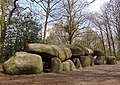
 D 27 Borger, de grootste hunnebed van Nederland.jpg 4,624 × 3,468; 7.37 MB
-
 Exterieur overzicht hunebed D 27 - Borger - 20322970 - RCE.jpg 1,188 × 1,200; 506 KB
-
 Exterieur overzicht hunebed D 27 - Borger - 20322971 - RCE.jpg 1,200 × 1,197; 520 KB
-

-
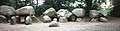
 Grootste hunebed van Nederl.jpg 1,296 × 972; 283 KB
-
 Het grootste Hunebed.jpg 3,872 × 2,592; 4.85 MB
-
 Hier werden de doden begraven in het hunebed Borger Drenthe.JPG 5,184 × 3,456; 5.11 MB
-
 Hunebed 006.jpg 1,280 × 960; 337 KB
-
 Hunebed 008.jpg 1,280 × 960; 354 KB
-
 Hunebed 010.jpg 1,280 × 960; 237 KB
-
 Hunebed 011 Panorama.jpg 1,278 × 332; 330 KB
-
 Hunebed 011.jpg 1,280 × 960; 429 KB
-
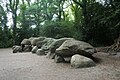
 Hunebed Borger 1.jpg 3,872 × 2,592; 4.78 MB
-
 Hunebed Borger.jpg 3,538 × 2,420; 4.33 MB
-
 Hunebed D27 -1.jpg 5,568 × 3,712; 9.61 MB
-
 Hunebed D27 -2.jpg 4,658 × 3,004; 6.11 MB
-
 Hunebed D27 -3.jpg 4,128 × 1,908; 2.61 MB
-
 Hunebed D27 -4.jpg 4,128 × 1,908; 3.08 MB
-
 Hunebed D27 -5.jpg 4,128 × 1,908; 3.27 MB
-
 Hunebed D27 2020.jpg 6,576 × 3,699; 33.27 MB
-
 Hunebed D27 Goedeljee.jpg 2,000 × 1,541; 687 KB
-
 Hunebed D27 in Borger flickr.jpg 4,256 × 2,848; 1.65 MB
-
 Hunebed stone.jpg 4,128 × 1,908; 4.06 MB
-
 Hunebed, Borger, Netherlands - 4094829113.jpg 1,066 × 1,600; 729 KB
-
 Hunebed, Borger, Netherlands - 4095587258.jpg 1,066 × 1,600; 712 KB
-
 Hunebed, Borger, Netherlands - 4095588116.jpg 1,066 × 1,600; 553 KB
-
 Hunebed, Borger, Netherlands - 4095621962.jpg 1,600 × 1,066; 616 KB
-
 Hunebed-d27.jpg 624 × 442; 94 KB
-
 Ingang hunebed in Borger Drenthe.jpg 2,048 × 1,536; 2.49 MB
-

-
 Largest hunnebed of the world Borger Drenthe.JPG 5,184 × 3,456; 6.21 MB
-
 Overzicht hunebed D27 - Borger - 20369120 - RCE.jpg 1,196 × 1,200; 494 KB
-
 Overzicht hunebed D27 - Borger - 20369121 - RCE.jpg 1,194 × 1,200; 490 KB
-
 Overzicht hunebed D27 - Borger - 20369122 - RCE.jpg 1,189 × 1,200; 485 KB
-
 Panorama Borger 1 pagebanner.JPG 4,510 × 645; 910 KB
-
 Panorama Borger 1.JPG 4,510 × 2,262; 3.29 MB
-
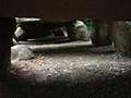
 Under the hunebed.jpg 5,568 × 3,712; 9.53 MB
-
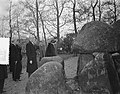
 Werkbezoek van de Koningin aan Drenthe, Bestanddeelnr 907-4411.jpg 3,235 × 2,504; 1.7 MB
-
 Werkbezoek van de Koningin aan Drenthe, Bestanddeelnr 907-4412.jpg 3,207 × 2,504; 1.49 MB
-
 Werkbezoek van de Koningin aan Drenthe, Bestanddeelnr 907-4413.jpg 3,235 × 2,504; 1.44 MB
-
 Werkbezoek van de Koningin aan Drenthe, Bestanddeelnr 907-4414.jpg 3,235 × 2,504; 1.52 MB
-
 Werkbezoek van de Koningin aan Drenthe, Bestanddeelnr 907-4415.jpg 3,235 × 2,504; 1.43 MB
-
 Werkbezoek van de Koningin aan Drenthe, Bestanddeelnr 907-4416.jpg 3,220 × 2,516; 1.9 MB


