Category:Horsham
Jump to navigation
Jump to search
town in West Sussex, England  | |||||
| Upload media | |||||
| Instance of | |||||
|---|---|---|---|---|---|
| Location | Horsham, West Sussex, South East England, England | ||||
| Area |
| ||||
| Different from | |||||
| official website | |||||
 | |||||
English: Images of the town of Horsham, West Sussex, England. The third-order administrative division of Horsham District includes the town, being the administrative centre and an unparished area, and 32 surrounding civil parishes.
Subcategories
This category has the following 9 subcategories, out of 9 total.
Media in category "Horsham"
The following 200 files are in this category, out of 326 total.
(previous page) (next page)-

-
 Carfax Horsham West Sussex England - Horsham Stone tiled roof 2.jpg 3,000 × 1,500; 2.28 MB
-
 The Capitol theatre and cinema, Horsham, West Sussex, England.jpg 3,875 × 2,583; 7.11 MB
-
-
 West Sussex County Council & Horsham District Council offices, Horsham.jpg 4,353 × 3,265; 11.34 MB
-
 Piries Place tower crane in Horsham, West Sussex, England 01.jpg 2,878 × 4,315; 9.43 MB
-
 Piries Place alley in Horsham, West Sussex, England.jpg 3,314 × 4,419; 12.21 MB
-
 Piries Place entrance in Horsham, West Sussex, England.jpg 2,933 × 3,666; 6.89 MB
-
 Horsham Stone roof at Piries Place, Horsham, West Sussex, England.jpg 4,289 × 3,216; 11.66 MB
-
 Piries Place timber framing in Horsham, West Sussex, England.jpg 4,264 × 3,198; 12.82 MB
-
 Piries Place tower crane in Horsham, West Sussex, England 02.jpg 2,855 × 4,282; 9.7 MB
-
 Handwash basin, Roffey, Horsham, West Sussex.jpg 3,570 × 3,570; 6.51 MB
-
 Urinal reflections, Roffey, Horsham, West Sussex.jpg 3,388 × 6,023; 10.82 MB
-
 Central Horsham footpath and underpass, West Sussex.jpg 5,547 × 4,160; 22.52 MB
-
 Premier Inn bathroom toilet, Horsham, West Sussex.jpg 4,043 × 6,065; 12.6 MB
-
 Premier Inn bathroom handwash basin, Horsham, West Sussex.jpg 4,891 × 3,844; 9.61 MB
-

-

-
-
 Architectural melange - geograph.org.uk - 389538.jpg 640 × 485; 79 KB
-
 Architectural Mix, the Causeway, Horsham. - geograph.org.uk - 175567.jpg 640 × 436; 161 KB
-
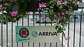 Arriva Horsham in bloom sign.JPG 3,328 × 1,872; 2.08 MB
-
 Arthur Lodge Veterinary Surgery - geograph.org.uk - 907819.jpg 640 × 480; 57 KB
-
 Barrack Field Crossing - geograph.org.uk - 1291822.jpg 640 × 430; 99 KB
-
 Barrack Field crossing - geograph.org.uk - 414355.jpg 640 × 483; 78 KB
-
 Barttelot Court - geograph.org.uk - 907957.jpg 640 × 480; 72 KB
-
 Bennetts Road Allotments - geograph.org.uk - 388105.jpg 640 × 480; 117 KB
-
 Bennetts Road Allotments - geograph.org.uk - 388121.jpg 640 × 480; 98 KB
-
 Black Cattle by Hamper's Lane - geograph.org.uk - 1288223.jpg 640 × 430; 116 KB
-
 Blackbridge Lane post box.jpg 3,456 × 4,608; 8.48 MB
-
 Boardwalk, Warnham Nature Reserve - geograph.org.uk - 237840.jpg 640 × 487; 435 KB
-
 Bodleian Libraries, Horsham from the Ordnance Survey.jpg 672 × 1,000; 98 KB
-

-
 Car Park off London Road - geograph.org.uk - 1562061.jpg 640 × 480; 121 KB
-
 Carfax Horsham West Sussex England - Horsham Stone tiled roof 1.jpg 3,000 × 2,000; 4.24 MB
-
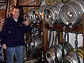 Cask Ales.jpg 448 × 340; 54 KB
-
 Caterpillar, Warnham Nature Reserve - geograph.org.uk - 237935.jpg 462 × 640; 259 KB
-
 Central Horsham. - geograph.org.uk - 175574.jpg 431 × 640; 109 KB
-
 Change of use for Exchange House - geograph.org.uk - 1561959.jpg 640 × 480; 109 KB
-
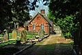
 Chapel at Christ's Hospital.jpg 2,988 × 5,312; 2.96 MB
-
 Charles Eversfield and His Wife.jpeg 1,200 × 923; 630 KB
-
 Chesworth Allotments - geograph.org.uk - 795678.jpg 640 × 480; 109 KB
-
 Coleridge Close - geograph.org.uk - 1290447.jpg 640 × 430; 97 KB
-

-
 Coltsfoot Drive - geograph.org.uk - 1290907.jpg 640 × 430; 58 KB
-
 Commemorative Fountain, North St - geograph.org.uk - 1291554.jpg 640 × 430; 73 KB
-

-
 Denn Place (Denne Park) by Samuel Hieronymus Grimm 1788.jpg 976 × 692; 207 KB
-
 Depot Rd Allotments, Depot Rd (2) - geograph.org.uk - 1287867.jpg 640 × 430; 81 KB
-
 Depot Rd Allotments, Depot Rd - geograph.org.uk - 1287866.jpg 640 × 430; 82 KB
-

-
 Drake Close off North Heath Lane - geograph.org.uk - 1290867.jpg 640 × 430; 75 KB
-
 Drill Hall, Denne Road - geograph.org.uk - 414834.jpg 640 × 486; 57 KB
-
 Dry pond - geograph.org.uk - 637409.jpg 640 × 480; 80 KB
-
 DSCN2500 Dragon's Teeth to defend Horsham.jpg 3,456 × 4,608; 7.55 MB
-
 DSCN2507 FREEMASONS have met in Horsham.jpg 4,608 × 3,456; 7.44 MB
-

-

-
 Exterior of Horsham Museum.jpg 3,456 × 5,184; 4.45 MB
-
 Farthing Bridge, Horsham - geograph.org.uk - 68796.jpg 479 × 640; 228 KB
-
 Fire in Hurst Road - geograph.org.uk - 905992.jpg 640 × 480; 106 KB
-

-
 Flour sack hoist - geograph.org.uk - 453498.jpg 640 × 480; 60 KB
-
 Folly Pond - geograph.org.uk - 406210.jpg 640 × 480; 168 KB
-
 Footbridge over the A24 - geograph.org.uk - 396638.jpg 640 × 487; 55 KB
-
 Footbridge over the Hornbrook - geograph.org.uk - 385680.jpg 640 × 480; 132 KB
-
 Footbridge over the river Arun - geograph.org.uk - 384401.jpg 640 × 480; 141 KB
-
 Footpath near Gunbarn Crossing (geograph 4027774).jpg 640 × 430; 140 KB
-
 Forestboysschool.jpg 640 × 480; 82 KB
-
 Former art college - geograph.org.uk - 903732.jpg 640 × 480; 132 KB
-
 Former estate building in Blackhorse Way - geograph.org.uk - 540948.jpg 640 × 480; 361 KB
-
 Former stables, Blackhorse Way - geograph.org.uk - 466120.jpg 640 × 480; 85 KB
-
 Forum - Coffee Shop - geograph.org.uk - 913080.jpg 640 × 480; 62 KB
-
 Fountain near public library - geograph.org.uk - 237335.jpg 640 × 469; 266 KB
-
 Gasteruption jaculator 104919873.jpg 1,848 × 1,082; 1.3 MB
-
 Gate at the end of Peary Close - geograph.org.uk - 1290847.jpg 640 × 430; 94 KB
-
 Gates to Coolhurst House - geograph.org.uk - 385614.jpg 640 × 480; 71 KB
-
 Giant parasols, Carfax, Horsham - geograph.org.uk - 238715.jpg 640 × 485; 329 KB
-
 Girl Guide Headquarters - geograph.org.uk - 1562032.jpg 640 × 480; 119 KB
-
 Gladstone Rd, Hurst Rd junction - geograph.org.uk - 1287744.jpg 640 × 430; 63 KB
-
 Gordon Rd - geograph.org.uk - 1291008.jpg 640 × 430; 130 KB
-
 Gorings Mead - geograph.org.uk - 908442.jpg 640 × 481; 72 KB
-
 Graffiti pi (10697503904).jpg 3,648 × 2,432; 1.29 MB
-
 Graylands, Horsham.jpg 988 × 406; 389 KB
-
 Hammerpond Road, Horsham (geograph 4051722).jpg 2,965 × 2,227; 2.14 MB
-
 Hammerpond Road, Horsham (geograph 4051736).jpg 3,072 × 2,304; 2.02 MB
-
 Hammerpond Road, Horsham (geograph 4051805).jpg 3,072 × 2,304; 2.21 MB
-
 Hampers Farm - geograph.org.uk - 453547.jpg 640 × 480; 70 KB
-
 Hampers Farm - geograph.org.uk - 453552.jpg 640 × 480; 59 KB
-

-
 Heath Way, North Heath Lane junction - geograph.org.uk - 1290899.jpg 640 × 430; 67 KB
-

-
 Home Truths On the A264 - geograph.org.uk - 323317.jpg 640 × 426; 102 KB
-
 Hornbrook junction with river Arun - geograph.org.uk - 385760.jpg 640 × 480; 135 KB
-
 Bennett's Field play area - geograph.org.uk - 1802753.jpg 640 × 428; 100 KB
-
 Horsham Ambulance Station, Hurst Rd - geograph.org.uk - 1291032.jpg 640 × 430; 112 KB
-
 Horsham Bandstand 2023.jpg 6,000 × 4,000; 11.69 MB
-
 Horsham Causeway, Sussex (NBY 438420).jpg 2,352 × 3,600; 2.18 MB
-
 Horsham Causeway, Sussex. (NBY 440637).jpg 2,344 × 3,600; 2.3 MB
-
 Horsham Community Hospital - geograph.org.uk - 1291025.jpg 640 × 430; 70 KB
-
 Horsham Community Hospital annexe - geograph.org.uk - 1558319.jpg 640 × 480; 73 KB
-
 Horsham Copnall Way traffic lights 2.JPG 3,712 × 2,088; 2.96 MB
-
 Horsham Copnall Way traffic lights.JPG 3,712 × 2,088; 3.07 MB
-
 Horsham cottage hospital - geograph.org.uk - 903813.jpg 640 × 480; 107 KB
-
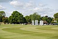 Horsham Cricket Club (2) - geograph.org.uk - 1291773.jpg 640 × 430; 67 KB
-
 Horsham Cricket Club - geograph.org.uk - 1291764.jpg 640 × 411; 60 KB
-
 Horsham Cricket Club Pavilion - geograph.org.uk - 1431190.jpg 640 × 480; 67 KB
-
 Horsham Cricket Ground - geograph.org.uk - 1431202.jpg 640 × 480; 91 KB
-
 Horsham Cricket Ground - geograph.org.uk - 1431211.jpg 640 × 454; 77 KB
-
 Horsham East Street railway bridge.JPG 3,712 × 2,088; 3.33 MB
-
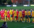
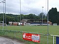
 Horsham FC v Crawley Down Gatwick (8507786451).jpg 800 × 585; 363 KB
-
 Horsham FC v Crawley Down Gatwick (8507798201).jpg 3,059 × 2,519; 5.01 MB
-
 Horsham FC v Crawley Down Gatwick (8508897594).jpg 3,121 × 2,229; 4.48 MB
-
 Horsham FC v Crawley Down Gatwick (8508901198).jpg 2,532 × 3,504; 4.32 MB
-
 Horsham FC v Crawley Down Gatwick (8508905578).jpg 613 × 480; 265 KB
-
 Horsham FC v Crawley Down Gatwick (8510776369).jpg 701 × 522; 386 KB
-
 Horsham FC v Crawley Down Gatwick (8511880622).jpg 640 × 402; 152 KB
-
 Horsham FC v Crawley Down Gatwick (8511883106).jpg 2,570 × 3,528; 3.64 MB
-
 Horsham FC v Crawley Down Gatwick (8511887470).jpg 3,644 × 2,732; 5.96 MB
-
 Horsham FC v Crawley Down Gatwick (8511887598).jpg 553 × 600; 194 KB
-
 Horsham FC v Crawley Down Gatwick (8513607767).jpg 2,218 × 3,073; 4.36 MB
-
 Horsham FC v Crawley Down Gatwick (8513610441).jpg 2,824 × 2,219; 3.63 MB
-
 Horsham FC v Crawley Down Gatwick (8514708340).jpg 3,568 × 2,626; 5.53 MB
-
 Horsham FC v Crawley Down Gatwick (8514712568).jpg 3,558 × 2,612; 5.45 MB
-
 Horsham FC v Crawley Down Gatwick (8514716020).jpg 2,981 × 2,708; 4.6 MB
-
 Horsham FC v Crawley Down Gatwick (8516384969).jpg 3,958 × 2,614; 5.57 MB
-
 Horsham FC v Crawley Down Gatwick (8517475052).jpg 794 × 768; 480 KB
-
 Horsham FC v Crawley Down Gatwick (8517479742).jpg 3,479 × 2,641; 5.71 MB
-
 Horsham Museum Garden.jpg 3,456 × 5,184; 6.93 MB
-
 Horsham Park - geograph.org.uk - 1291523.jpg 640 × 430; 139 KB
-
 Horsham Park Lake.jpg 3,456 × 5,184; 7.64 MB
-

-
 Horsham Skyline - geograph.org.uk - 927543.jpg 640 × 480; 54 KB
-
 Horsham Sorting Office, Hurst Rd - geograph.org.uk - 1287740.jpg 640 × 430; 68 KB
-
 Horsham South Street.JPG 3,712 × 2,088; 3.01 MB
-
 Horsham Swan Walk entrance.JPG 3,712 × 2,088; 3.2 MB
-
 Horsham Swan Walk.JPG 3,712 × 2,088; 3.24 MB
-
 Horsham Town Hall, now Bill's.jpg 6,000 × 4,000; 11.59 MB
-
 Horsham unparished area UK locator map.svg 1,187 × 1,226; 716 KB
-
 Horsham v Banstead (8106910037).jpg 2,048 × 1,536; 2.26 MB
-
 Horsham v Banstead (8106911867).jpg 2,048 × 1,536; 2.69 MB
-
 Horsham v Banstead (8106923594).jpg 2,048 × 1,536; 2.32 MB
-
 Horsham v Crawley Down Gatwick (8498251603).jpg 3,436 × 2,424; 3.91 MB
-
 Horsham v Crawley Down Gatwick (8498253529).jpg 3,578 × 2,640; 6.22 MB
-
 Horsham v Crawley Down Gatwick (8499354096).jpg 3,618 × 2,696; 6.76 MB
-
 Horsham v Crawley Down Gatwick (8499359214).jpg 3,514 × 2,548; 6.05 MB
-
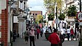 Horsham West Street 2.JPG 3,712 × 2,088; 2.98 MB
-
 Horsham West Street 3.JPG 3,712 × 2,088; 3.17 MB
-
 Horsham West Street.JPG 3,712 × 2,088; 3.16 MB
-
 Horsham West Sussex (1b).jpg 804 × 508; 74 KB
-
 Horsham YMCA Football Club - geograph.org.uk - 907734.jpg 640 × 480; 76 KB
-

-
 Houses on Hurst Rd - geograph.org.uk - 1296448.jpg 640 × 415; 76 KB
-
 Hurst Avenue and Hurst Rd junction - geograph.org.uk - 1291037.jpg 640 × 430; 84 KB
-
 Hurst Court, Hurst Rd - geograph.org.uk - 1291155.jpg 640 × 430; 76 KB
-
 Is that prettier^ - geograph.org.uk - 839572.jpg 640 × 480; 119 KB
-
 Jenny Bare Legs, Gate to Gorings Mead - geograph.org.uk - 927531.jpg 640 × 480; 136 KB
-
 Jenny far gate - geograph.org.uk - 927550.jpg 640 × 480; 112 KB
-
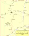 Leatherhead-horsham.gif 872 × 1,074; 61 KB
-
 London Road - geograph.org.uk - 779434.jpg 640 × 479; 83 KB
-
 Lost Monkey Cafe, Nightingale Rd - geograph.org.uk - 1287754.jpg 640 × 430; 87 KB
-
 Main entrance, Denne Road cemetery - geograph.org.uk - 1802942.jpg 640 × 428; 130 KB
-
 Marvellous mosaic under Albion Way - geograph.org.uk - 417704.jpg 640 × 480; 58 KB
-
 Mews off Hurst Rd - geograph.org.uk - 1296454.jpg 640 × 430; 72 KB
-
 Millais School Fields, Depot Rd - geograph.org.uk - 1287876.jpg 640 × 430; 67 KB
-
 Morris's Wood Panorama, Greylands, Horsham.png 1,203 × 303; 948 KB
-
 Nesting Swan, Warnham Nature Reserve - geograph.org.uk - 237821.jpg 640 × 493; 391 KB
-
 Neville Duke plaque.jpg 1,944 × 2,592; 855 KB
-
 New Street - A281 Junction - geograph.org.uk - 911901.jpg 640 × 480; 59 KB
-
 Norsat - geograph.org.uk - 915799.jpg 640 × 480; 74 KB
-
 North Point, North St - geograph.org.uk - 1291529.jpg 640 × 430; 64 KB
-
 Northlands Gill, Graylands, Horsham.jpg 682 × 1,024; 234 KB
-
 On Line House, North St - geograph.org.uk - 1291519.jpg 640 × 401; 54 KB
-
 Orchard Rd, Depot Rd - geograph.org.uk - 1287860.jpg 640 × 430; 63 KB
-

-
 Ordnance Survey One-Inch Sheet 182 Brighton & Worthing, Published 1940.jpg 8,191 × 9,533; 12.01 MB
-
 Ordnance Survey One-Inch Sheet 182 Brighton & Worthing, Published 1960.jpg 8,278 × 9,963; 12.59 MB
-
 Ordnance Survey One-Inch Sheet 182 Brighton & Worthing, Published 1970.jpg 11,089 × 13,154; 60.98 MB
-
 Ordnance Survey One-Inch Tourist Map of Brighton and the South Downs, Published 1922.jpg 16,010 × 12,092; 24.56 MB
-
 Ordnance Survey Sheet 302 Geological Map of Horsham, Published 1972.jpg 20,685 × 15,174; 21.1 MB
-
 Owers Close, Depot Rd - geograph.org.uk - 1287851.jpg 640 × 430; 115 KB
-
 Parish of Horsham - The Church Centre - geograph.org.uk - 913057.jpg 640 × 480; 76 KB
-
 Park Surgery - geograph.org.uk - 611850.jpg 640 × 452; 75 KB
-
 Passageway to Talbot Lane - geograph.org.uk - 915779.jpg 640 × 480; 51 KB
-
 Pavillions horsham.JPG 2,048 × 1,536; 800 KB
-

-
 Piries Place, Carfax, Horsham - geograph.org.uk - 1291602.jpg 640 × 430; 64 KB
-
 Poets Court - geograph.org.uk - 907776.jpg 640 × 480; 61 KB
-
-

-
 Potter's Corner Horsham.jpg 640 × 480; 58 KB
-
 Queen Street, ex-home of Horsham FC - geograph.org.uk - 1721699.jpg 800 × 600; 155 KB
-
 Queensway Garage - geograph.org.uk - 917065.jpg 640 × 480; 62 KB
-

-

-
 Relay For Life Horsham.JPG 2,848 × 2,136; 2.97 MB
-
 Richmond Rd (2) - geograph.org.uk - 1291003.jpg 640 × 430; 103 KB
-
 Richmond Rd (3) - geograph.org.uk - 1291005.jpg 640 × 430; 113 KB
-
 Richmond Rd - geograph.org.uk - 1291000.jpg 640 × 430; 100 KB
-
 Richmond Road Horsham - geograph.org.uk - 1360077.jpg 480 × 640; 109 KB
.jpg)


,_Horsham_Inner_Ring_Road_-_geograph.org.uk_-_1291562.jpg)


_by_Samuel_Hieronymus_Grimm_1788.jpg)
_-_geograph.org.uk_-_1287867.jpg)


.jpg)


.jpg)
.jpg)
.jpg)
.jpg)


,_Horsham,_West_Sussex_-_geograph.org.uk_-_86299.jpg)


.jpg)
.jpg)


_-_geograph.org.uk_-_1291773.jpg)


.jpg)
.jpg)
.jpg)
.jpg)
.jpg)
.jpg)
.jpg)
.jpg)
.jpg)
.jpg)
.jpg)
.jpg)
.jpg)
.jpg)
.jpg)
.jpg)
.jpg)
.jpg)


.jpg)
.jpg)
.jpg)
.jpg)
.jpg)
.jpg)
.jpg)


.jpg)


_-_geograph.org.uk_-_1291003.jpg)
_-_geograph.org.uk_-_1291005.jpg)

