Category:Homigot Lighthouse
Jump to navigation
Jump to search
| Object location | | View all coordinates using: OpenStreetMap |
|---|
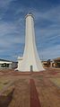
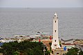
English: Homigot Lighthouse
lighthouse in South Korea  | |||||
| Upload media | |||||
| Instance of | |||||
|---|---|---|---|---|---|
| Made from material | |||||
| Location | Pohang, North Gyeongsang, ROK | ||||
| Inception |
| ||||
| Source of energy | |||||
| Height |
| ||||
 | |||||
Media in category "Homigot Lighthouse"
The following 4 files are in this category, out of 4 total.
-
 Homi lighthouse.jpg 1,836 × 3,264; 611 KB
-
 Homigot Lighthouse - panoramio.jpg 1,200 × 1,600; 382 KB
-
 Homigot Lighthouse from New Millennium Memorial Hall.jpg 1,349 × 900; 1.09 MB
-
 Homigot Lighthouse.jpg 900 × 1,357; 950 KB


