Category:Holywood, Dumfries and Galloway (civil parish)
Jump to navigation
Jump to search
Scottish parish in Dumfries and Galloway, Scotland, UK | |||||
| Upload media | |||||
| Instance of | |||||
|---|---|---|---|---|---|
| Named after | |||||
| Location |
| ||||
| Population |
| ||||
| Area |
| ||||
 | |||||
Subcategories
This category has only the following subcategory.
H
Media in category "Holywood, Dumfries and Galloway (civil parish)"
The following 200 files are in this category, out of 201 total.
(previous page) (next page)-
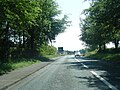
 A 76 near Holywood - geograph.org.uk - 2002360.jpg 640 × 470; 48 KB
-
 A 76 near turning for Irongray - geograph.org.uk - 2002389.jpg 640 × 477; 42 KB
-
 A track into the woods - geograph.org.uk - 6139209.jpg 900 × 1,600; 636 KB
-
 A track leading to Cairn Water - geograph.org.uk - 6139175.jpg 1,600 × 900; 371 KB
-
 A76 northbound - geograph.org.uk - 4257630.jpg 640 × 449; 36 KB
-
 A76 roadworks near Druids Park - geograph.org.uk - 4587240.jpg 640 × 480; 83 KB
-
 A76 southbound nearing Holywood - geograph.org.uk - 4587243.jpg 640 × 481; 108 KB
-
 A76 through Newington - geograph.org.uk - 3476969.jpg 640 × 425; 68 KB
-
 A76 west of Trynland Loch - geograph.org.uk - 4587238.jpg 640 × 482; 54 KB
-

-
 Approaching Dumfries - geograph.org.uk - 4352380.jpg 640 × 433; 91 KB
-
 Approaching Holywood - geograph.org.uk - 4115007.jpg 1,920 × 1,280; 1.73 MB
-
 Area of forest on Speddoch Moor - geograph.org.uk - 4574683.jpg 640 × 480; 100 KB
-
 Arggggh^ Hedge trimmer^ - geograph.org.uk - 4814385.jpg 1,024 × 768; 273 KB
-
 B729, Greenhead - geograph.org.uk - 4815188.jpg 1,024 × 768; 355 KB
-
 Barbuie Burn - geograph.org.uk - 3473004.jpg 640 × 480; 327 KB
-
 Barbuie Wood - geograph.org.uk - 3473020.jpg 640 × 480; 362 KB
-
 Barley, Blackpark - geograph.org.uk - 4814355.jpg 1,024 × 768; 368 KB
-
 Belties seen from Speddoch gate - geograph.org.uk - 2080822.jpg 2,048 × 1,536; 643 KB
-
 Berryland - geograph.org.uk - 4814668.jpg 1,024 × 768; 347 KB
-
 Beside the B729, near Townfoot - geograph.org.uk - 5985439.jpg 2,592 × 1,944; 1.83 MB
-
 Blackpark - geograph.org.uk - 2598827.jpg 3,872 × 2,592; 3.04 MB
-
 Bridge in Newbridge - geograph.org.uk - 5553887.jpg 1,024 × 768; 285 KB
-
 Bridge over the River Nith on the A75 - geograph.org.uk - 2112098.jpg 1,653 × 1,212; 400 KB
-
 Bridge over the River Nith on the A75 - geograph.org.uk - 3230032.jpg 2,015 × 1,528; 515 KB
-
 Burn on Speddoch Hill - geograph.org.uk - 2080830.jpg 2,048 × 1,536; 718 KB
-
 Burnside of Baltersan - geograph.org.uk - 2598837.jpg 3,872 × 2,592; 2.3 MB
-
 Bus passing Speddoch - geograph.org.uk - 3711191.jpg 640 × 480; 370 KB
-
 Bus shelter, Speddoch - geograph.org.uk - 3473042.jpg 640 × 480; 356 KB
-
 Cairn Valley Light Railway - geograph.org.uk - 4814745.jpg 1,024 × 768; 296 KB
-
 Cairn Water - geograph.org.uk - 3473048.jpg 640 × 480; 341 KB
-
 Cattle by Loweberry Loch - geograph.org.uk - 3112775.jpg 1,365 × 1,024; 1.2 MB
-
 Cattle, Clachan - geograph.org.uk - 4814746.jpg 1,024 × 768; 330 KB
-
 Cattle, Fourmerkland - geograph.org.uk - 4814461.jpg 1,024 × 768; 293 KB
-
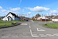
 Charlesfield - geograph.org.uk - 1222116.jpg 640 × 372; 72 KB
-
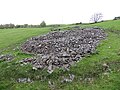 Clearance cairn - geograph.org.uk - 3711189.jpg 640 × 480; 280 KB
-
 Clearance cairn, Berryland - geograph.org.uk - 4814673.jpg 1,024 × 768; 327 KB
-
 Cluden Water at Irongray Bridge - geograph.org.uk - 2598861.jpg 3,872 × 2,592; 3.2 MB
-
 Cluden Water from Newbridge Bridge - geograph.org.uk - 4191830.jpg 4,000 × 3,000; 3.98 MB
-
 Community Hall, Holywood - geograph.org.uk - 3949935.jpg 1,920 × 1,280; 1.59 MB
-
 Community Hall, Holywood - geograph.org.uk - 3949953.jpg 1,920 × 1,280; 1.62 MB
-
 Concrete hardstanding, Morrinton Quarry - geograph.org.uk - 4815078.jpg 1,024 × 768; 269 KB
-
 Confluence of burns on Speddoch Hill - geograph.org.uk - 2080794.jpg 2,048 × 1,536; 683 KB
-
 Cormaddie - geograph.org.uk - 4814445.jpg 1,024 × 768; 305 KB
-
 Cormaddie Woods - geograph.org.uk - 909327.jpg 640 × 480; 134 KB
-
 Cowhill Lochan - geograph.org.uk - 1050292.jpg 640 × 480; 104 KB
-
 Crossroads on the B729 - geograph.org.uk - 4814747.jpg 1,024 × 768; 287 KB
-

-
 Dalquhairn and See Morris - geograph.org.uk - 4814545.jpg 1,024 × 768; 373 KB
-
 Dercongal Road, Holywood - geograph.org.uk - 3949930.jpg 1,920 × 1,280; 1.65 MB
-
 Dercongal Road, Holywood - geograph.org.uk - 3949982.jpg 1,920 × 1,280; 1.56 MB
-
 Dercongal Road, Holywood - geograph.org.uk - 5335135.jpg 2,592 × 1,728; 2.59 MB
-
 Driveway to Mc Whanrick - geograph.org.uk - 5208101.jpg 1,024 × 682; 272 KB
-
 Drumjohn Wood - geograph.org.uk - 4814427.jpg 1,024 × 768; 255 KB
-
 Drumpark Bridge - geograph.org.uk - 3884706.jpg 640 × 424; 149 KB
-
 Dry stone dyke on Stroquhan Moor - geograph.org.uk - 4574800.jpg 640 × 480; 107 KB
-
 Dry Stone Wall - geograph.org.uk - 3739020.jpg 2,560 × 1,920; 2.99 MB
-
 East Cluden, across the river - geograph.org.uk - 5714497.jpg 1,024 × 672; 144 KB
-
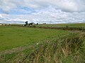
 Farmland at Holywood - geograph.org.uk - 5335155.jpg 2,592 × 1,728; 3.07 MB
-
 Farmland at Kilncroft - geograph.org.uk - 3949973.jpg 1,920 × 1,280; 1.82 MB
-
 Farmland below Greenhead - geograph.org.uk - 2598821.jpg 3,872 × 2,592; 2.81 MB
-
 Farmland fences at Mc Whanrick - geograph.org.uk - 5208107.jpg 1,024 × 639; 212 KB
-
 Farmland near Holywood - geograph.org.uk - 4115017.jpg 1,920 × 1,280; 1.45 MB
-
 Felled area, Durndrum Plantation - geograph.org.uk - 4815126.jpg 1,024 × 768; 282 KB
-
 Field and house near Portrack House - geograph.org.uk - 1347800.jpg 480 × 640; 50 KB
-
 Field Drain near Sunnyhill Cottages - geograph.org.uk - 6014018.jpg 2,880 × 2,160; 1.79 MB
-
 Field near Berryland - geograph.org.uk - 3112796.jpg 1,365 × 1,024; 1.42 MB
-

-
 Field, Newhouse - geograph.org.uk - 4814411.jpg 1,024 × 768; 368 KB
-
 Field, Newtonairds - geograph.org.uk - 4815045.jpg 1,024 × 768; 310 KB
-
 Field, Speddochhill - geograph.org.uk - 3473026.jpg 640 × 480; 194 KB
-
 Fields and dykes, Stepford - geograph.org.uk - 4814940.jpg 1,024 × 768; 259 KB
-
 Fields beside the B729 - geograph.org.uk - 4814749.jpg 1,024 × 768; 341 KB
-

-
 Five Of The Apostles - geograph.org.uk - 5937898.jpg 640 × 401; 99 KB
-
 Forest road on Steilston Hill - geograph.org.uk - 4814757.jpg 1,024 × 768; 505 KB
-
 Fourmerkland Farm - geograph.org.uk - 3884642.jpg 640 × 424; 123 KB
-
 Gatehouse at Newtonairds - geograph.org.uk - 3884653.jpg 640 × 424; 124 KB
-
 Gateway to Holywood Cemetery - geograph.org.uk - 5334947.jpg 2,592 × 1,728; 1.29 MB
-
 Guarded ruin - geograph.org.uk - 3112814.jpg 1,365 × 1,024; 1.21 MB
-
 Harvest near Cormaddie - geograph.org.uk - 4814449.jpg 1,024 × 768; 268 KB
-
 Heathfield Farm - geograph.org.uk - 1220426.jpg 640 × 480; 49 KB
-
 Holyn Bush Pool, Cluden Water - geograph.org.uk - 5714494.jpg 1,024 × 682; 268 KB
-
 Holywood Cemetery - geograph.org.uk - 5334958.jpg 2,592 × 1,728; 2.63 MB
-
 Holywood Cemetery - geograph.org.uk - 5334965.jpg 2,592 × 1,728; 2.22 MB
-
 Holywood Cemetery - geograph.org.uk - 5335045.jpg 2,592 × 1,728; 2.62 MB
-
 Holywood Cemetery - geograph.org.uk - 5335057.jpg 2,592 × 1,728; 2.5 MB
-
 Holywood Church - geograph.org.uk - 4191834.jpg 4,000 × 3,000; 3.38 MB
-
 Holywood Parish Church and Graveyard - geograph.org.uk - 5334973.jpg 2,592 × 1,728; 3.24 MB
-
 Holywood Parish Church and Graveyard - geograph.org.uk - 5334983.jpg 1,728 × 2,592; 2.68 MB
-
 Holywood Parish Church and Graveyard - geograph.org.uk - 5335037.jpg 2,548 × 1,728; 723 KB
-
 Holywood Parish Church Graveyard - geograph.org.uk - 5334997.jpg 2,592 × 1,728; 2.41 MB
-
 Holywood Parish Church Graveyard - geograph.org.uk - 5335006.jpg 2,592 × 1,728; 2.7 MB
-
 Holywood Parish Church Graveyard - geograph.org.uk - 5335014.jpg 2,592 × 1,728; 3.34 MB
-
 Holywood Signal Box - geograph.org.uk - 3949901.jpg 1,920 × 1,280; 1.74 MB
-
 Holywood Station - geograph.org.uk - 3949916.jpg 1,920 × 1,280; 1.67 MB
-
 Houses at Underwood - geograph.org.uk - 6139204.jpg 1,600 × 900; 412 KB
-
 Irongray Bridge - geograph.org.uk - 3884636.jpg 640 × 424; 149 KB
-
 Killyleoch Hill - geograph.org.uk - 3112747.jpg 1,365 × 1,024; 1.32 MB
-
 Killyleoch Hill - geograph.org.uk - 4814465.jpg 1,024 × 768; 361 KB
-
 Killyleoch Hill - geograph.org.uk - 4815033.jpg 1,024 × 768; 287 KB
-
 Kilncroft - geograph.org.uk - 5335163.jpg 2,592 × 1,728; 2.7 MB
-
 Kilnshang Plantation - geograph.org.uk - 3473034.jpg 640 × 480; 379 KB
-
 Lane at Sunnyhill Cottages - geograph.org.uk - 6014022.jpg 2,880 × 2,160; 2.18 MB
-
 Lane to Bearcroft - geograph.org.uk - 4191840.jpg 4,000 × 3,000; 3.2 MB
-
 Level Crossing at Holywood Station - geograph.org.uk - 3949897.jpg 1,920 × 1,280; 1.46 MB
-
 Lochan on Killyleoch Hill - geograph.org.uk - 5931625.jpg 1,024 × 768; 221 KB
-
 Logging road on Steilston Hill - geograph.org.uk - 4814676.jpg 1,024 × 768; 355 KB
-
 Logging road, Stielston Hill - geograph.org.uk - 4814345.jpg 1,024 × 768; 322 KB
-
 Loweberry - geograph.org.uk - 4815075.jpg 1,024 × 768; 376 KB
-
 Loweberry Loch - geograph.org.uk - 4814474.jpg 1,024 × 768; 339 KB
-
 Loweberry Loch and Farm Pasture - geograph.org.uk - 5931628.jpg 1,024 × 768; 135 KB
-
 Loweberry Wood - geograph.org.uk - 4815083.jpg 1,024 × 768; 528 KB
-
 Lower Stepford - geograph.org.uk - 4814942.jpg 1,024 × 768; 318 KB
-
 Manse Road, Holywood - geograph.org.uk - 3949988.jpg 1,920 × 1,280; 1.54 MB
-

-
 Moorland and forest on Speddoch Moor - geograph.org.uk - 4574707.jpg 640 × 480; 105 KB
-
 Mowing, Morrington - geograph.org.uk - 4814950.jpg 1,024 × 768; 365 KB
-
 Near to Gribton Hill - geograph.org.uk - 6139212.jpg 1,600 × 900; 280 KB
-
 New electricity pole - geograph.org.uk - 3472993.jpg 640 × 480; 261 KB
-
 Newhouse - geograph.org.uk - 4814415.jpg 1,024 × 768; 348 KB
-
 Newly cut barley - geograph.org.uk - 4815201.jpg 1,024 × 768; 359 KB
-
 Newtonairds Home Farm - geograph.org.uk - 3739037.jpg 2,560 × 1,920; 2.96 MB
-
 Newtonairds Wood - geograph.org.uk - 4814392.jpg 1,024 × 768; 499 KB
-
 Newtonairds Wood - geograph.org.uk - 4814797.jpg 1,024 × 768; 416 KB
-
 Newtonairds Wood - geograph.org.uk - 4815055.jpg 1,024 × 768; 344 KB
-
 North of Steilston Hill - geograph.org.uk - 4814347.jpg 1,024 × 768; 351 KB
-
 Northern Fringe Of Zuider Zee - geograph.org.uk - 2803038.jpg 3,448 × 4,592; 3.62 MB
-

-

-

-

-

-
 Ordnance Survey Cut Mark - geograph.org.uk - 4263275.jpg 4,000 × 3,000; 3.6 MB
-

-
 Pastoral Scene near Sunnyhill - geograph.org.uk - 6014007.jpg 2,880 × 2,160; 1.9 MB
-
 Quarry building, Morrinton Quarry - geograph.org.uk - 4815080.jpg 1,024 × 768; 418 KB
-
 Quarry, Steilston Hill - geograph.org.uk - 4814759.jpg 1,024 × 768; 416 KB
-

-
 Railway Line to Dumfries at Holywood Station - geograph.org.uk - 3949909.jpg 1,920 × 1,280; 1.94 MB
-
 Railway Line to Kilmarnock at Holywood Station - geograph.org.uk - 3949912.jpg 1,920 × 1,280; 2.11 MB
-
 Replanting Near Zuider Zee - geograph.org.uk - 2803061.jpg 4,592 × 3,448; 4.24 MB
-
 Ride, Killyleoch Hill - geograph.org.uk - 4815073.jpg 1,024 × 768; 396 KB
-
 Ride, Killyleoch Hill - geograph.org.uk - 4815087.jpg 1,024 × 768; 485 KB
-
 Ride, Killyleoch Hill - geograph.org.uk - 4815090.jpg 1,024 × 768; 554 KB
-
 River Nith - geograph.org.uk - 5354946.jpg 2,592 × 1,728; 2.45 MB
-

-
 Road into Holywood - geograph.org.uk - 3949966.jpg 1,920 × 1,280; 1.55 MB
-
 Road near Speddoch Hill - geograph.org.uk - 4792533.jpg 800 × 526; 103 KB
-
 Road past Fourmerkland - geograph.org.uk - 4814463.jpg 1,024 × 768; 282 KB
-
 Road to Dumfries at Holywood - geograph.org.uk - 3949959.jpg 1,920 × 1,280; 1.61 MB
-
 Road to Dunscore - geograph.org.uk - 3949951.jpg 1,920 × 1,248; 684 KB
-
 Road to Dunscore near Holywood - geograph.org.uk - 4115010.jpg 1,920 × 1,280; 2.11 MB
-
 Road to Irongray - geograph.org.uk - 4814750.jpg 1,024 × 768; 312 KB
-
 Road to the A76 from Holywood Station - geograph.org.uk - 3949919.jpg 1,920 × 1,179; 732 KB
-
 Road towards Fourmerkland - geograph.org.uk - 4814744.jpg 1,024 × 768; 289 KB
-
 Road, Loweberry - geograph.org.uk - 4815061.jpg 1,024 × 768; 466 KB
-
 Road, Loweberry - geograph.org.uk - 4815064.jpg 1,024 × 768; 526 KB
-
 Road, Loweberry Loch - geograph.org.uk - 4815051.jpg 1,024 × 768; 375 KB
-
 Road, Morrington - geograph.org.uk - 4814947.jpg 1,024 × 768; 390 KB
-
 Road, Newtonairds Wood - geograph.org.uk - 4814542.jpg 1,024 × 768; 454 KB
-
 Road, Steilston - geograph.org.uk - 4814431.jpg 1,024 × 768; 446 KB
-
 Robert Burns quote - geograph.org.uk - 1137821.jpg 640 × 426; 38 KB
-
 Roller, Upper Portrack - geograph.org.uk - 4815137.jpg 1,024 × 768; 437 KB
-
 Route Towards Killyleoch Hill - geograph.org.uk - 3739051.jpg 2,560 × 1,920; 2.83 MB
-
 Ruined dyke - geograph.org.uk - 3711161.jpg 640 × 480; 354 KB
-
 Sheep above Morrington - geograph.org.uk - 3112766.jpg 1,366 × 1,024; 1.31 MB
-
 Sheep on Speddoch Hill - geograph.org.uk - 3340126.jpg 640 × 424; 56 KB
-
 Site of Irongray station, Cairn Valley 2000 - geograph.org.uk - 5429304.jpg 2,371 × 1,373; 2.96 MB
-
 Snowy Scene Near Dumfries - geograph.org.uk - 4352372.jpg 640 × 387; 115 KB
-

-
 Steilston Hill road - geograph.org.uk - 4814762.jpg 1,024 × 768; 393 KB
-
 Steilston Hill seen across Loweberry Loch - geograph.org.uk - 5931623.jpg 1,024 × 768; 136 KB
-
 Stone Circle At Holywood - geograph.org.uk - 5937903.jpg 640 × 397; 96 KB
-
 Stone Steps over the Wall - geograph.org.uk - 5334953.jpg 2,592 × 1,728; 4.04 MB
-
 Stubble by the A76 - geograph.org.uk - 5207501.jpg 1,024 × 673; 200 KB
-
 Sunnyhill Cottages - geograph.org.uk - 5985441.jpg 2,592 × 1,867; 1.08 MB
-
 Sunnyhill Farm - geograph.org.uk - 6013984.jpg 2,880 × 2,160; 2.83 MB
-
 Sunnyhill House - geograph.org.uk - 5985442.jpg 2,592 × 1,944; 2.27 MB
-
 Sunrise at Sunnyhill - geograph.org.uk - 6013969.jpg 2,880 × 2,160; 3.08 MB
-
 Sunrise at Sunnyhill - geograph.org.uk - 6013976.jpg 2,880 × 2,160; 1.64 MB
-
 The A76 to Sanquhar at Holywood - geograph.org.uk - 3949944.jpg 1,920 × 1,280; 1.65 MB
-
 The Kirk - geograph.org.uk - 1156777.jpg 640 × 480; 73 KB
-
 The Nith - geograph.org.uk - 1463071.jpg 480 × 640; 48 KB
-
 The River Cluden - geograph.org.uk - 6139153.jpg 1,600 × 900; 557 KB
-
 The River Dee at Kirkcudbright - geograph.org.uk - 3644489.jpg 3,264 × 2,448; 3.28 MB
-
 The Road to Bearcroft - geograph.org.uk - 5335062.jpg 2,592 × 1,728; 2.6 MB
-
 The Twelve Apostles - geograph.org.uk - 5937911.jpg 640 × 416; 95 KB
-

-

-
 Track on Killyleoch Hill - geograph.org.uk - 4815076.jpg 768 × 1,024; 370 KB
-
 Tree on Speddoch Hill - geograph.org.uk - 3340118.jpg 640 × 408; 113 KB
-
 Twelve Apostles Stone Circle - geograph.org.uk - 5713134.jpg 640 × 480; 63 KB
-
 View out of Newtonairds Wood - geograph.org.uk - 4814539.jpg 1,024 × 768; 395 KB
-
 Village Garden, Holywood - geograph.org.uk - 5335140.jpg 2,592 × 1,728; 2.72 MB
-
 Village Garden, Holywood - geograph.org.uk - 5335149.jpg 2,592 × 1,728; 3.06 MB
-
 War Memorial, Holywood Churchyard - geograph.org.uk - 5335023.jpg 1,728 × 2,592; 3.94 MB
-
 War Memorial, Holywood Churchyard - geograph.org.uk - 5335032.jpg 1,728 × 2,592; 3.07 MB
-
 Wet field, Townfoot - geograph.org.uk - 4814437.jpg 1,024 × 768; 346 KB
-
 Woodland on Steilston Hill - geograph.org.uk - 4814678.jpg 1,024 × 768; 363 KB


&filefrom=Zuider+Zee+-+geograph.org.uk+-+1295093.jpg#mw-category-media)