Category:Hols kyrka
Jump to navigation
Jump to search
| Object location | | View all coordinates using: OpenStreetMap |
|---|
|
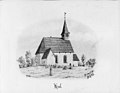
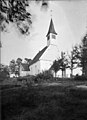
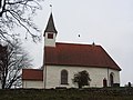
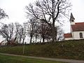
This is a category about an ecclesiastical monument in Sweden, number 21300000003337 in the RAÄ buildings database.
|
|
This is a category about a protected building in Sweden, number 21400000443690 in the RAÄ buildings database.
|
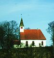
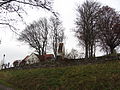
church building in Vårgårda Municipality, Västra Götaland County, Sweden  | |||||
| Upload media | |||||
| Instance of | |||||
|---|---|---|---|---|---|
| Location | Vårgårda Municipality, Västra Götaland County, Sweden | ||||
| Diocese | |||||
| Has use |
| ||||
| Occupant | |||||
| Heritage designation |
| ||||
 | |||||
Subcategories
This category has the following 2 subcategories, out of 2 total.
I
- Interior of Hols kyrka (38 F)
V
Media in category "Hols kyrka"
The following 21 files are in this category, out of 21 total.
-
 Hols kyrka - KMB - 16000200157812.jpg 443 × 600; 87 KB
-
 Hols kyrka - KMB - 16000200157813.jpg 771 × 600; 64 KB
-
 Hols kyrka - KMB - 16000200157814.jpg 515 × 600; 20 KB
-
 Hols kyrka - KMB - 16000200157817.jpg 746 × 600; 115 KB
-
 Hols kyrka - KMB - 16000200157819.jpg 434 × 600; 47 KB
-
 Hols kyrka - KMB - 16000200157821.jpg 927 × 600; 85 KB
-
 Hols kyrka - KMB - 16000200157822.jpg 880 × 600; 143 KB
-
 Hols kyrka - KMB - 16000200157889.jpg 434 × 600; 35 KB
-
 Hols kyrka - KMB - 16000200157890.jpg 447 × 600; 34 KB
-
 Hols kyrka - KMB - 16000200157891.jpg 438 × 600; 33 KB
-
 Hols kyrka - KMB - 16000200157892.jpg 483 × 600; 41 KB
-
 Hols kyrka - KMB - 16000200157893.jpg 820 × 600; 84 KB
-
 Hols kyrka 1, 10 oktober 2013.jpg 1,826 × 2,508; 925 KB
-
 Hols kyrka 2, 10 oktober 2013.jpg 1,758 × 1,560; 1.48 MB
-
 Hols kyrka1.JPG 4,000 × 3,000; 3.33 MB
-
 Hols kyrka2.JPG 4,000 × 3,000; 2.59 MB
-
 Hols kyrka3.JPG 4,000 × 3,000; 4.14 MB
-
 Hols kyrka5.JPG 4,000 × 3,000; 3.63 MB
-
 Hols kyrka6.JPG 4,000 × 3,000; 2.56 MB
-
 HolsKyrka.JPG 1,300 × 1,395; 349 KB
-
 Stigluckan i kyrkogårdsmuren vid Hols kyrka.JPG 4,000 × 3,000; 4.31 MB


