Category:Holmfirth
Jump to navigation
Jump to search
town in West Yorkshire, England .JPG) | |||||
| Upload media | |||||
| Instance of | |||||
|---|---|---|---|---|---|
| Location | Holme Valley, Kirklees, West Yorkshire, Yorkshire and the Humber, England | ||||
 | |||||
Cymraeg: Tref yn Swydd Gorllewin Efrog yw Holmfirth. Mae gan y dref boblogaeth o 17,970.
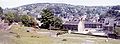
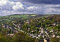
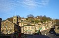
English: Holmfirth is a small town located on the A6024 Woodhead Road in the Holme Valley, within the Metropolitan Borough of Kirklees, West Yorkshire, England. Centred upon the confluence of the Holme and Ribble rivers, Holmfirth is 6 miles (10 km) south of Huddersfield and broadly consists of stone-built cottages nestled in the Pennine hills. The Peak District National Park around Holme Moss borders the south of the town.
Español: Homfirth es una pequeña ciudad en el área Kirklees de West Yorkshire, Inglaterra. La ciudad tiene una población de 1.980. La ciudad es famosa por ser el establecimiento de programas de televisión, Last of the Summer Wine (Ultimo de los vinos de verano).
Italiano: Holmfirth è un paese di 17.970 abitanti della contea del West Yorkshire, in Inghilterra. Si trova nella parrocchia civile della Holme Valley.
Nederlands: Holmfirth is een plaats in het bestuurlijke gebied Kirklees, in het Engelse graafschap West Yorkshire. De plaats telt 17.970 inwoners.
Română: Holmfirth este un oraş în comitatul West Yorkshire, regiunea Yorkshire and the Humber, Anglia. Oraşul se află în districtul metropolitan Kirklees.
Subcategories
This category has the following 9 subcategories, out of 9 total.
Media in category "Holmfirth"
The following 200 files are in this category, out of 264 total.
(previous page) (next page)-
 (Section of a) Memorial to the 1777 flood, Holmfirth (5765740803).jpg 1,635 × 4,080; 3.78 MB
-

-
 A. Quarmby. (5768935122).jpg 1,931 × 2,490; 2.69 MB
-
 A635 towards Holmfirth town centre - geograph.org.uk - 1439277.jpg 640 × 480; 46 KB
-

-
 All aboard for Compo's grave - geograph.org.uk - 1096453.jpg 640 × 479; 103 KB
-
 Amorous toads - geograph.org.uk - 2323675.jpg 583 × 479; 144 KB
-
 Arndale Grove - Cinder Hills Road - geograph.org.uk - 1981092.jpg 640 × 480; 74 KB
-
 Arrunden Court - Dunford Road - geograph.org.uk - 1981207.jpg 640 × 480; 86 KB
-

-
 Baby trees near Hades, Holmfirth - geograph.org.uk - 747352.jpg 640 × 490; 96 KB
-
 Back yard, Holmfirth - geograph.org.uk - 970549.jpg 480 × 640; 128 KB
-
 Bamforth and Co Ltd - Station Road - geograph.org.uk - 500155.jpg 578 × 640; 61 KB
-
-

-
 Beatties and Checkers Cafe, Holmfirth - geograph.org.uk - 1461451.jpg 640 × 480; 108 KB
-
 Beech Street - geograph.org.uk - 500202.jpg 484 × 640; 48 KB
-
 Bench and walls (3948133835).jpg 2,388 × 1,648; 4.16 MB
-
 Bengal Spice - Dunford Road - geograph.org.uk - 1981281.jpg 640 × 480; 110 KB
-
 Bill Payne, Little Feat (4893516140).jpg 4,256 × 2,832; 3.85 MB
-
 Bottoms Mill, Holmfirth (3405498432).jpg 3,663 × 2,321; 6.5 MB
-
 Bottoms Mill, Holmfirth - geograph.org.uk - 3309611.jpg 4,320 × 3,240; 3.05 MB
-

-
 Boundary stone - geograph.org.uk - 1359458.jpg 474 × 640; 138 KB
-
 Boundary Stone opposite Burnlee Road.jpg 800 × 600; 149 KB
-
 Boundary Stone, Hagg Wood.jpg 600 × 450; 369 KB
-

-
 Bridge Lane - Huddersfield Road - geograph.org.uk - 2008862.jpg 640 × 480; 92 KB
-
 Bridge over the River Holme - geograph.org.uk - 3443747.jpg 1,024 × 664; 293 KB
-

-
 British Isles rural and coastal (5538214250).jpg 4,032 × 2,688; 1.23 MB
-
 British Isles rural and coastal (5765419250).jpg 4,032 × 3,024; 1.16 MB
-
 British Isles rural and coastal (5765420338).jpg 4,032 × 3,024; 1.61 MB
-
 Call me (9377232715).jpg 2,142 × 3,213; 5.46 MB
-
 Cantilever Bus Stop, Holmfirth - geograph.org.uk - 3595781.jpg 3,968 × 2,232; 5.61 MB
-
 Cat on hot tin - geograph.org.uk - 807917.jpg 640 × 480; 80 KB
-
 Cemetery Road, Holmfirth - geograph.org.uk - 90881.jpg 640 × 480; 118 KB
-
 Central Holmfirth - geograph.org.uk - 3229940.jpg 4,000 × 3,000; 1.86 MB
-
 Checkers Cafe - geograph.org.uk - 1461450.jpg 450 × 600; 128 KB
-
 Checkers Cafe in Holmfirth - geograph.org.uk - 1252418.jpg 427 × 640; 74 KB
-
 Cheetah (6447315185).jpg 1,500 × 1,500; 1.01 MB
-
 Choppards Bank Road at Cross - geograph.org.uk - 3056837.jpg 2,048 × 1,536; 569 KB
-
 Choppards Misson (5747850468).jpg 3,781 × 2,756; 6.33 MB
-
 Cinder Hill - geograph.org.uk - 99805.jpg 640 × 480; 197 KB
-
 Clough Foot Lane, Holmfirth - geograph.org.uk - 716339.jpg 640 × 480; 89 KB
-
 Cobbler's Shop, Holmfirth - geograph.org.uk - 807890.jpg 640 × 470; 147 KB
-
 Cobbler, Holmfirth - geograph.org.uk - 981586.jpg 640 × 480; 66 KB
-
 Compo's Cafe - Greenfield Road - geograph.org.uk - 2007347.jpg 640 × 480; 78 KB
-
 Conservative club, Meltham (3310053884).jpg 1,789 × 1,671; 2.07 MB
-
 Cooper Lane - Huddersfield Road - geograph.org.uk - 2008136.jpg 640 × 480; 88 KB
-
 Countryside near Holmfirth (3922392027).jpg 2,522 × 1,681; 3.98 MB
-
 Cross Gate Road, Holmfirth (Wooldale) - geograph.org.uk - 751331.jpg 640 × 480; 68 KB
-
 Crossroads Centre (Lane Dyke House), Holmfirth Road, Meltham (14711642505).jpg 2,727 × 2,829; 5.06 MB
-
 Crown Lane - Huddersfield Road - geograph.org.uk - 2008858.jpg 640 × 480; 77 KB
-
 Cut Bench Mark, Huddersfield Road - geograph.org.uk - 3018887.jpg 1,024 × 682; 319 KB
-
 Cut benchmark on New Mill Road - geograph.org.uk - 3056859.jpg 2,048 × 1,536; 766 KB
-
 Cut benchmark on Station Road - geograph.org.uk - 3056846.jpg 2,048 × 1,536; 856 KB
-
 Daisy Lane - Station Road - geograph.org.uk - 2006612.jpg 480 × 640; 73 KB
-
 Daisy Lane, Holmfirth - geograph.org.uk - 380197.jpg 480 × 640; 69 KB
-
 Dam between Bilberry and Digley Reservoirs (3404680209).jpg 3,872 × 2,592; 9.05 MB
-
 Derelict (5765746851).jpg 3,928 × 2,619; 6.35 MB
-
 Dominic Carter On Debut For Holmfirth.jpg 332 × 346; 20 KB
-
 DominicCarterStats.jpg 760 × 365; 48 KB
-
 Doors (9380542160).jpg 2,657 × 2,814; 5.64 MB
-
 Doors (9380553428).jpg 3,480 × 2,320; 6.66 MB
-
 Double aperture pillar box, Holmfirth - geograph.org.uk - 970555.jpg 640 × 498; 129 KB
-
 Drill Hall - Huddersfield Road - geograph.org.uk - 500190.jpg 640 × 497; 49 KB
-
 Driveway to Hades, Holmfirth - geograph.org.uk - 747361.jpg 640 × 472; 92 KB
-
 Dunford Road at Cross, Holmfirth - geograph.org.uk - 716325.jpg 640 × 424; 55 KB
-
 Dunnock Road, Meltham (4994388154).jpg 2,560 × 1,707; 3.75 MB
-
 Dunsley Bank towards Holmfirth - geograph.org.uk - 90885.jpg 640 × 480; 87 KB
-
 Elephant and Castle - Hollowgate - geograph.org.uk - 500183.jpg 640 × 445; 54 KB
-
 Emley Moor and Mill (5765755037).jpg 4,000 × 3,000; 7.69 MB
-
 Emley Moor Transmitter (5747271575).jpg 3,000 × 4,000; 7.59 MB
-
 Emma (5755827955).jpg 4,320 × 2,432; 6.81 MB
-
 Farm on the Hill (3410285934).jpg 2,421 × 1,681; 2.8 MB
-
 Flood marker (3373082671).jpg 2,423 × 3,294; 5.72 MB
-
 Forestry track, Holmfirth - geograph.org.uk - 716349.jpg 640 × 480; 95 KB
-
 Fred Tackett, Little Feat (4892926229).jpg 4,256 × 2,832; 4.52 MB
-
 Fred Tackett, Little Feat (4893521776).jpg 4,256 × 2,832; 4.16 MB
-

-
 Gates at Upperthong Church (3405385758).jpg 1,920 × 2,560; 5.29 MB
-
 Geological sketch-map Holmfirth Glossop.jpg 2,882 × 1,822; 1.76 MB
-
 George VI Postbox (disused), Huddersfield Road - geograph.org.uk - 3018877.jpg 682 × 1,024; 210 KB
-

-
 Health Food Shop, Holmfirth - geograph.org.uk - 510841.jpg 640 × 480; 105 KB
-
 Hightown Lane - Huddersfield Road - geograph.org.uk - 2008251.jpg 640 × 480; 79 KB
-
 Hill Lane, Holmfirth - geograph.org.uk - 1896016.jpg 640 × 480; 155 KB
-
 Hill Lane, Holmfirth - geograph.org.uk - 3414772.jpg 3,240 × 4,320; 2.93 MB
-
 Hollin House Lane, New Mill, Holmfirth (3948832932).jpg 1,920 × 2,560; 6.08 MB
-
 Hollowgate - viewed from Town Gate - geograph.org.uk - 2006757.jpg 640 × 480; 61 KB
-
 Hollowgate, Holmfirth 1989 - geograph.org.uk - 1082598.jpg 640 × 435; 50 KB
-
 Holme Moss and Black Hill(RLH).JPG 3,648 × 1,312; 2.12 MB
-
 Holme Styes Reservoir, Holmfirth, United Kingdom (Unsplash).jpg 3,877 × 6,000; 23.67 MB
-
 Holmfirth (20982985654).jpg 2,806 × 2,004; 3.94 MB
-
 Holmfirth (21386659368).jpg 3,137 × 2,664; 8.21 MB
-
 Holmfirth (21391212510).jpg 2,152 × 3,738; 6.24 MB
-
 Holmfirth (21417771550).jpg 2,903 × 2,903; 6.1 MB
-
 Holmfirth (21500234129).jpg 3,756 × 2,836; 8.78 MB
-
 Holmfirth (21564319392).jpg 3,851 × 2,908; 8.26 MB
-
 Holmfirth (21565257612).jpg 3,000 × 4,000; 10.67 MB
-
 Holmfirth (3407780538).jpg 1,823 × 1,397; 2.41 MB
-
 Holmfirth (3410343356).jpg 2,523 × 1,870; 3.03 MB
-
 Holmfirth (3410345376).jpg 1,853 × 1,905; 2.52 MB
-
 Holmfirth (3922393517).jpg 2,560 × 1,920; 5.61 MB
-
 Holmfirth (49696685251).jpg 4,587 × 2,918; 2.68 MB
-
 Holmfirth (50728379368).jpg 4,704 × 3,082; 3.03 MB
-
 Holmfirth (5752096932).jpg 4,157 × 2,755; 8.24 MB
-
 Holmfirth (5760030138).jpg 1,965 × 2,948; 4.58 MB
-
 Holmfirth (5760032794).jpg 1,857 × 2,712; 2.83 MB
-
 Holmfirth (9377871503).jpg 2,931 × 2,574; 6.11 MB
-
 Holmfirth (9396890448).jpg 4,000 × 3,000; 9.4 MB
-
 Holmfirth (9401548703).jpg 2,835 × 3,945; 11.23 MB
-
 Holmfirth (9408906815).jpg 2,565 × 3,591; 7.31 MB
-

-
 Holmfirth 20060521(RLH).JPG 2,000 × 1,194; 506 KB
-
 Holmfirth Bus Station - geograph.org.uk - 510843.jpg 640 × 480; 78 KB
-

-
 Holmfirth Civic Hall (21614699891).jpg 2,487 × 2,487; 4.48 MB
-
 Holmfirth Community Fire Station - geograph.org.uk - 3344945.jpg 640 × 427; 429 KB
-

-
 Holmfirth from New Gate - geograph.org.uk - 2871512.jpg 4,000 × 3,000; 2.93 MB
-

-
 Holmfirth Library - Huddersfield Road - geograph.org.uk - 500185.jpg 640 × 495; 54 KB
-
 Holmfirth Memorial Park - geograph.org.uk - 594299.jpg 640 × 462; 132 KB
-

-
 Holmfirth Old RLH.jpg 1,400 × 514; 141 KB
-
 Holmfirth Road, Meltham (14773556576).jpg 2,574 × 3,107; 7.23 MB
-
 Holmfirth Sid's Cafe.jpg 335 × 331; 31 KB
-
 Holmfirth Technical College ^1 - geograph.org.uk - 3971571.jpg 2,000 × 1,365; 1.42 MB
-
 Holmfirth Town - geograph.org.uk - 981507.jpg 640 × 278; 30 KB
-
 Holmfirth Town Centre - geograph.org.uk - 1439293.jpg 640 × 480; 49 KB
-
 Holmfirth town centre - geograph.org.uk - 1461452.jpg 640 × 480; 69 KB
-
 Holmfirth village centre - geograph.org.uk - 1252424.jpg 640 × 427; 67 KB
-
 Holmfirth, Greenfield Road (A635) - geograph.org.uk - 3345415.jpg 640 × 481; 457 KB
-
 Holmfirth, Huddersfield Road - geograph.org.uk - 3345407.jpg 640 × 481; 520 KB
-
 Holmfirth, School Street - geograph.org.uk - 3344991.jpg 640 × 480; 484 KB
-
 Holmfirth, South Lane - geograph.org.uk - 3345380.jpg 640 × 480; 518 KB
-
 Holmfirth, Summerwine Tour Bus - geograph.org.uk - 3345377.jpg 640 × 480; 500 KB
-
 Holmfirth, Yorkshire - geograph.org.uk - 411534.jpg 640 × 623; 102 KB
-
 Holmfirth, Yorkshire - geograph.org.uk - 620766.jpg 640 × 543; 73 KB
-
 Holmfirth.jpg 1,736 × 1,235; 1.89 MB
-
 Holmfirth2.jpg 1,500 × 981; 263 KB
-
 HolmfirthCentral(RLH)2007-03-21(1Mb).jpg 2,616 × 3,488; 1.46 MB
-
 Holy Trinity Church, Holmfirth (3373112947).jpg 2,443 × 3,664; 6.93 MB
-
 Holy Trinity, Hepworth 1 (3948246255).jpg 2,560 × 1,920; 4.57 MB
-
 Holy Trinity, Hepworth 2 (3948147535).jpg 2,560 × 1,920; 5.32 MB
-
 Holy Trinity, Hepworth 3 (3948924302).jpg 1,920 × 2,560; 3.31 MB
-

-
 Housetops and Holmfirth (3923179844).jpg 2,560 × 1,920; 5.48 MB
-
 Huddersfield Road, Holmfirth - geograph.org.uk - 3018883.jpg 1,024 × 682; 215 KB
-
 Hullock (3948181825).jpg 2,560 × 1,713; 3.69 MB
-

-
 It never rains on TV ... (5752139786).jpg 1,921 × 2,882; 3.25 MB
-

-
 Junction on Stake Lane Bank above Holmfirth - geograph.org.uk - 3047196.jpg 1,024 × 657; 101 KB
-
 JW Kaye, Ironmonger, Holmfirth (5766277024).jpg 2,568 × 2,344; 3.46 MB
-
 Kenny Gradney, Little Feat (4892926929).jpg 4,256 × 2,832; 2.11 MB
-
 King King Holmfirth 2.jpg 400 × 300; 27 KB
-
 Lane Head Road Bridge - geograph.org.uk - 500189.jpg 640 × 383; 46 KB
-
 Lane Head Road Bridge, Holmfirth - geograph.org.uk - 3345347.jpg 640 × 480; 492 KB
-

-
 Lower Mill Lane - Hollowgate - geograph.org.uk - 2007282.jpg 640 × 480; 66 KB
-
 Magdale (14558600822).jpg 1,696 × 2,374; 3.2 MB
-
 Maythorne Cross, Holmfirth - geograph.org.uk - 981560.jpg 640 × 480; 83 KB
-

-
 Milepost east of Holmfirth.jpg 405 × 689; 49 KB
-
 Milepost, Hollowgate Bridge.jpg 1,500 × 2,000; 918 KB
-
 Milepost, Underbank.jpg 450 × 600; 152 KB
-

-
 Milestone near the centre of Holmfirth.jpg 480 × 640; 255 KB
-

-
 Mill in Holmfirth - geograph.org.uk - 1499515.jpg 425 × 640; 40 KB
-
 Modd Lane, Holmfirth - geograph.org.uk - 1112671.jpg 640 × 450; 79 KB
-
 Netherfields and Netherthong (RLH).JPG 1,400 × 788; 266 KB
-

-
 New Fold - off Hollowgate - geograph.org.uk - 500178.jpg 480 × 640; 50 KB
-
 New Fold, Holmfirth - geograph.org.uk - 981503.jpg 640 × 480; 74 KB
-
 New Mill, Holmfirth (3365535711).jpg 2,328 × 1,681; 2.93 MB
-
 New Row and Hollowgate, Holmfirth - geograph.org.uk - 2065073.jpg 436 × 594; 174 KB
-
 No novelty acts, please - geograph.org.uk - 594306.jpg 640 × 491; 133 KB
-
 Old Bridge Hotel, Holmfirth - geograph.org.uk - 2064961.jpg 635 × 439; 258 KB
-

-
 Old Genn (5762289937).jpg 2,262 × 4,025; 5.6 MB
-
-
 Old milestone (geograph 6739909).jpg 1,200 × 1,600; 369 KB
-

-
 Outhouse at Choppards Church, Wooldale - geograph.org.uk - 732760.jpg 640 × 473; 102 KB
-
 Bill Owen's grave 0001.jpg 3,072 × 2,304; 3.31 MB
-
 Bill Owen's grave.jpg 2,848 × 2,136; 2 MB
-
 Park by Bus Station - geograph.org.uk - 500157.jpg 640 × 480; 76 KB
-

-
 Red, white, mauve (5766284854).jpg 2,451 × 3,676; 8.53 MB
-

-
 River Holme - geograph.org.uk - 1461432.jpg 450 × 600; 131 KB
-
 River Holme - Towngate - geograph.org.uk - 500187.jpg 622 × 640; 114 KB
-
 Road sign, Holmfirth - geograph.org.uk - 981488.jpg 480 × 640; 98 KB
-
 Rotcher Road in the rain - geograph.org.uk - 1569857.jpg 640 × 479; 111 KB
-
 Scaly Gate (3948845436).jpg 2,560 × 1,920; 4.54 MB
-


.jpg)


_-_geograph.org.uk_-_751413.jpg)
_-_geograph.org.uk_-_751367.jpg)


.jpg)

.jpg)
.jpg)


_-_geograph.org.uk_-_751375.jpg)
.jpg)
.jpg)
.jpg)
.jpg)


.jpg)

.jpg)


.jpg)

.jpg)
_-_geograph.org.uk_-_751331.jpg)
,_Holmfirth_Road,_Meltham_(14711642505).jpg)


.jpg)
.jpg)


.jpg)
.jpg)


.jpg)


.jpg)
.jpg)
.jpg)
.jpg)

.jpg)
.jpg)

.jpg)

,_Huddersfield_Road_-_geograph.org.uk_-_3018877.jpg)


.jpg)


.jpg)
.jpg)
.jpg)
.jpg)
.jpg)
.jpg)
.jpg)
.jpg)
.jpg)
.jpg)
.jpg)
.jpg)
.jpg)
.jpg)
.jpg)
.jpg)
.jpg)
.jpg)
.jpg)
.jpg)
.jpg)


_-_geograph.org.uk_-_932267.jpg)
.jpg)


.jpg)


_-_geograph.org.uk_-_3345415.jpg)


2007-03-21(1Mb).jpg)
.jpg)
.jpg)
.jpg)
.jpg)

.jpg)

.jpg)

.jpg)
_and_New_Laithe_Lane,_Holmfirth_-_geograph.org.uk_-_2604267.jpg)

.jpg)
.jpg)


.jpg)

_-_geograph.org.uk_-_932274.jpg)


_-_geograph.org.uk_-_751363.jpg)

_-_geograph.org.uk_-_751355.jpg)


.JPG)


.jpg)


.jpg)

.jpg)


.jpg)
.jpg)
_-_geograph.org.uk_-_751216.jpg)


.jpg)
_-_geograph.org.uk_-_751345.jpg)
_Memorial_to_the_1777_flood,_Holmfirth_(5765740803).jpg)
.jpg)
.JPG)