Category:Holmesfield
Jump to navigation
Jump to search

village and civil parish in North East Derbyshire, England  | |||||
| Upload media | |||||
| Instance of | |||||
|---|---|---|---|---|---|
| Location | North East Derbyshire, Derbyshire, East Midlands, England | ||||
 | |||||
Subcategories
This category has the following 15 subcategories, out of 15 total.
B
- Barbrook 1 Stone Circle (4 F)
- Barbrook 2 Stone Circle (6 F)
- Barbrook 3 Stone Circle (5 F)
- Barbrook Reservoir (13 F)
C
- Cartledge (2 F)
- Cowley, Derbyshire (1 F)
H
- Holmesfield War Memorial (1 F)
L
- Lady's Cross, Holmesfield (7 F)
M
- Millthorpe Ford (3 F)
O
- Owler Bar (36 F)
R
- Ramsley Reservoir (6 F)
S
- Shillito Cross (6 F)
U
- Unthank, Derbyshire (4 F)
W
- Woodthorpe Hall (1 F)
Media in category "Holmesfield"
The following 200 files are in this category, out of 698 total.
(previous page) (next page)-
 "Horns Inn", Holmesfield - geograph.org.uk - 2647350.jpg 2,376 × 1,782; 895 KB
-
 "The Peacock Inn" at Owler Bar - geograph.org.uk - 3754208.jpg 4,532 × 3,237; 3.79 MB
-

-
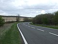 A bend in the A621 - geograph.org.uk - 4000435.jpg 640 × 480; 53 KB
-
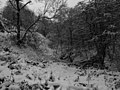
 A grey snowy day in Smeekley Wood - geograph.org.uk - 1631603.jpg 640 × 480; 78 KB
-
 A Lay-by on Baslow Road (geograph 7446316).jpg 1,280 × 854; 371 KB
-
 A monochrome scene - geograph.org.uk - 1631958.jpg 640 × 480; 126 KB
-
 A stand of trees south of Horsleygate Road - geograph.org.uk - 6159185.jpg 5,135 × 3,781; 4.21 MB
-
 A twisty A621 road - geograph.org.uk - 4000441.jpg 640 × 480; 68 KB
-
 A view of the airshaft on Totley Moss - geograph.org.uk - 5466953.jpg 4,903 × 3,680; 3.67 MB
-
 A621 at Fox Lane - geograph.org.uk - 4280909.jpg 640 × 481; 39 KB
-
 A621 heading north - geograph.org.uk - 4000411.jpg 640 × 480; 56 KB
-
 A621 south of Car Top - geograph.org.uk - 2437595.jpg 950 × 701; 282 KB
-
 A621 southbound on Ramsley Moor - geograph.org.uk - 4280908.jpg 640 × 480; 44 KB
-
 A621 towards Sheffield - geograph.org.uk - 4000427.jpg 640 × 480; 50 KB
-
 A621 towards Sheffield - geograph.org.uk - 4000437.jpg 640 × 480; 50 KB
-
 A621 towards Sheffield - geograph.org.uk - 4000463.jpg 640 × 480; 50 KB
-
 A621 view north from lay-by - geograph.org.uk - 1471694.jpg 640 × 480; 60 KB
-
 Access to moorland from the B6054 - geograph.org.uk - 2437570.jpg 950 × 707; 280 KB
-
 Air shaft for Totley Tunnel - geograph.org.uk - 3548694.jpg 4,000 × 2,248; 4.12 MB
-
 Air shaft on Totley Moss - geograph.org.uk - 2413333.jpg 768 × 1,024; 89 KB
-
 Air Shaft to Totley Tunnel - geograph.org.uk - 1263166.jpg 640 × 480; 98 KB
-
 Air Shaft to Totley Tunnel - geograph.org.uk - 1263178.jpg 640 × 480; 62 KB
-
 Airshaft on Totley Moss - geograph.org.uk - 5466964.jpg 4,450 × 3,801; 3.86 MB
-
 An oak tree near Cowley - geograph.org.uk - 5612732.jpg 3,557 × 4,729; 5.42 MB
-

-
 Approaching Cowley Chapel - geograph.org.uk - 6176951.jpg 3,828 × 5,026; 5.14 MB
-
 Approaching Cowley Mission Chapel - geograph.org.uk - 6176972.jpg 5,123 × 3,607; 3.29 MB
-
 Approaching Greenfield Farm on Cowley Lane - geograph.org.uk - 3749335.jpg 4,000 × 2,248; 7.53 MB
-
 Approaching Shillito Wood from Fox Lane - geograph.org.uk - 2710384.jpg 3,296 × 2,472; 1.02 MB
-
 At Old Hall, Fanshawe Gate Lane - geograph.org.uk - 4411252.jpg 5,015 × 3,835; 5.48 MB
-
 At the entrance to Cordwell Farm - geograph.org.uk - 6092589.jpg 3,529 × 4,880; 3.76 MB
-
 Autumn colour on Ramsley Moor - geograph.org.uk - 4677032.jpg 800 × 533; 151 KB
-
 Autumnal splendour in Smeekley Wood - geograph.org.uk - 1558598.jpg 640 × 480; 125 KB
-
 B6054 - Entering Holmesfield - geograph.org.uk - 1229025.jpg 640 × 480; 60 KB
-
 B6054 crossing Big Moor - geograph.org.uk - 3335126.jpg 1,024 × 676; 295 KB
-
 B6054 from Holmesfield to Owler Bar - geograph.org.uk - 2852345.jpg 4,000 × 2,672; 2.54 MB
-
 B6054 off the A621 - geograph.org.uk - 4781361.jpg 640 × 426; 53 KB
-
 B6054 west of Lydgate - geograph.org.uk - 2437456.jpg 950 × 686; 284 KB
-
 B6054 west of Lydgate - geograph.org.uk - 2941316.jpg 1,024 × 768; 287 KB
-
 Bags of removed heather - geograph.org.uk - 3343098.jpg 640 × 480; 66 KB
-
 Bandit at 9 o'clock - geograph.org.uk - 2629054.jpg 3,648 × 2,736; 5.41 MB
-
 Bank Green House - geograph.org.uk - 6159162.jpg 4,993 × 3,740; 4.92 MB
-
 Bar Brook - geograph.org.uk - 1942268.jpg 3,296 × 2,472; 1.02 MB
-
 Bar Brook in summer rain - geograph.org.uk - 3026467.jpg 1,024 × 866; 245 KB
-
 Bar brook valley, draining Big Moor - geograph.org.uk - 2901006.jpg 1,024 × 768; 183 KB
-
 Barbrook 1 stone circle, main stone - geograph.org.uk - 3345945.jpg 2,736 × 3,648; 4.72 MB
-
 Barbrook Bridge on the B6054 - geograph.org.uk - 1731592.jpg 2,560 × 1,920; 1.51 MB
-
 Barbrook III stone circle - geograph.org.uk - 4216388.jpg 600 × 800; 158 KB
-
 Barbrook Reservoir - geograph.org.uk - 3533030.jpg 3,946 × 2,146; 5.21 MB
-
 Barbrook Reservoir - geograph.org.uk - 5996307.jpg 1,024 × 639; 206 KB
-
 Barbrook stone circle - geograph.org.uk - 5865546.jpg 1,280 × 719; 282 KB
-
 Barbrook Valley Track - geograph.org.uk - 1010270.jpg 640 × 480; 70 KB
-
 Barns at Smeekley Farm, Car Road - geograph.org.uk - 1631943.jpg 640 × 480; 74 KB
-
 Big Moor - Cairn - geograph.org.uk - 963106.jpg 640 × 480; 92 KB
-
 Big Moor - geograph.org.uk - 1731564.jpg 640 × 480; 65 KB
-
 Big Moor - geograph.org.uk - 2885527.jpg 2,848 × 2,144; 1.51 MB
-
 Big Moor - geograph.org.uk - 4000416.jpg 640 × 480; 81 KB
-
 Big Moor - Track crossing Bar Brook - geograph.org.uk - 963143.jpg 640 × 480; 74 KB
-
 Big Moor Access Point - geograph.org.uk - 1942237.jpg 3,296 × 2,472; 1.2 MB
-
 Big Moor and Small Reservoir View - geograph.org.uk - 963088.jpg 640 × 480; 88 KB
-
 Big Moor towards Barbrook - geograph.org.uk - 2347488.jpg 640 × 480; 156 KB
-
 Big Moor's small reservoir - geograph.org.uk - 1585289.jpg 640 × 480; 59 KB
-
 Big Moor, small disused reservoir - geograph.org.uk - 2818532.jpg 4,000 × 3,000; 2.57 MB
-
 Birch polypore on fallen tree - geograph.org.uk - 2907030.jpg 1,024 × 768; 294 KB
-
 Birks Farm seen from Car Road - geograph.org.uk - 6159154.jpg 3,524 × 4,564; 4.06 MB
-
 Blacka Moor Nature Reserve - geograph.org.uk - 2247608.jpg 1,024 × 768; 325 KB
-
 Bluebells in Smeekley Wood - geograph.org.uk - 1871306.jpg 3,296 × 2,472; 989 KB
-
 Bluebells in Smeekley Wood - geograph.org.uk - 2941311.jpg 1,024 × 768; 390 KB
-
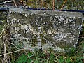 Boundary Stone, Blake Brook.jpg 640 × 480; 440 KB
-
 Bracken by the A621 - geograph.org.uk - 4781350.jpg 640 × 426; 49 KB
-
 Bridge over Bar Brook - geograph.org.uk - 2307424.jpg 640 × 480; 170 KB
-
 Bridleway into a wood - geograph.org.uk - 1631950.jpg 640 × 480; 98 KB
-
 Bridleway near Greave's Piece - geograph.org.uk - 1871297.jpg 3,296 × 2,472; 1.1 MB
-
 Bridleway off Horsleygate Road - geograph.org.uk - 1631581.jpg 640 × 480; 75 KB
-
 Bridleway off the B6054 - geograph.org.uk - 1229050.jpg 640 × 480; 94 KB
-
 Bridleway towards Horsleygate - geograph.org.uk - 5290023.jpg 1,600 × 1,200; 1.03 MB
-
 Brown Edge from Flask Edge - geograph.org.uk - 3673557.jpg 750 × 563; 95 KB
-
 Bucka Hill - geograph.org.uk - 4781357.jpg 640 × 426; 49 KB
-
 Bucka Hill - geograph.org.uk - 4781358.jpg 640 × 426; 54 KB
-
 Bucka Hill looking towards Sheffield - geograph.org.uk - 2628794.jpg 2,449 × 1,837; 1.38 MB
-
 Bus stop and footpath sign on Millthorpe Lane - geograph.org.uk - 2647384.jpg 1,813 × 2,417; 1.78 MB
-
 Bus stop on Millthorpe Lane - geograph.org.uk - 5057355.jpg 640 × 480; 50 KB
-
 By Flask Edge in wintertime - geograph.org.uk - 5642990.jpg 4,830 × 3,481; 3 MB
-
 By the edge of Kitchen Wood - geograph.org.uk - 2425965.jpg 950 × 721; 321 KB
-
 By Totley Moss looking to Carl Wark - geograph.org.uk - 5642996.jpg 5,022 × 3,588; 6.11 MB
-
 Cairn above the ancient stone circle known as Barbrook I - geograph.org.uk - 2959581.jpg 4,608 × 3,072; 3.41 MB
-
 Cairn on Big Moor - geograph.org.uk - 3345926.jpg 3,648 × 2,736; 4.73 MB
-
 Cairn on Brown Edge - geograph.org.uk - 6120456.jpg 5,184 × 3,888; 4.77 MB
-
 Cairn on Brown Edge, Totley Moors - geograph.org.uk - 5642981.jpg 5,044 × 3,559; 4.17 MB
-
 Car Road - geograph.org.uk - 2941346.jpg 768 × 1,024; 271 KB
-
 Car Road - geograph.org.uk - 6159158.jpg 5,129 × 3,779; 7.78 MB
-
 Car Road leading off A621 - geograph.org.uk - 4201318.jpg 4,000 × 2,248; 5.38 MB
-
 Car Road past barns at Smeekley Farm - geograph.org.uk - 2437290.jpg 950 × 713; 308 KB
-
 Car Top - geograph.org.uk - 4000431.jpg 640 × 480; 51 KB
-
 Carl's Wood - geograph.org.uk - 3373718.jpg 3,996 × 2,994; 2.52 MB
-
 Cartledge Grange - geograph.org.uk - 2398871.jpg 3,296 × 2,472; 1.23 MB
-
 Cattle at Bank Green - geograph.org.uk - 6159175.jpg 4,906 × 3,511; 6.33 MB
-
 Cattle sheltering by the small reservoir at Barbrook - geograph.org.uk - 2963666.jpg 4,417 × 2,945; 2.65 MB
-
 Cherry Tree Cottage - geograph.org.uk - 2941320.jpg 1,024 × 768; 326 KB
-
 Cherry Tree Farm, Cowley - geograph.org.uk - 1711992.jpg 640 × 480; 88 KB
-
 Clam Bridge over Bar Brook - geograph.org.uk - 1737422.jpg 3,296 × 2,472; 1.08 MB
-
 Close up, Elizabeth II postbox on Main Road, Holmesfield - geograph.org.uk - 5056407.jpg 1,336 × 2,446; 626 KB
-
 Close up, Elizabeth II postbox on Main Road, Holmesfield - geograph.org.uk - 5056513.jpg 1,643 × 3,074; 778 KB
-
 Companion Stone - geograph.org.uk - 2818554.jpg 4,000 × 3,000; 2.59 MB
-
 Companion Stone at Deadshaw Sick - geograph.org.uk - 2818523.jpg 4,000 × 3,000; 2.52 MB
-
 Companion Stone on Big Moor - geograph.org.uk - 4677024.jpg 800 × 533; 114 KB
-
 Companion Stone on Big Moor - geograph.org.uk - 4677028.jpg 533 × 800; 222 KB
-
 Cordwell Farmhouse.jpg 4,923 × 3,459; 6.87 MB
-

-

-
 Countryside and storm south of Cowley - geograph.org.uk - 2917756.jpg 4,300 × 2,867; 2.71 MB
-
 Countryside north of Unthank - geograph.org.uk - 2437336.jpg 950 × 713; 276 KB
-

-
 Cowley Hall, Cowley Lane near Holmesfield - geograph.org.uk - 2917723.jpg 4,182 × 2,788; 2.46 MB
-
 Cowley Lane, field and farm house - geograph.org.uk - 2425954.jpg 950 × 629; 257 KB
-
 Cowley Mission Chapel - geograph.org.uk - 2425947.jpg 950 × 860; 360 KB
-
 Cowley Mission Chapel - geograph.org.uk - 5341219.jpg 1,600 × 1,200; 363 KB
-
 Cowley Mission Chapel - geograph.org.uk - 5612728.jpg 4,885 × 3,663; 3.56 MB
-
 Cowley Mission Chapel - geograph.org.uk - 6176961.jpg 4,881 × 3,623; 4.73 MB
-
 Cows grazing the path on Ramsley Moor - geograph.org.uk - 2437612.jpg 950 × 623; 281 KB
-
 Crop field towards Little Brind Wood - geograph.org.uk - 5057345.jpg 640 × 480; 62 KB
-
 Culvert, Ramsley Moor, Derbyshire - geograph.org.uk - 2006700.jpg 1,024 × 768; 278 KB
-
 Dead Tree - geograph.org.uk - 4411256.jpg 3,788 × 5,007; 4.9 MB
-
 Derbyshire UK parish map highlighting Holmesfield.svg 888 × 1,308; 2.35 MB
-
 Descending Unthank Lane - geograph.org.uk - 3369138.jpg 4,000 × 2,248; 2.45 MB
-
 Descending Wimble Holme Hill - geograph.org.uk - 6131042.jpg 1,024 × 683; 241 KB
-
 Descending Wimble Holme Hill off Totley Moss - geograph.org.uk - 4166385.jpg 4,000 × 2,248; 6.04 MB
-
 Disused horsebox at Hills Farm - geograph.org.uk - 6177205.jpg 3,807 × 4,984; 6.15 MB
-
 Disused shed in woodland at Horsleygate - geograph.org.uk - 6092652.jpg 5,184 × 3,888; 7.18 MB
-
 Dobbin Lane near Peakley Hill, Derbyshire - geograph.org.uk - 2917736.jpg 3,072 × 4,608; 2.98 MB
-
 Double slab packhorse bridge over Barbrook - geograph.org.uk - 3633774.jpg 4,000 × 2,672; 6.27 MB
-
 Dovecote, Fanshawe Gate Hall.jpg 3,746 × 5,067; 5.69 MB
-
 Durbrook House, near Holmesfield - geograph.org.uk - 5290033.jpg 1,600 × 1,200; 402 KB
-
 Dwellings on Moorwood Lane - geograph.org.uk - 3078631.jpg 4,000 × 3,000; 2.51 MB
-
 Earthwork Remnants of Old Salt Route - geograph.org.uk - 1249857.jpg 640 × 480; 39 KB
-
 Edge of Shillito Wood - geograph.org.uk - 3013057.jpg 640 × 427; 259 KB
-
 Elizabeth II postbox on Main Road, Holmesfield - geograph.org.uk - 5056404.jpg 3,648 × 2,736; 1.75 MB
-

-
 Emptied Barbrook Reservoir - geograph.org.uk - 3533033.jpg 4,000 × 2,248; 5.56 MB
-
 Enclosed Coppice off Moorwood Lane - geograph.org.uk - 3078608.jpg 3,878 × 2,830; 2.14 MB
-
 Entering Holmesfield - geograph.org.uk - 5057361.jpg 640 × 480; 62 KB
-
 Entrance to Burrs Wood - geograph.org.uk - 3371848.jpg 800 × 533; 214 KB
-
 Entrance to Fox Lane Farm, Fox Lane - geograph.org.uk - 2959335.jpg 4,242 × 2,828; 2.57 MB
-
 Entry to Blacka Moor Nature Reserve - geograph.org.uk - 3634045.jpg 600 × 450; 394 KB
-
 Factory Fire - geograph.org.uk - 3555741.jpg 1,418 × 1,012; 796 KB
-

-
 Fallen tree near Cowley - geograph.org.uk - 5612736.jpg 5,183 × 3,619; 6.09 MB
-
 Family rambling on Wimble Holme Hill - geograph.org.uk - 6149317.jpg 5,069 × 3,813; 4.45 MB
-
 Fanshaw Gate Lane - geograph.org.uk - 1229015.jpg 640 × 480; 59 KB
-
 Fanshaw Gate Lane - geograph.org.uk - 1229057.jpg 640 × 480; 83 KB
-
 Fanshaw Hall - panoramio.jpg 3,072 × 2,304; 2.05 MB
-
 Fanshawe Gate Lane - geograph.org.uk - 3391935.jpg 4,000 × 1,558; 789 KB
-
 Fanshawe Gate Lane near Owler Lea - geograph.org.uk - 2519247.jpg 950 × 563; 215 KB
-
 Farm buildings at Woodthorpe Hall - geograph.org.uk - 3118156.jpg 1,024 × 768; 195 KB
-
 Farmland and moorland, Owler Bar - geograph.org.uk - 4000455.jpg 640 × 480; 67 KB
-
 Fence around north end of disused Barbrook Reservoir - geograph.org.uk - 4200155.jpg 4,000 × 2,248; 5.88 MB
-
 Field by Car Road with view north - geograph.org.uk - 2437311.jpg 950 × 713; 287 KB
-
 Field gate close to Pingle Dike - geograph.org.uk - 2647434.jpg 2,608 × 1,952; 1.86 MB
-
 Field path below Horsleygate. View SW - geograph.org.uk - 4630790.jpg 1,024 × 768; 218 KB
-
 Field with sheep above Horsleygate Hall - geograph.org.uk - 2437476.jpg 950 × 713; 332 KB
-
 Fishing pond behind Storth House - geograph.org.uk - 1711608.jpg 640 × 480; 100 KB
-
 Flask Edge trig point on Totley Moss - geograph.org.uk - 5513509.jpg 800 × 600; 156 KB
-
 Follow my leader - geograph.org.uk - 4182658.jpg 800 × 600; 172 KB
-
 Footbridge across stream below Cowley Hall - geograph.org.uk - 3749337.jpg 4,000 × 2,248; 7.17 MB
-
 Footbridge east of Woodthorpe Hall - geograph.org.uk - 3412176.jpg 1,536 × 2,048; 519 KB
-
 Footbridge over Totley Brook - geograph.org.uk - 3412179.jpg 2,048 × 1,536; 508 KB
-
 Footpath along southern boundary of Gosforth Estate - geograph.org.uk - 3749341.jpg 3,992 × 2,234; 5.63 MB
-
 Footpath at the edge of Dronfield - geograph.org.uk - 3757524.jpg 533 × 800; 167 KB
-

-

-
 Footpath from Horsleygate to Millthorpe - geograph.org.uk - 2347810.jpg 640 × 480; 165 KB
-

-
 Footpath in Gillfield Wood - geograph.org.uk - 2601689.jpg 640 × 480; 210 KB
-
 Footpath in Holmesfield Park Wood - geograph.org.uk - 2601900.jpg 640 × 480; 211 KB
-

-

-

-

-
 Footpath towards Bank Wood - geograph.org.uk - 2347799.jpg 640 × 480; 186 KB
-
 Footpath towards Hills Farm, Gosforth Valley - geograph.org.uk - 5341223.jpg 1,600 × 1,200; 316 KB
-
 Footpath towards Horsleygate - geograph.org.uk - 2347804.jpg 640 × 480; 153 KB
-
 Footpath towards Horsleygate - geograph.org.uk - 2601895.jpg 640 × 480; 178 KB
-
 Footpath towards the woods at Pingle Dike - geograph.org.uk - 5290008.jpg 1,600 × 1,200; 752 KB
-
 Ford on the bridleway in Kitchen Wood - geograph.org.uk - 5290044.jpg 1,600 × 1,200; 906 KB
-
 Former Horns Inn - geograph.org.uk - 5286886.jpg 5,376 × 3,024; 2.31 MB
-
 Former Horns Inn site under development for housing - geograph.org.uk - 5479023.jpg 5,354 × 2,984; 2.07 MB
-
 Former toll house near The Peacock Inn.jpg 6,000 × 4,000; 7.02 MB
-
 Fox Lane - After the storm - geograph.org.uk - 1472462.jpg 640 × 480; 68 KB
-

-
 Fox Lane - geograph.org.uk - 3013053.jpg 640 × 427; 203 KB
-
 Fox Lane - geograph.org.uk - 3999341.jpg 640 × 480; 56 KB
-
 Fox Lane - geograph.org.uk - 4785574.jpg 640 × 426; 53 KB
-

-
 Fox Lane Cross - geograph.org.uk - 3013040.jpg 640 × 427; 214 KB
-
 Fox Lane east of Ramsley Reservoir - geograph.org.uk - 2439420.jpg 950 × 706; 322 KB
-
 Foxlane Plantation (2) - geograph.org.uk - 2629020.jpg 3,648 × 2,736; 6.43 MB
-
 Foxlane Plantation - geograph.org.uk - 1632484.jpg 640 × 480; 111 KB
-
 Foxlane Plantation on Ramsley Moor - geograph.org.uk - 2601687.jpg 640 × 480; 163 KB
-
 Foxlane Plantation, looking south on a sunny morning - geograph.org.uk - 2629037.jpg 3,648 × 2,736; 6.16 MB


.jpg)


_-_geograph.org.uk_-_2629020.jpg)


