Category:Holbeton
Jump to navigation
Jump to search
village and civil parish in Devon, UK  | |||||
| Upload media | |||||
| Instance of | |||||
|---|---|---|---|---|---|
| Location | South Hams, Devon, South West England, England | ||||
 | |||||
This is a category containing media related to Holbeton, a village in Devon, England.
Subcategories
This category has the following 9 subcategories, out of 9 total.
A
B
F
- Ford, Holbeton (3 F)
M
- Mothecombe House, Holbeton (8 F)
O
- Owen's Point, Holbeton (15 F)
S
- Sequer's Bridge (2 F)
T
- Thatched cottages in Holbeton (11 F)
Media in category "Holbeton"
The following 200 files are in this category, out of 333 total.
(previous page) (next page)-
 A379 approaching the valley of Hollowcombe Cross - geograph.org.uk - 4438706.jpg 1,600 × 640; 682 KB
-
 A379 junction with A3121 near Hollowcombe Fm - geograph.org.uk - 3154074.jpg 1,024 × 925; 208 KB
-
 A379 south of Hollowcombe Farm - geograph.org.uk - 3859946.jpg 3,469 × 2,559; 1.42 MB
-
 A379 west of Addistone - geograph.org.uk - 3859958.jpg 3,439 × 2,645; 1.19 MB
-
 Across the Valley to Thornhill Wood - geograph.org.uk - 1415917.jpg 640 × 427; 111 KB
-
 All Saints Church , Holbeton - geograph.org.uk - 3712966.jpg 640 × 428; 63 KB
-
 All Saints church, Holbeton - geograph.org.uk - 3222057.jpg 1,067 × 1,600; 357 KB
-

-

-
 Along the Coastline - geograph.org.uk - 1415097.jpg 640 × 427; 92 KB
-
 Alston Cross - geograph.org.uk - 3863144.jpg 3,376 × 2,475; 1.03 MB
-
 Another view of St Anchorite's Rock - geograph.org.uk - 3893881.jpg 640 × 425; 69 KB
-
 Arable field above Keaton Cove - geograph.org.uk - 2731307.jpg 1,024 × 768; 214 KB
-
 Barn above Efford House - geograph.org.uk - 292666.jpg 640 × 480; 78 KB
-
 Barn above Efford House - geograph.org.uk - 292727.jpg 640 × 472; 65 KB
-
 Barn and bridleway - geograph.org.uk - 292669.jpg 480 × 640; 146 KB
-
 Barn near Efford House - geograph.org.uk - 291501.jpg 640 × 489; 116 KB
-
 Barn north of A379 - geograph.org.uk - 5917149.jpg 1,024 × 599; 120 KB
-
 Barn, Brownswell Farm - geograph.org.uk - 292619.jpg 640 × 480; 45 KB
-
 Barns at Ramsland - geograph.org.uk - 1458656.jpg 640 × 480; 86 KB
-
 Battisborough Cove and Bugle Hole - geograph.org.uk - 326298.jpg 640 × 475; 105 KB
-
 Battisborough Cross - geograph.org.uk - 2009893.jpg 640 × 480; 49 KB
-
 Battisborough Cross - geograph.org.uk - 3863143.jpg 4,000 × 3,000; 1.45 MB
-
 Battisborough Cross South Devon.JPG 2,076 × 1,599; 2.38 MB
-
 Battisborough House - geograph.org.uk - 4908195.jpg 1,024 × 768; 258 KB
-
 Beach in Ryder's Hole (2382).jpg 4,288 × 2,848; 6.47 MB
-
 Beached - geograph.org.uk - 1531295.jpg 640 × 428; 98 KB
-
 Beacon Hill and Stoke Point (2379).jpg 4,288 × 2,848; 5.42 MB
-
 Beacon Hill and Stoke Point from the east (2367).jpg 4,288 × 2,848; 4.18 MB
-
 Beacon Hill from the east (2844).jpg 4,288 × 2,848; 4.36 MB
-
 Beacon Point (2829).jpg 4,288 × 2,848; 5.63 MB
-
 Beacon Point (2835).jpg 4,288 × 2,848; 5.65 MB
-
 Beacon Point (2838).jpg 4,288 × 2,848; 5.37 MB
-
 Beacon Point (2840).jpg 4,288 × 2,848; 5.37 MB
-
 Bolt Tail from Carswell Cove (2363).jpg 4,288 × 2,848; 5.7 MB
-
 Borough Farm - geograph.org.uk - 292739.jpg 640 × 480; 81 KB
-
 Borough Farm from Hembury Cross - geograph.org.uk - 291904.jpg 640 × 480; 91 KB
-
 Bridge carries private track to Mothecombe - geograph.org.uk - 3863141.jpg 3,800 × 2,673; 1.54 MB
-
 Brownswell Farm, Holbeton - geograph.org.uk - 292576.jpg 640 × 480; 98 KB
-
 Bugle Hole - geograph.org.uk - 6252809.jpg 1,600 × 1,067; 457 KB
-
 Building in Carswell Cove (2388).jpg 4,288 × 2,848; 5.52 MB
-
 Burgh Island from Carswell Cove (2360).jpg 4,288 × 2,848; 4.79 MB
-
 Butcher's Cove - geograph.org.uk - 2731314.jpg 768 × 1,024; 201 KB
-
 Butcher's Cove - geograph.org.uk - 326312.jpg 480 × 640; 122 KB
-
 Butcher's Cove - geograph.org.uk - 3893910.jpg 640 × 425; 87 KB
-
 Butcher's Cove - geograph.org.uk - 4111751.jpg 1,920 × 1,440; 874 KB
-
 Butcher's Cove - geograph.org.uk - 6252804.jpg 1,600 × 1,067; 573 KB
-
 Butcher's Cove and Gull Cove - geograph.org.uk - 332722.jpg 640 × 480; 111 KB
-
 By Erme Mouth - geograph.org.uk - 4702421.jpg 1,600 × 1,067; 342 KB
-
 By Meadowsfoot Beach - geograph.org.uk - 4702374.jpg 1,067 × 1,600; 421 KB
-
 Carswell Cove - geograph.org.uk - 4110815.jpg 1,920 × 1,440; 758 KB
-
 Carswell Cove - geograph.org.uk - 4110881.jpg 1,920 × 1,440; 810 KB
-
 Carswell Cove - geograph.org.uk - 6252683.jpg 1,600 × 1,067; 387 KB
-
 Carswell Tor Cottage (2369).jpg 4,288 × 2,848; 5.2 MB
-
 Church of All Saints - geograph.org.uk - 3860220.jpg 3,175 × 2,655; 1.59 MB
-
 Claypark Plantation - geograph.org.uk - 292615.jpg 640 × 480; 119 KB
-
 Cliff above Gull Cove - geograph.org.uk - 4094255.jpg 1,536 × 2,048; 794 KB
-
 Cliffs below Battisborough House (2846).jpg 4,288 × 2,848; 6.47 MB
-
 Cliffs below Battisborough House (2847).jpg 4,288 × 2,848; 6.24 MB
-
 Cliffs below Battisborough House (2852).jpg 4,288 × 2,848; 6.38 MB
-
 Cliffs below Saddle Rock (2371).jpg 4,288 × 2,848; 6.23 MB
-
 Cliffs below Saddle Rock (2374).jpg 4,288 × 2,848; 6.17 MB
-
 Cliffs near St Anchorite's Rock (2380).jpg 4,288 × 2,848; 6.52 MB
-
 Cliffs west of Mothecombe (2352).jpg 4,288 × 2,848; 4.55 MB
-
 Cliffs west of Mothecombe (2353).jpg 4,288 × 2,848; 5.25 MB
-
 Cliffs west of Mothecombe (2355).jpg 4,288 × 2,848; 6.76 MB
-
 Cliffs west of Mothecombe (2358).jpg 4,288 × 2,848; 5.87 MB
-
 Cliffs west of Mothecombe (2359).jpg 4,288 × 2,848; 6.2 MB
-
 Cliffs west of Mothecombe (2381).jpg 4,288 × 2,848; 5.71 MB
-
 Cliffs west of Mothecombe (2383).jpg 4,288 × 2,848; 5.32 MB
-
 Cliffs west of Mothecombe (2384).jpg 4,288 × 2,848; 5.51 MB
-
 Cliffs west of Mothecombe (2385).jpg 4,288 × 2,848; 5.13 MB
-
 Climbing up the S.West Coast Path - geograph.org.uk - 3896271.jpg 640 × 425; 118 KB
-
 Coast around Carswell Cove - geograph.org.uk - 4110745.jpg 1,920 × 1,334; 800 KB
-
 Coast at Bugle Hole - geograph.org.uk - 332710.jpg 640 × 480; 126 KB
-
 Coast path above Carswell Cove - geograph.org.uk - 2724804.jpg 1,024 × 768; 145 KB
-
 Coast path above Ryder's Hole - geograph.org.uk - 2724800.jpg 1,024 × 768; 218 KB
-

-
 Coast path approaching the Erme estuary - geograph.org.uk - 2731418.jpg 1,024 × 768; 250 KB
-
 Coast path near Saddle Rock - geograph.org.uk - 4110893.jpg 1,920 × 1,280; 623 KB
-
 Coast Path passing through The Grove - geograph.org.uk - 3893956.jpg 640 × 425; 140 KB
-
 Coast Path to Mothercombe - geograph.org.uk - 3893893.jpg 640 × 425; 94 KB
-
 Coast Path to Mothercombe - geograph.org.uk - 3893952.jpg 640 × 425; 73 KB
-
 Coldharbour Wood - geograph.org.uk - 292998.jpg 640 × 480; 77 KB
-
 Combe Farm - geograph.org.uk - 293047.jpg 640 × 480; 74 KB
-
 Combe Farm - geograph.org.uk - 293053.jpg 640 × 480; 86 KB
-
 Cormorants on cliffs below Saddle Rock (2372).jpg 4,288 × 2,848; 6.15 MB
-
 Cormorants on cliffs below Saddle Rock (2373).jpg 4,288 × 2,848; 6.56 MB
-
 Cormorants on cliffs below Saddle Rock (2375).jpg 4,288 × 2,848; 6.38 MB
-
 Cormorants on cliffs below Saddle Rock (2376).jpg 4,288 × 2,848; 6.67 MB
-
 Cottage Farm, Holbeton - geograph.org.uk - 292644.jpg 640 × 480; 82 KB
-

-
 Crop field near Battisborough Cross - geograph.org.uk - 2676144.jpg 640 × 480; 85 KB
-
 Damp gateway above Efford House - geograph.org.uk - 292673.jpg 640 × 480; 99 KB
-
 Dead wood by the Erme - geograph.org.uk - 2375972.jpg 640 × 480; 122 KB
-

-

-
 Detail of St Anchorites Rock - geograph.org.uk - 1809445.jpg 640 × 480; 86 KB
-
 Drinking trough by the coast path - geograph.org.uk - 4110759.jpg 1,920 × 1,313; 520 KB
-
 Entrance gates to Flete - geograph.org.uk - 5941315.jpg 1,024 × 681; 163 KB
-
 Erme - Plym Trail crosses field - geograph.org.uk - 5941319.jpg 1,024 × 681; 171 KB
-
 Erme estuary - geograph.org.uk - 2375941.jpg 640 × 430; 65 KB
-
 Erme estuary - geograph.org.uk - 2376003.jpg 640 × 480; 136 KB
-
 Erme estuary - geograph.org.uk - 2731430.jpg 1,024 × 768; 179 KB
-
 Erme estuary - geograph.org.uk - 2731438.jpg 1,024 × 768; 168 KB
-
 Erme estuary, 1996 - geograph.org.uk - 3391590.jpg 640 × 355; 55 KB
-
 Erme estuary, 1996 - geograph.org.uk - 3392205.jpg 640 × 438; 98 KB
-
 Erme Plym Trail - geograph.org.uk - 2146505.jpg 640 × 480; 127 KB
-
 Erme-Plym trail - geograph.org.uk - 1379635.jpg 640 × 480; 132 KB
-
 Erme-Plym Trail near Flete - geograph.org.uk - 4851774.jpg 1,920 × 1,280; 1.27 MB
-
 Erne Mouth, Bigbury Bay, 1967 - geograph.org.uk - 4880872.jpg 2,399 × 1,578; 4.82 MB
-
 Farm Building - geograph.org.uk - 3712948.jpg 640 × 428; 77 KB
-
 Farm Buildings - geograph.org.uk - 3712918.jpg 640 × 428; 113 KB
-
 Field and Carswell Tor Cottage (2368).jpg 4,288 × 2,848; 5.19 MB
-
 Field and view near Holbeton - geograph.org.uk - 293058.jpg 640 × 480; 102 KB
-
 Field by A379 - geograph.org.uk - 5913673.jpg 1,024 × 681; 109 KB
-
 Field by A379 - geograph.org.uk - 5917153.jpg 1,024 × 681; 133 KB
-
 Field by A379 - geograph.org.uk - 5941323.jpg 1,024 × 681; 123 KB
-
 Field by the A379 - geograph.org.uk - 4851794.jpg 1,920 × 1,237; 544 KB
-
 Field by the bridleway - geograph.org.uk - 1381386.jpg 640 × 480; 83 KB
-
 Fields above the Erme estuary (2836).jpg 4,288 × 2,848; 4.1 MB
-
 Fields near Ramsland - geograph.org.uk - 1458679.jpg 640 × 443; 62 KB
-
 Fingerpost at Wonwell Cross - geograph.org.uk - 341869.jpg 640 × 480; 121 KB
-
 Footpath Through Barley - geograph.org.uk - 1415116.jpg 640 × 427; 115 KB
-
 Ford Holbeton South Devon.JPG 2,688 × 1,896; 4.13 MB
-
 Fore Street, Holbeton - geograph.org.uk - 291968.jpg 480 × 640; 98 KB
-
 Fore Street, Holbeton - geograph.org.uk - 341854.jpg 640 × 480; 118 KB
-
 Forest track - geograph.org.uk - 3711744.jpg 640 × 428; 166 KB
-
 Frozen animal trough above Carswell Cove (2362).jpg 4,288 × 2,848; 6.24 MB
-
 Fungi near the Newton Stream - geograph.org.uk - 292747.jpg 640 × 480; 136 KB
-
 Gate near Modbury Cross - geograph.org.uk - 1379644.jpg 640 × 480; 122 KB
-
 Gate posts - geograph.org.uk - 5941336.jpg 1,024 × 681; 191 KB
-
 Gatehouse at Wonnell Cross - geograph.org.uk - 50138.jpg 640 × 480; 110 KB
-
 Gatehouse by Wonnell Barn - geograph.org.uk - 2009938.jpg 640 × 480; 78 KB
-

-
 Gull Cove in SX5946 - geograph.org.uk - 1875137.jpg 1,600 × 1,200; 321 KB
-

-
 Hedges and houses at Battisborough Cross - geograph.org.uk - 4575098.jpg 1,600 × 1,067; 1.25 MB
-
 Hembury Cross - geograph.org.uk - 293057.jpg 640 × 480; 66 KB
-
 Hembury Cross - geograph.org.uk - 3863136.jpg 3,424 × 2,493; 1.16 MB
-
 Hembury Cross - geograph.org.uk - 4575103.jpg 1,600 × 1,199; 1.53 MB
-
 Henna Mill - geograph.org.uk - 291705.jpg 640 × 480; 151 KB
-
 Holbeton - South Devon - geograph.org.uk - 20033.jpg 640 × 480; 144 KB
-

-
 Holbeton from the south - geograph.org.uk - 293061.jpg 640 × 469; 75 KB
-
 Holbeton from the southeast - geograph.org.uk - 292630.jpg 640 × 398; 58 KB
-
 Holbeton Primary School - geograph.org.uk - 293075.jpg 640 × 480; 73 KB
-
 Holbeton Village Store and Post Office - geograph.org.uk - 341839.jpg 640 × 480; 112 KB
-
 Holbeton, Brownswell Farm - geograph.org.uk - 5717969.jpg 1,600 × 1,172; 691 KB
-
 Holbeton, Brownswell Farm - geograph.org.uk - 5717973.jpg 1,200 × 1,600; 720 KB
-
 Holbeton, descent to Meadowsfoot beach - geograph.org.uk - 2960887.jpg 640 × 427; 517 KB
-
 Holbeton, Erme estuary - geograph.org.uk - 1858924.jpg 640 × 427; 228 KB
-
 Holbeton, footpath on Owen's Hill - geograph.org.uk - 2960884.jpg 640 × 427; 555 KB
-
 Holbeton, gatehouse and estate entrance - geograph.org.uk - 2960921.jpg 640 × 427; 400 KB
-
 Holbeton, near the mouth of the Erme - geograph.org.uk - 627999.jpg 640 × 427; 157 KB
-
 Holbeton, obscured signpost - geograph.org.uk - 2960926.jpg 640 × 427; 448 KB
-
 Holbeton, on Owen's Hill - geograph.org.uk - 628026.jpg 640 × 427; 316 KB
-
 Holbeton, path from Meadowsfoot Beach - geograph.org.uk - 637225.jpg 640 × 427; 303 KB
-
 Holbeton, post office and Church Hill - geograph.org.uk - 293074.jpg 480 × 640; 84 KB
-
 Holbeton, road junction by Wonnell Barn - geograph.org.uk - 2960917.jpg 640 × 427; 415 KB
-
 Holbeton, school - geograph.org.uk - 5717962.jpg 1,511 × 1,600; 797 KB
-

-
 Holbeton, the bar, Mildmay Colours inn - geograph.org.uk - 5679022.jpg 1,200 × 1,600; 385 KB
-
 Holbeton, the road to Modbury - geograph.org.uk - 1490408.jpg 640 × 427; 432 KB
-
 Holbeton, the village centre - geograph.org.uk - 460001.jpg 640 × 427; 190 KB
-
 Holbeton, towards Brownswell Farm - geograph.org.uk - 5717971.jpg 1,600 × 1,019; 500 KB
-
 Holbeton, towards Mothecombe hamlet - geograph.org.uk - 2960898.jpg 640 × 427; 432 KB
-
 Holbeton, towards Owen's Hill - geograph.org.uk - 2960883.jpg 640 × 427; 462 KB
-
 Holbeton, towards Owen's Hill - geograph.org.uk - 2960897.jpg 640 × 427; 338 KB
-
 Holbeton, towards the church - geograph.org.uk - 2374734.jpg 640 × 427; 160 KB
-
 Holbeton, wood on Owen's Hill - geograph.org.uk - 2960886.jpg 640 × 427; 529 KB
-
 Holbeton- towards Mothecombe (geograph 4887443).jpg 1,600 × 1,200; 712 KB
-
 Holbeton- towards Mothecombe House (geograph 2960901).jpg 640 × 427; 373 KB
-
 Hole Farm - geograph.org.uk - 49957.jpg 640 × 436; 111 KB
-
 Hollowcombe Farm track - geograph.org.uk - 5917151.jpg 1,024 × 765; 182 KB
-
 Hope Cove from west of Mothecombe (2839).jpg 4,288 × 2,848; 4.27 MB
-
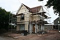 House Makeover - geograph.org.uk - 1415991.jpg 640 × 427; 100 KB
-
 Houses at Battisborough Cross - geograph.org.uk - 1083350.jpg 640 × 480; 75 KB
-
 Keaton Cove - geograph.org.uk - 6252807.jpg 1,600 × 1,067; 448 KB
-
 Kingston, limekiln on the beach - geograph.org.uk - 72120.jpg 640 × 421; 150 KB
-
 Lane junction east of Lambside - geograph.org.uk - 3863145.jpg 2,985 × 2,381; 958 KB
-
 Lane off A379 - geograph.org.uk - 5913638.jpg 1,024 × 681; 208 KB
-
 Lane off A379 - geograph.org.uk - 5917156.jpg 1,024 × 681; 194 KB
-
 Lane off A379 - geograph.org.uk - 5941339.jpg 1,024 × 681; 179 KB
-
 Lane south of Venges Brake - geograph.org.uk - 3860488.jpg 3,372 × 2,427; 2 MB
-
 Lane to Clickland - geograph.org.uk - 4851788.jpg 1,920 × 1,288; 690 KB
-
 Large Farm Building - geograph.org.uk - 3712912.jpg 640 × 428; 44 KB
-
 Large Herd of Cows near Mothecombe - geograph.org.uk - 443479.jpg 640 × 480; 134 KB
-
 Looking across the Erme Estuary - geograph.org.uk - 4126238.jpg 2,560 × 1,920; 2.15 MB
-

-
 Looking ahead on the Coast Path - geograph.org.uk - 3893828.jpg 640 × 425; 78 KB
-

-

-

-
 Looking towards Holbeton - geograph.org.uk - 3712934.jpg 640 × 428; 62 KB
-

-
 Lots of steps out of Bugle Hole - geograph.org.uk - 3893929.jpg 640 × 425; 112 KB
-
 Marsh east of Holbeton Wood - geograph.org.uk - 3860462.jpg 4,000 × 3,000; 3.81 MB
-
 Masters Cross - geograph.org.uk - 293017.jpg 640 × 480; 76 KB
-
 Meadows by River Erme - geograph.org.uk - 5941312.jpg 1,024 × 681; 112 KB


_-_geograph.org.uk_-_3539726.jpg)
_-_geograph.org.uk_-_3539727.jpg)


.jpg)

.jpg)


.jpg)
.jpg)


.jpg)


.jpg)
.jpg)
.jpg)
.jpg)
.jpg)
.jpg)
.jpg)
.jpg)
.jpg)
.jpg)
.jpg)
.jpg)
.jpg)
.jpg)
.jpg)


.jpg)
.jpg)
.jpg)
.jpg)


.jpg)


.jpg)


.jpg)


.jpg)
.jpg)


.jpg)


.jpg)
.jpg)
.jpg)
.jpg)
.jpg)
.jpg)
.jpg)