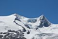
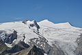
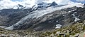
Category:Hoher Zaun
Jump to navigation
Jump to search
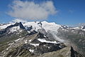
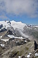
mountain in the Venediger Group in East Tyrol  Hoher Zaun (vlevo) a Schwarze Wand (vpravo) z doliny Gschlößtal | |||||
| Upload media | |||||
| Instance of | |||||
|---|---|---|---|---|---|
| Part of | |||||
| Location | |||||
| Mountain range | |||||
| Topographic prominence |
| ||||
| Topographic isolation |
| ||||
| Elevation above sea level |
| ||||
 | |||||
Media in category "Hoher Zaun"
The following 36 files are in this category, out of 36 total.
-
 2004-07-26 innergschlöss - alte prager hütte 21.JPG 1,984 × 1,488; 708 KB
-
 Alte prager huette pano.jpg 5,000 × 2,000; 2.54 MB
-
 Alte Prager Hütte Schlatenkees.jpg 4,000 × 3,000; 5.04 MB
-
 Blick vom Wildenkogel auf Venedigermassiv sowie Inneren und Äußeren Knorrkogel a.JPG 6,000 × 4,000; 12.43 MB
-
 Blick vom Wildenkogel auf Venedigermassiv sowie Inneren und Äußeren Knorrkogel b.JPG 6,000 × 4,000; 12.45 MB
-
 Blick vom Wildenkogel auf Venedigermassiv sowie Inneren und Äußeren Knorrkogel c.JPG 6,000 × 4,000; 11.29 MB
-
 Dorferkees 2007.jpg 1,157 × 560; 210 KB
-
 ETH-BIB-Venediger v. Süd-Osten-LBS H1-020369.tif 5,870 × 4,647; 78.13 MB
-
 Großvenediger und Rainerhorn - Vom Lasörling.JPG 2,048 × 1,536; 982 KB
-
 Großvenedigergruppe - Vom Gschlößtal.JPG 3,008 × 2,000; 1.25 MB
-
 Hoher Zaun und Schwarze Wand.jpg 3,008 × 2,000; 2.03 MB
-
 Hoher Zaun von der Weißspitze a.JPG 3,008 × 2,000; 2.16 MB
-
 Hoher Zaun von der Weißspitze b.JPG 3,008 × 2,000; 1.43 MB
-
 Hoher Zaun, Rainerhorn, Schwarze Wand und Großvenediger vom Wildenkogel a.JPG 6,000 × 4,000; 9.62 MB
-
 Hoher Zaun, Rainerhorn, Schwarze Wand und Großvenediger vom Wildenkogel b.JPG 6,000 × 4,000; 12.03 MB
-
 Hoher Zaun, Rainerhorn, Schwarze Wand und Großvenediger vom Wildenkogel.JPG 6,000 × 4,000; 10.51 MB
-
 Hoher Zaun, Rainerhorn, Schwarze Wand vom Wildenkogel.JPG 6,000 × 4,000; 8.37 MB
-
 Innergschloess.jpg 1,554 × 1,024; 447 KB
-
 Kristallwand bis Keeskogel mit Knorrkkogeln vom Wildenkogel.JPG 6,000 × 4,000; 12.37 MB
-
 Panorama Frosnitztörl bis Schwarze Wand.jpg 11,786 × 3,471; 30.8 MB
-
 Panorama Großvenediger vom Wildenkogel.jpg 6,817 × 2,731; 16.5 MB
-
 Panorama Venedigergruppe 2020a.jpg 23,897 × 2,885; 16.21 MB
-
 Panorama Venedigergruppe 2020b.jpg 17,784 × 2,980; 15.15 MB
-
 Rainerhorn, Schwarze Wand und Hoher Zaun von der Weißspitze c.JPG 3,008 × 2,000; 1.6 MB
-
 Schlatenkees Hoher Zaun Schwarze Wand 2020.jpg 4,000 × 3,000; 5.06 MB
-
 Schlatenkees Hoher Zaun Schwarze Wand Großvenediger.jpg 4,000 × 3,000; 4.53 MB
-
 Schlatenkees Hoher Zaun Schwarze Wand Klein- Großvenediger.jpg 6,376 × 2,814; 4.86 MB
-
 Schlatenkees Hoher Zaun Schwarze Wand.jpg 4,000 × 3,000; 4.84 MB
-
 Schlatenkees Nationalpark Hohe Tauern.jpg 595 × 470; 186 KB
-
 Schlatenkees schwarze wand.jpg 6,526 × 1,458; 6.37 MB
-
 Schlatenkees vom Wildenkogel mit Groß- und Kleinvenediger,rechts der Keeskogel c.JPG 4,000 × 6,000; 11.77 MB
-
 Schlatenkees von Alter Prager Hütte.jpg 4,000 × 3,000; 4.99 MB
-
 Shady and sunny slopes, Venedigergruppe.jpg 3,648 × 2,736; 1.63 MB
-
 Venedigergruppe vom Gschlößtal.jpg 3,008 × 2,000; 1.97 MB
-
 VenedigerPanorama from S.jpg 3,343 × 671; 689 KB
-
 ZentraleVenedigergruppe.JPG 2,048 × 1,536; 689 KB


