Category:Himley
Jump to navigation
Jump to search
English: Himley is a village located in Staffordshire, England. It is most notable for being the location of Himley Hall and the location of the death or capture of a group of conspirators following the Gunpowder Plot of 1605.

village in the United Kingdom  | |||||
| Upload media | |||||
| Instance of | |||||
|---|---|---|---|---|---|
| Location | South Staffordshire, Staffordshire, West Midlands, England | ||||
| Area |
| ||||
| Said to be the same as | Himley (Wikimedia duplicated page, civil parish) | ||||
 | |||||
Subcategories
This category has the following 7 subcategories, out of 7 total.
B
- Baggeridge Country Park (79 F)
C
- The Crooked House (25 F)
G
- Gospel End (9 F)
H
- Himley railway station (5 F)
S
- St Michael's church, Himley (8 F)
T
- The Dudley Arms, Himley (4 F)
Media in category "Himley"
The following 200 files are in this category, out of 665 total.
(previous page) (next page)-

-
 A ha-ha and Himley Hall - geograph.org.uk - 5852267.jpg 1,024 × 683; 311 KB
-
 A Hill which use to be part of Baggeridge Colliery - geograph.org.uk - 5112532.jpg 3,648 × 2,736; 2.84 MB
-
 A449 - B4176 junction, Himley - geograph.org.uk - 2118858.jpg 640 × 480; 62 KB
-
 A449 approaching Beggars Bush Lane - geograph.org.uk - 2055404.jpg 640 × 480; 68 KB
-
 A449 approaching Himley - geograph.org.uk - 6178766.jpg 800 × 600; 137 KB
-
 A449 Himley - geograph.org.uk - 6124138.jpg 800 × 600; 218 KB
-
 A449 north of the B4176 junction - geograph.org.uk - 2055397.jpg 640 × 480; 53 KB
-
 A449 north of Wall Heath - geograph.org.uk - 4635301.jpg 640 × 480; 83 KB
-
 A449 northbound at Himley - geograph.org.uk - 4635303.jpg 640 × 481; 48 KB
-
 A449 Scene - geograph.org.uk - 6124128.jpg 800 × 600; 130 KB
-
 A449 View - geograph.org.uk - 5290684.jpg 800 × 600; 45 KB
-
 A449 View - geograph.org.uk - 5749664.jpg 800 × 438; 49 KB
-
 A449 View - geograph.org.uk - 5809603.jpg 800 × 600; 124 KB
-
 A449 View - geograph.org.uk - 6187833.jpg 800 × 600; 176 KB
-
 Access to sewage treatment works near Gospel End - geograph.org.uk - 3845430.jpg 1,024 × 768; 202 KB
-
 Approaching Gospel End village - geograph.org.uk - 2839192.jpg 979 × 734; 384 KB
-
-
 Arch View - geograph.org.uk - 6125155.jpg 600 × 800; 210 KB
-
 B4176 Field - geograph.org.uk - 4999599.jpg 800 × 600; 111 KB
-
 B4176 Junction - geograph.org.uk - 6188988.jpg 800 × 600; 99 KB
-
 B4176 Scene - geograph.org.uk - 5367075.jpg 800 × 503; 71 KB
-
 B4176 View - geograph.org.uk - 5620538.jpg 800 × 600; 104 KB
-
 Back of Himley Hall - geograph.org.uk - 5370299.jpg 800 × 600; 156 KB
-
 Bag Pool - geograph.org.uk - 3059426.jpg 800 × 600; 173 KB
-
 Bag Pool Path - geograph.org.uk - 4115579.jpg 800 × 600; 133 KB
-
 Bag Pool Scene - geograph.org.uk - 6335283.jpg 800 × 600; 103 KB
-
 Bag Pool Way - geograph.org.uk - 6015598.jpg 800 × 595; 102 KB
-
 Baggeridge Bath - geograph.org.uk - 5558088.jpg 800 × 600; 136 KB
-
 Baggeridge Bench - geograph.org.uk - 3059537.jpg 800 × 600; 118 KB
-
 Baggeridge Bike Track - geograph.org.uk - 3059478.jpg 800 × 600; 224 KB
-
 Baggeridge Brick Bridge - geograph.org.uk - 3061563.jpg 800 × 600; 190 KB
-
 Baggeridge Brick Chimney - geograph.org.uk - 3061607.jpg 600 × 800; 139 KB
-
 Baggeridge Brick Scene - geograph.org.uk - 4116743.jpg 800 × 600; 98 KB
-
 Baggeridge Brick Works - geograph.org.uk - 3061618.jpg 800 × 600; 132 KB
-
 Baggeridge Brick Works - geograph.org.uk - 4116753.jpg 800 × 600; 72 KB
-
 Baggeridge Broken Tree - geograph.org.uk - 3059438.jpg 800 × 600; 241 KB
-
 Baggeridge Car Park - geograph.org.uk - 4115516.jpg 600 × 800; 108 KB
-
 Baggeridge Clearing - geograph.org.uk - 4115467.jpg 800 × 600; 118 KB
-
 Baggeridge Close - geograph.org.uk - 5811766.jpg 800 × 600; 97 KB
-
 Baggeridge Conservation Area - geograph.org.uk - 3059489.jpg 800 × 600; 108 KB
-
 Baggeridge Country Fayre - geograph.org.uk - 4115407.jpg 800 × 600; 101 KB
-
 Baggeridge Entrance View - geograph.org.uk - 5563847.jpg 800 × 600; 146 KB
-
 Baggeridge Field - geograph.org.uk - 4115450.jpg 800 × 600; 117 KB
-
 Baggeridge Footpath - geograph.org.uk - 5945432.jpg 800 × 600; 221 KB
-
 Baggeridge Green - geograph.org.uk - 6246150.jpg 800 × 600; 80 KB
-
 Baggeridge House - geograph.org.uk - 6246121.jpg 800 × 600; 143 KB
-
 Baggeridge Memorial - geograph.org.uk - 4116792.jpg 800 × 600; 163 KB
-
 Baggeridge Nest - geograph.org.uk - 6204879.jpg 800 × 600; 171 KB
-
 Baggeridge Parking - geograph.org.uk - 4116775.jpg 800 × 600; 100 KB
-
 Baggeridge Path - geograph.org.uk - 3061373.jpg 800 × 600; 196 KB
-
 Baggeridge Path - geograph.org.uk - 5945428.jpg 800 × 600; 148 KB
-
 Baggeridge Path Gate - geograph.org.uk - 6015595.jpg 800 × 598; 134 KB
-
 Baggeridge Path View - geograph.org.uk - 3061544.jpg 800 × 600; 176 KB
-
 Baggeridge Path View - geograph.org.uk - 4115558.jpg 600 × 800; 113 KB
-
 Baggeridge Path View - geograph.org.uk - 6172778.jpg 800 × 600; 134 KB
-
 Baggeridge Path View - geograph.org.uk - 6335209.jpg 800 × 600; 122 KB
-
 Baggeridge Pond Dip - geograph.org.uk - 3061583.jpg 800 × 600; 220 KB
-
 Baggeridge Pool View - geograph.org.uk - 3059544.jpg 800 × 600; 128 KB
-
 Baggeridge Rail Crossing - geograph.org.uk - 4116728.jpg 800 × 600; 96 KB
-
 Baggeridge Railway - geograph.org.uk - 4116722.jpg 800 × 600; 146 KB
-
 Baggeridge Railway - geograph.org.uk - 6015606.jpg 800 × 593; 165 KB
-
 Baggeridge Railway Bridge - geograph.org.uk - 3061390.jpg 600 × 800; 230 KB
-
 Baggeridge Reeds - geograph.org.uk - 5682481.jpg 800 × 600; 205 KB
-
 Baggeridge Riders - geograph.org.uk - 6188981.jpg 800 × 600; 142 KB
-
 Baggeridge Ropes - geograph.org.uk - 3061554.jpg 600 × 800; 216 KB
-
 Baggeridge Sign - geograph.org.uk - 3061638.jpg 800 × 600; 119 KB
-
 Baggeridge Spring Pool - geograph.org.uk - 3061414.jpg 600 × 800; 155 KB
-
 Baggeridge Steps - geograph.org.uk - 4115537.jpg 800 × 600; 102 KB
-
 Baggeridge Steps - geograph.org.uk - 5682474.jpg 800 × 595; 212 KB
-
 Baggeridge Summit - geograph.org.uk - 3059521.jpg 800 × 600; 115 KB
-
 Baggeridge Tea Shop - geograph.org.uk - 4116788.jpg 800 × 600; 75 KB
-
 Baggeridge Track - geograph.org.uk - 5558093.jpg 800 × 600; 96 KB
-
 Baggeridge Track - geograph.org.uk - 5682466.jpg 800 × 600; 204 KB
-
 Baggeridge Valley - geograph.org.uk - 4115483.jpg 800 × 600; 167 KB
-
 Baggeridge View - geograph.org.uk - 6246144.jpg 800 × 600; 113 KB
-
 Baggeridge Wood - geograph.org.uk - 6113865.jpg 800 × 600; 223 KB
-
 Baggeridge Wood Farm - geograph.org.uk - 6335203.jpg 800 × 600; 152 KB
-
 Barn conversions near Himley, Staffordshire - geograph.org.uk - 2725711.jpg 1,024 × 573; 473 KB
-
 Bluebell Bank - geograph.org.uk - 5367044.jpg 800 × 600; 203 KB
-
 Bluebell Path - geograph.org.uk - 5365653.jpg 800 × 600; 212 KB
-
 Boathouse View - geograph.org.uk - 6113860.jpg 800 × 600; 216 KB
-
 Brick Kiln Way - geograph.org.uk - 6246137.jpg 800 × 600; 82 KB
-
 Brick Kiln Way View - geograph.org.uk - 6297528.jpg 800 × 600; 93 KB
-
 Brick Works View - geograph.org.uk - 3396596.jpg 800 × 600; 114 KB
-
 Brickworks chimney near Sedgley, Dudley - geograph.org.uk - 2686238.jpg 600 × 800; 379 KB
-

-
 Bridge over the A449 near Himley, Staffordshire - geograph.org.uk - 4381138.jpg 1,024 × 768; 535 KB
-
 Bridge Scene - geograph.org.uk - 4854270.jpg 800 × 600; 150 KB
-
 Bridge Scene - geograph.org.uk - 5809665.jpg 800 × 600; 101 KB
-
 Bridge View - geograph.org.uk - 5809627.jpg 800 × 600; 145 KB
-
 Bridgnorth Road Bend - geograph.org.uk - 3205246.jpg 800 × 600; 125 KB
-

-
 Bridgnorth Road View - geograph.org.uk - 3299117.jpg 800 × 600; 151 KB
-
 Bridgnorth Road View - geograph.org.uk - 5684267.jpg 800 × 600; 146 KB
-
 Bridgnorth Road View - geograph.org.uk - 6124144.jpg 800 × 600; 230 KB
-
 Bridleway north of Wall Heath - geograph.org.uk - 6111209.jpg 1,024 × 768; 249 KB
-
 Bungalows on Sandyfields Road - geograph.org.uk - 6341690.jpg 800 × 534; 78 KB
-
 Bus stop and shelter on Sandyfields Road - geograph.org.uk - 6341692.jpg 800 × 600; 101 KB
-
 Buttercup Meadow - geograph.org.uk - 5811892.jpg 800 × 600; 147 KB
-
 Bypass Junction - geograph.org.uk - 3299112.jpg 800 × 600; 179 KB
-
 Bypass View - geograph.org.uk - 3299043.jpg 800 × 600; 128 KB
-
 Canadian Feeding - geograph.org.uk - 5682512.jpg 800 × 600; 212 KB
-
 Canadian Scene - geograph.org.uk - 6015648.jpg 800 × 521; 162 KB
-
 Car Park Drive - geograph.org.uk - 5424015.jpg 800 × 600; 235 KB
-
 Car Park Scene - geograph.org.uk - 6246161.jpg 800 × 600; 150 KB
-
 Care home near Himley, Staffordshire - geograph.org.uk - 4378532.jpg 1,280 × 709; 624 KB
-
 Chaucer Road View - geograph.org.uk - 2954526.jpg 800 × 600; 67 KB
-
 Cherry Lane - geograph.org.uk - 6123987.jpg 800 × 600; 224 KB
-
 Cherry Lane in Himley, Staffordshire - geograph.org.uk - 4698395.jpg 1,024 × 712; 621 KB
-
 Chimney Scene - geograph.org.uk - 6246107.jpg 800 × 600; 70 KB
-
 Chimney View - geograph.org.uk - 5412982.jpg 585 × 800; 86 KB
-
 Chimney View - geograph.org.uk - 5703415.jpg 800 × 600; 106 KB
-
 Church Road - geograph.org.uk - 6187844.jpg 800 × 600; 112 KB
-
 Church View - geograph.org.uk - 3299006.jpg 800 × 600; 181 KB
-
 Church View - geograph.org.uk - 4854264.jpg 800 × 600; 125 KB
-
 Churns Hill Lane - geograph.org.uk - 5006020.jpg 800 × 600; 117 KB
-
 Churns Hill Lane View - geograph.org.uk - 5809595.jpg 800 × 600; 120 KB
-
 Churns Hill Lane, Himley - geograph.org.uk - 2118832.jpg 640 × 480; 109 KB
-
 Churns Hill Lane, Himley - geograph.org.uk - 2571598.jpg 640 × 428; 96 KB
-
 Colours of Spring in Himley Park, Staffordshire - geograph.org.uk - 4698354.jpg 1,280 × 894; 790 KB
-
 Common Path - geograph.org.uk - 5811837.jpg 800 × 600; 167 KB
-
 Conifer Skyline - geograph.org.uk - 363704.jpg 640 × 480; 161 KB
-
 Cool Dip - geograph.org.uk - 3061531.jpg 600 × 800; 167 KB
-
 Coot Chick - geograph.org.uk - 6204886.jpg 800 × 600; 160 KB
-
 Coppice Farmland - geograph.org.uk - 6125079.jpg 800 × 600; 115 KB
-
 Coppice Scene - geograph.org.uk - 6015625.jpg 800 × 600; 118 KB
-
 Coppice View - geograph.org.uk - 6014746.jpg 800 × 600; 126 KB
-
 Country Hotel - geograph.org.uk - 3505241.jpg 800 × 581; 105 KB
-
 Country park Gate - geograph.org.uk - 5293280.jpg 800 × 600; 177 KB
-
 Covering the Field - geograph.org.uk - 5053342.jpg 800 × 600; 57 KB
-
 Cricket View - geograph.org.uk - 5367053.jpg 800 × 600; 136 KB
-

-

-

-

-
 Cropfield and housing near Himley, Staffordshire - geograph.org.uk - 4384857.jpg 1,280 × 864; 855 KB
-
 Cropfield and woodland east of Wombourne in Staffordshire - geograph.org.uk - 6354830.jpg 1,440 × 1,080; 1.57 MB
-
 Cropfields near Himley, Staffordshire - geograph.org.uk - 4384808.jpg 1,280 × 786; 773 KB
-
 Crossing Penn Brook near Penn Common - geograph.org.uk - 3845436.jpg 1,024 × 768; 225 KB
-
 Crossroads near Himley, Staffordshire - geograph.org.uk - 2725729.jpg 800 × 600; 333 KB
-
 Daffs Path - geograph.org.uk - 6094942.jpg 800 × 600; 241 KB
-
 Dead tree in a field (Part of Baggeridge Wood Farm) - geograph.org.uk - 5112568.jpg 3,648 × 2,736; 2.99 MB
-
 Decaying Wall (202533527).jpeg 2,048 × 1,366; 2 MB
-
 Derelict farm buildings - geograph.org.uk - 2839158.jpg 1,142 × 857; 374 KB
-

-
 Dismantled Railway, Himley, Staffordshire - geograph.org.uk - 633018.jpg 640 × 486; 144 KB
-
 Dismantled Railway, Himley, Staffordshire - geograph.org.uk - 634192.jpg 640 × 480; 143 KB
-
 Dismantled Railway, near Himley, Staffordshire - geograph.org.uk - 4381663.jpg 1,280 × 960; 920 KB
-
 Dismantled Railway, near Himley, Staffordshire - geograph.org.uk - 4381678.jpg 1,280 × 960; 1,003 KB
-
 Dismantled Railway, near Himley, Staffordshire - geograph.org.uk - 4382440.jpg 1,280 × 960; 1.48 MB
-
 Dismantled Railway, near Himley, Staffordshire - geograph.org.uk - 4382442.jpg 768 × 1,024; 691 KB
-

-
 Disused Railway Bridge over A449 - geograph.org.uk - 1536329.jpg 640 × 540; 70 KB
-
 Disused railway bridge over the A449 - geograph.org.uk - 2055396.jpg 640 × 480; 75 KB
-
 Dog Walker - geograph.org.uk - 3205351.jpg 800 × 600; 223 KB
-
 Dog Walking - geograph.org.uk - 4318179.jpg 800 × 600; 125 KB
-

-

-
 Dragon boat racing at Himley Hall, Staffordshire - geograph.org.uk - 4693789.jpg 1,280 × 820; 485 KB
-

-

-
 Drive to the Hall - geograph.org.uk - 6133005.jpg 800 × 600; 142 KB
-
 Duck Pool - geograph.org.uk - 5422846.jpg 800 × 600; 203 KB
-
 Dudley - geograph.org.uk - 466517.jpg 640 × 480; 56 KB
-
 Dudley Arms - geograph.org.uk - 5749667.jpg 800 × 545; 69 KB
-
 Dudley Clay Pits - geograph.org.uk - 457016.jpg 640 × 480; 125 KB
-
 Dudley Road - geograph.org.uk - 6124164.jpg 800 × 600; 145 KB
-
 Dudley Road Field - geograph.org.uk - 6124194.jpg 800 × 600; 150 KB
-
 Dudley Road Field View - geograph.org.uk - 6124196.jpg 800 × 600; 140 KB
-
 Dudley Road in Himley - geograph.org.uk - 5215360.jpg 800 × 486; 122 KB
-
 Dudley Road Scene - geograph.org.uk - 5809697.jpg 800 × 600; 102 KB
-
 Dudley Road View - geograph.org.uk - 5620535.jpg 800 × 600; 65 KB
-
 Empty Pegs - geograph.org.uk - 6045980.jpg 800 × 600; 156 KB
-
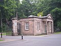 Entrance lodge at Himley hall - geograph.org.uk - 814121.jpg 640 × 480; 82 KB
-
 Evening View - geograph.org.uk - 5185902.jpg 800 × 600; 73 KB
-
-
 Fallen Elm - geograph.org.uk - 5558084.jpg 800 × 600; 189 KB
-
 Farm land south-east of Wombourne, Staffordshire - geograph.org.uk - 2685395.jpg 1,024 × 616; 390 KB
-
 Farm Shop View - geograph.org.uk - 1981080.jpg 800 × 600; 170 KB
-
 Farm View - geograph.org.uk - 6295174.jpg 800 × 600; 136 KB
-

-

-

-
 Farmland east of Himley, Staffordshire - geograph.org.uk - 4381142.jpg 1,024 × 681; 562 KB
-
 Farmland east of Himley, Staffordshire - geograph.org.uk - 4381143.jpg 1,024 × 1,024; 775 KB
-
 Farmland Edge - geograph.org.uk - 6125110.jpg 800 × 600; 140 KB
-
 Farmland Scene - geograph.org.uk - 6125088.jpg 800 × 600; 129 KB
-

-
 Farmland View - geograph.org.uk - 6124270.jpg 800 × 600; 85 KB
-
 Fayre Scene - geograph.org.uk - 4115495.jpg 800 × 600; 93 KB
-
 Field corner with wall near Wombourne, Staffordshire - geograph.org.uk - 6353870.jpg 1,440 × 1,080; 2.08 MB
-
 Field Path - geograph.org.uk - 6069277.jpg 800 × 600; 198 KB
-
 Field Scene - geograph.org.uk - 5234275.jpg 800 × 600; 131 KB
-
 Field Scene - geograph.org.uk - 6321750.jpg 800 × 600; 108 KB
-
 Field View - geograph.org.uk - 4318208.jpg 800 × 600; 172 KB
-
 Field view - geograph.org.uk - 6321747.jpg 800 × 600; 111 KB
-
 Field, wall and footpath near Wombourne, Staffordshire - geograph.org.uk - 6353880.jpg 1,440 × 1,080; 2.11 MB
-
 Fir Street - geograph.org.uk - 5811751.jpg 800 × 600; 145 KB
-
 Football Field - geograph.org.uk - 6321744.jpg 800 × 600; 156 KB


_-_geograph.org.uk_-_5112568.jpg)
.jpeg)


