Category:Hills of Pittsburgh
Jump to navigation
Jump to search
Subcategories
This category has the following 7 subcategories, out of 7 total.
Media in category "Hills of Pittsburgh"
The following 167 files are in this category, out of 167 total.
-
 19680331 20 PAT 1637 11th Ave. @ Liberty Ave.jpg 1,800 × 1,150; 348 KB
-
 20000805 02 Monongahela River, Pittsburgh, PA (7173748782).jpg 1,753 × 1,171; 433 KB
-
 20050604 01 Pittsburgh, PA (10893723916).jpg 2,560 × 1,920; 1.03 MB
-
 20050605 01 Ophelia & Hamlet Sts., Pittsburgh, PA (10908712106).jpg 2,560 × 1,920; 1,017 KB
-
 20090323-CP-0166.jpg 3,000 × 1,920; 1.12 MB
-
 2014-08-29-Heinz-Field-01.jpg 2,106 × 1,404; 1.49 MB
-
 2014-09-08-Troy-Hill-01.jpg 2,232 × 1,674; 1.83 MB
-
 28th Street Bridge Construction (715.3115177.CP).jpg 3,000 × 2,060; 855 KB
-
 4a10181u.tif 5,000 × 4,001; 19.11 MB
-
 Abandoned Railroad Cars and Tracks (715.168802.CP).jpg 3,000 × 2,431; 1.39 MB
-
 Advertisements (715.L238.CP).png 3,000 × 2,148; 4.42 MB
-
 Allegheny General Hospital from West End Overlook.jpg 1,457 × 1,093; 815 KB
-
 Allegheny River and Sharpsburg Bridge (1999.34.9).png 3,000 × 2,396; 11.53 MB
-
 Allegheny Station, 2015-02-09, 03.jpg 3,850 × 2,565; 2.69 MB
-
 Armstrong Tunnel - Second Ave. Portal (20180813-hpichswp-0017).png 4,204 × 2,982; 8.77 MB
-
 Armstrong Tunnel - South Portal (20180813-hpichswp-0107).png 4,160 × 2,940; 8.25 MB
-
-
 Bates at Wilmot (715.112037.CP).jpg 3,000 × 1,981; 887 KB
-
 Bates Street Wall (715.112374.CP).jpg 3,000 × 1,985; 1.63 MB
-
 Becks Run (8223.1806.RR).jpg 3,000 × 2,400; 1.49 MB
-
 Bellefield Bridge.jpg 1,457 × 904; 471 KB
-
 Bennett Brothers Auto Wreckers (715.287468.CP).jpg 3,000 × 2,099; 1.44 MB
-
 Boating Display (9122.XIII20.GT).jpg 3,000 × 2,422; 1.02 MB
-
 Boulevard of the Allies (715.226480.CP).png 3,000 × 2,176; 4.66 MB
-
 Boulevard of the Allies (715.226706.CP).png 3,000 × 2,168; 4.2 MB
-
 Boulevard of the Allies Wall Construction (715.226474.CP).png 3,000 × 2,159; 4.71 MB
-
 Boulevard of the Allies Wall Construction (715.226635.CP).png 3,000 × 2,184; 5.1 MB
-
 Boundary Street (715.L200.CP).jpg 3,000 × 2,143; 1.29 MB
-
 Bridge (31563828246).jpg 3,264 × 2,448; 1.03 MB
-
 Brilliant Railroad Tracks (715.071614.CP).jpg 3,000 × 2,267; 1.03 MB
-
 Carnegie Lake from Highland Park, Pittsburgh, Pa. (det.4a12741).tif 5,170 × 4,065; 20.07 MB
-
 Castle Shannon Incline car.jpg 1,521 × 1,636; 482 KB
-
 Castle Shannon Incline from top.jpg 1,668 × 1,055; 236 KB
-
 Cathedral of Learning (14314317304).jpg 5,760 × 3,840; 4.23 MB
-
 Cathedral of Learning from Mt. Washington (3871853007).jpg 2,592 × 3,872; 3.04 MB
-
 Clemente bridge (4263850497).jpg 1,944 × 1,296; 514 KB
-
 Construction of Carnegie Inst. of Tech 1912-1913 (26962932571) (2).jpg 5,617 × 4,447; 5.85 MB
-
 Curtoparkview.jpg 3,664 × 2,748; 2.11 MB
-
 Curtoview2.jpg 3,664 × 2,748; 2.18 MB
-
 Danger (715.236962.CP).png 3,000 × 2,170; 3.85 MB
-
 Downtown (5349361119).jpg 4,592 × 3,056; 3.64 MB
-
 Dredging Saw Mill Run (715.3732243.CP).png 3,000 × 1,857; 3.73 MB
-
 Dredging Saw Mill Run (715.3732254.CP).png 3,000 × 1,850; 3.98 MB
-
 Driveway From Try Street Freight Yard (201203.1914.4770).png 3,000 × 2,388; 4.95 MB
-
 Driveway to Try Street Freight Yard (201203.1914.4761).png 3,000 × 2,402; 4.36 MB
-
 East Street Trolley Tracks (715.185335.CP).png 3,000 × 2,177; 4.69 MB
-
 ExpositionParkin1915.jpg 3,000 × 2,383; 1.23 MB
-
 Fallowfield Bridge (31473377892).jpg 2,432 × 3,286; 2.6 MB
-
 Fill Under Trestle (715.133103A.CP).jpg 3,000 × 2,270; 1.27 MB
-
 Forward and Greenfield (715.08962.CP).jpg 3,000 × 1,976; 1.12 MB
-
 Forward and Greenfield Avenues (715.081107.CP).jpg 3,000 × 1,932; 1.27 MB
-
 Forward and Sylvan (715.08964.CP).jpg 3,000 × 1,958; 1.16 MB
-
 Forward and Sylvan Avenue Bridge (715.091219.CP).jpg 3,000 × 1,936; 974 KB
-
 Forward Avenue (715.091218.CP).jpg 3,000 × 1,940; 963 KB
-
 From Greenfield- Panther Hollow & parkway (62803917).jpg 2,816 × 2,112; 4.52 MB
-
 FromCoL 8234828991.jpg 3,984 × 2,250; 5.56 MB
-
 Gateway Center Pittsburgh 1952.jpg 2,600 × 1,560; 2.15 MB
-
 General View of Dump (715.05414.CP).jpg 3,000 × 1,978; 729 KB
-
 Georgia Avenue Bridge from the North End (20180813-hpichswp-0018).png 4,183 × 2,938; 8.23 MB
-
 Georgia Avenue Bridge from the South End (20180813-hpichswp-0019).png 4,187 × 2,847; 8.61 MB
-
 Heinz Field (14128389727).jpg 5,760 × 3,840; 6.15 MB
-
 Heinz Field Stedium, Pittsburgh - panoramio.jpg 3,264 × 2,448; 1.67 MB
-
 Heinz Stadium (14080050137).jpg 4,128 × 2,322; 4.18 MB
-
 Image from page 46 of "Greater Pittsburg" (1910).jpg 2,396 × 1,812; 1.3 MB
-
 In the mill district of Pittsburgh, Pennsylvania (fsa.8c29020).tif 4,815 × 5,109; 23.51 MB
-

-
 Interstate 376 - Pennsylvania (8461459348).jpg 3,072 × 2,304; 508 KB
-
 Jack's Run Railroad Station (20110001-hpicnpl-0054).png 3,000 × 2,321; 4.55 MB
-

-
 Knoxville Incline view.jpg 2,317 × 1,566; 887 KB
-
 Laclede Street (715.168794.CP).jpg 3,000 × 2,413; 1.27 MB
-
 Laclede Street (715.168799.CP).jpg 3,000 × 2,420; 1.64 MB
-
 Leech Farm (715.138820.CP).jpg 3,000 × 2,339; 1.17 MB
-
 Liberty Bridge Approach (North) Looking Towards River (20180813-hpichswp-0068).png 4,168 × 2,812; 8.52 MB
-

-
 Liberty Tunnel - Cutting Away Hillside (20180813-hpichswp-0146).png 4,138 × 2,830; 8.43 MB
-
 Liberty Tunnels (715.3216706.CP).jpg 3,000 × 2,130; 1.32 MB
-
 Liberty Tunnels (715.3217618.CP).jpg 3,000 × 2,158; 1.11 MB
-
 McArdle Roadway Bridge 2.jpg 4,032 × 3,024; 5.19 MB
-
 McFarren Avenue Footbridge (715.195669.CP).jpg 3,000 × 2,151; 1.31 MB
-
 Mill District - Pittsburgh.jpg 3,436 × 3,524; 2.39 MB
-
 Monongahela River Lock and Dam 1 Upstream View (20180220-hpichswp-0268).jpg 4,500 × 3,600; 1.71 MB
-
 Mount Oliver Incline Side View (7429.0027.PR).jpg 3,000 × 2,405; 1.37 MB
-
 Murray Avenue (715.122767A.CP).jpg 3,000 × 1,977; 1.05 MB
-
 New Railroad Bridge (715.168803.CP).jpg 3,000 × 2,428; 1.25 MB
-
 Nine Mile Run Browns Road (715.275363.CP).jpg 3,000 × 2,121; 1.28 MB
-
-
 North Approach - Liberty Bridge Looking South from Forbes St. (20180813-hpichswp-0095).png 4,189 × 2,882; 8.68 MB
-
 Nunnery Hill Incline.jpg 1,725 × 904; 428 KB
-
 Ohio Connecting Railway Bridge (201203.1914.4989).png 3,000 × 2,419; 4.9 MB
-
 Ohio Connecting Railway Bridge (201203.1914.4992).png 3,000 × 2,420; 4.93 MB
-
 Old Fort Wayne RR bridge.jpg 2,239 × 1,359; 673 KB
-
 Panther Hollow Lake (715.60108702.CP).png 3,000 × 2,366; 4.75 MB
-
 Penn Incline above tracks.jpg 1,705 × 1,154; 349 KB
-
 Penn Incline and Resort.png 568 × 751; 407 KB
-
 Penn incline from Street Railway Journal.jpg 598 × 400; 35 KB
-
 Penn Station - Pittsburgh (11503921753).jpg 5,478 × 3,652; 5.06 MB
-
 PennsylvaniaHallPittUpperCampus.jpg 2,112 × 2,816; 2.17 MB
-
 Pgh DSC 0041.JPG (283636926).jpg 3,008 × 2,000; 1.46 MB
-
 Pittsburgh (8235885242).jpg 3,664 × 2,750; 6.91 MB
-
 Pittsburgh (8235888024).jpg 3,501 × 2,627; 4.46 MB
-
 Pittsburgh - Three Rivers from Duquesne Heights (1968).jpg 1,100 × 735; 467 KB
-
 Pittsburgh B&O station.png 2,855 × 1,749; 3.11 MB
-
 Pittsburgh Fort Wayne Railroad Bridge.jpg 1,984 × 1,488; 650 KB
-
 Pittsburgh from Mt. Washington in 1800s.png 3,640 × 2,932; 6.15 MB
-
 Pittsburgh From The Incline Peak 1; 5.30.2005; 549pm.jpg 1,600 × 1,200; 374 KB
-
 Pittsburgh hillside late 1800s.png 3,694 × 2,905; 7.26 MB
-
 Pittsburgh River View, Looking at Downtown from the Monongahela River (84.17.66).jpg 3,000 × 2,347; 728 KB
-
 Pittsburgh River View, Looking at Downtown from the Monongahela River (84.17.67).jpg 3,000 × 1,969; 644 KB
-
 Pittsburgh Train receding in the South Side.JPG 1,536 × 2,048; 1.68 MB
-
 Pittsburgh, Pa., from Mt. Washington (det.4a06912).tif 10,050 × 8,062; 77.32 MB
-
 Pittsburgh, Pa., from Mt. Washington (det.4a06913).tif 5,034 × 4,023; 19.34 MB
-
 Pittsburgh, Pa., from Mt. Washington (det.4a06914).tif 5,038 × 4,023; 19.36 MB
-
 Pittsburgh, Pa., from Mt. Washington (det.4a06915).tif 5,034 × 4,035; 19.4 MB
-
 Pittsburgh-14.jpg 2,560 × 1,920; 2.78 MB
-
 Pittsburgh-32.jpg 2,560 × 1,920; 2.72 MB
-
 Pittsburgh-33.jpg 1,920 × 2,560; 2.88 MB
-
 Pittsburgh-34.jpg 2,560 × 1,920; 2.88 MB
-
 Plant of a blast furnace (13540125134).jpg 2,000 × 1,008; 2.05 MB
-
 R. M. Erksine Real Estate and Insurance (715.091217.CP).png 3,000 × 1,967; 3.9 MB
-
 Railroad Station Near the River (715.3216737.CP).jpg 3,000 × 2,125; 1.15 MB
-
 Railroad Tracks (715.168796.CP).jpg 3,000 × 2,405; 1.34 MB
-
 Railroad Yard (715.3525839.CP).png 3,000 × 2,092; 4.16 MB
-

-
 Schenley Park (715.L16.CP).jpg 3,000 × 2,374; 780 KB
-
 SchenleyParkBridges.JPG 2,816 × 2,112; 3.31 MB
-
 Seldom Seen Greenway view 5.jpg 4,656 × 3,492; 9.92 MB
-
 Shadyside Train Station (715.287466.CP).jpg 3,000 × 2,038; 702 KB
-
 Sixteenth Street Bridge from Frank Curto Park.jpg 2,250 × 1,500; 1.45 MB
-

-
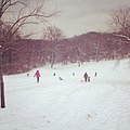 Sledding at Frick Park.jpg 612 × 612; 144 KB
-

-
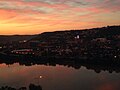 Southside at sunrise (15133164272).jpg 2,272 × 1,704; 2.43 MB
-
 Sylvan Avenue Bridge (715.144285.CP).jpg 3,000 × 2,180; 1.17 MB
-
 Sylvan Avenue Bridge (715.144287.CP).jpg 3,000 × 2,217; 1.39 MB
-
 Sylvan Avenue Bridge (715.144288.CP).jpg 3,000 × 2,166; 1.13 MB
-
 Sylvan Avenue Bridge (715.144289.CP).jpg 3,000 × 2,161; 1.01 MB
-
 Sylvan Avenue Bridge (715.154458.CP).jpg 3,000 × 2,116; 1.32 MB
-
 Sylvan Avenue Bridge (715.154523.CP).jpg 3,000 × 2,134; 1.07 MB
-
 Sylvan Avenue Bridge (715.154685.CP).jpg 3,000 × 2,155; 1.09 MB
-
 Sylvan Avenue Bridge (715.164755.CP).jpg 3,000 × 2,143; 1.13 MB
-
 Sylvan Avenue Bridge (715.164757.CP).jpg 2,154 × 3,000; 1.7 MB
-
 The Point (715.164636.CP).png 3,000 × 2,262; 4.74 MB
-
 The Point, Pittsburgh, Pa. (det.4a10300).tif 5,008 × 3,997; 19.12 MB
-
 The Point, Pittsburgh, Pa. (det.4a10301).tif 4,978 × 4,001; 19.03 MB
-
 Three Rivers Stadium Pittsburgh (27241839874).jpg 1,800 × 1,200; 502 KB
-

-
 Tracks in Greenfield (715.3216884.CP).png 3,000 × 2,146; 5.08 MB
-
 U.S. Route 19 in Pennsylvania (48523055657).jpg 4,608 × 3,456; 7.18 MB
-
 U.S. Route 19 in Pennsylvania (48523056207).jpg 4,608 × 3,456; 7.05 MB
-
 U.S. Steel Tower Behind Strip District in Morning Light.jpg 4,908 × 2,761; 10.23 MB
-
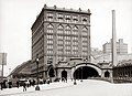 Union Station - Pittsburgh.jpg 6,985 × 5,039; 12.64 MB
-
 Union Station and Vicinity (201203.1912.6673).jpg 3,000 × 2,382; 803 KB
-
 Union Station, Pittsburg, Pa. (det.4a11823).tif 5,012 × 3,997; 19.14 MB
-
 University of Pittsburgh (11446183424).jpg 5,616 × 3,744; 6.47 MB
-
 View from the City County Building (715.215136.CP).png 3,000 × 2,378; 4.95 MB
-
 View from the Hill (715.216122.CP).jpg 3,000 × 2,221; 1.72 MB
-
 View Of Downtown (7429.0097.PR).jpg 2,455 × 3,000; 1.3 MB
-

-
 View of Pittsburgh (715.000101.CP).png 3,000 × 1,886; 3.78 MB
-
 ViewoftheSouthsidefromMtWashington.JPG 2,816 × 1,282; 889 KB
-
 Wabash Playground (715.208940.CP).png 3,000 × 2,388; 4.55 MB
-
 Wesco Building Pittsburgh.jpg 3,140 × 2,048; 4.25 MB
-
 West Carson Street (715.226603.CP).png 3,000 × 2,186; 4.54 MB
-
 Wheatland Street (715.195532.CP).png 3,000 × 2,124; 4.14 MB
-

-


.jpg)
.jpg)
.jpg)


.jpg)
.jpg)
.png)

.png)

.png)
.png)
.jpg)
.jpg)
.jpg)
.jpg)

.jpg)
.jpg)
.png)
.png)
.png)
.png)
.jpg)
.jpg)
.jpg)


.jpg)
.jpg)
.jpg)
_(2).jpg)


.png)
.jpg)
.png)
.png)
.png)
.png)
.png)

.jpg)
.jpg)
.jpg)
.jpg)
.jpg)
.jpg)
.jpg)
.jpg)


.jpg)
.png)
.png)
.jpg)

.jpg)
.jpg)
.png)
.jpg)
.png)

.jpg)
.jpg)
.jpg)
_Looking_Towards_River_(20180813-hpichswp-0068).png)
.png)
.png)
.jpg)
.jpg)

.jpg)

.jpg)
.jpg)
.jpg)
.jpg)
.jpg)
.png)
.png)

.png)
.png)

.png)


.jpg)

.jpg)
.jpg)
.jpg)
.jpg)


.jpg)
.jpg)


.jpg)
.png)
.jpg)
.jpg)
.png)

.jpg)


.jpg)


.jpg)
.jpg)
.jpg)
.jpg)
.jpg)
.jpg)
.jpg)
.jpg)
.jpg)
.jpg)
.png)
.jpg)

.png)
.jpg)
.jpg)


.jpg)
.jpg)
.png)
.jpg)
.jpg)
.png)

.png)

.png)
.png)
