Category:Hiking and footpath signs in the Netherlands
Jump to navigation
Jump to search
Countries of Europe: Albania · Andorra · Austria · Azerbaijan‡ · Belgium · Bulgaria · Croatia · Cyprus‡ · Czech Republic · Denmark · Finland · France‡ · Georgia‡ · Germany · Greece · Hungary · Republic of Ireland · Italy · Liechtenstein · Luxembourg · Montenegro · Netherlands‡ · North Macedonia · Norway · Poland · Portugal‡ · Romania · Russia‡ · Serbia · Slovakia · Slovenia · Spain‡ · Sweden · Switzerland · Turkey‡ · Ukraine · United Kingdom
Specific status: Isle of Man
‡: partly located in Europe
Specific status: Isle of Man
‡: partly located in Europe
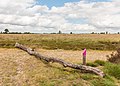
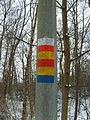
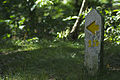
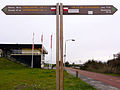
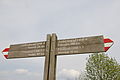
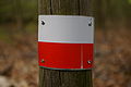
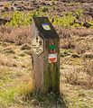
Dutch long-distance hiking routes generally signposted in white and red (in the manner of French routes), or yellow and red (for circuitious routes). Shorter routes can be marked in yellow and blue (maintained by the Nederlandse Wandelsport Bond) or otherwise (maintained by local tourist boards).
Subcategories
This category has the following 6 subcategories, out of 6 total.
Media in category "Hiking and footpath signs in the Netherlands"
The following 65 files are in this category, out of 65 total.
-
 2017 Maastricht, Kleine Weerd 29.jpg 1,910 × 2,400; 1.97 MB
-
 2020-09-13 — Boom met ingegroeid bord 'Opengesteld'.jpg 2,248 × 4,000; 3.37 MB
-
 Almeerdaagse walking route signs, Almere (2020) 01.jpg 2,736 × 4,864; 3.19 MB
-
 Almeerdaagse walking route signs, Almere (2020) 02.jpg 4,864 × 2,736; 3.97 MB
-
 ANWB Bondswandelweg.jpg 600 × 486; 148 KB
-
 ANWB-bord Rondje Rotterdam.jpg 1,767 × 1,245; 248 KB
-
 Balloërveld, natuurgebied in Drenthe 003.jpg 4,235 × 2,799; 8.61 MB
-
 Balloërveld, natuurgebied in Drenthe 006.jpg 5,002 × 3,283; 13.67 MB
-
 Balloërveld, natuurgebied in Drenthe 008.jpg 2,747 × 3,383; 8.58 MB
-
 Balloërveld, natuurgebied in Drenthe 013.jpg 5,184 × 3,255; 11.73 MB
-
 Balloërveld, natuurgebied in Drenthe 024.jpg 5,184 × 3,456; 20.41 MB
-
 Balloërveld, natuurgebied in Drenthe 027.jpg 5,147 × 3,447; 18.68 MB
-
 Balloërveld, natuurgebied in Drenthe 13.jpg 4,465 × 3,349; 14.48 MB
-
 Balloërveld, natuurgebied in Drenthe 14.jpg 5,006 × 3,226; 16.81 MB
-
 Balloërveld, natuurgebied in Drenthe 15.jpg 4,663 × 2,780; 12.53 MB
-
 Balloërveld, natuurgebied in Drenthe 16.jpg 5,017 × 3,345; 17.33 MB
-
 Balloërveld, natuurgebied in Drenthe 20.jpg 5,143 × 3,429; 13.33 MB
-
 Balloërveld, natuurgebied in Drenthe 20b.jpg 4,807 × 3,223; 12.61 MB
-
 Balloërveld, natuurgebied in Drenthe 21.jpg 4,778 × 3,417; 11.32 MB
-
 De Wijk, Netherlands 19 April 2021 - 28.jpeg 3,024 × 3,024; 566 KB
-
 DenHaag51.JPG 2,816 × 2,112; 3.11 MB
-
 Dutch hiking route markings.JPG 600 × 800; 163 KB
-
 Footpath signs Breda (NL).JPG 2,560 × 1,920; 2.28 MB
-
 GelePijl15.jpg 3,872 × 2,592; 6.01 MB
-
 Hellendoorn2.JPG 2,112 × 2,816; 3.98 MB
-
 Hiking route marking on Texel.jpg 3,456 × 2,304; 719 KB
-
 Hiking route markings indicating change of direction.jpg 3,008 × 2,000; 454 KB
-
 Hollandse IJsselpad.JPG 4,288 × 2,848; 3.51 MB
-
 Holleweg Klompenpad Wageningse Engpad.jpg 715 × 1,072; 506 KB
-
 Holleweg Wageningen 8.jpg 1,828 × 2,741; 3.1 MB
-
 Hondsrug, De Strubben-Kniphorstbosch 12.jpg 5,093 × 2,717; 14.3 MB
-
 Keuzepuntpaal.jpg 480 × 640; 139 KB
-
 Klompenpad Wekerom.jpg 2,448 × 3,264; 1.63 MB
-
 KNBLO Jubileum wandelpad.JPG 638 × 500; 69 KB
-
 Langeafstandspadenwegwijzer.jpg 3,648 × 2,736; 1.04 MB
-
 Long distance trails direction sign.jpg 3,008 × 2,000; 603 KB
-
 Markeerder.jpg 2,592 × 1,944; 1.59 MB
-
 Markeren kruis.jpg 187 × 181; 47 KB
-
 Markering geel-blauw.svg 300 × 200; 192 bytes
-
 Markering geel-rood.svg 150 × 100; 1 KB
-
 Nationaal Park Drents-Friese Wold 07.JPG 2,275 × 2,844; 4.51 MB
-
 Nationaal Park Weerribben-Wieden. Gemarkeerd voetpad 03.JPG 2,410 × 3,213; 6.21 MB
-
 Nivon wandelmarkering 1980.JPG 392 × 270; 54 KB
-
 Nivon wandelmarkering, eind jaren zeventig.JPG 600 × 800; 192 KB
-
 Noaberpad.jpg 1,060 × 1,591; 201 KB
-
 Openingspaal.JPG 1,200 × 1,600; 1,004 KB
-
 Pieterpad bordje.JPG 3,968 × 2,976; 2.52 MB
-
 Pieterpad.JPG 2,592 × 1,944; 1.79 MB
-
 Route Centrum-Sportstad sign, Heerenveen (2018).jpg 1,728 × 3,072; 1.52 MB
-
 Routemarkering. Locatie, natuurgebied Delleboersterheide – Catspoele.jpg 5,184 × 3,173; 18.37 MB
-
 Sign Airbornepad OLAT in Sint-Oedenrode.JPG 4,000 × 3,000; 2.56 MB
-
 Splitsingsbordje.jpg 1,141 × 1,045; 184 KB
-
 Standard hiking route markings.jpg 3,008 × 2,000; 434 KB
-
 Stokkum Bergherbos Uitkijktoren Hulzenberg PM19-01.jpg 3,179 × 4,504; 5.3 MB
-
 Verdronken Zwarte Polder.jpg 640 × 1,342; 118 KB
-
 Verschillende paden in het Purmerbos.png 794 × 790; 1.21 MB
-
 Waddenwandelen.JPG 1,000 × 1,333; 506 KB
-
 Walk like a snail.jpg 2,241 × 1,956; 1.05 MB
-
 Wandeling over het Hulshorsterzand 011.jpg 2,783 × 3,244; 8.98 MB
-
 Wandeling over het Hulshorsterzand 61.jpg 4,846 × 3,352; 11.57 MB
-
 Wandeling over het Hulshorsterzand 62.jpg 3,934 × 3,456; 10.29 MB
-
 Wandelknooppunt 65 20220801.jpg 2,160 × 2,160; 2.36 MB
-
 Wandelroutenetwerk Nederweert.jpg 3,648 × 5,472; 16.3 MB
-
 Wegwijzer Erasmuspad.JPG 2,272 × 1,704; 579 KB
-
 Zevenwoudenpad.jpg 3,567 × 2,675; 719 KB


_01.jpg)
_02.jpg)


.JPG)


.jpg)


