Category:Hiking and footpath signs in Rhein-Neckar-Kreis
Jump to navigation
Jump to search
Urban districts (cities): Baden-Baden · Karlsruhe · Pforzheim ·
Subcategories
This category has the following 3 subcategories, out of 3 total.
Media in category "Hiking and footpath signs in Rhein-Neckar-Kreis"
The following 15 files are in this category, out of 15 total.
-
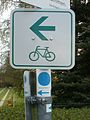
 20120403Wegmarkierung Ketsch1.jpg 1,500 × 2,000; 808 KB
-
 20120403Wegmarkierung Ketsch2.jpg 2,000 × 1,500; 851 KB
-
 20120528Wegweiser Altlussheim01.jpg 1,688 × 2,250; 1.14 MB
-
 20120528Wegweiser Altlussheim02.jpg 1,500 × 2,000; 833 KB
-
 20120528Wegweiser Altlussheim03.jpg 1,688 × 2,250; 1.21 MB
-
 20120528Wegweiser Altlussheim04.jpg 1,688 × 2,250; 1.09 MB
-
 20120528Wegweiser Altlussheim05.jpg 1,688 × 2,250; 1.18 MB
-
 20120422Rheinauenweg1.jpg 2,500 × 1,875; 1.49 MB
-
 20120422Rheinauenweg2.jpg 1,875 × 2,500; 1.13 MB
-
 20120422Rheinauenweg4.jpg 2,500 × 1,875; 1.7 MB
-
 20120422Rheinauenweg6.jpg 1,875 × 2,500; 1.42 MB
-
 20120403Riedlinie Schwetzingen.jpg 1,500 × 2,000; 652 KB
-
 20120403Unterer Dossenwald1.jpg 1,500 × 2,000; 1.01 MB
-
 20120403Unterer Dossenwald2.jpg 2,250 × 1,688; 1.14 MB
-
 20120408Untere Lusshardt St Leon8.jpg 2,500 × 1,875; 1.42 MB


