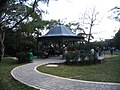
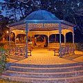
Category:High West Picnic Area
Jump to navigation
Jump to search
| Object location | | View all coordinates using: OpenStreetMap |
|---|
English: Located at the intersection of Lugard Road and Harlech Road
中文:高西郊遊區
Media in category "High West Picnic Area"
The following 6 files are in this category, out of 6 total.
-
 High West Picnic Area 03-03-2023(1).jpg 4,032 × 3,024; 7.25 MB
-
 High West Picnic Area 03-03-2023(2).jpg 4,032 × 3,024; 7.79 MB
-
 High West Picnic Area 03-03-2023(3).jpg 4,032 × 3,024; 7.18 MB
-
 High West Picnic Site 1.jpg 2,048 × 1,536; 1.1 MB
-
 High West Picnic Site 2.jpg 2,048 × 1,536; 1.22 MB
-
 Victoria Peak, Hong Kong - panoramio (13).jpg 2,044 × 2,048; 525 KB
.jpg)
.jpg)
.jpg)


.jpg)