Category:Heuchelhof
Jump to navigation
Jump to search
human settlement in Germany  | |||||
| Upload media | |||||
| Instance of | |||||
|---|---|---|---|---|---|
| Location | Würzburg, Lower Franconia, Bavaria, Germany | ||||
| Area |
| ||||
| Elevation above sea level |
| ||||
 | |||||
Subcategories
This category has the following 5 subcategories, out of 5 total.
Media in category "Heuchelhof"
The following 39 files are in this category, out of 39 total.
-
 1 Blick Heidingsfeld, Heuchelhof 1.jpg 3,872 × 2,592; 4.1 MB
-
 Beweidung auf dem Heuchelhof Juni 2020.jpg 4,608 × 3,456; 7.11 MB
-
 Ehemaliges Technikum-Hotel Berner Straße 8 Würzburg.JPG 6,000 × 4,000; 5.47 MB
-
 Gramschatzer Wald 16.10.2016 Pillar of the B19 Bridge (25384768949).jpg 3,456 × 5,184; 4.35 MB
-
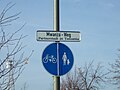 Heuchelhof Mwanza-Weg.jpg 3,264 × 2,448; 1.6 MB
-
 Heuchelhof Panorama.jpg 16,891 × 2,264; 4.45 MB
-
 Heuchelhof Sonnenuhr.jpg 3,264 × 2,448; 2.54 MB
-
 Hochhäuser an der Bonner Straße Würzburg-Heuchelhof.JPG 6,000 × 4,000; 6.99 MB
-
 Katzenbergkreutz Nahaufnahme Inschrift.jpg 4,608 × 2,592; 6.95 MB
-
 Katzenbergkreuz.jpg 2,592 × 4,608; 5.34 MB
-
 Lage Würzburger Bezirke- Heuchelhof.svg 744 × 1,052; 29 KB
-
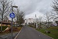 Mwanza-Weg mit Fußgängerbrücke Würzburg-Heuchelhof.JPG 6,000 × 4,000; 5.88 MB
-
 Panorama Berner, Budapester Straße Würzburg.JPG 4,800 × 1,080; 1.51 MB
-
 Panorama Bonner, Brüsseler, Pariser Straße Würzburg 1.JPG 4,800 × 1,632; 2.08 MB
-
 Panorama Bonner, Brüsseler, Pariser Straße Würzburg 2.JPG 4,800 × 1,632; 2.21 MB
-
 Panorama Bonner, Brüsseler, Pariser Straße Würzburg 3.JPG 4,800 × 1,632; 2.23 MB
-
 Panorama Bonner, Brüsseler, Pariser Straße Würzburg 4.JPG 4,800 × 1,632; 2.23 MB
-
 Panorama Brüsseler, Den Haager, Pariser Straße Würzburg.JPG 4,800 × 1,632; 2.08 MB
-
 Panorama Fußgängersteg Heuchelhofstraße Würzburg 1.JPG 4,800 × 1,632; 2.23 MB
-
 Panorama Fußgängersteg Heuchelhofstraße Würzburg 2.JPG 4,800 × 1,632; 2.15 MB
-
 Panorama Fußgängersteg Heuchelhofstraße Würzburg 3.JPG 4,800 × 1,080; 1.61 MB
-
 Panorama Heuchelhofstraße vom Fußgängersteg in Richtung Westen.JPG 4,800 × 1,632; 1.92 MB
-
 Panorama Mittelschule Würzburg-Heuchelhof.JPG 4,800 × 1,632; 2.12 MB
-
 Panorama Mwanza-Weg Würzburg-Heuchelhof 1.JPG 4,800 × 1,080; 1.57 MB
-
 Panorama Mwanza-Weg Würzburg-Heuchelhof 2.JPG 4,800 × 1,080; 1.61 MB
-
 Panorama Place de Caen Würzburg.JPG 4,800 × 1,632; 2.2 MB
-
 Panorama Rochesterstraße und Dundeestraße von Osten Würzburg-Heuchelhof 1.JPG 4,800 × 1,080; 1.64 MB
-
 Panorama Rochesterstraße und Dundeestraße von Osten Würzburg-Heuchelhof 2.JPG 4,800 × 1,080; 1.62 MB
-
 Panorama Rochesterstraße von Osten Würzburg-Heuchelhof.JPG 4,800 × 1,080; 1.61 MB
-
 Panorama Spielplatz Pariser, Römer Straße Würzburg 1.JPG 4,800 × 1,632; 2.06 MB
-
 Panorama Spielplatz Pariser, Römer Straße Würzburg 2.JPG 4,800 × 1,632; 2.23 MB
-
 Panorama Spielplatz Pariser, Römer Straße Würzburg 3.JPG 4,800 × 1,632; 2.13 MB
-
 Sportpark-Heuchelhof.jpg 3,365 × 2,243; 6.64 MB
-
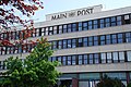
 Verlagsgebäude Main-Post.jpg 6,000 × 4,000; 2.91 MB
-
 Verlagsgebäude.jpg 860 × 570; 216 KB
-
 Würzburg-Heuchelhof as seen from Heidingsfeld Hills 20140109 1.jpg 5,426 × 1,469; 1.42 MB
-
 Zentrum für Körperbehinderte Berner Straße 10 Würzburg 1.JPG 6,000 × 4,000; 5.81 MB
-
 Zentrum für Körperbehinderte Berner Straße 10 Würzburg 2.JPG 6,000 × 4,000; 5.89 MB
-
 Zwickerleinshof.jpg 4,608 × 2,592; 4.72 MB


.jpg)


