Category:Herengracht 366, Amsterdam
Jump to navigation
Jump to search
| Object location | | View all coordinates using: OpenStreetMap |
|---|
 | |||||
| Upload media | |||||
| Instance of |
| ||||
|---|---|---|---|---|---|
| Part of |
| ||||
| Location | Amsterdam, North Holland, Netherlands | ||||
| Street address |
| ||||
| Architect | |||||
| Heritage designation |
| ||||
 | |||||
|
This is a category about rijksmonument number 1819
|
| Address |
|
Media in category "Herengracht 366, Amsterdam"
The following 30 files are in this category, out of 30 total.
-
 Herengracht - panoramio.jpg 2,385 × 1,582; 530 KB
-
 Herengracht - panoramio - Rokus C.jpg 2,707 × 1,800; 657 KB
-
 Overzicht gevelwand grachtenhuizen - Amsterdam - 20319583 - RCE.jpg 1,200 × 825; 202 KB
-
 Herengracht 366, Amsterdam.jpg 2,448 × 3,264; 1.85 MB
-
 Herengracht 366.jpg 3,000 × 4,000; 2.3 MB
-
 Overzicht voorgevel grachtenhuis - Amsterdam - 20322317 - RCE.jpg 941 × 1,200; 299 KB
-
 Amsterdam-3361-Herrengracht-Bijblesmuseum-2008-gje.jpg 3,072 × 2,048; 2.48 MB
-
 Amsterdam-3362-Herrengracht aus Bijblesmuseum-2008-gje.jpg 3,072 × 1,892; 2.11 MB
-
 Bijbels Museum-Amsterdam.jpg 3,264 × 2,448; 6.94 MB
-
 Bijbels museum.jpg 2,000 × 1,500; 1.31 MB
-
 Bijbels museum2.jpg 2,000 × 1,500; 1.38 MB
-
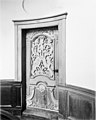 Eiken deur in trappenhuis - Amsterdam - 20017322 - RCE.jpg 963 × 1,200; 177 KB
-
 Herengracht 368.jpg 1,415 × 3,584; 1.1 MB
-
 Het trappenhuis - Amsterdam - 20017320 - RCE.jpg 1,200 × 945; 233 KB
-
 INTERIEUR, DETAIL - Amsterdam - 20260012 - RCE.jpg 1,200 × 775; 188 KB
-
 INTERIEUR, DETAIL PLAFONDSCHILDERING - Amsterdam - 20300220 - RCE.jpg 1,193 × 1,200; 254 KB
-
 INTERIEUR, FRAGMENT PLAFONDSCHILDERING - Amsterdam - 20300218 - RCE.jpg 1,193 × 1,200; 204 KB
-
 INTERIEUR, FRAGMENT PLAFONDSCHILDERING - Amsterdam - 20300219 - RCE.jpg 1,194 × 1,200; 204 KB
-
 Interieur, houten wandtafel en console - Amsterdam - 20352076 - RCE.jpg 1,200 × 824; 142 KB
-
 Interieur, plafond in eetvertrek - Amsterdam - 20352075 - RCE.jpg 1,200 × 1,014; 159 KB
-
 Interieur, plafond in slaapvertrek - Amsterdam - 20352074 - RCE.jpg 1,200 × 855; 151 KB
-
 INTERIEUR, SCHILDERINGEN, DETAIL - Amsterdam - 20260013 - RCE.jpg 775 × 1,200; 148 KB
-
 INTERIEUR, SCHILDERINGEN, DETAIL - Amsterdam - 20260014 - RCE.jpg 775 × 1,200; 170 KB
-
 INTERIEUR, SCHILDERINGEN, DETAIL - Amsterdam - 20260015 - RCE.jpg 1,200 × 775; 163 KB
-
 INTERIEUR, SCHILDERINGEN, DETAIL - Amsterdam - 20260016 - RCE.jpg 1,200 × 775; 155 KB
-
 Pieter Oosterhuis, Afb 010005001119.jpg 2,052 × 1,332; 417 KB
-
 Pieter Oosterhuis, Afb 010005001885.jpg 2,007 × 1,309; 403 KB
-

-
 Staircase-Bijbels Museum-Amsterdam.jpg 2,448 × 3,264; 5.46 MB
-
 Trappenhuis - Amsterdam - 20017321 - RCE.jpg 953 × 1,200; 201 KB


