Category:Heille
Jump to navigation
Jump to search
| Object location | | View all coordinates using: OpenStreetMap |
|---|
hamlet in Sluis, Netherlands   | |||||
| Upload media | |||||
| Instance of | |||||
|---|---|---|---|---|---|
| Location | |||||
| Population |
| ||||
 | |||||
Subcategories
This category has the following 2 subcategories, out of 2 total.
P
- Papenpoldersdijk (Heille) (6 F)
Z
- Zuiderbruggeweg 27, Heille (15 F)
Media in category "Heille"
The following 10 files are in this category, out of 10 total.
-
 Heille wapen.svg 366 × 423; 31 KB
-
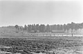 H. 42, overzicht - Heille - 20106803 - RCE.jpg 3,415 × 2,244; 2.74 MB
-
 H. 42, voormalige schaapskooi - Heille - 20106804 - RCE.jpg 1,200 × 780; 178 KB
-
 H. 42, voormalige schaapskooi - Heille - 20106805 - RCE.jpg 1,200 × 776; 295 KB
-
 H. 42, voormalige schaapskooi - Heille - 20106806 - RCE.jpg 1,200 × 773; 257 KB
-
 Kop- en zijgevel - Heille - 20464251 - RCE.jpg 1,200 × 900; 190 KB
-
 Zij- en kopgevel - Heille - 20464250 - RCE.jpg 1,200 × 900; 193 KB
-
 Zij- en kopgevel - Heille - 20464253 - RCE.jpg 1,200 × 900; 122 KB
-
 Zij- en kopgevel - Heille - 20464254 - RCE.jpg 1,200 × 900; 129 KB
-
 Zijgevel Jaarverslag 1994 - Heille - 20464252 - RCE.jpg 1,200 × 900; 174 KB


