Category:Healey, Greater Manchester
Jump to navigation
Jump to search
English: Healey is a village within the Metropolitan Borough of Rochdale, in Greater Manchester, England. It is situated to the north of the town of Rochdale.
village in Greater Manchester, UK  | |||||
| Upload media | |||||
| Instance of | |||||
|---|---|---|---|---|---|
| Location | Rochdale, Greater Manchester, North West England, England | ||||
 | |||||
Subcategories
This category has the following 4 subcategories, out of 4 total.
H
- Christ Church, Healey (3 F)
- Healey Dell Viaduct (12 F)
Media in category "Healey, Greater Manchester"
The following 38 files are in this category, out of 38 total.
-
 Boundary Stone - geograph.org.uk - 995987.jpg 640 × 480; 109 KB
-
 Boundary Stone - geograph.org.uk - 996005.jpg 640 × 480; 79 KB
-
 Boundary Stone - geograph.org.uk - 996010.jpg 640 × 480; 70 KB
-
 Boundary Stone - geograph.org.uk - 996015.jpg 640 × 480; 83 KB
-
 Boundary Stone - geograph.org.uk - 996017.jpg 640 × 480; 88 KB
-
 Boundary Stone - geograph.org.uk - 996021.jpg 640 × 480; 103 KB
-
 Captain Pasture - geograph.org.uk - 3047689.jpg 3,872 × 2,592; 4.97 MB
-
 Cows resting near Middle Healey - geograph.org.uk - 3047731.jpg 3,872 × 2,592; 4.96 MB
-
 Detached houses on Lowerfold Way - geograph.org.uk - 5938706.jpg 640 × 480; 100 KB
-
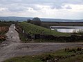
 Dry Reservoir at Healey - geograph.org.uk - 1098926.jpg 640 × 427; 112 KB
-
 Gandy Brow - geograph.org.uk - 4069117.jpg 2,560 × 1,920; 4.15 MB
-
 Healey Dell - geograph.org.uk - 2099688.jpg 3,872 × 2,592; 6.68 MB
-
 Healey Stones - geograph.org.uk - 996029.jpg 640 × 480; 67 KB
-
 Hillside below Brownhouse Wham Reservoir - geograph.org.uk - 3047698.jpg 3,872 × 2,592; 4.71 MB
-
 Houses on Bentley Street, Rochdale - geograph.org.uk - 5938142.jpg 640 × 480; 74 KB
-
 Houses on Harridge Street, Rochdale - geograph.org.uk - 5938703.jpg 640 × 480; 91 KB
-
 Junction of moorland tracks by old reservoir - geograph.org.uk - 3463824.jpg 3,264 × 2,448; 1.95 MB
-
 Lythe Slack - geograph.org.uk - 1758615.jpg 2,816 × 2,112; 1.09 MB
-

-

-

-

-
 Path to Lower Healey - geograph.org.uk - 3047721.jpg 3,872 × 2,592; 4.6 MB
-
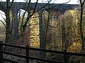 Railway viaduct, Healey Dell - geograph.org.uk - 1186278.jpg 640 × 480; 117 KB
-
 Shawclough Road (B6377) - geograph.org.uk - 5938695.jpg 640 × 480; 89 KB
-
 Shawclough Road (B6377) - geograph.org.uk - 5938704.jpg 640 × 459; 70 KB
-
 Sign for the Healey public house - geograph.org.uk - 5938699.jpg 496 × 640; 96 KB
-
 Spodden Valley - geograph.org.uk - 1734461.jpg 2,816 × 2,112; 2.38 MB
-
 Spodden Valley - geograph.org.uk - 1734491.jpg 2,816 × 2,112; 2.28 MB
-

-
 The Healey public house - geograph.org.uk - 5938697.jpg 640 × 509; 100 KB
-
 The Oxford - geograph.org.uk - 1758622.jpg 2,816 × 2,112; 1,000 KB
-

-
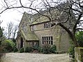 Vicarage, Christ Church - geograph.org.uk - 1199406.jpg 640 × 480; 136 KB
-
 Whitworth Road, Lower Healey - geograph.org.uk - 3047745.jpg 3,872 × 2,592; 3.69 MB
-
 Bridge, Ending, near Healey, Lancashire - geograph.org.uk - 375961.jpg 640 × 530; 138 KB
-
 Road Lane, Healey near Rochdale - geograph.org.uk - 118708.jpg 640 × 480; 179 KB
-
 Th'Owd Mill i'th Thrutch - geograph.org.uk - 369661.jpg 640 × 480; 173 KB


_-_geograph.org.uk_-_5938695.jpg)
_-_geograph.org.uk_-_5938704.jpg)


_-_geograph.org.uk_-_5938701.jpg)


