Category:Healaugh, Selby
Jump to navigation
Jump to search
village and civil parish near Tadcaster, North Yorkshire, England, UK  | |||||
| Upload media | |||||
| Instance of | |||||
|---|---|---|---|---|---|
| Location |
| ||||
 | |||||
Subcategories
This category has the following 2 subcategories, out of 2 total.
H
- Healaugh Manor Farm/Priory (13 F)
Media in category "Healaugh, Selby"
The following 191 files are in this category, out of 191 total.
-
 A Bridleway To Healaugh - geograph.org.uk - 369128.jpg 640 × 480; 103 KB
-
 A Bridleway To Healaugh - geograph.org.uk - 369134.jpg 640 × 480; 67 KB
-
 A Field Of Rape - geograph.org.uk - 369124.jpg 640 × 480; 77 KB
-
 A Field Of Rape - geograph.org.uk - 369145.jpg 640 × 480; 101 KB
-
 A muddy Manor Lane Healaugh - geograph.org.uk - 4342826.jpg 1,024 × 768; 193 KB
-

-
 A Ploughed Field - geograph.org.uk - 369126.jpg 640 × 480; 109 KB
-

-

-
 Abbey Lane - geograph.org.uk - 5342006.jpg 640 × 427; 219 KB
-
 Access Lane to Church Hill Farm - geograph.org.uk - 5549512.jpg 5,184 × 3,456; 6.91 MB
-
 Animal enclosure, near Foss Bridge - geograph.org.uk - 5268160.jpg 1,024 × 768; 163 KB
-
 Approaching Church Hill Farm - geograph.org.uk - 5549507.jpg 5,184 × 3,456; 5.97 MB
-
 Approaching the bend - geograph.org.uk - 5375669.jpg 640 × 427; 208 KB
-
 Arable field south-east of Healaugh Grange - geograph.org.uk - 5268384.jpg 1,024 × 768; 186 KB
-
 Barn off Manor Lane, - geograph.org.uk - 4836482.jpg 1,200 × 799; 291 KB
-
 Bend on Wighill Lane - geograph.org.uk - 5342011.jpg 640 × 427; 201 KB
-
 Between Catterton and Healaugh - geograph.org.uk - 5342001.jpg 640 × 427; 249 KB
-
 Bridge over Catterton Beck - geograph.org.uk - 3855131.jpg 1,600 × 1,200; 738 KB
-
 Bridge over Healaugh Beck at Healaugh Gate - geograph.org.uk - 5704935.jpg 1,600 × 1,200; 746 KB
-
 Bridleway alongside The Foss - geograph.org.uk - 3219959.jpg 2,048 × 1,536; 574 KB
-
 Bridleway and private road from Healaugh grange - geograph.org.uk - 4342819.jpg 1,024 × 698; 100 KB
-
 Bridleway at Healaugh Gate - geograph.org.uk - 4834932.jpg 1,200 × 799; 330 KB
-
 Bridleway beside Dews Wood - geograph.org.uk - 5549521.jpg 5,184 × 3,456; 6.95 MB
-
 Bridleway beside The Foss - geograph.org.uk - 5983199.jpg 5,184 × 3,456; 6.2 MB
-
 Bridleway east of Shire Oaks - geograph.org.uk - 3220541.jpg 2,048 × 1,536; 549 KB
-
 Bridleway from Healaugh Grange - geograph.org.uk - 4115904.jpg 1,024 × 768; 140 KB
-
 Bridleway heading North from Healaugh Gate - geograph.org.uk - 6101425.jpg 5,184 × 3,456; 6.03 MB
-
 Bridleway joins Wighill Lane - geograph.org.uk - 3219892.jpg 2,048 × 1,536; 568 KB
-
 Bridleway near Broadfields Farm - geograph.org.uk - 3220549.jpg 2,048 × 1,536; 760 KB
-
 Bridleway south from Healaugh - geograph.org.uk - 3219948.jpg 2,048 × 1,536; 589 KB
-
 Bridleway towards Angram - geograph.org.uk - 2729574.jpg 640 × 480; 62 KB
-
 Bridleway towards Healaugh - geograph.org.uk - 3219884.jpg 2,048 × 1,536; 609 KB
-
 Bridleway towards Healaugh Grange leaves Wighill Lane - geograph.org.uk - 3219897.jpg 2,048 × 1,536; 746 KB
-
 Building on Wighill Lane, Healaugh - geograph.org.uk - 4835147.jpg 1,200 × 799; 500 KB
-
 Building on Wighill Lane, Healaugh - geograph.org.uk - 4835150.jpg 1,200 × 799; 447 KB
-
 Catterton Beck bridge - geograph.org.uk - 4342858.jpg 1,024 × 768; 190 KB
-
 Catterton Beck from Catterton lane - geograph.org.uk - 320735.jpg 640 × 480; 160 KB
-
 Catterton Lane - geograph.org.uk - 4138045.jpg 1,024 × 768; 175 KB
-
 Catterton Road Farm, Healaugh - geograph.org.uk - 2729555.jpg 800 × 503; 62 KB
-
 Catterton Road, Healaugh - geograph.org.uk - 3219943.jpg 2,048 × 1,536; 579 KB
-
 Church Cottage - Healaugh - geograph.org.uk - 248190.jpg 640 × 479; 100 KB
-
 Church Cottage, Healaugh - geograph.org.uk - 4835534.jpg 1,200 × 799; 478 KB
-
 Church in Healaugh - geograph.org.uk - 6127074.jpg 1,024 × 683; 565 KB
-
 Corner Cottage, Healaugh - geograph.org.uk - 4834986.jpg 1,200 × 799; 256 KB
-
 Countryside North of Tadcaster (1) - geograph.org.uk - 5983190.jpg 5,184 × 3,456; 7.27 MB
-
 Countryside North of Tadcaster (2) - geograph.org.uk - 5983194.jpg 5,184 × 3,456; 7.25 MB
-

-
 Drive towards Healaugh Grange - geograph.org.uk - 4115889.jpg 1,600 × 1,200; 442 KB
-
 Entrance to farm - geograph.org.uk - 5342016.jpg 640 × 427; 274 KB
-
 Even muddier bridleway - geograph.org.uk - 4342780.jpg 1,024 × 768; 248 KB
-
 Ewe and lambs - geograph.org.uk - 5375672.jpg 640 × 427; 213 KB
-
 Farm House near Shire Oaks Plantation - geograph.org.uk - 306181.jpg 640 × 480; 79 KB
-
 Farm Road near Shire Oaks - geograph.org.uk - 2628677.jpg 3,264 × 2,448; 2.64 MB
-
 Farm Road to Healaugh Manor Farm - geograph.org.uk - 2628664.jpg 3,264 × 2,448; 2.08 MB
-
 Farm Road towards Tadcaster - geograph.org.uk - 2628695.jpg 3,264 × 2,448; 1.56 MB
-
 Farmland near Foss Bridge - geograph.org.uk - 2729506.jpg 640 × 480; 60 KB
-
 Farmland near Healaugh - geograph.org.uk - 2729513.jpg 640 × 480; 52 KB
-
 Farmland near Healaugh - geograph.org.uk - 2729541.jpg 640 × 480; 61 KB
-
 Farmland near Healaugh - geograph.org.uk - 2729572.jpg 640 × 480; 33 KB
-
 Farmland near Healaugh Grange - geograph.org.uk - 2729518.jpg 640 × 480; 49 KB
-
 Farmland near New Buildings Farm - geograph.org.uk - 5342015.jpg 640 × 427; 219 KB
-
 Farmland near New Buildings Farm - geograph.org.uk - 5375665.jpg 427 × 640; 276 KB
-
 Farmland north of Tadcaster - geograph.org.uk - 5342502.jpg 640 × 427; 224 KB
-
 Farmland off York Road - geograph.org.uk - 2729577.jpg 640 × 480; 78 KB
-
 Farmland on the east bank of The Foss - geograph.org.uk - 5268147.jpg 1,024 × 768; 198 KB
-
 Farmland on the outskirts of Healaugh - geograph.org.uk - 248195.jpg 640 × 479; 76 KB
-
 Farmland south of New Buildings Farm - geograph.org.uk - 5268144.jpg 1,024 × 768; 179 KB
-
 Farmland west of Healaugh - geograph.org.uk - 5268375.jpg 1,024 × 615; 117 KB
-
 Farmland, with Healaugh in the distance - geograph.org.uk - 3370793.jpg 1,600 × 1,200; 379 KB
-
 Field beside Manor Lane - geograph.org.uk - 5982698.jpg 5,184 × 3,456; 7.33 MB
-
 Field beside Stubbing Gate - geograph.org.uk - 5548943.jpg 5,184 × 3,456; 6.15 MB
-
 Flowering hedgerow - geograph.org.uk - 5342003.jpg 640 × 427; 243 KB
-
 Footbridge on the path east of Woodhouse Farm - geograph.org.uk - 3855156.jpg 1,600 × 1,200; 921 KB
-
 Footpath from Woodhouse Farm towards Catterton Rash - geograph.org.uk - 3855151.jpg 1,600 × 1,200; 638 KB
-
 Footpath off Manor Lane - geograph.org.uk - 4835603.jpg 1,200 × 799; 399 KB
-
 Foss Bridge, Wighill Lane - geograph.org.uk - 4115920.jpg 1,024 × 768; 184 KB
-
 Foss Bridge, Wighill Lane - geograph.org.uk - 5268154.jpg 1,024 × 768; 192 KB
-
 Gated Bridleway from Manor Lane - geograph.org.uk - 2628601.jpg 3,264 × 2,448; 1.78 MB
-
 Grass Track heading towards Nova Scotia Wood - geograph.org.uk - 5549487.jpg 5,184 × 3,456; 5.55 MB
-
 Harvested Field north of Tadcaster - geograph.org.uk - 2628712.jpg 3,264 × 2,448; 2.05 MB
-
 Healaugh - geograph.org.uk - 5342007.jpg 640 × 427; 215 KB
-
 Healaugh Beck - geograph.org.uk - 248177.jpg 479 × 640; 128 KB
-
 Healaugh Beck - geograph.org.uk - 2729580.jpg 640 × 480; 145 KB
-
 Healaugh Beck - geograph.org.uk - 4115857.jpg 1,600 × 1,200; 634 KB
-
 Healaugh Beck - geograph.org.uk - 5375674.jpg 640 × 427; 248 KB
-
 Healaugh Grange - geograph.org.uk - 248193.jpg 640 × 479; 89 KB
-
 Healaugh Grange - geograph.org.uk - 3370775.jpg 1,600 × 1,200; 508 KB
-
 Healaugh Hall, Healaugh - geograph.org.uk - 4835008.jpg 1,200 × 799; 517 KB
-
 Healaugh Manor Farm - geograph.org.uk - 5983371.jpg 5,184 × 3,456; 6.91 MB
-
 Healaugh Post Office - geograph.org.uk - 690175.jpg 400 × 600; 151 KB
-
 Healaugh Priory - geograph.org.uk - 5983353.jpg 5,184 × 3,456; 6.65 MB
-
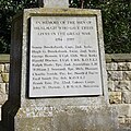
 Healaugh War Memorial - geograph.org.uk - 4115874.jpg 1,600 × 1,200; 425 KB
-

-

-
 A Public Right Of Way - geograph.org.uk - 369129.jpg 640 × 480; 113 KB
-
 A Public Right Of Way - geograph.org.uk - 369131.jpg 480 × 640; 107 KB
-
 Here the track turns into a surfaced road - geograph.org.uk - 3370759.jpg 1,600 × 1,200; 398 KB
-
 House on Main Street, Healaugh - geograph.org.uk - 4834992.jpg 1,200 × 799; 383 KB
-
 House on Main Street, Healaugh - geograph.org.uk - 4834997.jpg 1,200 × 799; 433 KB
-
 Houses along Wighill Lane - geograph.org.uk - 5342507.jpg 640 × 427; 213 KB
-
 Houses on Wighill Lane, Tadcaster - geograph.org.uk - 4131204.jpg 1,600 × 1,064; 545 KB
-
 Junction in Healaugh - geograph.org.uk - 248184.jpg 640 × 479; 85 KB
-
 Junction of the bridleway and Wighill Lane - geograph.org.uk - 5268395.jpg 1,024 × 768; 166 KB
-
-
 Lane to Healaugh near Foss Bridge - geograph.org.uk - 2729509.jpg 640 × 480; 72 KB
-
 Lilac Cottage, Healaugh - geograph.org.uk - 4834988.jpg 1,200 × 799; 410 KB
-
 Looking across the River Wharfe to the North of Tadcaster - geograph.org.uk - 5982687.jpg 5,184 × 3,456; 7.24 MB
-
 Main Street - geograph.org.uk - 5342009.jpg 640 × 427; 231 KB
-
 Main Street, Healaugh - geograph.org.uk - 5549544.jpg 5,184 × 3,456; 6.13 MB
-
 Manor Lane at Dews Wood - geograph.org.uk - 4835554.jpg 1,200 × 798; 413 KB
-
 Manor Lane heading North towards Shire Oaks - geograph.org.uk - 5983527.jpg 5,156 × 3,151; 6.18 MB
-
 Manor Lane looking North - geograph.org.uk - 5982694.jpg 5,170 × 3,239; 7.38 MB
-
 Manor Lane towards Healaugh - geograph.org.uk - 2628583.jpg 3,264 × 2,448; 1.78 MB
-
 Manor Lane towards Healaugh Manor Farm - geograph.org.uk - 4835549.jpg 1,200 × 799; 464 KB
-
 Manor Lane towards Healaugh Manor Farm - geograph.org.uk - 4835559.jpg 1,200 × 799; 436 KB
-
 Manor Lane towards Healaugh Manor Farm - geograph.org.uk - 4835562.jpg 1,200 × 799; 411 KB
-
 Manor Lane towards Healaugh Manor Farm - geograph.org.uk - 4835600.jpg 1,200 × 799; 319 KB
-
 Manor Lane towards Healaugh Manor Farm - geograph.org.uk - 4836472.jpg 1,200 × 799; 413 KB
-
 Manor Lane towards Healaugh Manor Farm - geograph.org.uk - 4836478.jpg 1,200 × 799; 398 KB
-
 Manor Lane towards Tadcaster - geograph.org.uk - 4836504.jpg 1,200 × 799; 334 KB
-
 Manor Lane towards Tadcaster - geograph.org.uk - 4836524.jpg 1,200 × 799; 395 KB
-
 Manor Lane towards Tadcaster - geograph.org.uk - 4836530.jpg 1,200 × 799; 404 KB
-
 Manor Lane towards Tadcaster - geograph.org.uk - 4836551.jpg 1,200 × 799; 473 KB
-
 Manor Lane towards Tadcaster - geograph.org.uk - 4836557.jpg 1,200 × 799; 322 KB
-
 Master Pavior Road Roller - geograph.org.uk - 4836498.jpg 1,200 × 799; 435 KB
-
 Middle Park Farm, Healaugh - geograph.org.uk - 4834990.jpg 1,200 × 799; 503 KB
-
 Mill Hill - geograph.org.uk - 5342002.jpg 640 × 427; 211 KB
-
 Mole Trap - geograph.org.uk - 4835012.jpg 1,200 × 799; 717 KB
-
 New Buildings Farm - geograph.org.uk - 248197.jpg 640 × 479; 81 KB
-
 New fencing on Manor Lane - geograph.org.uk - 4836529.jpg 1,200 × 799; 482 KB
-
 New hedge line east of Healaugh Manor Farm - geograph.org.uk - 3219967.jpg 2,048 × 1,536; 530 KB
-
 On Manor Lane - geograph.org.uk - 5983563.jpg 5,184 × 3,456; 6.04 MB
-
 Outskirts of Healaugh - geograph.org.uk - 5342005.jpg 640 × 427; 262 KB
-
 Pasture and Access Lane at Healaugh Grange - geograph.org.uk - 5549494.jpg 5,184 × 3,456; 4.11 MB
-
 Pasture on High Moor - geograph.org.uk - 5549530.jpg 5,184 × 3,456; 6.53 MB
-
 Pherbellia sp. (albocostata^) - a Sciomyzid fly - Flickr - S. Rae.jpg 774 × 628; 224 KB
-
 Physiphora alceae - Flickr - S. Rae (1).jpg 1,240 × 1,000; 503 KB
-
 Physiphora alceae - Flickr - S. Rae (2).jpg 774 × 666; 179 KB
-
 Physiphora alceae - Flickr - S. Rae.jpg 962 × 792; 310 KB
-
 Plank Bridge over The Foss - geograph.org.uk - 5983203.jpg 5,184 × 3,456; 7.61 MB
-
 Pond at Healaugh Manor Farm - geograph.org.uk - 2628639.jpg 3,264 × 2,448; 1.48 MB
-
 Post Office on Main Street, Healaugh - geograph.org.uk - 4834993.jpg 1,200 × 799; 494 KB
-
 Post Office on Main Street, Healaugh - geograph.org.uk - 4834994.jpg 799 × 1,200; 356 KB
-
 Post Office on Main Street, Healaugh - geograph.org.uk - 4834995.jpg 1,200 × 799; 356 KB
-
 Public bridleway to Bilton in Ainstey - geograph.org.uk - 5268394.jpg 1,024 × 768; 153 KB
-
 Public Footpath heading North towards Healaugh - geograph.org.uk - 5983145.jpg 5,184 × 3,456; 7.69 MB
-
 Pylons and power lines - geograph.org.uk - 3370772.jpg 1,600 × 1,200; 231 KB
-
 Rape fields from Wighill Lane - geograph.org.uk - 5342485.jpg 640 × 427; 219 KB
-
 Shire Oaks - geograph.org.uk - 5983533.jpg 5,184 × 3,456; 7.62 MB
-
 Stile and Footpath, Tadcaster - geograph.org.uk - 295455.jpg 640 × 480; 100 KB
-
 Stream south of Foss Bridge - geograph.org.uk - 5704936.jpg 1,600 × 1,200; 816 KB
-
 The Foss - geograph.org.uk - 369133.jpg 640 × 480; 137 KB
-
 The Foss from Manor Lane - geograph.org.uk - 2628622.jpg 3,264 × 2,448; 3.45 MB
-
 The no through road leading to Healaugh Grange - geograph.org.uk - 3370783.jpg 1,600 × 1,200; 404 KB
-

-

-
 The stream called The Foss - geograph.org.uk - 5268141.jpg 1,024 × 768; 212 KB
-
 The track leading to Healaugh Manor farm - geograph.org.uk - 3370804.jpg 1,600 × 1,200; 510 KB
-
 Timber - geograph.org.uk - 4342800.jpg 1,024 × 768; 207 KB
-
 Track (bridleway) to Healaugh Priory - geograph.org.uk - 2729544.jpg 640 × 480; 94 KB
-
 Track leading towards Woodhouse Farm - geograph.org.uk - 5983187.jpg 5,184 × 3,456; 7.17 MB
-
 Track on High Moor - geograph.org.uk - 5549523.jpg 5,184 × 3,456; 6.29 MB
-
 Track to Healaugh Grange - geograph.org.uk - 2729521.jpg 640 × 480; 62 KB
-
 Tree and Rape off Wighill Lane - geograph.org.uk - 5342013.jpg 427 × 640; 254 KB
-
 Trees along The Foss - geograph.org.uk - 5268170.jpg 1,024 × 768; 173 KB
-
 Two Dilapidated Barns - geograph.org.uk - 369135.jpg 640 × 480; 105 KB
-
 Unrideable (well by me) bridleway - geograph.org.uk - 4342791.jpg 1,024 × 768; 246 KB
-
 View along the track, leading slightly uphill - geograph.org.uk - 3370722.jpg 1,600 × 1,200; 686 KB
-
 View northwards from the highest point on the track - geograph.org.uk - 3370738.jpg 1,600 × 1,200; 530 KB
-
 War Memorial on Main Street, Healaugh - geograph.org.uk - 4834998.jpg 799 × 1,200; 535 KB
-
 War Memorial on Main Street, Healaugh - geograph.org.uk - 4835001.jpg 1,115 × 1,118; 536 KB
-
 Well flailed hedges leaving Healaugh - geograph.org.uk - 4342834.jpg 1,024 × 768; 185 KB
-
 Wighill Lane - geograph.org.uk - 5342018.jpg 640 × 427; 291 KB
-
 Wighill Lane - geograph.org.uk - 5342499.jpg 640 × 427; 293 KB
-
 Wighill Lane approaching Tadcaster - geograph.org.uk - 6185548.jpg 4,000 × 3,000; 4.54 MB
-
 Wighill Lane towards Healaugh - geograph.org.uk - 2729515.jpg 640 × 480; 45 KB
-
 Wighill Lane towards Tadcaster - geograph.org.uk - 4131194.jpg 1,600 × 1,064; 785 KB
-
 Wighill Lane towards Wighill - geograph.org.uk - 2649688.jpg 1,600 × 1,200; 692 KB
-

-
 Woodhouse Farm - geograph.org.uk - 3855166.jpg 1,600 × 720; 205 KB
-
 York Road - geograph.org.uk - 5375671.jpg 640 × 427; 237 KB
-
 York Road at Healaugh Gate - geograph.org.uk - 2627890.jpg 3,264 × 2,448; 2.35 MB
-
 York Road at Healaugh Gate - geograph.org.uk - 4834929.jpg 1,200 × 799; 412 KB
-
 York Road Farm Healaugh - geograph.org.uk - 2627894.jpg 3,264 × 2,448; 2.03 MB
-
 York Road Farm, Healaugh - geograph.org.uk - 4834983.jpg 1,200 × 799; 351 KB
-
 York Road heading West towards Healaugh - geograph.org.uk - 5549537.jpg 5,184 × 3,456; 3.86 MB
-
 York Road towards Healaugh - geograph.org.uk - 4834935.jpg 1,200 × 799; 372 KB
-
 York Road towards Healaugh - geograph.org.uk - 4834978.jpg 1,200 × 799; 416 KB
-
 York Road, Healaugh - geograph.org.uk - 4115866.jpg 1,024 × 768; 180 KB
-
 Healaugh - geograph.org.uk - 248188.jpg 640 × 479; 93 KB


_-_geograph.org.uk_-_5983190.jpg)
_-_geograph.org.uk_-_5983194.jpg)


_-_a_Sciomyzid_fly_-_Flickr_-_S._Rae.jpg)
.jpg)
.jpg)


_to_Healaugh_Priory_-_geograph.org.uk_-_2729544.jpg)


_bridleway_-_geograph.org.uk_-_4342791.jpg)


