Category:Headon cum Upton
Jump to navigation
Jump to search
English: Headon cum Upton is a civil parish in the Bassetlaw district, in the county of Nottinghamshire, England.
civil parish in Bassetlaw, Nottinghamshire, England | |||||
| Upload media | |||||
| Instance of | |||||
|---|---|---|---|---|---|
| Location | Bassetlaw, Nottinghamshire, East Midlands, England | ||||
 | |||||
Subcategories
This category has the following 3 subcategories, out of 3 total.
Media in category "Headon cum Upton"
The following 133 files are in this category, out of 133 total.
-
 A bend on Main Street - geograph.org.uk - 5474252.jpg 800 × 600; 128 KB
-
 A big sky over Nottinghamshire farmland - geograph.org.uk - 5835604.jpg 800 × 600; 121 KB
-

-
 Bends on the Retford to Headon road - geograph.org.uk - 2147231.jpg 640 × 378; 50 KB
-
 Bottom Woodbeck Farm - geograph.org.uk - 4646061.jpg 800 × 600; 90 KB
-
 Brigg Lane (track) - geograph.org.uk - 2688212.jpg 640 × 480; 79 KB
-
 By the lane to Headon - geograph.org.uk - 1868153.jpg 826 × 1,024; 499 KB
-
 By Treswell Wood - geograph.org.uk - 1872438.jpg 1,024 × 768; 496 KB
-
 Byway east of Headon - geograph.org.uk - 1868341.jpg 1,024 × 701; 423 KB
-
 Byway from Thorpe Street - geograph.org.uk - 1001163.jpg 640 × 480; 88 KB
-
 Byway to Headon - geograph.org.uk - 1868362.jpg 1,024 × 768; 488 KB
-
 Clover Close Lane (2) - geograph.org.uk - 3283323.jpg 1,024 × 768; 136 KB
-
 Clover Close Lane (track) - geograph.org.uk - 2688222.jpg 640 × 480; 62 KB
-
 Clover Close Lane (track) - geograph.org.uk - 4026640.jpg 3,088 × 2,056; 3.27 MB
-
 Clover Close Lane - geograph.org.uk - 3283319.jpg 1,024 × 768; 220 KB
-
 Cottam Power Station - geograph.org.uk - 4342158.jpg 1,024 × 768; 117 KB
-
 Cottam Power Station over the hill - geograph.org.uk - 1009911.jpg 640 × 427; 69 KB
-
 Countryside in the springtime - geograph.org.uk - 1872121.jpg 1,024 × 774; 511 KB
-
 Dead tree - geograph.org.uk - 1009924.jpg 640 × 427; 68 KB
-
 Detail of Trinity Farm barn - geograph.org.uk - 4129491.jpg 1,280 × 955; 298 KB
-
 Dolegate Road - geograph.org.uk - 4296569.jpg 1,024 × 768; 165 KB
-
 Drayton Road southeast of Upton - geograph.org.uk - 4897313.jpg 1,600 × 1,200; 485 KB
-
 Drayton Road towards East Drayton - geograph.org.uk - 2688215.jpg 640 × 480; 48 KB
-
 Ears of wheat - geograph.org.uk - 525232.jpg 480 × 640; 115 KB
-
 Entering Eaton Wood - geograph.org.uk - 5075078.jpg 1,024 × 718; 265 KB
-
 Entering Upton, Nottinghamshire - geograph.org.uk - 4026636.jpg 3,088 × 2,056; 3.37 MB
-
 Farm buildings, Lilac Cottage Farm - geograph.org.uk - 4129506.jpg 1,280 × 870; 138 KB
-
 Farmland and woodland - geograph.org.uk - 2688256.jpg 640 × 480; 92 KB
-
 Farmland between Grove and Headon - geograph.org.uk - 3281849.jpg 1,024 × 768; 161 KB
-
 Farmland between Headon and Upton - geograph.org.uk - 1868353.jpg 1,024 × 768; 360 KB
-
 Farmland near Grove - geograph.org.uk - 4646057.jpg 800 × 600; 97 KB
-
 Farmland near Grove - geograph.org.uk - 4646058.jpg 800 × 600; 148 KB
-
 Farmland near Magpie Hall Farm - geograph.org.uk - 2688228.jpg 640 × 480; 68 KB
-
 Farmland off Drayton Road - geograph.org.uk - 2688214.jpg 640 × 480; 57 KB
-
 Farmland off Hazelwood Lane - geograph.org.uk - 2688231.jpg 640 × 480; 49 KB
-
 Farmland off Westfields - geograph.org.uk - 2688218.jpg 640 × 480; 76 KB
-
 Farmland off Westfields - geograph.org.uk - 2688219.jpg 640 × 480; 69 KB
-
 Farmland, Headon Park - geograph.org.uk - 2688254.jpg 640 × 480; 98 KB
-
 Field and hedge following the course of a stream - geograph.org.uk - 1872107.jpg 1,024 × 768; 565 KB
-
 Field edge footpath - geograph.org.uk - 1868334.jpg 1,024 × 755; 519 KB
-
 Field edge near Eaton Wood - geograph.org.uk - 5075085.jpg 1,024 × 768; 237 KB
-
 Field entrance off Thorpe Street - geograph.org.uk - 2688226.jpg 640 × 480; 60 KB
-
 Field Farm - geograph.org.uk - 5198354.jpg 1,024 × 768; 270 KB
-
 Field of growing barley - geograph.org.uk - 1868375.jpg 1,012 × 1,024; 491 KB
-
 Fields towards Woodbeck - geograph.org.uk - 1872136.jpg 1,024 × 730; 446 KB
-
 Fingerpost, Thorpe Street-Church Street, Headon - geograph.org.uk - 4129461.jpg 960 × 1,280; 339 KB
-
 Firdean, Headon - geograph.org.uk - 4129374.jpg 1,280 × 920; 256 KB
-
 Fly tipping on Thorpe Street - geograph.org.uk - 4027051.jpg 3,088 × 2,056; 3.36 MB
-
 Footbridge on the path between Ladywell Rise and Headon - geograph.org.uk - 4897241.jpg 1,600 × 1,200; 566 KB
-
 Footpath across the runway southeast of Headon - geograph.org.uk - 4897299.jpg 1,600 × 1,200; 490 KB
-
 Footpath off Lady Well Lane - geograph.org.uk - 2688249.jpg 640 × 480; 146 KB
-
 Footpath to Retford Road - geograph.org.uk - 5198343.jpg 1,024 × 768; 211 KB
-
 Footpath to Treswell Wood - geograph.org.uk - 1872423.jpg 1,024 × 768; 485 KB
-
 Footpath to Westfields - geograph.org.uk - 5072044.jpg 1,024 × 768; 277 KB
-
 Footpath towards Eaton Wood - geograph.org.uk - 4897970.jpg 1,600 × 1,200; 425 KB
-
 Footpath towards Grove - geograph.org.uk - 1868135.jpg 1,024 × 768; 441 KB
-
 Footpath towards Headon Wood - geograph.org.uk - 2688252.jpg 640 × 480; 66 KB
-
 Footpath towards Ladywell Rise - geograph.org.uk - 4897229.jpg 1,600 × 1,200; 514 KB
-
 Footpath towards Stanhope Farm - geograph.org.uk - 2688236.jpg 640 × 480; 73 KB
-
 Gate and grass field - geograph.org.uk - 5198348.jpg 1,024 × 768; 256 KB
-

-
 Gatepost, Headon churchyard - geograph.org.uk - 4129369.jpg 960 × 1,280; 319 KB
-
 Greenspotts Lane - geograph.org.uk - 3579731.jpg 640 × 480; 98 KB
-
 Greenspotts Lane - geograph.org.uk - 3579733.jpg 640 × 480; 96 KB
-
 Grove Road heading west - geograph.org.uk - 2688259.jpg 640 × 480; 75 KB
-
 Grove Road looking towards Headon - geograph.org.uk - 2147224.jpg 640 × 411; 65 KB
-
 Hanging Santa - geograph.org.uk - 3310273.jpg 1,024 × 768; 205 KB
-
 Hazelwood Lane - geograph.org.uk - 4296561.jpg 1,024 × 768; 180 KB
-
 Hazelwood Lane - geograph.org.uk - 4342152.jpg 1,024 × 679; 194 KB
-
 Hazelwood Lane towards Mill Hill - geograph.org.uk - 3049797.jpg 800 × 600; 91 KB
-
 Hazelwood Lane towards Woodbeck - geograph.org.uk - 2688239.jpg 640 × 480; 68 KB
-
 Headen village by the church - geograph.org.uk - 1498014.jpg 640 × 427; 87 KB
-
 Headon Camp Industrial Estate - geograph.org.uk - 4152406.jpg 1,280 × 960; 257 KB
-
 Headon Camp Industrial Estate - geograph.org.uk - 4152407.jpg 1,280 × 960; 308 KB
-
 Headon Camp Industrial Estate - geograph.org.uk - 4152411.jpg 1,280 × 960; 247 KB
-
 Headon Camp Industrial Estate - geograph.org.uk - 4897233.jpg 1,600 × 1,200; 544 KB
-
 Headon Manor Farm - geograph.org.uk - 211294.jpg 640 × 427; 57 KB
-
 Headon, Retford, postbox ref DN22 12 - geograph.org.uk - 4129376.jpg 960 × 1,280; 285 KB
-
 Headon-cum-Upton village hall - geograph.org.uk - 4129364.jpg 1,280 × 868; 179 KB
-
 Headon-cum-Upton Village Hall - geograph.org.uk - 4897246.jpg 1,600 × 1,200; 429 KB
-
 High Marnham in the distance - geograph.org.uk - 1498032.jpg 640 × 427; 55 KB
-
 Lady Well Lane - geograph.org.uk - 1868149.jpg 1,024 × 768; 527 KB
-
 Lady Well Lane at Mill Hill - geograph.org.uk - 3049820.jpg 800 × 600; 125 KB
-
 Lady Well Lane heading west - geograph.org.uk - 2688246.jpg 640 × 480; 72 KB
-
 Landing strip southeast of Headon - geograph.org.uk - 4897303.jpg 1,600 × 1,200; 397 KB
-
 Lane towards Stokeham - geograph.org.uk - 1868392.jpg 1,024 × 708; 387 KB
-
 Lone tree - geograph.org.uk - 2144701.jpg 640 × 427; 84 KB
-
 Looking north along Ashley Lane - geograph.org.uk - 3049794.jpg 800 × 600; 107 KB
-
 Main Street, Headon cum Upton - geograph.org.uk - 3049829.jpg 800 × 600; 122 KB
-
 May blossom and oil-seed rape - geograph.org.uk - 1872431.jpg 1,024 × 715; 522 KB
-
 Minor road junction - geograph.org.uk - 4646064.jpg 800 × 600; 116 KB
-
 Minor road towards Eaton - geograph.org.uk - 2688221.jpg 640 × 480; 50 KB
-
 Minor road towards Stokeham - geograph.org.uk - 2688229.jpg 640 × 480; 51 KB
-

-

-
 On the roadside - geograph.org.uk - 1498060.jpg 640 × 427; 98 KB
-
 Outbuildings at Glebe Farm, Headon - geograph.org.uk - 4897273.jpg 1,600 × 1,200; 654 KB
-
 Overgrown path in Eaton Wood - geograph.org.uk - 5835665.jpg 800 × 600; 229 KB
-
 Public Footpath to East Drayton - geograph.org.uk - 4027055.jpg 3,088 × 2,056; 3.74 MB
-
 Rampton to the left - geograph.org.uk - 1497985.jpg 640 × 427; 121 KB
-
 Retford road - geograph.org.uk - 4027054.jpg 3,088 × 2,056; 3.35 MB
-
 Roadway to Prospect Farm - geograph.org.uk - 3310270.jpg 1,024 × 768; 116 KB
-
 Rural road - geograph.org.uk - 1514063.jpg 640 × 427; 62 KB
-
 Small plantation by Hazelwood Lane - geograph.org.uk - 5198834.jpg 1,024 × 768; 200 KB
-
 Snowbound path - geograph.org.uk - 3309854.jpg 1,024 × 768; 105 KB
-
 St Peter's Church - geograph.org.uk - 5366903.jpg 640 × 480; 85 KB
-
 Start of a footpath - geograph.org.uk - 1872142.jpg 1,024 × 728; 496 KB
-
 Start of the byway off Thorpe Street, Headon - geograph.org.uk - 4897282.jpg 1,600 × 1,200; 435 KB
-
 Straw stack and old shed - geograph.org.uk - 4321947.jpg 1,024 × 768; 166 KB
-
 The colours are turning - geograph.org.uk - 1009913.jpg 640 × 427; 57 KB
-
 The eastern edge of Eaton Wood - geograph.org.uk - 5075082.jpg 1,024 × 768; 257 KB
-
 The road towards Gamston Woods - geograph.org.uk - 760526.jpg 640 × 427; 66 KB
-
 The Upton to East Drayton Road - geograph.org.uk - 1514054.jpg 640 × 427; 59 KB
-
 This is the path we want - geograph.org.uk - 4646067.jpg 800 × 600; 185 KB
-
 Thorpe Street towards Mill Hill - geograph.org.uk - 2688224.jpg 640 × 480; 57 KB
-
 Towards the top of Thorpe Street - geograph.org.uk - 1868370.jpg 1,024 × 654; 393 KB
-
 Track by a field of maize - geograph.org.uk - 3281852.jpg 1,024 × 768; 133 KB
-
 Upton, Retford, postbox ref DN22 14 - geograph.org.uk - 4129494.jpg 960 × 1,280; 191 KB
-
 View from Clover Close Lane - geograph.org.uk - 3281839.jpg 1,024 × 768; 105 KB
-
 View to St Peter's Church - geograph.org.uk - 3579726.jpg 640 × 480; 58 KB
-
 View towards Grove - geograph.org.uk - 2144715.jpg 640 × 427; 85 KB
-
 View towards Grove from Westfields - geograph.org.uk - 5074183.jpg 1,024 × 768; 227 KB
-
 View towards Stanhope Farm - geograph.org.uk - 1872427.jpg 1,024 × 768; 503 KB
-
 View towards Treswell Wood - geograph.org.uk - 5198204.jpg 1,024 × 768; 180 KB
-
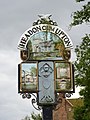
 Village sign, Headon - geograph.org.uk - 4129457.jpg 960 × 1,280; 256 KB
-
 Village sign, Upton - geograph.org.uk - 4129513.jpg 960 × 1,280; 228 KB
-
 Village sign, Upton - geograph.org.uk - 4129518.jpg 960 × 1,280; 176 KB
-
 Westfields towards Eaton - geograph.org.uk - 2688217.jpg 640 × 480; 46 KB
-
 Wet bales - geograph.org.uk - 1042955.jpg 640 × 434; 67 KB
-
 Wheat waiting to be harvested near Upton - geograph.org.uk - 5072041.jpg 1,024 × 768; 230 KB
-
 Willows by the beck - geograph.org.uk - 3309865.jpg 1,024 × 768; 172 KB
-
 Wind turbine on Mill Hill - geograph.org.uk - 4646063.jpg 800 × 600; 81 KB
-
 Yellow and blue with a bit of green - geograph.org.uk - 1872435.jpg 1,024 × 606; 361 KB


_-_geograph.org.uk_-_2688212.jpg)


_-_geograph.org.uk_-_3283323.jpg)
_-_geograph.org.uk_-_2688222.jpg)
_-_geograph.org.uk_-_4026640.jpg)


