Category:Headland, County Durham
Jump to navigation
Jump to search
civil parish in Hartlepool, County Durham, England  | |||||
| Upload media | |||||
| Instance of | |||||
|---|---|---|---|---|---|
| Location | Hartlepool, County Durham, North East England, England | ||||
 | |||||
Subcategories
This category has the following 8 subcategories, out of 8 total.
F
- The Friarage, Hartlepool (3 F)
H
- Town Wall, Hartlepool (9 F)
- Hartlepool Borough Hall (5 F)
- Hartlepool Old Pier light (8 F)
- St Mary's Church, Hartlepool (4 F)
S
- Statue of Andy Capp (3 F)
Media in category "Headland, County Durham"
The following 200 files are in this category, out of 263 total.
(previous page) (next page)-
 "Stormy C” approaching harbour, Hartlepool - geograph.org.uk - 2090590.jpg 1,280 × 960; 440 KB
-
 "The Pot House", The Headland, Hartlepool - geograph.org.uk - 5432472.jpg 3,686 × 4,850; 2.92 MB
-
 A trophy from Sebastopol - geograph.org.uk - 5659608.jpg 800 × 572; 101 KB
-
 A trophy from Sebastopol - geograph.org.uk - 5659622.jpg 800 × 542; 78 KB
-
 Abandoned factory site - geograph.org.uk - 3242918.jpg 1,024 × 768; 168 KB
-
 Abandoned garden, Marine Drive - geograph.org.uk - 3242933.jpg 1,024 × 768; 157 KB
-
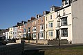
 Albion Terrace - geograph.org.uk - 614483.jpg 640 × 427; 74 KB
-
 Albion Terrace, Hartlepool - geograph.org.uk - 4738617.jpg 640 × 480; 45 KB
-
 Albion Terrace, Hartlepool - geograph.org.uk - 5593171.jpg 5,376 × 3,024; 1.7 MB
-
 Albion Terrace, Hartlepool Headland - geograph.org.uk - 6099932.jpg 2,000 × 1,500; 416 KB
-
 Albion Terrace, Headland - geograph.org.uk - 2090586.jpg 960 × 1,280; 321 KB
-
 Andy Capp at Headland - geograph.org.uk - 4746549.jpg 640 × 480; 487 KB
-
 Balustrading, The Headland Promenade - geograph.org.uk - 1615998.jpg 640 × 480; 89 KB
-
 Balustrading, The Headland Promenade - geograph.org.uk - 614086.jpg 640 × 427; 57 KB
-

-
 Beacon at Town Moor - geograph.org.uk - 5659631.jpg 800 × 465; 77 KB
-
 Beacon House, Hartlepool Headland - geograph.org.uk - 318318.jpg 640 × 480; 57 KB
-

-

-
 Block Sands, Hartlepool Headland - geograph.org.uk - 1607298.jpg 1,024 × 576; 293 KB
-
 Blue box on the beach - geograph.org.uk - 3242885.jpg 1,024 × 768; 72 KB
-
 Boats at the Fish Quay - geograph.org.uk - 3199104.jpg 4,608 × 3,456; 5.2 MB
-
 Boats on Hartlepool Bay - geograph.org.uk - 5659590.jpg 800 × 495; 106 KB
-
 Breakwater, Hartlepool - geograph.org.uk - 5593174.jpg 5,372 × 3,016; 2.02 MB
-
 Breakwater, Hartlepool - geograph.org.uk - 5593177.jpg 5,376 × 3,024; 2.68 MB
-
 Broadfield Road, The Headland - geograph.org.uk - 2820838.jpg 640 × 480; 46 KB
-
 Cannon next to the Heugh lighthouse - geograph.org.uk - 5659618.jpg 800 × 526; 81 KB
-
 Cannon, The Headland, Hartlepool - geograph.org.uk - 1997096.jpg 1,280 × 853; 381 KB
-
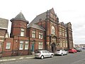
 Carnegie Library on Northgate - geograph.org.uk - 4746577.jpg 640 × 480; 431 KB
-
 Carnegie Library, Headland - geograph.org.uk - 3257504.jpg 1,024 × 768; 167 KB
-
 Cliff Terrace From the Breakwater - geograph.org.uk - 615003.jpg 640 × 427; 63 KB
-
 Cliff Terrace, Hartlepool Headland - geograph.org.uk - 1607628.jpg 640 × 480; 89 KB
-
 Cliff Terrace, Hartlepool Headland - geograph.org.uk - 1607827.jpg 640 × 480; 82 KB
-

-

-

-

-

-

-
 Coastal defences at The Headland - geograph.org.uk - 4432035.jpg 1,600 × 1,074; 198 KB
-
-
 Cobles Landscape (6004610483).jpg 999 × 706; 223 KB
-
 Cobles on the Fish Sands (6004610481).jpg 999 × 706; 211 KB
-
 Commemorative stone, The Old Cemetery - geograph.org.uk - 3247286.jpg 1,024 × 768; 277 KB
-

-

-
 Croft Gardens, Hartlepool Headland - geograph.org.uk - 1606370.jpg 640 × 480; 92 KB
-
 Darlington Street, Headland - geograph.org.uk - 3257518.jpg 1,024 × 768; 125 KB
-
 Demolition work on the Headland, Hartlepool - geograph.org.uk - 5593201.jpg 5,242 × 2,760; 1.84 MB
-
 Dunes and North Sands - geograph.org.uk - 4686693.jpg 640 × 480; 86 KB
-
 End of Marine Drive, Hartlepool - geograph.org.uk - 3351231.jpg 4,608 × 3,456; 4.23 MB
-
 England Coast Path at Heugh Battery - geograph.org.uk - 4746625.jpg 640 × 480; 364 KB
-
 England Coast Path at North Sands - geograph.org.uk - 5661270.jpg 800 × 500; 96 KB
-

-

-
-
 Entrance to Spion Kop Cemetery Hartlepool - geograph.org.uk - 2149683.jpg 2,048 × 1,536; 553 KB
-
 Entrance to the Spion Kop Cemetery - geograph.org.uk - 5662048.jpg 800 × 600; 143 KB
-
 Entrance to Victoria Harbour - geograph.org.uk - 2013403.jpg 640 × 480; 207 KB
-
 Entrance to Victoria Harbour, Hartlepool - geograph.org.uk - 6099925.jpg 2,000 × 1,500; 510 KB
-

-

-

-
 Fish Sands at the Headland in Hartlepool - geograph.org.uk - 5658487.jpg 800 × 645; 127 KB
-
 Fish Sands, Hartlepool Headland - geograph.org.uk - 1606546.jpg 640 × 480; 94 KB
-
 Fish Sands, Hartlepool Headland - geograph.org.uk - 1606568.jpg 1,024 × 576; 413 KB
-
 Fishermans Arms on Southgate - geograph.org.uk - 3332493.jpg 600 × 800; 90 KB
-
-
 Fishing from the Promenade - geograph.org.uk - 3243001.jpg 1,024 × 768; 139 KB
-

-

-
 Gladstone Street - geograph.org.uk - 614219.jpg 640 × 427; 57 KB
-
 Good dog^ - geograph.org.uk - 4745842.jpg 640 × 480; 370 KB
-
 Gun on Moor Parade, Headland - geograph.org.uk - 4746594.jpg 640 × 480; 432 KB
-
 Hartlepool Docks, aerial 2018 - geograph.org.uk - 5908385.jpg 800 × 533; 84 KB
-
 Hartlepool Fish Quay - geograph.org.uk - 3199070.jpg 4,608 × 3,456; 5.24 MB
-
 Hartlepool Headland - geograph.org.uk - 136636.jpg 640 × 293; 34 KB
-
 Hartlepool Headland - geograph.org.uk - 6086318.jpg 1,024 × 576; 88 KB
-
 Hartlepool Headland Amateur Boxing Club - geograph.org.uk - 3257510.jpg 1,024 × 768; 123 KB
-
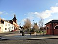
 Hartlepool Headland Town Square - geograph.org.uk - 6099919.jpg 2,000 × 1,500; 320 KB
-
 Hartlepool Lifeboat Station - geograph.org.uk - 6099921.jpg 2,000 × 1,500; 334 KB
-
 Hartlepool Lighthouse (4398428394).jpg 448 × 327; 35 KB
-
 Hartlepool monkey - geograph.org.uk - 3192165.jpg 1,500 × 1,096; 81 KB
-
 Hartlepool railway station (site), County Durham (geograph 4299986).jpg 1,600 × 1,200; 363 KB
-
 Headland fire station - geograph.org.uk - 288252.jpg 640 × 427; 173 KB
-
 Headland Fire Station - geograph.org.uk - 3257497.jpg 1,024 × 768; 125 KB
-
 Heugh Battery - geograph.org.uk - 5838998.jpg 1,024 × 683; 141 KB
-
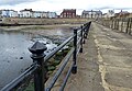
 Heugh Breakwater - geograph.org.uk - 1607277.jpg 640 × 480; 100 KB
-
 Heugh Breakwater - geograph.org.uk - 615010.jpg 427 × 640; 58 KB
-
-

-

-
 Heugh Gun Battery - geograph.org.uk - 3199118.jpg 4,608 × 3,456; 3.78 MB
-
 High Street on Hartlepool Headland - geograph.org.uk - 4299996.jpg 1,600 × 1,200; 305 KB
-

-
 Jetty, Hartlepool Headland - geograph.org.uk - 318319.jpg 640 × 480; 66 KB
-
 Jewish Cemetery Hartlepool - geograph.org.uk - 2149650.jpg 2,048 × 1,536; 594 KB
-
 Junction of Durham Road and Northgate - geograph.org.uk - 3253300.jpg 4,608 × 3,456; 4.68 MB
-
 Junction of Town Wall and Northgate - geograph.org.uk - 1606455.jpg 640 × 480; 93 KB
-
 Library and docks - geograph.org.uk - 3257507.jpg 1,024 × 637; 79 KB
-

-
 Lighthouse on Hartlepool Headland - geograph.org.uk - 5593222.jpg 5,376 × 3,024; 3.13 MB
-
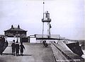
 Lighthouse, Old Pier - geograph.org.uk - 2820862.jpg 640 × 480; 62 KB
-
 Lone fisherman, Throston beach - geograph.org.uk - 3242940.jpg 1,024 × 768; 103 KB
-
 Looking eastwards along the promenade - geograph.org.uk - 3253307.jpg 4,608 × 3,456; 3.82 MB
-
 Looking towards St Hilda's Church, Hartlepool - geograph.org.uk - 3197055.jpg 3,656 × 2,813; 2.92 MB
-
 Looking towards Throston beach - geograph.org.uk - 3242951.jpg 1,024 × 768; 153 KB
-
 Looking up the coast from Marine Drive - geograph.org.uk - 3351239.jpg 4,608 × 3,456; 4.81 MB
-

-
 Marine Drive, Throston - geograph.org.uk - 3330568.jpg 800 × 600; 70 KB
-
 Mary Rowntree's Victorian Tearoom and Restaurant - geograph.org.uk - 3247401.jpg 1,024 × 768; 172 KB
-
 Mary Rowntree's, Headland - geograph.org.uk - 4746546.jpg 480 × 640; 458 KB
-
 Montague Street, Hartlepool Headland - geograph.org.uk - 1608624.jpg 640 × 480; 76 KB
-
 Moor Parade - geograph.org.uk - 614488.jpg 640 × 427; 51 KB
-
 Moor Parade, Hartlepool - geograph.org.uk - 3253321.jpg 4,608 × 3,456; 4.64 MB
-
 Moor Terrace - geograph.org.uk - 4242429.jpg 800 × 533; 98 KB
-

-
 Nesham Road, Hartlepool Headland - geograph.org.uk - 1608660.jpg 640 × 481; 63 KB
-

-
 North Basin - geograph.org.uk - 2003285.jpg 640 × 427; 252 KB
-
 North Sands - geograph.org.uk - 4746556.jpg 640 × 480; 397 KB
-
 North Sands - geograph.org.uk - 928713.jpg 480 × 640; 37 KB
-
 North Sands, Hartlepool - geograph.org.uk - 4745858.jpg 640 × 480; 315 KB
-
 Northgate shopping parade - geograph.org.uk - 4746554.jpg 640 × 480; 379 KB
-
 Northgate, Hartlepool - geograph.org.uk - 6099912.jpg 2,000 × 1,500; 373 KB
-
 Northgate, Headland - geograph.org.uk - 4746459.jpg 640 × 480; 375 KB
-
 Northgate, The Headland, Harltepool - geograph.org.uk - 6027713.jpg 2,000 × 1,500; 401 KB
-
 Northgate-Durham Street junction - geograph.org.uk - 4738614.jpg 640 × 481; 44 KB
-

-
 Old cemetery wall - geograph.org.uk - 3247328.jpg 1,024 × 768; 139 KB
-
 On the Clifton - Bulli Road (2532458837).jpg 1,024 × 755; 446 KB
-
 On the Town Wall - geograph.org.uk - 3247436.jpg 1,024 × 768; 110 KB
-
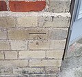
 Ordnance Survey 1GL Bolt - geograph.org.uk - 5909869.jpg 545 × 1,024; 83 KB
-
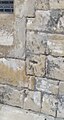
 Ordnance Survey Cut Mark - geograph.org.uk - 5909833.jpg 980 × 1,024; 340 KB
-
 Ordnance Survey Cut Mark - geograph.org.uk - 5909835.jpg 1,024 × 852; 352 KB
-
 Ordnance Survey Cut Mark - geograph.org.uk - 5909838.jpg 1,024 × 631; 195 KB
-
 Ordnance Survey Cut Mark - geograph.org.uk - 5909843.jpg 1,024 × 822; 325 KB
-
 Ordnance Survey Cut Mark - geograph.org.uk - 5909853.jpg 1,024 × 968; 321 KB
-
 Ordnance Survey Cut Mark - geograph.org.uk - 5909857.jpg 1,024 × 810; 205 KB
-
 Ordnance Survey Cut Mark - geograph.org.uk - 5909861.jpg 1,024 × 706; 233 KB
-
 Ordnance Survey Cut Mark - geograph.org.uk - 5909874.jpg 1,024 × 830; 250 KB
-
 Ordnance Survey Cut Mark - geograph.org.uk - 5909881.jpg 758 × 1,024; 292 KB
-
 Oystercatchers on the beach - geograph.org.uk - 3247301.jpg 1,024 × 768; 102 KB
-
 Oystercatchers, broken pier and spray - geograph.org.uk - 3247306.jpg 1,024 × 768; 70 KB
-

-
 Pair of Travelling Cranes - geograph.org.uk - 2003289.jpg 427 × 640; 278 KB
-
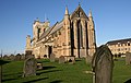
 Parish Church of St Hilda, Abbess of Hartlepool - geograph.org.uk - 5593231.jpg 4,658 × 2,724; 1.27 MB
-
 Park, High Street, Hartlepool - geograph.org.uk - 6099926.jpg 2,000 × 1,500; 393 KB
-
 Parton Rocks - geograph.org.uk - 2820840.jpg 640 × 480; 88 KB
-
 Parton Rocks on the Hartlepool shoreline - geograph.org.uk - 5661247.jpg 800 × 600; 141 KB
-
 Pipeline at Parton Rocks, Hartlepool - geograph.org.uk - 5661243.jpg 800 × 600; 116 KB
-

-

-
 Promenade at the Headland, Hartlepool - geograph.org.uk - 5661238.jpg 800 × 700; 109 KB
-
 Promenade at Town Moor, Hartlepool - geograph.org.uk - 5661223.jpg 800 × 498; 89 KB
-
 Promenade, Hartlepool Headland - geograph.org.uk - 1606853.jpg 640 × 480; 82 KB
-
 Promenade, Hartlepool Headland - geograph.org.uk - 1608475.jpg 1,024 × 576; 385 KB
-
 Promenade, Hartlepool Headland - geograph.org.uk - 1608521.jpg 1,024 × 576; 365 KB
-
 Public library, Northgate, Hartlepool - geograph.org.uk - 6027718.jpg 2,000 × 1,500; 401 KB
-
 Ramp up from the beach - geograph.org.uk - 4746622.jpg 640 × 480; 448 KB
-
 Redheugh Gardens Hartlepool - geograph.org.uk - 1896038.jpg 2,048 × 1,536; 823 KB
-
 Rocks below Seawall, Headland - geograph.org.uk - 2090585.jpg 1,280 × 960; 524 KB
-
 Rocks below the Promenade - geograph.org.uk - 3243007.jpg 1,024 × 768; 188 KB
-
 Rocks off The Headland - geograph.org.uk - 2820858.jpg 640 × 480; 66 KB
-
 Rocks off The Headland, Hartlepool - geograph.org.uk - 2820847.jpg 640 × 480; 98 KB
-

-
 Ruins of 1920s Open Air Bathing Pool - geograph.org.uk - 614692.jpg 640 × 427; 74 KB
-
 Sailing back to the harbour - geograph.org.uk - 3243068.jpg 1,024 × 768; 114 KB
-
 Saint Andrew's Church - geograph.org.uk - 2075678.jpg 640 × 480; 78 KB
-
 Sanderlings on North Sands - geograph.org.uk - 4746560.jpg 640 × 480; 515 KB
-
 Sanderlings on North Sands - geograph.org.uk - 4746565.jpg 640 × 480; 521 KB
-
 Sanderlings on North Sands... - geograph.org.uk - 4746563.jpg 640 × 480; 433 KB
-

-
 Sea angler on North Sands - geograph.org.uk - 4745830.jpg 640 × 480; 374 KB
-
 Sea wall at the Headland, Hartlepool - geograph.org.uk - 5658607.jpg 800 × 597; 143 KB
-
 Slope down to the beach - geograph.org.uk - 3243019.jpg 1,024 × 768; 149 KB
-
 South Crescent - geograph.org.uk - 3243044.jpg 1,024 × 768; 124 KB
-
 South Crescent from the Heugh Breakwater - geograph.org.uk - 1607338.jpg 1,024 × 576; 461 KB
-
 South Crescent, Hartlepool, 1967 - geograph.org.uk - 3307200.jpg 640 × 396; 56 KB
-
 Spion Kop cemetery - geograph.org.uk - 3242899.jpg 1,024 × 768; 157 KB
-
 Spion Kop Cemetery - geograph.org.uk - 5661278.jpg 800 × 492; 124 KB
-
 Spion Kop Cemetery - geograph.org.uk - 5661284.jpg 800 × 554; 100 KB
-

-
 St Hilda's Church - geograph.org.uk - 4242433.jpg 800 × 510; 84 KB
-

-
 St Hilda’s Church, The Headland, Hartlepool - geograph.org.uk - 4432012.jpg 1,600 × 1,200; 607 KB
-
 St. Hilda's and the Water Pump (5933914260).jpg 999 × 706; 186 KB
-
 Statue of Andy Capp, Hartlepool - geograph.org.uk - 5436545.jpg 4,868 × 3,687; 3.76 MB
-
 Steel stocks and Victoria Harbour - geograph.org.uk - 3243089.jpg 1,024 × 768; 97 KB
-
 Steetley Pier - geograph.org.uk - 4819873.jpg 640 × 384; 60 KB
-

-
 Steps down to the rocks - geograph.org.uk - 3242959.jpg 1,024 × 768; 168 KB
-
 Steps Down to the Sea - geograph.org.uk - 2003300.jpg 427 × 640; 272 KB
-
 Stone steps near the Heugh Battery - geograph.org.uk - 3351248.jpg 640 × 480; 53 KB
-
 Take a Seat - geograph.org.uk - 1834920.jpg 640 × 427; 66 KB
-
 Tall Ships, Victoria Harbour, Hartlepool - geograph.org.uk - 2152470.jpg 1,024 × 768; 146 KB
-

-

-
 The beach looking towards Throston - geograph.org.uk - 3247315.jpg 1,024 × 768; 100 KB
-
 The Big Wheel, Hartlepool Headland - geograph.org.uk - 1997129.jpg 1,280 × 853; 359 KB


.jpg)
.jpg)


.jpg)


.jpg)

,_County_Durham_(geograph_4299986).jpg)


.jpg)


.jpg)


.jpg)


