Category:Hawkesbury, Gloucestershire
Jump to navigation
Jump to search
village and civil parish in South Gloucestershire, UK | |||||
| Upload media | |||||
| Instance of | |||||
|---|---|---|---|---|---|
| Location | South Gloucestershire, Gloucestershire, South West England, England | ||||
 | |||||
English: Hawkesbury is a hamlet consisting of a few cottages around a triangular green, it is also the name of a civil parish in the South Gloucestershire unitary authority in England in which Hawkesbury itself lies, it is located west of Hawkesbury Upton, off the A46 road.
Subcategories
This category has the following 5 subcategories, out of 5 total.
Media in category "Hawkesbury, Gloucestershire"
The following 200 files are in this category, out of 355 total.
(previous page) (next page)-
 "The Plain". nr Little Badminton, Gloucestershire 2012 - geograph.org.uk - 5212971.jpg 2,208 × 1,403; 934 KB
-
 2011 , Cattle on Hawkesbury Common - geograph.org.uk - 2672740.jpg 4,155 × 2,061; 3.79 MB
-
 2011 , Gate and cattle grid exiting Hawkesbury Common - geograph.org.uk - 2672772.jpg 4,263 × 2,587; 3.98 MB
-
 2011 , Looking north to Orange End - geograph.org.uk - 2674294.jpg 3,862 × 2,512; 3.82 MB
-
 2011 , Looking south to Broad Hill - geograph.org.uk - 2635063.jpg 4,155 × 2,850; 4.39 MB
-
 2011 , North on the lane at the foot of Broad Hill - geograph.org.uk - 2672690.jpg 3,232 × 2,744; 5.71 MB
-

-
 2011 , Pastures and drystone walls with repairs - geograph.org.uk - 2703558.jpg 4,042 × 2,518; 3.65 MB
-
 2011 , Road junction at Orange End - geograph.org.uk - 2674343.jpg 4,234 × 2,624; 7.88 MB
-
 2011 , South between Orange End and Hawkesbury Common - geograph.org.uk - 2674315.jpg 3,396 × 2,681; 3.5 MB
-
 2011 , South west at the foot of Broad Hill - geograph.org.uk - 2672678.jpg 4,266 × 2,402; 3.66 MB
-
 2011 , South west from the lane north of Horton Court - geograph.org.uk - 2635045.jpg 4,727 × 2,750; 4.63 MB
-
 2011 , West from the lane south of Hawkesbury - geograph.org.uk - 2672657.jpg 4,221 × 2,737; 4.43 MB
-
 A Corner of Hawkesbury Common - geograph.org.uk - 5506385.jpg 3,264 × 2,448; 2.57 MB
-
 A field of barley above Horton - geograph.org.uk - 5190381.jpg 6,000 × 4,000; 4.21 MB
-
 A lane to Hawkesbury - geograph.org.uk - 3443413.jpg 2,592 × 1,944; 1.58 MB
-
 A lane to Hawkesbury Upton - geograph.org.uk - 3443427.jpg 2,592 × 1,944; 2.22 MB
-
 A minor ride on the Badminton Estate - geograph.org.uk - 2500121.jpg 2,592 × 1,944; 1.57 MB
-
 A new tree-lined avenue on the Badminton estate - geograph.org.uk - 2500193.jpg 2,592 × 1,944; 2.69 MB
-
 A public road through the Badminton estate - geograph.org.uk - 2489581.jpg 2,592 × 1,944; 1.29 MB
-

-
 A very narrow and wet King Lane - geograph.org.uk - 1612535.jpg 640 × 480; 106 KB
-
 A433 at the Gloucestershire boundary - geograph.org.uk - 2837566.jpg 1,024 × 779; 173 KB
-

-

-

-
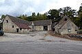
 American Barn, Little Badminton, Gloucestershire 1986 - geograph.org.uk - 5215798.jpg 1,663 × 1,082; 697 KB
-
 Ancient Oak Tree, Badminton Park, Gloucestershire 2012 - geograph.org.uk - 5223082.jpg 2,121 × 1,374; 603 KB
-
 Ancient Oak Tree, Badminton Park, Gloucestershire 2012 - geograph.org.uk - 5223088.jpg 2,141 × 1,386; 633 KB
-
 Ancient Oak Trees, Badminton Park, Gloucestershire 2016 - geograph.org.uk - 5226037.jpg 2,877 × 1,803; 1.15 MB
-
 Ancient Oak, Badminton Park, Gloucestershire 2001 - geograph.org.uk - 6260650.jpg 1,748 × 1,100; 662 KB
-
 Ancient Tree, Badminton Park, Gloucestershire 2014 - geograph.org.uk - 5230973.jpg 3,684 × 2,409; 2.09 MB
-
 Approaching a cattle-grid near Cat Cottage - geograph.org.uk - 3082014.jpg 1,024 × 676; 98 KB
-

-
 Approaching Lance Coppice - geograph.org.uk - 5183325.jpg 2,592 × 1,944; 1.64 MB
-
 Back Lane towards Highfield Lane - geograph.org.uk - 3452683.jpg 800 × 600; 144 KB
-
 Back Lane towards Highfield Lane - geograph.org.uk - 3452688.jpg 800 × 600; 147 KB
-
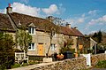
 Back Street, Hawkesbury Upton - geograph.org.uk - 2784476.jpg 640 × 480; 65 KB
-
 Back Street, Hawkesbury Upton - geograph.org.uk - 5098749.jpg 6,000 × 4,000; 3.41 MB
-

-
 Back Street, Hawkesbury Upton, Gloucestershire 2013 - geograph.org.uk - 5814884.jpg 2,170 × 1,377; 785 KB
-
 Badminton Park, Gloucestershire 2015 - geograph.org.uk - 5226045.jpg 3,872 × 2,414; 2.03 MB
-

-

-
 Barley field near Hawkesbury Upton - geograph.org.uk - 5190370.jpg 6,000 × 4,000; 3.99 MB
-
 Barn at Petty France - geograph.org.uk - 5622253.jpg 5,184 × 2,920; 5.88 MB
-
 Barn Fire, Little Badminton, Gloucestershire 1983 - geograph.org.uk - 5771663.jpg 1,708 × 1,106; 784 KB
-
 Barns and granary, Little Badminton Farm - geograph.org.uk - 5157692.jpg 4,000 × 2,680; 2.82 MB
-
 Bath Lane towards Highfield Lane - geograph.org.uk - 3452697.jpg 800 × 600; 163 KB
-
 Bath Lane towards Highfield Lane - geograph.org.uk - 3452709.jpg 800 × 600; 154 KB
-
 Bath Lane towards Highfield Lane - geograph.org.uk - 3453523.jpg 800 × 600; 152 KB
-
 Bath Lane, near Hawkesbury Upton - geograph.org.uk - 4262171.jpg 2,560 × 1,920; 2.71 MB
-
 Beaufort Arms, High Street, Hawkesbury Upton - geograph.org.uk - 4778492.jpg 2,712 × 1,832; 2.87 MB
-

-
 Beaufort Hunt, Hawkesbury, Gloucestershire 2014 - geograph.org.uk - 5292303.jpg 3,669 × 2,398; 1.99 MB
-
 Beech Lane - geograph.org.uk - 2489567.jpg 2,592 × 1,944; 1.61 MB
-
 Bend in the road - geograph.org.uk - 2826974.jpg 1,024 × 707; 170 KB
-
 Bethesda Chapel, Hawkesbury Upton - geograph.org.uk - 5098766.jpg 6,000 × 4,000; 7.16 MB
-
 Blue Boy House, High Street, Hawkesbury Upton - geograph.org.uk - 4778548.jpg 2,816 × 1,880; 2.37 MB
-

-
 Bouncy.castle.arp.jpg 1,669 × 1,305; 665 KB
-
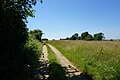
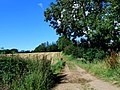 Bridle path - geograph.org.uk - 3109556.jpg 640 × 480; 134 KB
-

-
 Broad Hill - geograph.org.uk - 1659757.jpg 640 × 480; 80 KB
-
 Bullpark Lane, nr Didmarton, Gloucestershire 2012 - geograph.org.uk - 5732285.jpg 2,165 × 1,393; 1.2 MB
-
 Bullpark Wood - geograph.org.uk - 4779869.jpg 3,264 × 2,448; 1.68 MB
-

-

-
 Cattle, nr Little Badminton, Gloucestershire 2012 - geograph.org.uk - 5212968.jpg 2,149 × 1,400; 868 KB
-
 Chase Hill - geograph.org.uk - 5805677.jpg 4,608 × 3,456; 6.23 MB
-

-
 Church Farmhouse, Hawkesbury, Gloucestershire 2014 - geograph.org.uk - 5291498.jpg 3,780 × 2,409; 1.81 MB
-
 Clay Pond, Little Badminton, Gloucestershire 2014 - geograph.org.uk - 5214367.jpg 3,750 × 2,430; 3.27 MB
-

-
 Community shop, Hawkesbury Upton - geograph.org.uk - 5098724.jpg 6,000 × 4,000; 3.27 MB
-

-
 Coppiced woodland, South Moon Ridings - geograph.org.uk - 4189590.jpg 1,920 × 1,440; 1,011 KB
-
 Cotswold Way towards Clay Hill - geograph.org.uk - 3452506.jpg 800 × 600; 183 KB
-
 Cottage opposite Stiff's Coppice - geograph.org.uk - 2827826.jpg 1,024 × 769; 138 KB
-
-

-
 Cropready House, High Street, Hawkesbury Upton - geograph.org.uk - 4778531.jpg 2,816 × 1,880; 2.04 MB
-
 Development at Bix Farm - geograph.org.uk - 382355.jpg 640 × 480; 67 KB
-
 Didmarton Lane, nr Didmarton, Gloucestershire 2012 - geograph.org.uk - 5733675.jpg 2,169 × 1,399; 941 KB
-
 Didmarton Lane, nr Didmarton, Gloucestershire 2012 - geograph.org.uk - 5733688.jpg 2,171 × 1,369; 1.11 MB
-
 Didmarton Lane, nr Didmarton, Gloucestershire 2012 - geograph.org.uk - 5733693.jpg 2,180 × 1,387; 1.16 MB
-
 Didmarton Telephone Exchange, Glos - geograph.org.uk - 5768350.jpg 2,592 × 1,944; 1.43 MB
-

-
 Dovecote, Little badminton, Gloucestershire 2011 - geograph.org.uk - 5208296.jpg 2,117 × 1,386; 508 KB
-
 Dovecote, Little Badminton, Gloucestershire 2011 - geograph.org.uk - 5208312.jpg 2,167 × 1,421; 723 KB
-
 Dovecote, Little Badminton, Gloucestershire 2013 - geograph.org.uk - 5208608.jpg 2,184 × 1,397; 717 KB
-

-
 Drovers' Pond - geograph.org.uk - 5437752.jpg 3,264 × 2,448; 2.76 MB
-
 Duchess's Clump - geograph.org.uk - 3109537.jpg 640 × 480; 71 KB
-

-

-

-
 East from Highfield Lane (2) - geograph.org.uk - 1000194.jpg 640 × 462; 77 KB
-
 East from Highfield Lane - geograph.org.uk - 987331.jpg 640 × 484; 68 KB
-
 Edge of Hawkesbury Common - geograph.org.uk - 1398878.jpg 640 × 480; 54 KB
-
 Edge of North Elms Wood - geograph.org.uk - 4190319.jpg 1,920 × 1,440; 926 KB
-

-
 Entering Little Badminton - geograph.org.uk - 2826986.jpg 1,024 × 548; 78 KB
-

-

-
 Farm Buildings, Little Badminton, Gloucestershire 2013 - geograph.org.uk - 5211665.jpg 2,179 × 1,389; 935 KB
-
 Farm Shed in Field, nr Sopworth, Wiltshire 2012 - geograph.org.uk - 5807943.jpg 2,167 × 1,371; 512 KB
-
 Farm Shed in Field, nr Sopworth, Wiltshire 2012 - geograph.org.uk - 5807945.jpg 1,024 × 656; 178 KB
-
 Farm track on Clay Hill - geograph.org.uk - 5097238.jpg 6,000 × 4,000; 6.41 MB
-
 Farm track on Clay Hill - geograph.org.uk - 5097246.jpg 5,463 × 3,642; 3.31 MB
-
 Farmland near Hawkesbury Upton - geograph.org.uk - 5183311.jpg 2,592 × 1,944; 2.25 MB
-
 Farmland near Sopworth - geograph.org.uk - 2500153.jpg 2,592 × 1,944; 1.24 MB
-
 Field by Saltmoors Ditch - geograph.org.uk - 4190021.jpg 1,920 × 2,534; 1.58 MB
-
 Field of oats above Horton - geograph.org.uk - 5190377.jpg 6,000 × 4,000; 3.67 MB
-

-
 Footpath at Oxleaze Farm - geograph.org.uk - 3528774.jpg 3,648 × 2,736; 3.04 MB
-
 Footpath from Hawkesbury Road through the cow field - geograph.org.uk - 1828203.jpg 1,600 × 1,200; 437 KB
-
 Footpath to Newhouse Farm - geograph.org.uk - 3528762.jpg 3,648 × 2,736; 3.05 MB
-
 Ford and Metal Footbridge - geograph.org.uk - 5441651.jpg 3,264 × 2,448; 4.3 MB
-
 Forest ride in Swangrove Wood - geograph.org.uk - 2489574.jpg 2,592 × 1,944; 2.21 MB
-
 Former Cart Shed, Little Badminton, Gloucestershire 2011 - geograph.org.uk - 5211648.jpg 2,234 × 1,392; 787 KB
-

-

-

-

-
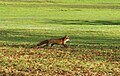 Fox, Badminton Park, Gloucestershire 2008 - geograph.org.uk - 5226052.jpg 2,055 × 1,306; 647 KB
-
 France Lane, Hawkesbury Upton - geograph.org.uk - 5098738.jpg 6,000 × 4,000; 3.75 MB
-
 Free range hens near Lower Woods - geograph.org.uk - 4190110.jpg 1,920 × 2,487; 1.84 MB
-
 Fungus, South Moon Ridings - geograph.org.uk - 4190392.jpg 1,920 × 1,628; 567 KB
-

-
 Gates on Highfield Lane - geograph.org.uk - 1659164.jpg 640 × 480; 83 KB
-

-
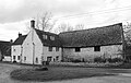
 Haskin's Farm - geograph.org.uk - 382352.jpg 640 × 480; 113 KB
-

-

-

-

-

-

-

-
 Hawkesbury Common - geograph.org.uk - 1612541.jpg 640 × 293; 32 KB
-
 Hawkesbury Common - geograph.org.uk - 3528760.jpg 3,648 × 2,736; 2.21 MB
-
 Hawkesbury Common - geograph.org.uk - 5506388.jpg 3,264 × 2,448; 3.26 MB
-
 Hawkesbury Countryside, Gloucestershire 2014 - geograph.org.uk - 5292363.jpg 3,867 × 2,444; 2.05 MB
-
 Hawkesbury Countryside, Gloucestershire 2014 - geograph.org.uk - 5292366.jpg 3,872 × 2,424; 1.58 MB
-
 Hawkesbury Countryside, Gloucestershire 2014 - geograph.org.uk - 5814952.jpg 2,199 × 1,397; 790 KB
-
 Hawkesbury in Gloucestershire.jpg 4,896 × 3,264; 7.53 MB
-
 Hawkesbury Knoll as seen from the west.jpg 3,264 × 4,896; 11.15 MB
-
 Hawkesbury Knoll Long Barrow Facing North.jpg 4,896 × 3,264; 9.3 MB
-
 Hawkesbury Knoll Long Barrow from the east.jpg 4,896 × 3,264; 8.65 MB
-
 Hawkesbury Knoll.jpg 4,896 × 3,264; 9.44 MB
-
 Hawkesbury Stores - geograph.org.uk - 5190361.jpg 6,000 × 4,000; 7.78 MB
-
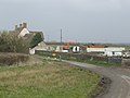
 Hawkesbury Upton High Street - geograph.org.uk - 2827233.jpg 1,024 × 642; 156 KB
-
 Hawkesbury Village, Gloucestershire 2014 - geograph.org.uk - 5291523.jpg 3,857 × 1,747; 1.91 MB
-
 Hawksbury Knoll Long Barrow from the southeast.jpg 4,896 × 3,264; 7.69 MB
-
 Hay field in the corner of Frith Wood and Claypit Wood - geograph.org.uk - 5477978.jpg 3,776 × 2,520; 4.09 MB
-
 Headland, Birch Hill - geograph.org.uk - 1659428.jpg 640 × 480; 103 KB
-
 High Street, Hawkesbury Upton - geograph.org.uk - 5098712.jpg 6,000 × 4,000; 7.66 MB
-
 High Street, Hawkesbury Upton, Gloucestershire 2013 - geograph.org.uk - 5814837.jpg 2,176 × 1,356; 632 KB
-
 High Street, Hawkesbury Upton, Gloucestershire 2013 - geograph.org.uk - 5814845.jpg 2,240 × 1,488; 652 KB
-
 High Street, Hawkesbury Upton, Gloucestershire 2013 - geograph.org.uk - 5814848.jpg 2,164 × 1,362; 640 KB
-
 High Street, Hawkesbury Upton, Gloucestershire 2013 - geograph.org.uk - 5814857.jpg 2,184 × 1,371; 816 KB
-
 Highfield Lane - geograph.org.uk - 5477931.jpg 3,776 × 2,520; 3.83 MB
-
 Highfield Lane leading to Hawkesbury Upton - geograph.org.uk - 5477934.jpg 3,776 × 2,520; 4.1 MB
-
 Hinnegar Lane, nr Didmarton, Gloucestershire 2012 - geograph.org.uk - 5732318.jpg 2,154 × 1,366; 825 KB
-
 Hinnegar Lodge, nr Didmarton, Gloucestershire 2012 - geograph.org.uk - 5733698.jpg 2,030 × 1,305; 615 KB
-
 Hinnegar Lodge, nr Didmarton, Gloucestershire 2012 - geograph.org.uk - 5733703.jpg 2,159 × 1,411; 1.06 MB
-
 Hinnegar Lodge, nr Didmarton, Gloucestershire 2012 - geograph.org.uk - 5733706.jpg 2,139 × 1,384; 786 KB
-
 House at Dunkirk - geograph.org.uk - 3082701.jpg 640 × 480; 58 KB
-
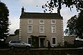
 House in Hawkesbury, Gloucestershire.jpg 4,896 × 3,264; 9.08 MB
-
-
 Houses seen across the field - geograph.org.uk - 2827228.jpg 1,024 × 552; 74 KB
-

-
 Inglestone Common - geograph.org.uk - 1398869.jpg 640 × 480; 49 KB
-
 Inglestone Common - geograph.org.uk - 2786030.jpg 1,024 × 712; 109 KB
-
 Inglestone Common - geograph.org.uk - 990432.jpg 640 × 480; 63 KB
-
 Inglestone Farm - geograph.org.uk - 489662.jpg 640 × 480; 103 KB
-
 Inglestone Farm Postbox - geograph.org.uk - 1965621.jpg 2,816 × 2,112; 2.47 MB
-
 Junction near the Ragged Castle - geograph.org.uk - 4779915.jpg 3,264 × 2,448; 1.72 MB
-
 Lane to Hawkesbury - geograph.org.uk - 1659764.jpg 640 × 450; 72 KB
-
 Little Badminton Church, Gloucestershire 2011 - geograph.org.uk - 5204666.jpg 2,167 × 1,397; 870 KB
-
 Little Badminton Church, Gloucestershire 2011 - geograph.org.uk - 5204668.jpg 2,164 × 1,400; 1 MB
-
 Little Badminton Church, Gloucestershire 2011 - geograph.org.uk - 5211795.jpg 2,205 × 1,409; 713 KB
-
 Little Badminton Farmhouse, Gloucestershire 1981 - geograph.org.uk - 5211689.jpg 2,541 × 1,636; 838 KB
-
 Little Badminton Farmhouse, Gloucestershire 2013 - geograph.org.uk - 5211679.jpg 2,199 × 1,403; 754 KB
-

-
 Logging in Lower Woods Nature Reserve - geograph.org.uk - 3528779.jpg 3,648 × 2,736; 4.05 MB
-
 Logs by The Walk - geograph.org.uk - 4190004.jpg 1,920 × 1,440; 1,000 KB
-
 Looking north towards Hawkesbury Upton - geograph.org.uk - 4262165.jpg 2,370 × 1,778; 1.64 MB
-
 Lord Somerset's Monument - geograph.org.uk - 2779687.jpg 2,000 × 3,072; 1.02 MB
-
 Lord Somerset's Monument - geograph.org.uk - 3452539.jpg 600 × 800; 165 KB
-
 Lord Somerset's Monument in 1980 - geograph.org.uk - 3926192.jpg 1,024 × 879; 188 KB
-
 Lord's Copse - geograph.org.uk - 2500204.jpg 2,592 × 1,944; 1.38 MB
-

-
 Medieval Strip Lynchets near Hawkesbury.jpg 4,896 × 3,264; 9.64 MB
-
-
 Memorial Cross - geograph.org.uk - 5506392.jpg 2,992 × 2,246; 1.58 MB
-
 Minor road near Monument Farm - geograph.org.uk - 3081944.jpg 1,024 × 769; 100 KB
-

-


_-_geograph.org.uk_-_1000194.jpg)


