Category:Haverthwaite
Jump to navigation
Jump to search
English: Haverthwaite is a small village in the Furness region of Cumbria. It is also within the boundaries of the Lake District National Park. It is located several miles east of Ulverston and is near the southern end of Windermere. The village gets part of its name from the old Norse word "thwaite" which usually refers to a clearing or settlement in the forest.

village and civil parish in Cumbria, United Kingdom  | |||||
| Upload media | |||||
| Instance of | |||||
|---|---|---|---|---|---|
| Location | South Lakeland, Cumbria, North West England, England | ||||
| Said to be the same as | Haverthwaite (Wikimedia duplicated page, civil parish) | ||||
 | |||||
Subcategories
This category has the following 7 subcategories, out of 7 total.
Media in category "Haverthwaite"
The following 200 files are in this category, out of 257 total.
(previous page) (next page)-
 A 'Beltie' on Bigland Barrow - geograph.org.uk - 3236374.jpg 800 × 418; 69 KB
-

-
 A bull by the Leven estuary - geograph.org.uk - 3001926.jpg 640 × 471; 88 KB
-

-
 A small reservoir on Bishop's Allotment - geograph.org.uk - 5351633.jpg 2,592 × 1,944; 1.82 MB
-
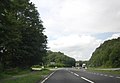
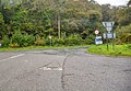
 A590 at the Brow Edge Turning - geograph.org.uk - 2536544.jpg 1,600 × 1,185; 286 KB
-
 A590 by the Haverthwaite turning - geograph.org.uk - 2536563.jpg 1,024 × 711; 131 KB
-
 A590 eastbound at Backbarrow - geograph.org.uk - 5688027.jpg 640 × 481; 78 KB
-
 A590 near Friendly Cottage - geograph.org.uk - 5685271.jpg 640 × 480; 61 KB
-
 A590 near Haverthwaite - geograph.org.uk - 2633501.jpg 640 × 430; 50 KB
-
 A590 north of Backbarrow - geograph.org.uk - 5688037.jpg 640 × 480; 64 KB
-
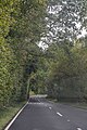
 A590 through Haverthwaite - geograph.org.uk - 3694731.jpg 800 × 633; 119 KB
-
 A590, Backbarrow - geograph.org.uk - 3220880.jpg 640 × 430; 47 KB
-
 A590, eastbound - geograph.org.uk - 3218495.jpg 640 × 385; 38 KB
-
 A590, eastbound - geograph.org.uk - 3218499.jpg 640 × 430; 35 KB
-
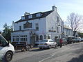
 Anglers Arms, Haverthwaite - geograph.org.uk - 2185995.jpg 616 × 460; 189 KB
-
 Autumn reflections on the River Leven - geograph.org.uk - 2149021.jpg 1,024 × 576; 166 KB
-
 B5278 bend near Burn Barrow Moss - geograph.org.uk - 5685246.jpg 640 × 480; 103 KB
-
 B5278 bend near Low Stribers Wood - geograph.org.uk - 5685241.jpg 640 × 480; 88 KB
-
 B5278 leaving Haverthwaite village - geograph.org.uk - 5685263.jpg 640 × 480; 61 KB
-
 Back Reddings Allotment - geograph.org.uk - 1353476.jpg 640 × 480; 108 KB
-
 Back Reddings Tarn - geograph.org.uk - 2317745.jpg 1,600 × 1,200; 714 KB
-
 Back Reddings Tarn - geograph.org.uk - 5351768.jpg 2,592 × 1,944; 1.34 MB
-
 Backbarrow - geograph.org.uk - 1858405.jpg 1,000 × 654; 303 KB
-
 Backbarrow Ironworks blowing engine - geograph.org.uk - 6362673.jpg 640 × 435; 99 KB
-
 Backbarrow, River Leven - geograph.org.uk - 4009477.jpg 640 × 480; 353 KB
-
 Barn at Abbots Reading Farm - geograph.org.uk - 2371849.jpg 1,600 × 1,198; 629 KB
-
 Barn at Abbots Reading Farm - geograph.org.uk - 5195245.jpg 4,896 × 3,672; 1.81 MB
-
 Barn, north of Abbots Reading Farm - geograph.org.uk - 2400178.jpg 640 × 480; 147 KB
-
 Bigland Hall Caravan Park entrance - geograph.org.uk - 3377672.jpg 3,456 × 2,304; 2.53 MB
-
 Bigland Hall, Cumbia.jpg 960 × 519; 196 KB
-
 Black Reddings Allotment Tarn - geograph.org.uk - 1070818.jpg 600 × 450; 94 KB
-
 Boardwalk across Fish House Moss - geograph.org.uk - 2193375.jpg 640 × 457; 191 KB
-

-
 Brow Edge Road, Backbarrow - geograph.org.uk - 6279331.jpg 1,024 × 683; 204 KB
-
 Cairn on Grassgarth Heights - geograph.org.uk - 5554651.jpg 640 × 480; 77 KB
-
 Canny Hill Tarn - geograph.org.uk - 4461159.jpg 640 × 480; 77 KB
-
 Canoeing the Leven - geograph.org.uk - 2148973.jpg 640 × 480; 112 KB
-
 Cave in low limestone ridge - geograph.org.uk - 609886.jpg 640 × 472; 112 KB
-
 Confluence at Pool Foot - geograph.org.uk - 2149005.jpg 640 × 480; 95 KB
-
 Cottages beside the River Leven in 1992 - geograph.org.uk - 3029200.jpg 1,024 × 715; 225 KB
-
 Cottages in Finsthwaite Lane - geograph.org.uk - 4432303.jpg 640 × 480; 74 KB
-
 Cottages over the field - geograph.org.uk - 3369988.jpg 3,399 × 2,214; 1.73 MB
-
 Cows near Hard Crag - geograph.org.uk - 1987564.jpg 1,600 × 1,067; 571 KB
-
 Curious cattle, Abbots Reading Farm - geograph.org.uk - 3005456.jpg 800 × 621; 241 KB
-
 Dappled sunlight falls on footpath to Backbarrow - geograph.org.uk - 2371857.jpg 1,600 × 1,198; 778 KB
-
 Dead reed stems, Bigland Tarn - geograph.org.uk - 3238254.jpg 640 × 480; 190 KB
-
 Departure from Haverthwaite - geograph.org.uk - 6279337.jpg 1,024 × 683; 195 KB
-
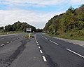
 Dual carriageway section of the A590 - geograph.org.uk - 2633509.jpg 640 × 430; 56 KB
-
 Egton with Newland , River Leven - geograph.org.uk - 6352562.jpg 6,000 × 4,000; 3.06 MB
-
 Elmlath Moss woodland - geograph.org.uk - 5195252.jpg 2,989 × 2,244; 528 KB
-
 Entrance to Bigland Hall - geograph.org.uk - 2186469.jpg 640 × 480; 199 KB
-
 Entrance to Bigland Hall - geograph.org.uk - 2186470.jpg 640 × 480; 154 KB
-
 Entrance to Bigland Hall estate - geograph.org.uk - 2502619.jpg 1,600 × 1,200; 638 KB
-
 Entrance to Black Beck Caravan Site - geograph.org.uk - 136485.jpg 640 × 426; 106 KB
-
 Entrance to Mungeon Farm - geograph.org.uk - 2395471.jpg 640 × 480; 116 KB
-
 Fallen tree - geograph.org.uk - 2193443.jpg 640 × 457; 230 KB
-
 Fence Alongside the River Pool - geograph.org.uk - 780403.jpg 640 × 427; 230 KB
-
 Fields in the valley at Causeway End - geograph.org.uk - 5195242.jpg 4,896 × 3,672; 1.07 MB
-
 Finsthwaite Lane - geograph.org.uk - 4432308.jpg 640 × 480; 87 KB
-
 Fish House Moss - geograph.org.uk - 609865.jpg 615 × 640; 136 KB
-
 Footbridge over Leven estuary - geograph.org.uk - 2080026.jpg 640 × 425; 274 KB
-
 Footbridge over Leven estuary - geograph.org.uk - 2080030.jpg 640 × 425; 277 KB
-

-
 Footpath from Haverthwaite to Rusland - geograph.org.uk - 179065.jpg 600 × 450; 224 KB
-
 Footpath west of Haverthwaite - geograph.org.uk - 2148988.jpg 640 × 480; 130 KB
-
 Footpath, Haverthwaite - geograph.org.uk - 2148952.jpg 640 × 480; 116 KB
-
 Former railway cottage - geograph.org.uk - 3001921.jpg 640 × 446; 109 KB
-
 Frosty fields, sheep, and woodland - geograph.org.uk - 1098728.jpg 640 × 480; 97 KB
-
 Gate across the old A590 - geograph.org.uk - 2186456.jpg 640 × 480; 156 KB
-
 Gate and School House Farm - geograph.org.uk - 4507276.jpg 3,504 × 2,336; 5.15 MB
-

-
 Grassgarth Heights - geograph.org.uk - 3309289.jpg 1,600 × 1,200; 1.14 MB
-
 Grassgarth Heights - geograph.org.uk - 783716.jpg 427 × 640; 196 KB
-
 Grassgarth House - geograph.org.uk - 3377707.jpg 3,456 × 2,304; 3.27 MB
-
 Greenhurst farmstead - geograph.org.uk - 2502528.jpg 1,600 × 1,200; 576 KB
-
 Greenodd , A590 - geograph.org.uk - 6352560.jpg 4,288 × 2,848; 2.49 MB
-
 Greenodd , River Leven - geograph.org.uk - 6352557.jpg 6,000 × 4,000; 3.21 MB
-
 Harebridge House - geograph.org.uk - 4882486.jpg 640 × 427; 69 KB
-
 Haverthwaite , A590 - geograph.org.uk - 6309605.jpg 6,000 × 4,000; 5.84 MB
-
 Haverthwaite , A590 - geograph.org.uk - 6309610.jpg 6,000 × 4,000; 7.04 MB
-
 Haverthwaite , A590 - geograph.org.uk - 6309611.jpg 6,000 × 4,000; 5.35 MB
-
 Haverthwaite , A590 - geograph.org.uk - 6352546.jpg 6,000 × 4,000; 3.25 MB
-
 Haverthwaite , A590 - geograph.org.uk - 6352548.jpg 4,288 × 2,848; 2.31 MB
-
 Haverthwaite , A590 - geograph.org.uk - 6352652.jpg 6,000 × 4,000; 6.36 MB
-
 Haverthwaite , B5278 - geograph.org.uk - 6309598.jpg 6,000 × 4,000; 4.35 MB
-
 Haverthwaite , B5278 - geograph.org.uk - 6352649.jpg 6,000 × 4,000; 6.14 MB
-
 Haverthwaite , B5278 - geograph.org.uk - 6352650.jpg 6,000 × 4,000; 6.32 MB
-
 Haverthwaite , B5278 - geograph.org.uk - 6357707.jpg 4,000 × 6,000; 6.79 MB
-
 Haverthwaite , B5278 - geograph.org.uk - 6357710.jpg 4,000 × 6,000; 7.65 MB
-
 Haverthwaite , B5278 - geograph.org.uk - 6357712.jpg 6,000 × 4,000; 5.32 MB
-
 Haverthwaite , Grassy Field - geograph.org.uk - 6352542.jpg 4,288 × 2,848; 6.89 MB
-
 Haverthwaite , Grassy Field - geograph.org.uk - 6352544.jpg 4,288 × 2,848; 2.14 MB
-
 Haverthwaite , Grassy Field ^ Gate - geograph.org.uk - 6309603.jpg 6,000 × 4,000; 4.84 MB
-
 Haverthwaite , Haverthwaite Station - geograph.org.uk - 6309606.jpg 6,000 × 4,000; 6.51 MB
-
 Haverthwaite , Levensgarth - geograph.org.uk - 6309602.jpg 6,000 × 4,000; 4.39 MB
-
 Haverthwaite , Oakmoss - geograph.org.uk - 6309601.jpg 6,000 × 4,000; 6.38 MB
-
 Haverthwaite , River Leven - geograph.org.uk - 6352514.jpg 6,000 × 4,000; 6.2 MB
-
 Haverthwaite , River Leven - geograph.org.uk - 6352517.jpg 6,000 × 4,000; 5.81 MB
-
 Haverthwaite , Road - geograph.org.uk - 6310574.jpg 786 × 545; 206 KB
-
 Haverthwaite - geograph.org.uk - 2186238.jpg 640 × 480; 226 KB
-
 Haverthwaite - geograph.org.uk - 2186241.jpg 640 × 480; 228 KB
-
 Haverthwaite - geograph.org.uk - 2186243.jpg 640 × 480; 218 KB
-
 Haverthwaite - geograph.org.uk - 4370083.jpg 640 × 480; 43 KB
-
 Haverthwaite arrival - geograph.org.uk - 5917652.jpg 480 × 640; 104 KB
-
 Haverthwaite Station - geograph.org.uk - 5917626.jpg 640 × 480; 64 KB
-
 Haverthwaite Station Platform - geograph.org.uk - 6301901.jpg 4,608 × 3,456; 3.37 MB
-
 Hawthorn, Black Beck - geograph.org.uk - 780508.jpg 640 × 426; 224 KB
-
 Herdwicks on holiday, Rusland Valley - geograph.org.uk - 2921583.jpg 800 × 583; 110 KB
-
 Houses in Finsthwaite Lane, from the railway - geograph.org.uk - 6279330.jpg 1,024 × 683; 209 KB
-
 Intake for the mill race, River Leven - geograph.org.uk - 3237787.jpg 640 × 480; 105 KB
-
 Ireland Moss, Rusland Valley - geograph.org.uk - 2925236.jpg 640 × 480; 114 KB
-
 Island in the Rain - geograph.org.uk - 783728.jpg 640 × 426; 222 KB
-
 Lane to Backbarrow - geograph.org.uk - 783725.jpg 640 × 426; 212 KB
-
 Lanes Ends, Haverthwaite - geograph.org.uk - 5195241.jpg 4,501 × 3,372; 1.52 MB
-
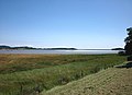
 Leven Estuary - geograph.org.uk - 2038294.jpg 640 × 427; 202 KB
-
 Leven Estuary - geograph.org.uk - 2395929.jpg 640 × 480; 104 KB
-
 Leven estuary at Greenodd - geograph.org.uk - 2080024.jpg 640 × 417; 334 KB
-
 Leven estuary at Greenodd - geograph.org.uk - 2080031.jpg 640 × 425; 177 KB
-
 Leven Valley View - geograph.org.uk - 5586913.jpg 640 × 447; 116 KB
-
 Levensgarth from Low Wood Bridge - geograph.org.uk - 6279334.jpg 1,024 × 683; 174 KB
-
 Limestone cliffs, Skelwith Hill - geograph.org.uk - 3958424.jpg 640 × 480; 72 KB
-
 Looking across to Greenodd Sands - geograph.org.uk - 3127566.jpg 800 × 600; 162 KB
-
 Lost on Haverthwaite Heights - geograph.org.uk - 2371879.jpg 1,600 × 1,198; 787 KB
-
 Low Brow Edge - geograph.org.uk - 4516041.jpg 3,189 × 1,885; 2.28 MB
-
 Low Brow Edge - geograph.org.uk - 4516046.jpg 2,336 × 3,504; 3.43 MB
-
 Low lying field by Rusland Pool - geograph.org.uk - 1098714.jpg 640 × 464; 58 KB
-
 Low lying fields by Rusland Pool - geograph.org.uk - 1098726.jpg 640 × 462; 69 KB
-
 Low Wood - geograph.org.uk - 2395546.jpg 480 × 640; 90 KB
-
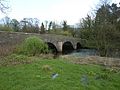 Low Wood Bridge, Haverthwaite.jpg 640 × 480; 172 KB
-
 Mearness and Skelwith - geograph.org.uk - 2193423.jpg 640 × 457; 150 KB
-
 Minor road off the A590 - geograph.org.uk - 3220877.jpg 640 × 430; 63 KB
-
 Minor road off the A590 - geograph.org.uk - 3220885.jpg 640 × 528; 101 KB
-
 Nature Trail - geograph.org.uk - 2193383.jpg 640 × 457; 233 KB
-
 Near Bigland Tarn - geograph.org.uk - 5558642.jpg 640 × 480; 67 KB
-
 No way over the Leven^ - geograph.org.uk - 2149290.jpg 480 × 640; 154 KB
-
 Not very incey -wincey at all - geograph.org.uk - 2193452.jpg 640 × 457; 174 KB
-
 Old Lime Kiln - geograph.org.uk - 609783.jpg 640 × 472; 131 KB
-
 Outcrop - geograph.org.uk - 241982.jpg 640 × 480; 142 KB
-
 Pasture by Rusland Pool - geograph.org.uk - 1098718.jpg 640 × 411; 51 KB
-
 Pastures, Rusland Valley - geograph.org.uk - 2148966.jpg 640 × 480; 82 KB
-
 Path in Bishop's Allotment - geograph.org.uk - 4461176.jpg 640 × 480; 125 KB
-
 Path in the woods below High Brow Edge - geograph.org.uk - 6279333.jpg 1,024 × 683; 354 KB
-
 Path on Haverthwaite Heights - geograph.org.uk - 4404041.jpg 640 × 480; 137 KB
-
 Peaty water, Roudsea Wood nature reserve - geograph.org.uk - 3005555.jpg 480 × 640; 127 KB
-
 Playdale Playground Mountain Towers.jpg 1,280 × 960; 476 KB
-
 Playdale Playgrounds, Offices and Factory.jpg 1,280 × 767; 267 KB
-
 Pool beside Rusland Pool - geograph.org.uk - 2149013.jpg 640 × 480; 109 KB
-
 Pt 156m, Haverthwaite Heights - geograph.org.uk - 2149303.jpg 640 × 480; 140 KB
-
 Reed-choked pool near Greenhurst - geograph.org.uk - 2542692.jpg 640 × 480; 74 KB
-
 Remains of railway bridge, Haverthwaite - geograph.org.uk - 2186246.jpg 640 × 480; 223 KB
-

-
 River Leven - geograph.org.uk - 5317877.jpg 640 × 427; 91 KB
-
 River Leven at Backbarrow - geograph.org.uk - 4010479.jpg 640 × 480; 303 KB
-
 River Leven at Backbarrow - geograph.org.uk - 6279332.jpg 1,024 × 683; 293 KB
-
 River Leven at Greenodd - geograph.org.uk - 5493956.jpg 640 × 480; 70 KB
-
 River Leven near Lakeland Motor Museum, Cumbria - geograph.org.uk - 4329188.jpg 1,238 × 929; 1.44 MB
-
 River Leven near Lakeland Motor Museum, Cumbria - geograph.org.uk - 4329189.jpg 1,238 × 929; 1.55 MB
-
 River Leven, Backbarrow - geograph.org.uk - 4009481.jpg 640 × 483; 436 KB
-

-
 River Levens from Low Wood Bridge - geograph.org.uk - 2395539.jpg 640 × 480; 143 KB
-
 Road junction at Ealinghearth - geograph.org.uk - 2371838.jpg 1,600 × 1,198; 584 KB
-
 Road junction Oatley Mosses-Barnsley Bottom - geograph.org.uk - 3377745.jpg 3,456 × 2,304; 5.33 MB
-
 Road near Mungeon Farm - geograph.org.uk - 2395476.jpg 640 × 480; 128 KB
-
 Road north of Abbots Reading Farm - geograph.org.uk - 2400181.jpg 640 × 480; 125 KB
-
 Road off the A590, Oak Bank - geograph.org.uk - 2633505.jpg 640 × 401; 72 KB
-
 Road south of Mungeon Farm - geograph.org.uk - 2395461.jpg 640 × 480; 212 KB
-
 Roudsea Wood - geograph.org.uk - 2193438.jpg 640 × 457; 229 KB
-
 Rough grassland Roudsea Wood - geograph.org.uk - 2149028.jpg 640 × 480; 125 KB
-
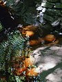
 Royal Fern - geograph.org.uk - 2193447.jpg 640 × 457; 246 KB
-
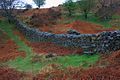
 Ruined Wall, Mungeon Farm - geograph.org.uk - 780505.jpg 640 × 426; 218 KB
-
 Rusland Pool - geograph.org.uk - 2148996.jpg 640 × 480; 108 KB
-
 Rusland Pool from bridge - geograph.org.uk - 2571650.jpg 640 × 480; 64 KB
-
 Rusland Pool Hotel, Haverthwaite - geograph.org.uk - 98200.jpg 640 × 317; 92 KB
-
 Rusland Pool near Abbots Reading - geograph.org.uk - 2921528.jpg 640 × 480; 139 KB
-
 Rusland Valley sheep - geograph.org.uk - 2686431.jpg 640 × 480; 58 KB
-
-
 School Hall Farm, High Brow Edge - geograph.org.uk - 780499.jpg 640 × 426; 228 KB
-
 Sea of Green - geograph.org.uk - 1353440.jpg 640 × 480; 109 KB
-
 Second World War pillbox near Lane Ends - geograph.org.uk - 2921602.jpg 640 × 478; 135 KB
-

-

-
 Slow worm (Angius Fragilis) - geograph.org.uk - 2193467.jpg 640 × 457; 255 KB
-
 Small tarn above Hard Crag - geograph.org.uk - 3236379.jpg 480 × 640; 85 KB
-
 Stables at Bigland Hall - geograph.org.uk - 3236398.jpg 960 × 410; 115 KB
-
 Stables at Bigland Hall - geograph.org.uk - 954116.jpg 640 × 426; 42 KB
-
 Steam Engine Victor at Haverthwaite Station - geograph.org.uk - 6301903.jpg 4,608 × 3,456; 3.44 MB
-
 Stile Over Wall, Bigland Allotment - geograph.org.uk - 783741.jpg 640 × 426; 252 KB
-
 Stile, Footpath to Haverthwaite - geograph.org.uk - 783412.jpg 640 × 427; 223 KB
-
 SW boundary of Backbarrow - geograph.org.uk - 3694744.jpg 800 × 799; 176 KB
-
 Tank Engines, Haverthwaite - geograph.org.uk - 6185694.jpg 1,024 × 768; 207 KB
-

-
 Tarn above Brow Edge - geograph.org.uk - 4507287.jpg 3,504 × 2,336; 3.23 MB
-
 The A590 at Greenodd - geograph.org.uk - 3368941.jpg 3,456 × 2,304; 1.67 MB
-
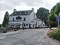
 The Anglers Arms at Haverthwaite - geograph.org.uk - 797336.jpg 640 × 480; 77 KB
-

-

-
 The Causeway - geograph.org.uk - 2400171.jpg 640 × 480; 93 KB
-
 The coastal embankment at Mearness Farm - geograph.org.uk - 3001864.jpg 640 × 480; 112 KB
-
 The Cumbria Coastal Way signposted at Grassgarth - geograph.org.uk - 2502568.jpg 1,600 × 1,200; 514 KB


_-_geograph.org.uk_-_2193467.jpg)


