Category:Hatfield, Herefordshire
Jump to navigation
Jump to search
English: Hatfield is a small village in Hatfield and Newhampton civil parish near Leominster in Herefordshire, England. (→Hatfield, Herefordshire)
Cymraeg: Pentref yn Swydd Henffordd, Gorllewin Canolbarth Lloegr, ger Leominster, ydy Hatfield, Herefordshire. (→Hatfield, Swydd Henffordd)
Polski: Hatfield – wieś w Anglii, w hrabstwie Herefordshire. Leży 21 km na północ od miasta Hereford i 188 km na północny zachód od Londynu. (→Hatfield (Herefordshire))
Simple English: Hatfield is a small village near Leominster in Herefordshire. It has a small church called Hatfield St. Leonard, built south of Hatfield. The Herefordshire Trail (walking trail) runs through the village. (→Hatfield, Herefordshire)

village in Herefordshire, United Kingdom  Église St Leonard à Hatfield | |||||
| Upload media | |||||
| Instance of |
| ||||
|---|---|---|---|---|---|
| Location | Hatfield and Newhampton, Herefordshire, West Midlands, England | ||||
 | |||||
Subcategories
This category has only the following subcategory.
L
Media in category "Hatfield, Herefordshire"
The following 10 files are in this category, out of 10 total.
-

-
 Church Cottage, Old Hatfield (30026300196).jpg 4,288 × 3,216; 4.14 MB
-
 Grassland, Hatfield - geograph.org.uk - 1298194.jpg 640 × 359; 69 KB
-
 Hatfield - the old school - geograph.org.uk - 1052905.jpg 640 × 480; 72 KB
-
 Hatfield Fields - geograph.org.uk - 1052949.jpg 640 × 480; 88 KB
-
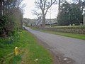
 Hatfield village - geograph.org.uk - 1512548.jpg 640 × 480; 96 KB
-
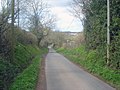
 Lane at Hatfield - geograph.org.uk - 1512243.jpg 640 × 480; 112 KB
-
 Lane out of Hatfield - geograph.org.uk - 1512558.jpg 640 × 480; 97 KB
-
 Lane through Hatfield - geograph.org.uk - 1512277.jpg 640 × 480; 129 KB
-
 Meadow near Hatfield Church - geograph.org.uk - 1512241.jpg 640 × 480; 109 KB

.jpg)


