Category:Harthill, Cheshire
Jump to navigation
Jump to search
English: Harthill is a village and civil parish in the unitary authority of Cheshire West and Chester and the ceremonial county of Cheshire, England.
village and civil parish in Cheshire, UK  | |||||
| Upload media | |||||
| Instance of | |||||
|---|---|---|---|---|---|
| Location | Cheshire West and Chester, Cheshire, North West England, England | ||||
 | |||||
Media in category "Harthill, Cheshire"
The following 94 files are in this category, out of 94 total.
-
 1 and 2, The Green, Harthill.jpg 3,456 × 2,304; 3.33 MB
-
 3 and 4, The Green, Harthill.jpg 3,456 × 2,304; 3.24 MB
-
 All Saints Church and Mausoleum - geograph.org.uk - 3955232.jpg 4,320 × 3,240; 4.27 MB
-
 All Saints Church, Harthill - geograph.org.uk - 3137822.jpg 5,184 × 3,456; 2.5 MB
-
 All Saints Church, Harthill - geograph.org.uk - 3137832.jpg 5,184 × 3,456; 2.78 MB
-
 All Saints Church, Harthill - geograph.org.uk - 5192137.jpg 640 × 480; 87 KB
-
 All Saints' Church, Harthill - geograph.org.uk - 5809216.jpg 3,888 × 5,184; 4.23 MB
-
 Bickerton Hill from Salter's Lane - geograph.org.uk - 2857899.jpg 3,264 × 2,448; 4.89 MB
-
 Birch woods on Bickerton Hill - geograph.org.uk - 185343.jpg 640 × 480; 130 KB
-
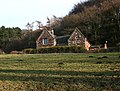
 Bodnook Cottage - geograph.org.uk - 2133561.jpg 4,224 × 3,168; 3.27 MB
-
 Bodnook Wood - geograph.org.uk - 2874378.jpg 800 × 543; 309 KB
-
 Caves at Raw Head - geograph.org.uk - 518080.jpg 640 × 480; 76 KB
-
 Close up, Elizabeth II postbox, Harthill - geograph.org.uk - 5193304.jpg 1,190 × 2,217; 563 KB
-
 Conifer plantation beneath Raw Head - geograph.org.uk - 2874116.jpg 800 × 533; 351 KB
-

-

-
 Doorway of All Saints Church, Harthill - geograph.org.uk - 3137868.jpg 3,456 × 5,184; 4.28 MB
-
 Droppingstone Cottage - geograph.org.uk - 1563242.jpg 640 × 480; 109 KB
-
 Elizabeth II postbox and telephone box, Harthill - geograph.org.uk - 5193303.jpg 2,007 × 1,688; 691 KB
-
 Erosion in Raw Head crags - geograph.org.uk - 2874228.jpg 800 × 646; 334 KB
-
 Estate Cottages, Harthill - geograph.org.uk - 3955208.jpg 4,320 × 3,240; 5.62 MB
-
 Farm shed at New Lane Farm - geograph.org.uk - 1563253.jpg 640 × 480; 88 KB
-
 Flock of birds on the Cheshire Plain - geograph.org.uk - 2874401.jpg 800 × 481; 164 KB
-
 Forest of the Future - geograph.org.uk - 1563237.jpg 640 × 480; 171 KB
-
 Former All Saints' Church Harthill - geograph.org.uk - 3955189.jpg 4,320 × 3,240; 5.27 MB
-
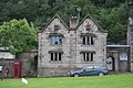
 Former Harthill School.jpg 3,456 × 2,304; 2.85 MB
-
 Giant whisk sculpture (detail) - geograph.org.uk - 3355019.jpg 1,600 × 1,218; 348 KB
-
 Giant whisk sculpture - geograph.org.uk - 3355003.jpg 1,270 × 1,600; 551 KB
-
 Grazing towards Burwardsley Hill - geograph.org.uk - 5192130.jpg 640 × 480; 53 KB
-
 Grazing, Fuller's Moor - geograph.org.uk - 5192818.jpg 640 × 480; 51 KB
-
 Harthill Cookery School - geograph.org.uk - 5192140.jpg 640 × 480; 65 KB
-
 Harthill houses - geograph.org.uk - 1564791.jpg 640 × 480; 75 KB
-
 Harthill Junior School - geograph.org.uk - 1564000.jpg 640 × 480; 59 KB
-
 Harthill Lane - geograph.org.uk - 3137939.jpg 4,000 × 3,000; 2.03 MB
-
 Harthill Lane - geograph.org.uk - 5192134.jpg 640 × 480; 91 KB
-
 Harthill Lane - geograph.org.uk - 5192144.jpg 640 × 480; 86 KB
-
 Harthill Lane at Harthill - geograph.org.uk - 3137807.jpg 5,184 × 3,456; 2.62 MB
-
 Harthill Road - geograph.org.uk - 3137789.jpg 4,000 × 3,000; 2.91 MB
-
 Harthill school.jpg 640 × 480; 213 KB
-
 Houses, Harthill - geograph.org.uk - 5193308.jpg 2,848 × 2,136; 1.37 MB
-
 Mickerdale Cottage, Harthill - geograph.org.uk - 2874338.jpg 800 × 608; 261 KB
-
 Mickerloo Art Gallery and Cafe - geograph.org.uk - 1564856.jpg 640 × 480; 93 KB
-
 Mixed woodland on Burwardsley Hill - geograph.org.uk - 2874408.jpg 800 × 533; 195 KB
-
 Motor engineers, Harthill - geograph.org.uk - 5192143.jpg 640 × 480; 72 KB
-
 Musket Hole - geograph.org.uk - 2336619.jpg 4,000 × 3,000; 2.82 MB
-
 Musket Hole crags from low-level track - geograph.org.uk - 2874041.jpg 707 × 800; 314 KB
-
 New Lane Farm - geograph.org.uk - 1563249.jpg 640 × 480; 67 KB
-
 New Lane, Harthill - geograph.org.uk - 3137931.jpg 4,000 × 3,000; 3.68 MB
-
 Panorama from Maiden Castle viewpoint - geograph.org.uk - 185340.jpg 480 × 640; 99 KB
-
 Park Wood from the Sandstone - geograph.org.uk - 2857869.jpg 3,264 × 2,448; 3.59 MB
-
 Pasture by Bodnook Wood - geograph.org.uk - 2874361.jpg 800 × 533; 189 KB
-
 Path junction on Raw Head - geograph.org.uk - 2874020.jpg 800 × 533; 359 KB
-
 Pony grazing on a winter's afternoon - geograph.org.uk - 2874413.jpg 800 × 533; 216 KB
-
 Raw Head - geograph.org.uk - 1562422.jpg 640 × 480; 86 KB
-
 Raw Head - geograph.org.uk - 860400.jpg 640 × 480; 105 KB
-
 Raw Head crags in winter - geograph.org.uk - 2873930.jpg 630 × 800; 266 KB
-
 Rawhead Information Board - geograph.org.uk - 3175216.jpg 2,024 × 1,346; 927 KB
-
 Rawhead Trig Point - geograph.org.uk - 3175209.jpg 2,024 × 1,346; 690 KB
-
 Remember George Barbour^ - geograph.org.uk - 1563259.jpg 640 × 480; 95 KB
-
 Road Junction on Salters Lane - geograph.org.uk - 2857602.jpg 3,264 × 2,448; 4.87 MB
-
 Salter's Lane (A534), Fuller's Moor - geograph.org.uk - 5192816.jpg 640 × 480; 82 KB
-

-
 Sandstone cliff at Raw Head - geograph.org.uk - 5809223.jpg 5,184 × 3,888; 5.86 MB
-
 Sandstone of Raw Head crags - geograph.org.uk - 2874246.jpg 800 × 739; 386 KB
-
 Sandstone outcrop on Raw Head - geograph.org.uk - 1562442.jpg 480 × 640; 166 KB
-
 Sign for the Sandstone public house - geograph.org.uk - 5192148.jpg 448 × 640; 56 KB
-
 Signpost on Harthill Lane - geograph.org.uk - 3137771.jpg 3,456 × 5,184; 3.58 MB
-
 Signposts old and new, Fuller's Moor - geograph.org.uk - 5192824.jpg 611 × 640; 187 KB
-
 Steep oak-lined lane, Harthill - geograph.org.uk - 3955239.jpg 4,320 × 3,240; 6.32 MB
-
 Stone trough by Harthill school gate - geograph.org.uk - 1563278.jpg 480 × 640; 109 KB
-
 The Belfry of All Saints Church, Harthill - geograph.org.uk - 3137850.jpg 3,456 × 5,184; 1.5 MB
-
 The Green, Harthill - geograph.org.uk - 3137814.jpg 5,184 × 3,456; 3.48 MB
-

-

-
 The Sandstone Trail to Rawhead - geograph.org.uk - 2133598.jpg 3,168 × 4,224; 3.25 MB
-
 Through the forest ... - geograph.org.uk - 2336801.jpg 3,000 × 4,000; 6.13 MB
-
 Track to Church Farm, Harthill - geograph.org.uk - 1564777.jpg 480 × 640; 106 KB
-
 Trig Point on Raw Head - geograph.org.uk - 1562407.jpg 480 × 640; 92 KB
-
 View from Harthill Lane - geograph.org.uk - 1564817.jpg 640 × 480; 61 KB
-
 View from the top of Raw Head - geograph.org.uk - 1562432.jpg 640 × 480; 52 KB
-
 View towards Mickerdale Cottage - geograph.org.uk - 2874391.jpg 800 × 517; 199 KB
-
 Walking through Bodnook Wood - geograph.org.uk - 3354990.jpg 1,257 × 1,600; 795 KB
-
 Westward Ho - geograph.org.uk - 2333706.jpg 4,000 × 3,000; 3.81 MB
-
 Barnhill - geograph.org.uk - 159861.jpg 640 × 480; 213 KB
-
 Bolesworth Hill Road - geograph.org.uk - 159863.jpg 640 × 480; 156 KB
-
 Coomb Dale - geograph.org.uk - 246671.jpg 436 × 640; 124 KB
-
 Footpath to Mad Allen's Hole - geograph.org.uk - 108692.jpg 640 × 480; 157 KB
-
 Gallantry Bank - geograph.org.uk - 152186.jpg 640 × 480; 140 KB
-
 Guidepost on the A534 - geograph.org.uk - 108052.jpg 480 × 640; 107 KB
-
 Harthill Park - geograph.org.uk - 134173.jpg 640 × 480; 166 KB
-
 Near Harthill - geograph.org.uk - 134177.jpg 640 × 480; 204 KB
-
 Raw Head - geograph.org.uk - 200425.jpg 640 × 480; 152 KB
-
 Raw Head - geograph.org.uk - 9161.jpg 640 × 480; 81 KB
-
 View over Brown Knowl and Fullers Moor. - geograph.org.uk - 106997.jpg 640 × 480; 102 KB


_-_geograph.org.uk_-_3355019.jpg)


,_Fuller%27s_Moor_-_geograph.org.uk_-_5192816.jpg)


