Category:Harrowden
Jump to navigation
Jump to search
hamlet in Bedfordshire, England, UK  | |||||
| Upload media | |||||
| Instance of | |||||
|---|---|---|---|---|---|
| Location | Shortstown, Bedford, Bedfordshire, East of England, England | ||||
| Official language | |||||
| Inception |
| ||||
| Area |
| ||||
 | |||||
English: Harrowden is a one street hamlet in the English county of Bedfordshire. The street runs from east to west parallel and to the south of the A421 Bedford Southern Bypass, and 200 metres to the north of the village of Shortstown. Like Shortstown, Harrowden is in the Eastcotts parish, of the Borough of Bedford.
Media in category "Harrowden"
The following 18 files are in this category, out of 18 total.
-
 43058 Harrowden.jpg 4,950 × 3,074; 2.21 MB
-
 43080 Harrowden.jpg 3,858 × 2,360; 1.21 MB
-
 A421 eastbound - geograph.org.uk - 4873425.jpg 640 × 480; 45 KB
-
 A421 looking east from A600 bridge - geograph.org.uk - 371574.jpg 637 × 440; 45 KB
-
 A600-A421 junction looking west - geograph.org.uk - 371567.jpg 637 × 442; 49 KB
-
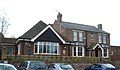
 Bedford Academy - geograph.org.uk - 6003997.jpg 1,600 × 1,200; 485 KB
-
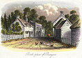 Birth place of Bunyan.jpg 453 × 322; 50 KB
-
 Footpath looking north - geograph.org.uk - 371555.jpg 635 × 387; 31 KB
-

-
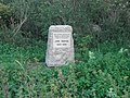
 John Bunyans Birthplace - geograph.org.uk - 1249473.jpg 640 × 480; 132 KB
-
 JohnBunyanBirthplace.JPG 3,648 × 2,736; 4.87 MB
-
 Old trackbed from A600 bridge on A421 - geograph.org.uk - 371579.jpg 639 × 423; 47 KB
-
 Public Bridleway - geograph.org.uk - 777329.jpg 640 × 480; 106 KB
-
 Rushes by the path - geograph.org.uk - 6003993.jpg 1,600 × 1,066; 512 KB
-
 SignToBunyansBirthplace.JPG 2,736 × 3,648; 4.89 MB
-

-
 The Gate, Harrowden - geograph.org.uk - 724857.jpg 426 × 640; 72 KB
-
 The Gate, Harrowden - geograph.org.uk - 777335.jpg 640 × 376; 55 KB


