Category:Harrison West
neighborhood in Columbus, Ohio, United States  | |||||
| Upload media | |||||
| Instance of | |||||
|---|---|---|---|---|---|
| Location | Columbus, Franklin County, Ohio | ||||
 | |||||
Harrison West is a historic, urban neighborhood located north and near west of Downtown. The neighborhood character is similar to the better-known Victorian Village just to the east. The area is bounded by Harrison Avenue on the east, Goodale Street on the South, Fifth Avenue on the north, and Olentangy River Road to the west (including "Gowdy Field"). In January 2008, the neighborhood expanded to include all of "Thurber Village" to the south east.
Developed from the Neil Farm in the early 20th century, Harrison West is characterized by Victorian and Edwardian-style homes, although the housing stock is generally more modest than the grand homes found in Victorian Village proper. Frame houses are more common than brick. Just south of Harrison West, the similar "Flytown" was destroyed during "slum clearance" in the 1960s and replaced by I-670 and the "James Thurber Village" apartment and business area. Today, some of the homes have been split into rented apartments, while others remain as historical landmarks. Still others have since been purchased and restored to their original style.
Subcategories
This category has the following 3 subcategories, out of 3 total.
Media in category "Harrison West"
The following 7 files are in this category, out of 7 total.
-
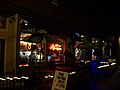 Caffe.jpg 2,048 × 1,536; 571 KB
-
 Columbus Fire Station 25 - DPLA - 1ac00e56a198066742fd05c5101450f4 (page 1).jpg 3,600 × 2,700; 905 KB
-
 Columbus Fire Station 25 - DPLA - 1ac00e56a198066742fd05c5101450f4 (page 2).jpg 3,600 × 2,700; 1.11 MB
-
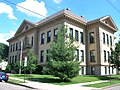 Columbus Fourth Avenue School.jpg 2,288 × 1,712; 702 KB
-
 Handsome Homes of Columbus, Ohio - DPLA - 390a9745335ed62f65db0c1416729ffe (page 78).jpg 5,639 × 3,760; 3.3 MB
-
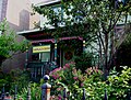
 HWhouse.jpg 1,632 × 1,232; 651 KB
-
 HWimpeach.jpg 1,632 × 1,232; 681 KB

.jpg)
.jpg)

.jpg)
