Category:Hargrave, Northamptonshire
Jump to navigation
Jump to search
English: Hargrave is a small village situated in rural Northamptonshire, England. Hargrave is located approximately 15 miles north-east of Northampton and is adjacent to the Northamptonshire / Cambridgeshire border.
village and civil parish situated in rural Northamptonshire, England | |||||
| Upload media | |||||
| Instance of | |||||
|---|---|---|---|---|---|
| Location | North Northamptonshire, Northamptonshire, East Midlands, England | ||||
| Said to be the same as | Hargrave (Wikimedia duplicated page, civil parish) | ||||
 | |||||
Subcategories
This category has the following 2 subcategories, out of 2 total.
Media in category "Hargrave, Northamptonshire"
The following 30 files are in this category, out of 30 total.
-
 'Boring Field' - geograph.org.uk - 6190944.jpg 1,024 × 745; 185 KB
-
 All Saints, Hargrave - geograph.org.uk - 6087636.jpg 1,024 × 576; 185 KB
-
 Black lodge - geograph.org.uk - 378044.jpg 640 × 480; 135 KB
-
 Bridleway heading towards Keyson - geograph.org.uk - 719962.jpg 640 × 425; 80 KB
-
 Bridleway to Covington - geograph.org.uk - 588523.jpg 640 × 425; 100 KB
-
 Cereal crop at Windy Barn Farm - geograph.org.uk - 6190895.jpg 1,024 × 768; 180 KB
-
 Church Road at the junction of the B645 - geograph.org.uk - 5427514.jpg 2,032 × 1,514; 1.72 MB
-
 Church Road in spring - geograph.org.uk - 851621.jpg 640 × 479; 108 KB
-
 Farm Track near Covington - geograph.org.uk - 6190905.jpg 1,024 × 768; 185 KB
-
 Grass covered road junction near Hargrave - geograph.org.uk - 3041200.jpg 2,560 × 1,920; 1.04 MB
-
 Hargrave Millennium Celebration Plinth - geograph.org.uk - 2197622.jpg 2,736 × 3,648; 2.17 MB
-
 Hargrave's pub no more - geograph.org.uk - 2197627.jpg 3,648 × 2,736; 2.2 MB
-

-
 House in Church Street, Hargrave (geograph 6530217).jpg 1,024 × 768; 154 KB
-
 Nags Head Lane - geograph.org.uk - 6087639.jpg 576 × 1,024; 132 KB
-
 Old Toll House, Hargrave - geograph.org.uk - 6114873.jpg 524 × 640; 238 KB
-
 Road junction with grass traffic island - geograph.org.uk - 3289631.jpg 2,560 × 1,920; 911 KB
-
 Road sign in poor repair - geograph.org.uk - 3041210.jpg 2,560 × 1,920; 984 KB
-
 Road to Hargrave - geograph.org.uk - 1189755.jpg 640 × 480; 84 KB
-

-
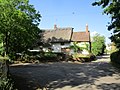
 Thatched cottage in village of Hargrave - geograph.org.uk - 607451.jpg 640 × 480; 121 KB
-
 The former Nags Head (geograph 6530240).jpg 1,024 × 768; 223 KB
-
 The former Nags Head pub, Hargrave - geograph.org.uk - 4514129.jpg 4,320 × 3,240; 3.09 MB
-
 Track to Three Shire House - geograph.org.uk - 6190930.jpg 1,024 × 768; 197 KB
-
 Tree by the B645 near Chelveston - geograph.org.uk - 5427516.jpg 2,048 × 1,536; 1.34 MB
-
 Water Tower - geograph.org.uk - 88138.jpg 480 × 640; 91 KB
-

-
 Bottom Farm Hargrave - geograph.org.uk - 719928.jpg 640 × 425; 94 KB
-
 Large field of early wheat - geograph.org.uk - 383020.jpg 640 × 480; 88 KB
-
 Radio mast Raunds - geograph.org.uk - 378169.jpg 640 × 504; 99 KB


.jpg)


.jpg)


