Category:Harewood, Herefordshire
Jump to navigation
Jump to search
civil parish in Herefordshire, England | |||||
| Upload media | |||||
| Instance of | |||||
|---|---|---|---|---|---|
| Location | Herefordshire, West Midlands, England | ||||
 | |||||
English: Harewood is a civil parish in Herefordshire, England. Within Harewood is the rural estate of Harewood Park, owned by the Duchy of Cornwall.
Subcategories
This category has the following 2 subcategories, out of 2 total.
H
- Harewood Park, Herefordshire (8 F)
Media in category "Harewood, Herefordshire"
The following 41 files are in this category, out of 41 total.
-

-
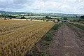
 Arable land at Harewood End - geograph.org.uk - 2759334.jpg 1,024 × 680; 228 KB
-
 Arable land at Harewood End - geograph.org.uk - 2759341.jpg 1,024 × 680; 274 KB
-
 Arable land west of Hoarwithy - geograph.org.uk - 5793041.jpg 1,600 × 901; 674 KB
-
 Bridleway at Harewood End - geograph.org.uk - 2759190.jpg 1,024 × 680; 287 KB
-

-
 Bridleway to Hoarwithy - geograph.org.uk - 2759367.jpg 1,024 × 680; 241 KB
-
 Elvastone Farm, 2019 - geograph.org.uk - 6020253.jpg 1,600 × 901; 848 KB
-
 Entrance to Redbrook Farm, Hoarwithy - geograph.org.uk - 4319447.jpg 800 × 600; 173 KB
-
 Farmland at Redbrook Farm - geograph.org.uk - 2759370.jpg 1,024 × 680; 236 KB
-

-

-
 Grange Farm, Harewood Park (geograph 5692034).jpg 640 × 480; 70 KB
-
 Green pastures - geograph.org.uk - 1008314.jpg 640 × 480; 165 KB
-
 Harewood Park and Grange Farm - geograph.org.uk - 2759183.jpg 1,024 × 680; 259 KB
-
 Harvested wheatfield and Elvaston Farm - geograph.org.uk - 3582543.jpg 1,024 × 680; 197 KB
-

-
 New hedge, Harewood End - geograph.org.uk - 2759353.jpg 1,024 × 680; 238 KB
-
 Oak by the bridleway - geograph.org.uk - 980239.jpg 640 × 480; 80 KB
-

-
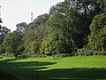
 Parkland trees at Harewood Park - geograph.org.uk - 2086508.jpg 640 × 480; 96 KB
-
 Pylon over Elvastone Wood - geograph.org.uk - 998588.jpg 640 × 480; 150 KB
-
 Ring of pines - geograph.org.uk - 977560.jpg 640 × 340; 69 KB
-
 Saint Denis Chapel - geograph.org.uk - 1534398.jpg 640 × 480; 47 KB
-
 Saint Denis Chapel from the front - geograph.org.uk - 1534411.jpg 547 × 640; 58 KB
-
 Sheds at Redbrook Farm - geograph.org.uk - 1009841.jpg 640 × 480; 103 KB
-
 Sheep pasture at Elvastone - geograph.org.uk - 6020254.jpg 1,600 × 900; 665 KB
-
 Signs at entrance to Harewood estate - geograph.org.uk - 6092192.jpg 1,600 × 934; 746 KB
-
 Single oak by the bridleway - geograph.org.uk - 1000274.jpg 480 × 640; 217 KB
-

-
 St Denis's Chapel, Harewood End (geograph 5692031).jpg 640 × 480; 122 KB
-
 The Harewood End - geograph.org.uk - 4862167.jpg 4,608 × 2,472; 1.75 MB
-
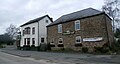
 The Harewood End Inn - geograph.org.uk - 5166720.jpg 1,600 × 1,200; 771 KB
-
 The Harewood End Inn - geograph.org.uk - 5692062.jpg 640 × 455; 69 KB
-
 Track and bridleway to Woodlands Farm - geograph.org.uk - 2759346.jpg 1,024 × 680; 187 KB
-
 Tree in an arable field - geograph.org.uk - 2759355.jpg 680 × 1,024; 219 KB
-
 Valley between two woods - geograph.org.uk - 1000076.jpg 640 × 480; 158 KB
-
 View to Hoarwithy - geograph.org.uk - 1009855.jpg 640 × 480; 78 KB
-
 View to Ring Grove - geograph.org.uk - 977558.jpg 640 × 410; 63 KB
-
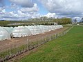 Windmill Hill Fruit Farm - geograph.org.uk - 762763.jpg 640 × 480; 84 KB
-
 Early Blackberries - geograph.org.uk - 206804.jpg 640 × 480; 46 KB


.jpg)


.jpg)


