Category:Harbour maps
Jump to navigation
Jump to search
Subcategories
This category has the following 5 subcategories, out of 5 total.
Media in category "Harbour maps"
The following 24 files are in this category, out of 24 total.
-
 17th century harbour map, Cagliari.jpg 3,482 × 2,482; 696 KB
-
 1829 Black Rock Harbour map.jpg 3,662 × 2,227; 1.42 MB
-
 1906 Toronto Harbour map.png 2,324 × 811; 2.87 MB
-
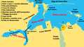
 Bal Harbour.png 575 × 425; 20 KB
-
 Cagliari harbour map, Roux 1764.jpg 937 × 655; 184 KB
-
 Churchill Harbour, survey of 1887.jpg 4,550 × 7,792; 8.94 MB
-
 Darling harbour map.svg 538 × 653; 141 KB
-
 Darling Harbour.png 695 × 755; 402 KB
-
 Hafen neapel.jpg 737 × 411; 107 KB
-
 Havana Cuba Map 1898.jpg 963 × 667; 123 KB
-
 Hudson Bay Route Plan of Churchill Harbour (1927).jpg 4,008 × 7,483; 9 MB
-
 Inner Harbor Oswego, New York - NARA - 128215717.jpg 4,944 × 3,991; 1.07 MB
-
 Juvarra disegno23d 1800.jpg 1,492 × 1,193; 1.1 MB
-
 Juvarra disegnoe2e 1800.jpg 2,503 × 2,271; 1.44 MB
-
 Keppel Harbour 1945 map.jpg 1,272 × 950; 595 KB
-
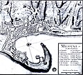
 Mappa del porto di Brindisi.png 929 × 518; 86 KB
-
 Mare-Harbour.PNG 2,554 × 1,804; 141 KB
-
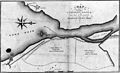
 NIE 1905 Harbor - Ceara.jpg 451 × 258; 24 KB
-
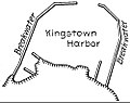 NIE 1905 Harbor - Kingstown.jpg 500 × 394; 33 KB
-
 Northisland NZ Kaipara Harbour.png 327 × 500; 37 KB
-
 Plan du port et de la Ville de Brindisi - Roux Joseph - 1804.jpg 1,500 × 1,032; 777 KB
-

-
 Porto di Livorno.PNG 924 × 971; 55 KB
-
 West Hartlepool dock map.jpg 2,012 × 3,102; 1.65 MB


.jpg)


.jpg)

