Category:Harbottle
Jump to navigation
Jump to search
village and civil parish in Northumberland, United Kingdom  | |||||
| Upload media | |||||
| Instance of | |||||
|---|---|---|---|---|---|
| Location | Northumberland, North East England, England | ||||
 | |||||
English: Harbottle is a village and civil parish in Northumberland, England about south-east of the Scottish border, nestled among the Cheviot Hills and inside Northumberland National Park. The village is the site of Harbottle Castle built by order of Henry II. Now in ruins, the castle was constructed by the Umfraville family to protect against invaders from Scotland.

Subcategories
This category has the following 7 subcategories, out of 7 total.
D
- Dueshill Farm (2 F)
H
- Harbottle Castle (19 F)
P
- The Peels, Northumberland (4 F)
S
- Sharperton (36 F)
- The Star Inn, Harbottle (8 F)
W
- Woodhouses Bastle (10 F)
Media in category "Harbottle"
The following 200 files are in this category, out of 546 total.
(previous page) (next page)-
 'Burma Road', Otterburn Ranges - geograph.org.uk - 1484334.jpg 4,000 × 2,248; 4.97 MB
-
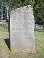 'Sad Castle' stone - geograph.org.uk - 2468211.jpg 3,216 × 4,288; 3.79 MB
-
 'The Sad Castle' memorial stone - geograph.org.uk - 1810330.jpg 1,024 × 768; 381 KB
-
 (Part of) Yearning Crag - geograph.org.uk - 3733317.jpg 640 × 480; 83 KB
-
 A bird's eye view of Harbottle - geograph.org.uk - 5948510.jpg 4,177 × 2,770; 2.46 MB
-

-
 Abandoned farmstead - geograph.org.uk - 4025460.jpg 3,840 × 2,160; 2.31 MB
-
 Abandoned farmstead at Harbottle Crag - geograph.org.uk - 4945633.jpg 1,600 × 1,200; 313 KB
-

-
 Alien animals in Coquetdale - geograph.org.uk - 2851687.jpg 1,600 × 1,200; 304 KB
-
 All mod cons at South Yardhope - geograph.org.uk - 3937333.jpg 1,600 × 1,200; 422 KB
-
 Alpacas at Sharperton - geograph.org.uk - 2123879.jpg 640 × 480; 86 KB
-
 Alpacas at Wood Hall farm - geograph.org.uk - 780198.jpg 640 × 480; 113 KB
-
 Alpacas at Wood Hall, Sharperton (1) - geograph.org.uk - 2452692.jpg 640 × 480; 95 KB
-
 Alpacas at Wood Hall, Sharperton (2) - geograph.org.uk - 2452693.jpg 640 × 480; 111 KB
-
 Alpacas at Woodhall Farm - geograph.org.uk - 377308.jpg 640 × 571; 64 KB
-
 Alpacas in paddock at Sharperton - geograph.org.uk - 2123894.jpg 640 × 480; 101 KB
-
 Alwinton - geograph.org.uk - 4945588.jpg 1,600 × 1,225; 320 KB
-
 An interesting weather vane - geograph.org.uk - 1517703.jpg 480 × 640; 81 KB
-
 Angry Haugh - geograph.org.uk - 3502084.jpg 640 × 480; 258 KB
-

-
 Another use for pallets^ - geograph.org.uk - 4944748.jpg 900 × 1,200; 327 KB
-
 Approaching a cattle grid - geograph.org.uk - 3937382.jpg 1,600 × 1,200; 480 KB
-
 Ashy Bank - geograph.org.uk - 4948144.jpg 1,600 × 1,200; 344 KB
-
 B6341 - geograph.org.uk - 4660714.jpg 800 × 600; 494 KB
-
 Barrow Burn - geograph.org.uk - 3565457.jpg 640 × 480; 71 KB
-
 Barrow Burn - geograph.org.uk - 3565465.jpg 640 × 480; 80 KB
-
 Barrow Burn - geograph.org.uk - 4944648.jpg 1,600 × 1,200; 345 KB
-
 Barrow Burn - geograph.org.uk - 4944663.jpg 1,600 × 1,200; 263 KB
-
 Barrow Burn and Barrow Hill - geograph.org.uk - 3735872.jpg 640 × 480; 68 KB
-

-
 Barrow Burn west of footbridge - geograph.org.uk - 2539881.jpg 1,024 × 768; 363 KB
-
 Barrow Hill - geograph.org.uk - 4944664.jpg 1,600 × 1,200; 257 KB
-

-
 Black Cleugh - geograph.org.uk - 3565412.jpg 640 × 480; 81 KB
-
 Black Hill - geograph.org.uk - 3669988.jpg 640 × 480; 81 KB
-

-
 Black House - geograph.org.uk - 2223626.jpg 3,847 × 2,150; 1.53 MB
-
 Bloody Moss - geograph.org.uk - 3708445.jpg 640 × 480; 78 KB
-
 Bluebells at Angryhaugh - geograph.org.uk - 2482879.jpg 1,600 × 1,200; 500 KB
-
 Bluebells beside the path - geograph.org.uk - 4948148.jpg 900 × 1,200; 355 KB
-
 Bluebells in Ferny Wood - geograph.org.uk - 4948140.jpg 1,600 × 1,200; 602 KB
-
 Bog asphodel near Harbottle Lake - geograph.org.uk - 3565481.jpg 480 × 640; 48 KB
-
 Bog asphodels near Harbottle Lake - geograph.org.uk - 3565483.jpg 640 × 480; 94 KB
-

-

-
 Boulders at the edge of the field - geograph.org.uk - 3835168.jpg 1,600 × 1,200; 360 KB
-
 Boulders beside Rowantree Cleugh - geograph.org.uk - 3937297.jpg 1,600 × 1,117; 403 KB
-
 Boundary stone - geograph.org.uk - 4944758.jpg 900 × 1,200; 294 KB
-
 Boundary stone on Cuddy Moss - geograph.org.uk - 3565088.jpg 640 × 480; 90 KB
-

-
-
 Bracken, reeds and rough grass - geograph.org.uk - 3934849.jpg 1,600 × 1,114; 421 KB
-

-
 Bridge, Holystone - geograph.org.uk - 3505236.jpg 640 × 480; 356 KB
-
 Bridge, Sharperton - geograph.org.uk - 2386144.jpg 640 × 417; 205 KB
-
 Bridleway north of Harbottle - geograph.org.uk - 1871535.jpg 1,024 × 768; 200 KB
-
 British Soldier Lichen - geograph.org.uk - 4948210.jpg 1,000 × 870; 254 KB
-
 Burma Road - geograph.org.uk - 4330828.jpg 2,560 × 1,920; 2.29 MB
-

-
 By the side of the river - geograph.org.uk - 2468170.jpg 4,288 × 3,216; 2.49 MB
-
 Cairn below The Drake Stone. - geograph.org.uk - 1375726.jpg 480 × 640; 88 KB
-
 Cairn on the track to Drake Stone - geograph.org.uk - 4046902.jpg 1,600 × 1,200; 390 KB
-
 Camp Knowes - geograph.org.uk - 1773813.jpg 3,456 × 2,033; 1.32 MB
-
 Car parking area, Harehaugh Picnic Site - geograph.org.uk - 3618457.jpg 2,592 × 1,944; 1.32 MB
-
 Carved stone at the castle car park - geograph.org.uk - 5948575.jpg 3,239 × 4,319; 4.47 MB
-
 Castle walls, Harbottle - geograph.org.uk - 1820700.jpg 1,024 × 768; 240 KB
-
 Cattle grid - geograph.org.uk - 3958897.jpg 1,600 × 1,200; 208 KB
-
 Circular fenced enclosure - geograph.org.uk - 3835580.jpg 1,600 × 1,200; 587 KB
-
 Clear area in Harbottle Wood - geograph.org.uk - 1484560.jpg 4,000 × 2,248; 1.98 MB
-
 Clear fell - geograph.org.uk - 3503778.jpg 640 × 480; 308 KB
-
 Clear fell and replanting - geograph.org.uk - 3959028.jpg 1,600 × 1,200; 297 KB
-
 Clear felled woodland - geograph.org.uk - 1264329.jpg 640 × 480; 108 KB
-
 Clear felling north of the Yardhope Burn - geograph.org.uk - 3937347.jpg 1,600 × 1,109; 378 KB
-
 Clennell Memorial Fountain, Harbottle - geograph.org.uk - 1869959.jpg 768 × 1,024; 301 KB
-
 Cocidius - a deity worshipped in northern Britain - geograph.org.uk - 3935101.jpg 1,600 × 1,396; 590 KB
-
 Cold Law - geograph.org.uk - 1495907.jpg 640 × 480; 93 KB
-
 Cold Law - geograph.org.uk - 3758040.jpg 640 × 480; 290 KB
-
 Cold Law - geograph.org.uk - 4330800.jpg 2,560 × 1,920; 2.61 MB
-
 Cold Law cairn and trig point - geograph.org.uk - 1495911.jpg 640 × 480; 97 KB
-
 Common Sike - geograph.org.uk - 1484351.jpg 640 × 480; 138 KB
-
 Common Strip woodland on Haddon Hill - geograph.org.uk - 3835182.jpg 1,600 × 1,200; 278 KB
-
 Coquet - Alwin confluence - geograph.org.uk - 3502096.jpg 640 × 480; 327 KB
-
 Coquet flood plain - geograph.org.uk - 3505245.jpg 640 × 480; 255 KB
-
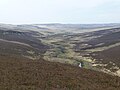
 Coquetdale - geograph.org.uk - 6160111.jpg 2,767 × 874; 1.53 MB
-
 Corrugated iron culvert - geograph.org.uk - 4878238.jpg 1,600 × 1,200; 703 KB
-
 Cottage at Charity Hall - geograph.org.uk - 3959044.jpg 1,600 × 1,086; 318 KB
-
 Cottage at Rockey's Hall - geograph.org.uk - 3959024.jpg 1,600 × 1,200; 392 KB
-
 Country lane north of Sharperton - geograph.org.uk - 5948817.jpg 2,817 × 3,153; 2.27 MB
-
 Country lane, Well House Farm - geograph.org.uk - 5948828.jpg 4,320 × 3,240; 3.59 MB
-
 Country road near Biddlestone Edge - geograph.org.uk - 2099141.jpg 640 × 480; 84 KB
-
 Country road near Foxton Burn - geograph.org.uk - 2099131.jpg 640 × 480; 140 KB
-
 Cowey's Cairn and Greenwood Law - geograph.org.uk - 3565104.jpg 640 × 480; 70 KB
-
 Crags above Barrow Burn - geograph.org.uk - 3735830.jpg 640 × 480; 74 KB
-
 Crags above South Yardhope (2) - geograph.org.uk - 3669962.jpg 640 × 480; 94 KB
-
 Crags above South Yardhope - geograph.org.uk - 3667338.jpg 640 × 480; 78 KB
-
-
 Crags north of Cold Law - geograph.org.uk - 1495890.jpg 640 × 360; 78 KB
-
 Crags south of South Yardhope - geograph.org.uk - 3669952.jpg 640 × 480; 98 KB
-
 Cross shaped sheepfold - geograph.org.uk - 3835591.jpg 1,600 × 1,200; 247 KB
-
 Cumulus from Harbottle Crag - geograph.org.uk - 4384531.jpg 604 × 453; 20 KB
-
 Daw's Hill (2) - geograph.org.uk - 3685029.jpg 640 × 480; 79 KB
-
 Daw's Hill - geograph.org.uk - 3685027.jpg 640 × 480; 75 KB
-
 Daw's Moss - geograph.org.uk - 3685021.jpg 640 × 480; 83 KB
-

-
 Daw's Moss below Pedlar's Stone - geograph.org.uk - 3518419.jpg 640 × 480; 71 KB
-
 Daw's Moss north of Pedlar's Stone - geograph.org.uk - 3685038.jpg 640 × 480; 70 KB
-
 Debris in and beside the Barrow Burn - geograph.org.uk - 4945566.jpg 1,600 × 1,200; 725 KB
-
 Deep gully formed from drainage ditch - geograph.org.uk - 4944605.jpg 900 × 1,200; 287 KB
-
 Deep puddles on the track to Harbottle Grange - geograph.org.uk - 3835677.jpg 1,600 × 1,200; 216 KB
-
 Derelict farm at South Yardhope - geograph.org.uk - 3937336.jpg 900 × 1,200; 336 KB
-

-

-
 Dod Hill - geograph.org.uk - 3669970.jpg 640 × 480; 79 KB
-
 Drake Stone - geograph.org.uk - 4046911.jpg 1,600 × 1,200; 223 KB
-
 Drakes Stone - geograph.org.uk - 2913441.jpg 1,024 × 768; 164 KB
-
 Drakestone Burn - geograph.org.uk - 1496542.jpg 640 × 480; 87 KB
-
 DrakeStone.jpg 640 × 480; 197 KB
-
 Drive to Dueshill Farm - geograph.org.uk - 4948475.jpg 1,600 × 1,226; 463 KB
-
 Dry cleugh above Barrow Burn - geograph.org.uk - 3735891.jpg 640 × 480; 83 KB
-
 Dues Hill round cairn (geograph 7444730).jpg 1,024 × 768; 304 KB
-
 Dueshill Wood - geograph.org.uk - 3835673.jpg 1,600 × 1,200; 244 KB
-
 Eastern end of the 'Burma road' - geograph.org.uk - 4023705.jpg 800 × 600; 49 KB
-
 Edge of Dueshill Wood - geograph.org.uk - 3505254.jpg 640 × 480; 339 KB
-
 Entrance to the Otterburn Ranges - geograph.org.uk - 4878077.jpg 1,600 × 1,195; 300 KB
-
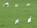 Ewe, lambs and guinea fowl - geograph.org.uk - 4948472.jpg 1,600 × 1,198; 297 KB
-
 Farm buildings, Harbottle - geograph.org.uk - 3503760.jpg 640 × 480; 323 KB
-
 Farm road west of Park House - geograph.org.uk - 1871469.jpg 1,024 × 769; 259 KB
-
 Farm road, Alwinton - geograph.org.uk - 3755676.jpg 640 × 480; 313 KB
-
 Farmland near Holystone - geograph.org.uk - 2386123.jpg 640 × 338; 121 KB
-
 Farmstead on Harbottle Crag - geograph.org.uk - 2215208.jpg 720 × 540; 71 KB
-
 Farmstead on Harbottle Crag - geograph.org.uk - 4039449.jpg 3,840 × 2,160; 2.72 MB
-
 Fence on hill called Black House - geograph.org.uk - 4944451.jpg 1,600 × 1,200; 314 KB
-
 Fly agaric - geograph.org.uk - 1496879.jpg 640 × 480; 82 KB
-
 Footbridge over Barrow Burn - geograph.org.uk - 2539855.jpg 1,024 × 768; 376 KB
-
 Footbridge over the River Coquet - geograph.org.uk - 3835596.jpg 1,600 × 1,180; 464 KB
-
 Footbridge, Harbottle - geograph.org.uk - 457180.jpg 480 × 640; 139 KB
-
 Ford and footbridge - geograph.org.uk - 4948141.jpg 900 × 1,200; 343 KB
-
 Ford at Holystone - geograph.org.uk - 5194887.jpg 3,000 × 2,000; 6.44 MB
-

-
 Forest and moorland edge at Yardhope - geograph.org.uk - 1483553.jpg 8,192 × 2,210; 3.52 MB
-
 Forest on the slopes of Cat Law - geograph.org.uk - 3937374.jpg 1,600 × 1,200; 344 KB
-
 Forest ride, Harbottle Wood - geograph.org.uk - 1484510.jpg 640 × 480; 151 KB
-
 Forest ride, Holystone Forest - geograph.org.uk - 1484360.jpg 640 × 480; 149 KB
-
 Forest ride, Holystone Forest - geograph.org.uk - 1484376.jpg 640 × 480; 122 KB
-
 Forest road - geograph.org.uk - 2173948.jpg 1,824 × 1,216; 904 KB
-
 Forest road, Holystone Common - geograph.org.uk - 1483370.jpg 640 × 480; 122 KB
-
 Forest track, Harbottle Wood - geograph.org.uk - 1484485.jpg 640 × 480; 111 KB
-
 Forestry fire precautions - geograph.org.uk - 3958993.jpg 1,600 × 1,163; 323 KB
-
 Forestry on Highspoon Hill - geograph.org.uk - 4944609.jpg 1,600 × 1,200; 322 KB
-
 Forestry track to Yardhope Burn - geograph.org.uk - 4878511.jpg 1,600 × 1,200; 403 KB
-
 Forestry work, Harbottle Wood - geograph.org.uk - 1484530.jpg 640 × 480; 131 KB
-
 Former Presbyterian Church, Harbottle - geograph.org.uk - 1871321.jpg 1,024 × 989; 201 KB
-
 Foulplay Knowe (3) - geograph.org.uk - 3666157.jpg 640 × 480; 94 KB
-
 Foulplay Knowe (4) - geograph.org.uk - 3666163.jpg 640 × 480; 76 KB
-
 Foulplay Knowe and Greenwood Law - geograph.org.uk - 3666166.jpg 640 × 480; 73 KB
-
 Foulplay Knowe and Long Hill - geograph.org.uk - 3517190.jpg 640 × 480; 77 KB
-
 Free flowing spring - geograph.org.uk - 4945640.jpg 1,600 × 1,200; 514 KB
-
 From one hill fort to another (geograph 6397104).jpg 1,338 × 1,899; 529 KB
-
 Gates near Hepple - geograph.org.uk - 2387307.jpg 472 × 640; 246 KB
-
 Gateway to a pasture - geograph.org.uk - 3835621.jpg 1,600 × 1,200; 478 KB
-
 Geordy's Nick, West Wood - geograph.org.uk - 1496840.jpg 640 × 480; 134 KB
-
 Goats in a wood - geograph.org.uk - 4945790.jpg 1,600 × 1,170; 614 KB
-
 Grasslees Burn - geograph.org.uk - 1140227.jpg 640 × 396; 74 KB
-
 Grasslees Burn - geograph.org.uk - 3356048.jpg 900 × 1,200; 328 KB
-
 Grouse butts on the ranges^ - geograph.org.uk - 163080.jpg 640 × 480; 90 KB
-
 Harbottle - geograph.org.uk - 2082008.jpg 2,592 × 2,930; 1.92 MB
-
 Harbottle - geograph.org.uk - 2082012.jpg 3,861 × 2,553; 1.29 MB
-
 Harbottle - geograph.org.uk - 2675987.jpg 640 × 426; 60 KB
-
 Harbottle - geograph.org.uk - 3503772.jpg 640 × 480; 320 KB
-
 Harbottle - geograph.org.uk - 3593675.jpg 640 × 480; 75 KB
-
 Harbottle Castle (1) - geograph.org.uk - 5948528.jpg 4,320 × 2,091; 1.51 MB
-
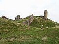 Harbottle Castle (2) - geograph.org.uk - 5948546.jpg 4,320 × 3,240; 1.92 MB
-
 Harbottle Castle (3) - geograph.org.uk - 5948557.jpg 4,297 × 2,480; 1.87 MB
-
 Harbottle crag - geograph.org.uk - 4039461.jpg 3,840 × 2,160; 2.11 MB
-
 Harbottle Crag - geograph.org.uk - 4878110.jpg 1,600 × 1,200; 480 KB
-
 Harbottle Crag ruined farmstead - geograph.org.uk - 1496227.jpg 640 × 480; 68 KB
-
 Harbottle Crags - geograph.org.uk - 4944735.jpg 1,600 × 1,339; 322 KB
-
 Harbottle Crags Nature Reserve - geograph.org.uk - 1495843.jpg 640 × 360; 87 KB
-
 Harbottle Crags Nature Reserve - geograph.org.uk - 1496339.jpg 640 × 360; 67 KB
-
 Harbottle First School - geograph.org.uk - 1870153.jpg 1,024 × 768; 271 KB
-
 Harbottle Ford - geograph.org.uk - 3985998.jpg 3,872 × 2,592; 4.79 MB
-
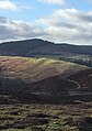
 Harbottle Hills - geograph.org.uk - 1495129.jpg 640 × 360; 71 KB
-
 Harbottle Hills - geograph.org.uk - 1495378.jpg 640 × 360; 85 KB
-
 Harbottle Hills - geograph.org.uk - 3503767.jpg 640 × 480; 278 KB
-
 Harbottle Hills near West Wood - geograph.org.uk - 812427.jpg 640 × 480; 117 KB
-
 Harbottle Lake (2) - geograph.org.uk - 3725337.jpg 640 × 480; 78 KB
-
 Harbottle Lake (3) - geograph.org.uk - 3725343.jpg 640 × 480; 76 KB
-
 Harbottle Lake - Frozen^ - geograph.org.uk - 2215197.jpg 720 × 540; 79 KB
-
 Harbottle Lake - geograph.org.uk - 1375679.jpg 640 × 480; 78 KB
-
 Harbottle Lake - geograph.org.uk - 1496583.jpg 640 × 480; 61 KB
-
 Harbottle Lake - geograph.org.uk - 2675996.jpg 640 × 426; 49 KB
-
 Harbottle Lake - geograph.org.uk - 3565386.jpg 640 × 480; 71 KB
-
 Harbottle Pant (geograph 7363525).jpg 787 × 1,024; 236 KB
-
 Harbottle wood and the 'Burma road' - geograph.org.uk - 3982344.jpg 3,840 × 2,160; 1.77 MB
-
 Harbottle Wood from Cold Law - geograph.org.uk - 1496158.jpg 640 × 480; 73 KB
-
 Harbottlevillage.jpg 1,152 × 864; 55 KB
-
 Harehaugh Hill - geograph.org.uk - 4660716.jpg 800 × 600; 482 KB
-
 Hatchmeadow Well - geograph.org.uk - 5335115.jpg 2,448 × 3,264; 2.92 MB
-
 Hatchmeadow Well lurks within the Larch trees - geograph.org.uk - 5335148.jpg 2,448 × 3,264; 2.91 MB


_Yearning_Crag_-_geograph.org.uk_-_3733317.jpg)


_-_geograph.org.uk_-_2452692.jpg)
_-_geograph.org.uk_-_2452693.jpg)


_or_Cowberry_(Vaccinium_vitis-idaea)_-_geograph.org.uk_-_1496361.jpg)


_Yearning_Crag_-_geograph.org.uk_-_3733320.jpg)


_-_geograph.org.uk_-_3669962.jpg)


_-_geograph.org.uk_-_3685029.jpg)


.jpg)


_-_geograph.org.uk_-_3666157.jpg)
_-_geograph.org.uk_-_3666163.jpg)


.jpg)


_-_geograph.org.uk_-_5948528.jpg)
_-_geograph.org.uk_-_5948546.jpg)
_-_geograph.org.uk_-_5948557.jpg)


_-_geograph.org.uk_-_3725337.jpg)
_-_geograph.org.uk_-_3725343.jpg)


.jpg)


