Category:Hamstall Ridware
Jump to navigation
Jump to search
English: Hamstall Ridware is a village and civil parish in the district of Lichfield in Staffordshire, England. It is in the Trent Valley, and lies close to the villages of Hill Ridware, Mavesyn Ridware and Pipe Ridware. It is eight miles north of the city of Lichfield, and four miles east of Rugeley.
village and civil parish in Staffordshire, United Kingdom  | |||||
| Upload media | |||||
| Instance of | |||||
|---|---|---|---|---|---|
| Location | Lichfield, Staffordshire, West Midlands, England | ||||
 | |||||
Subcategories
This category has the following 3 subcategories, out of 3 total.
H
- Hamstall Hall (5 F)
Media in category "Hamstall Ridware"
The following 134 files are in this category, out of 134 total.
-
 A Stile that is well maintained - geograph.org.uk - 2659610.jpg 428 × 640; 117 KB
-

-
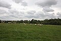
 Barley field between Yoxall Road and Green Lane - geograph.org.uk - 6228191.jpg 1,600 × 1,200; 590 KB
-
 Barley field, east of Sandborough House Farm - geograph.org.uk - 6228192.jpg 1,681 × 1,261; 742 KB
-
 Barley field, Olive Green - geograph.org.uk - 6228186.jpg 1,600 × 1,200; 521 KB
-
 Barn Conversions, Fawley Farm - geograph.org.uk - 2658322.jpg 640 × 428; 64 KB
-
 Blithbury Road in Hamstall Ridware - geograph.org.uk - 4556110.jpg 1,024 × 729; 280 KB
-
 Blithbury Road, Hamstall Ridware - geograph.org.uk - 5331498.jpg 640 × 480; 107 KB
-

-
-

-
-
 Bus shelter at Hamstall Ridware - geograph.org.uk - 1157784.jpg 640 × 480; 258 KB
-
 Chestnut trees and Rough Park - geograph.org.uk - 402742.jpg 640 × 477; 160 KB
-
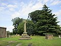 Churchyard Cross, Hamstall Ridware (geograph 6554513).jpg 1,024 × 768; 197 KB
-

-
 Cottage, Sandborough - geograph.org.uk - 5331525.jpg 640 × 415; 77 KB
-
 Cowley Hill Farm from Cowley Hill - geograph.org.uk - 1157817.jpg 640 × 480; 294 KB
-
 Cowley Hill, Hamstall Ridware - geograph.org.uk - 1157768.jpg 640 × 480; 239 KB
-
 Cows near Hayend Farm - geograph.org.uk - 4556056.jpg 1,024 × 782; 237 KB
-
 Crop field and pond, Olive Green - geograph.org.uk - 5331535.jpg 640 × 480; 65 KB
-
 Dairy farming near Abbots Bromley - geograph.org.uk - 402717.jpg 640 × 480; 175 KB
-

-
 Derelict house, Olive Green - geograph.org.uk - 5331532.jpg 640 × 480; 59 KB
-
 Elizabeth II postbox on Blithbury Road, Hamstall Ridware - geograph.org.uk - 5333313.jpg 2,657 × 2,043; 1.15 MB
-
 Farm Buildings Lower Rowley - geograph.org.uk - 2658339.jpg 640 × 428; 81 KB
-
 Farm pond and straw bales - geograph.org.uk - 402705.jpg 640 × 480; 121 KB
-
 Field entrance off Yoxall Road - geograph.org.uk - 5331526.jpg 640 × 480; 94 KB
-
 Field from churchyard - geograph.org.uk - 927298.jpg 640 × 426; 54 KB
-
 Footpath near the River Trent - geograph.org.uk - 4556187.jpg 1,024 × 857; 408 KB
-
 Footpath to Bentlee Park - geograph.org.uk - 5236045.jpg 1,600 × 1,066; 494 KB
-
 Footpath to Hadley End - geograph.org.uk - 5236040.jpg 1,600 × 1,066; 589 KB
-

-
 Gate on footpath to Cowley Hill - geograph.org.uk - 1157811.jpg 640 × 480; 350 KB
-
 Grand Entrance to Cowley Hill - geograph.org.uk - 2495467.jpg 640 × 428; 78 KB
-
 Green Lane Junction, Sandborough - geograph.org.uk - 2658263.jpg 640 × 428; 64 KB
-
 Green Lane, Sandborough - geograph.org.uk - 5331529.jpg 640 × 480; 64 KB
-
 Hamstall Fishery, Hamstall Ridware - geograph.org.uk - 1274459.jpg 640 × 480; 222 KB
-
 Hamstall Ridware - geograph.org.uk - 2495455.jpg 640 × 428; 85 KB
-
 Hamstall Ridware - geograph.org.uk - 5331504.jpg 640 × 480; 76 KB
-
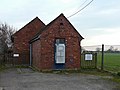
 Hamstall Ridware Gospel Hall - geograph.org.uk - 1163683.jpg 640 × 480; 249 KB
-
 Hamstall Ridware sewage works - geograph.org.uk - 1157775.jpg 640 × 480; 277 KB
-
 Hamstall Ridware village sign - geograph.org.uk - 4556140.jpg 1,024 × 781; 259 KB
-
 Harvested cereal field near Hamstall Ridware - geograph.org.uk - 6238785.jpg 1,024 × 768; 175 KB
-
 Harvested field of oilseed rape - geograph.org.uk - 6238781.jpg 1,024 × 768; 236 KB
-
 House on Yoxall Road, Olive Green - geograph.org.uk - 5331531.jpg 640 × 480; 64 KB
-
 House, Hamstall Ridware - geograph.org.uk - 5331505.jpg 640 × 480; 56 KB
-
 Houses at Olive Green - geograph.org.uk - 425096.jpg 640 × 459; 151 KB
-

-

-
 Isolated tree, Purleyhill - geograph.org.uk - 6238788.jpg 1,024 × 768; 213 KB
-
 Ivy Covered House, Nethertown - geograph.org.uk - 2495482.jpg 640 × 428; 93 KB
-
 Junction at Sandborough - geograph.org.uk - 1440309.jpg 640 × 426; 293 KB
-

-
 Lane junction and Lombardy Poplars - geograph.org.uk - 1440293.jpg 425 × 640; 75 KB
-
 Lane to Olive Green - geograph.org.uk - 6238810.jpg 1,024 × 768; 128 KB
-
 Lichfield Road in Hamstall Ridware - geograph.org.uk - 4556148.jpg 1,024 × 726; 157 KB
-
 Lichfield Road, Hamstall Ridware - geograph.org.uk - 1157782.jpg 640 × 480; 276 KB
-
 Lichfield Road, Hamstall Ridware - geograph.org.uk - 5331506.jpg 640 × 480; 63 KB
-
 Lonesome Pine on Cowley Hill - geograph.org.uk - 1157826.jpg 480 × 640; 252 KB
-
 Looking Towards Rough Park - geograph.org.uk - 2658278.jpg 640 × 406; 105 KB
-
 Meaford Farm - geograph.org.uk - 402745.jpg 640 × 480; 77 KB
-

-
 Narrow Lane with Poplar Trees - geograph.org.uk - 2658282.jpg 640 × 383; 93 KB
-
 Nethertown near Hamstall Ridware - geograph.org.uk - 2495478.jpg 640 × 428; 66 KB
-

-

-

-

-
 Pond near Hamstall Ridware - geograph.org.uk - 1157958.jpg 640 × 238; 128 KB
-
 Pond on Cowley Hill - geograph.org.uk - 1157838.jpg 640 × 480; 243 KB
-

-
 Postbox in Nethertown - geograph.org.uk - 4556171.jpg 1,024 × 903; 281 KB
-
 Priory Farm - dog - geograph.org.uk - 439501.jpg 640 × 480; 85 KB
-
 Pumping and gauging station on the River Blithe - geograph.org.uk - 3604099.jpg 3,776 × 2,520; 4.25 MB
-
 Pumping Station, Hamstall Ridware - geograph.org.uk - 1274507.jpg 640 × 480; 237 KB
-
 River bank - geograph.org.uk - 442234.jpg 640 × 480; 103 KB
-
 River Blithe north of Hamstall Ridware - geograph.org.uk - 1163647.jpg 640 × 480; 225 KB
-
 River Blithe north of Hamstall Ridware - geograph.org.uk - 1163658.jpg 477 × 636; 223 KB
-
 River Blithe south of Hamstall Ridware - geograph.org.uk - 1157765.jpg 640 × 480; 352 KB
-
 River Trent, Nethertown - geograph.org.uk - 555402.jpg 640 × 480; 93 KB
-
 Road into Nethertown - geograph.org.uk - 3604122.jpg 3,776 × 2,520; 4.08 MB
-
 Road Junction, Hamstall Ridware - geograph.org.uk - 425080.jpg 640 × 428; 120 KB
-
 Ruined cottages, Yoxall Road, Olive Green - geograph.org.uk - 6228181.jpg 1,600 × 1,200; 392 KB
-
 Sandboro' Farm - geograph.org.uk - 5331521.jpg 640 × 480; 71 KB
-

-
 Signpost and Sandboro' Farm - geograph.org.uk - 6238802.jpg 1,024 × 768; 159 KB
-
-
 Smallholding Renovation - geograph.org.uk - 2659591.jpg 640 × 428; 86 KB
-
 St Michael ^ All Angels church, Hamstall Ridware - geograph.org.uk - 4556123.jpg 1,024 × 813; 234 KB
-

-
 Stile at Nethertown - geograph.org.uk - 1157907.jpg 480 × 640; 231 KB
-
 Stile near Hamstall Ridware Church - geograph.org.uk - 1162054.jpg 640 × 480; 227 KB
-
 Stile on Cowley Hill - geograph.org.uk - 1157822.jpg 480 × 640; 98 KB
-
 Stile on Cowley Hill - geograph.org.uk - 1157830.jpg 640 × 480; 269 KB
-
 Stile on Cowley Hill - geograph.org.uk - 1157834.jpg 480 × 640; 270 KB
-
 Stile on Hunger Hill - geograph.org.uk - 1157847.jpg 480 × 640; 245 KB
-
 Sycamore Cottage (geograph 6238798).jpg 1,024 × 739; 154 KB
-
 Sycamore Cottage, Hamstall Ridware - geograph.org.uk - 1157807.jpg 640 × 480; 272 KB
-
 Telephone box, Hamstall Ridware - geograph.org.uk - 1157795.jpg 480 × 640; 312 KB
-
 The beginning of a footpath to Weaverslake - geograph.org.uk - 6238815.jpg 1,024 × 768; 183 KB
-

-

-
 The empty Ridware countryside - geograph.org.uk - 1769814.jpg 518 × 389; 170 KB
-
 The end of the road, Rowley Farms - geograph.org.uk - 402749.jpg 640 × 480; 141 KB
-
 The Great Barn, Hamstall Ridware - geograph.org.uk - 1163613.jpg 480 × 640; 234 KB
-
 The Last Smallholding, Rowley Farms - geograph.org.uk - 2659628.jpg 640 × 428; 69 KB
-
 The Little Blithe - geograph.org.uk - 439519.jpg 480 × 640; 155 KB
-
 The Old Saddlery, Hamstall Ridware - geograph.org.uk - 1157802.jpg 640 × 480; 242 KB
-

-
 The River Blithe at Hamstall Ridware - geograph.org.uk - 1602577.jpg 640 × 480; 86 KB
-
 The River Blithe near Hamstall Ridware - geograph.org.uk - 6238792.jpg 1,024 × 768; 231 KB
-
 The Shoulder of Mutton - geograph.org.uk - 1440300.jpg 640 × 426; 259 KB
-
 The Shoulder of Mutton, Hamstall Ridware - geograph.org.uk - 1157798.jpg 640 × 445; 233 KB
-

-
 This way to the church - geograph.org.uk - 1440301.jpg 640 × 426; 451 KB
-
 Town End Farm - geograph.org.uk - 5331488.jpg 640 × 480; 86 KB
-
 Town End Farm along Blithbury Road - geograph.org.uk - 4556092.jpg 1,024 × 750; 251 KB
-
 Track at Nethertown - geograph.org.uk - 1157901.jpg 480 × 640; 241 KB
-
-
 Track to Bancroft - geograph.org.uk - 3604051.jpg 3,776 × 2,520; 4.21 MB
-
 Tractor heading west to Hamstall Ridware - geograph.org.uk - 6228165.jpg 1,383 × 1,037; 369 KB
-
 Tree along Blithbury Road - geograph.org.uk - 4556059.jpg 1,024 × 768; 239 KB
-
 Upper Nethertown Farm in Nethertown - geograph.org.uk - 4556164.jpg 1,024 × 766; 281 KB
-
 View From Hunger Hill - geograph.org.uk - 555824.jpg 640 × 480; 71 KB
-

-
 Waterworks building at Nethertown - geograph.org.uk - 1157929.jpg 640 × 480; 251 KB
-
 Yoxall Road, Olive Green - geograph.org.uk - 5331537.jpg 640 × 480; 59 KB
-
 End of the Road - geograph.org.uk - 440407.jpg 640 × 480; 86 KB
-
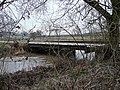
 Footbridge - geograph.org.uk - 436967.jpg 640 × 480; 116 KB
-
 Footbridge - geograph.org.uk - 442231.jpg 640 × 480; 90 KB
-
 Old cottage and road sign - geograph.org.uk - 442218.jpg 640 × 480; 67 KB
-
 Ouch^ Stung again - geograph.org.uk - 439529.jpg 480 × 640; 159 KB
-
 The ford at Priory Farm - geograph.org.uk - 439494.jpg 640 × 480; 130 KB


.jpg)


.jpg)


._-_geograph.org.uk_-_936400.jpg)


