Category:Hamburg-Mannheimer-Hochhaus (Gelsenkirchen)
Jump to navigation
Jump to search
| Object location | | View all coordinates using: OpenStreetMap |
|---|
Subcategories
This category has only the following subcategory.
Media in category "Hamburg-Mannheimer-Hochhaus (Gelsenkirchen)"
The following 3 files are in this category, out of 3 total.
-
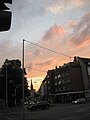 GE Kirchstraße (35).jpg 2,448 × 3,264; 2 MB
-
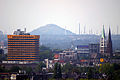 Gelsenkirchen aug2004 002.jpg 800 × 533; 143 KB
-
 Gelsenkirchen Kriegerdenkmal Machensplatz.JPG 2,448 × 3,264; 3.5 MB
.jpg)

