Category:Halsall
Jump to navigation
Jump to search
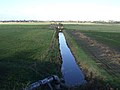
English: Halsall is a village and civil parish in West Lancashire, England, located close to Ormskirk on the A5147 and Leeds and Liverpool Canal. The parish has a population of 1,921 and covers an area of 28.31 square kilometres. The church and much of the village stand on a rocky ridge, in marked contrast to the low-lying flat peat mossland between the ridge and the sand of Ainsdale and Birkdale. (→Halsall)
Nederlands: Halsall is een plaats en civil parish in het bestuurlijke gebied West Lancashire, in het Engelse graafschap Lancashire. (→Halsall)
Polski: Halsall – wieś w Anglii, w hrabstwie Lancashire, w dystrykcie West Lancashire. Leży 50 km na zachód od miasta Manchester i 300 km na północny zachód od Londynu. (→Halsall)
village and civil parish in West Lancashire, England, UK  | |||||
| Upload media | |||||
| Instance of | |||||
|---|---|---|---|---|---|
| Location | West Lancashire, Lancashire, North West England, England | ||||
 | |||||
Subcategories
This category has the following 6 subcategories, out of 6 total.
Media in category "Halsall"
The following 200 files are in this category, out of 454 total.
(previous page) (next page)-
 "The Halsall Navvy" - geograph.org.uk - 2694108.jpg 640 × 480; 126 KB
-
 3 and 5 Renacres Lane - geograph.org.uk - 2711495.jpg 640 × 480; 108 KB
-
 7 Renacres Lane - geograph.org.uk - 2711502.jpg 640 × 480; 87 KB
-
 7 Renacres Lane. - geograph.org.uk - 3100719.jpg 640 × 480; 101 KB
-
 A "Caravan Park" - geograph.org.uk - 5036770.jpg 4,204 × 2,068; 6.22 MB
-
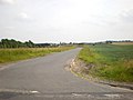
 A bend in the road in Plex Moss Lane - geograph.org.uk - 5018104.jpg 4,592 × 3,056; 5.79 MB
-
 A bend on Heathey Lane - geograph.org.uk - 4221123.jpg 640 × 480; 88 KB
-

-

-

-
 A drainage ditch and ripening crops - geograph.org.uk - 5072219.jpg 4,227 × 2,695; 7.72 MB
-
 A farm track on to Halsall Moss - geograph.org.uk - 5036137.jpg 4,592 × 3,056; 6.93 MB
-
 A field by Dicconsons Lane - geograph.org.uk - 4121273.jpg 4,592 × 3,056; 6.05 MB
-
 A growing crop soaking up the rain at Plex Moss - geograph.org.uk - 5036067.jpg 4,539 × 3,021; 6.37 MB
-

-
 A Syrphus hoverfly, Halsall - geograph.org.uk - 4552916.jpg 1,024 × 681; 84 KB
-
 A track at Plex Moss - geograph.org.uk - 5036016.jpg 4,532 × 3,016; 5.44 MB
-
 A track-footpath towards New Cut Brook - geograph.org.uk - 5072249.jpg 4,056 × 2,906; 7.64 MB
-
 Alder Lane - geograph.org.uk - 5036753.jpg 4,592 × 3,056; 7.91 MB
-
 All bagged up - geograph.org.uk - 5073783.jpg 4,487 × 2,021; 4.99 MB
-
 An undeveloped gap between houses - geograph.org.uk - 5080297.jpg 4,100 × 2,848; 7.81 MB
-
 Ancient Yew tree at St Cuthbert's, Halsall - geograph.org.uk - 4858197.jpg 961 × 1,200; 581 KB
-
 Anderson's Farm, Halsall Moss - geograph.org.uk - 3508572.jpg 640 × 480; 63 KB
-
 Approaching Mere Lane Bridge, Halsall - geograph.org.uk - 4858282.jpg 1,200 × 898; 864 KB
-
 Asmall Lane at Cut Lane - geograph.org.uk - 3444205.jpg 640 × 480; 47 KB
-
 Asmall Lane, Primrose Hill - geograph.org.uk - 6137646.jpg 800 × 600; 86 KB
-
 B5243 Road Bridge.jpg 3,648 × 2,736; 4.7 MB
-
 B5243 towards Birkdale - geograph.org.uk - 2739588.jpg 640 × 480; 81 KB
-
 Bales of Straw, Plex Moss Lane - geograph.org.uk - 4639723.jpg 640 × 480; 72 KB
-
 Barn and conversion, Bangor's Green - geograph.org.uk - 6137637.jpg 800 × 600; 106 KB
-
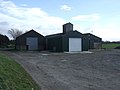
 Barn at Gettern Farm - geograph.org.uk - 5686299.jpg 640 × 427; 368 KB
-
 Barn House Farm, Carr Moss Lane, Halsall - geograph.org.uk - 4556429.jpg 1,024 × 681; 163 KB
-
 Barn, Malt House Farm - geograph.org.uk - 6137642.jpg 800 × 477; 55 KB
-

-
 Birkdale Kop (B5243) - geograph.org.uk - 4221111.jpg 640 × 480; 84 KB
-
 Bishop's Walk, Halsall Wildlife and Nature Area - geograph.org.uk - 4859044.jpg 1,200 × 898; 565 KB
-
 Black soil, Halsall Moss - geograph.org.uk - 5030535.jpg 1,024 × 682; 166 KB
-
 Blundell House - geograph.org.uk - 5129583.jpg 5,156 × 2,493; 1.93 MB
-
 Blundell House Farm - geograph.org.uk - 5129561.jpg 5,184 × 3,456; 1.53 MB
-
 Boundary Brook - geograph.org.uk - 5063675.jpg 4,500 × 2,995; 7.07 MB
-
 Bridge 26 on the Leeds and Liverpool Canal - geograph.org.uk - 3065918.jpg 4,427 × 3,056; 6.6 MB
-
 Bridge number 26, Leeds to Liverpool canal - geograph.org.uk - 5165149.jpg 1,000 × 750; 221 KB
-
 Bridge over dismantled railway - geograph.org.uk - 5063534.jpg 4,293 × 2,857; 7.45 MB
-
 Bridge over dismantled railway, Birkdale Cop - geograph.org.uk - 4742369.jpg 1,024 × 681; 164 KB
-

-

-
 Bristow Farm, Halsall Moss. - geograph.org.uk - 3100703.jpg 640 × 480; 82 KB
-
 Bungalows on Carr Moss Lane, Halsall - geograph.org.uk - 4556646.jpg 1,024 × 639; 123 KB
-
 Bus Stop on Halsall Road - geograph.org.uk - 5686182.jpg 640 × 427; 479 KB
-
 Buzzard on dead tree - geograph.org.uk - 2089911.jpg 1,200 × 843; 926 KB
-
 Cabbage field, Small Lane North, Halsall - geograph.org.uk - 4708757.jpg 1,024 × 681; 181 KB
-
 Canal bridge on Summerwood Lane, Halsall - geograph.org.uk - 4858226.jpg 1,200 × 899; 606 KB
-
 Canal workers monument - panoramio.jpg 1,200 × 900; 302 KB
-
 Carr Moss Farm - geograph.org.uk - 3990989.jpg 640 × 480; 52 KB
-
 Carr Moss Lane - geograph.org.uk - 2618153.jpg 640 × 480; 77 KB
-
 Carr Moss Lane - geograph.org.uk - 2621286.jpg 640 × 480; 46 KB
-
 Carr Moss Lane - geograph.org.uk - 2621315.jpg 640 × 480; 50 KB
-
 Carr Moss Lane - geograph.org.uk - 2621329.jpg 640 × 480; 71 KB
-
 Carr Moss Lane - geograph.org.uk - 2621350.jpg 640 × 480; 67 KB
-
 Carr Moss Lane - geograph.org.uk - 2621361.jpg 640 × 480; 50 KB
-
 Carr Moss Lane - geograph.org.uk - 2621456.jpg 640 × 480; 59 KB
-
 Carr Moss Lane - geograph.org.uk - 3990941.jpg 640 × 480; 58 KB
-
 Carr Moss Lane - geograph.org.uk - 3990947.jpg 640 × 480; 46 KB
-
 Carr Moss Lane - geograph.org.uk - 3990950.jpg 640 × 480; 44 KB
-
 Carr Moss Lane - geograph.org.uk - 3990971.jpg 640 × 480; 52 KB
-
 Carr Moss Lane - geograph.org.uk - 3990982.jpg 640 × 480; 77 KB
-
 Carr Moss Lane - geograph.org.uk - 3990986.jpg 640 × 480; 62 KB
-
 Carr Moss Lane - geograph.org.uk - 3991000.jpg 640 × 480; 76 KB
-
 Carr Moss Lane - geograph.org.uk - 5072278.jpg 3,989 × 2,720; 7.64 MB
-
 Carr Moss Lane reaches civilisation - geograph.org.uk - 5073771.jpg 4,592 × 3,056; 6.07 MB
-
 Christmas at St Cuthbert's Church, Halsall - geograph.org.uk - 4772218.jpg 1,024 × 682; 126 KB
-
 Clieves Hill from Halsall Lane - geograph.org.uk - 4552669.jpg 1,024 × 682; 150 KB
-
 Common Market Garden - geograph.org.uk - 95926.jpg 640 × 426; 86 KB
-
 Country road junction, Primrose Hill - geograph.org.uk - 6137644.jpg 800 × 600; 76 KB
-
 Crop field near Dicconson's Farm - geograph.org.uk - 6137634.jpg 800 × 600; 100 KB
-
 Crop field off Birkdale Kop - geograph.org.uk - 4221105.jpg 640 × 480; 68 KB
-
 Crops and a drainage ditch - geograph.org.uk - 5018047.jpg 4,532 × 3,016; 7.7 MB
-
 Crops and drainage ditch, Bangor's Green. - geograph.org.uk - 1866104.jpg 3,648 × 2,736; 2.49 MB
-
 Crops at Plex Moss - geograph.org.uk - 4828420.jpg 640 × 480; 493 KB
-
 Cut Lane - geograph.org.uk - 3065706.jpg 4,592 × 3,056; 7.03 MB
-
 Cut Lane off Asmall Lane - geograph.org.uk - 1385901.jpg 640 × 480; 53 KB
-

-
 Dicconson's Farm - geograph.org.uk - 6137633.jpg 800 × 600; 111 KB
-

-
 Digger in fields off New Cut Lane, Halsall - geograph.org.uk - 5348998.jpg 1,024 × 682; 241 KB
-
 Dismantled railway - geograph.org.uk - 1394582.jpg 640 × 480; 79 KB
-
 Drain off Birkdale Kop - geograph.org.uk - 4221116.jpg 640 × 480; 61 KB
-
 Drainage Ditch near Gettern Farm - geograph.org.uk - 3332805.jpg 2,589 × 2,441; 1.45 MB
-
 Drainage ditch near White Otter Farm - geograph.org.uk - 1498235.jpg 640 × 426; 78 KB
-
 Drainage ditch north of Barton - geograph.org.uk - 4859009.jpg 1,200 × 900; 553 KB
-
 Drainage ditch southeast of Halsall - geograph.org.uk - 1625656.jpg 640 × 480; 92 KB
-
 Drains near Carr Moss Farm - geograph.org.uk - 3990998.jpg 640 × 480; 90 KB
-
 East Crantum Farm - geograph.org.uk - 2708599.jpg 640 × 480; 60 KB
-
 East of Gettern Farm - geograph.org.uk - 5394175.jpg 4,128 × 2,322; 4.17 MB
-
 Entering Ainsdale - geograph.org.uk - 5394031.jpg 4,128 × 2,322; 2.69 MB
-
 Entrance to Renacres Hall Hospital - geograph.org.uk - 2708631.jpg 640 × 480; 111 KB
-
 Farm building near White Moss Farm - geograph.org.uk - 4221114.jpg 640 × 480; 83 KB
-
-

-

-
 Farmland and hedgerow - geograph.org.uk - 4221153.jpg 640 × 480; 45 KB
-
 Farmland and hedgerow - geograph.org.uk - 4221168.jpg 640 × 480; 122 KB
-
 Farmland at Barn House Farm - geograph.org.uk - 5394046.jpg 4,128 × 2,322; 3.1 MB
-
 Farmland at Gettern Farm - geograph.org.uk - 5394176.jpg 4,128 × 2,322; 2.67 MB
-
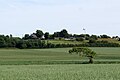
 Farmland near Halsall - geograph.org.uk - 5394069.jpg 4,128 × 2,322; 2.85 MB
-
 Farmland near Renacres Hall Hospital - geograph.org.uk - 4221170.jpg 640 × 480; 88 KB
-
-
 Farmland off New Street - geograph.org.uk - 3991001.jpg 640 × 480; 99 KB
-
 Farmland off Renacres Lane - geograph.org.uk - 4221154.jpg 640 × 480; 63 KB
-
 Farmland off Renacres Lane - geograph.org.uk - 4221174.jpg 640 × 480; 103 KB
-
 Farmland south of Carr Moss Lane - geograph.org.uk - 3990949.jpg 640 × 480; 82 KB
-
 Farmland towards Barton - geograph.org.uk - 3991005.jpg 640 × 480; 54 KB
-
 Farmland towards Brookside Farm - geograph.org.uk - 3990992.jpg 640 × 480; 50 KB
-
 Farmland, Gettern Mere Farm - geograph.org.uk - 3990976.jpg 640 × 480; 69 KB
-
 Farmland, Holt Farm - geograph.org.uk - 3990984.jpg 640 × 480; 79 KB
-
 Farmland, North Moor - geograph.org.uk - 4221188.jpg 640 × 480; 91 KB
-
 Farmland, White Otter Farm - geograph.org.uk - 3990944.jpg 640 × 480; 77 KB
-

-
 Field, Barn House Farm - geograph.org.uk - 3990960.jpg 640 × 480; 84 KB
-
 Fields at Bangor's Green, near Halsall - geograph.org.uk - 4552640.jpg 1,024 × 681; 217 KB
-
 Fields beside Renacres Lane, Halsall - geograph.org.uk - 4708830.jpg 1,024 × 681; 69 KB
-

-
 Fields in New Cut Lane, Halsall - geograph.org.uk - 5349000.jpg 1,024 × 682; 131 KB
-
 Fields on Carr Moss Lane, Halsall - geograph.org.uk - 4556404.jpg 1,024 × 681; 121 KB
-
 Fields, New Cut Lane, near Ainsdale - geograph.org.uk - 4555505.jpg 1,024 × 681; 173 KB
-
 Fine Jane's Brook - geograph.org.uk - 5075634.jpg 4,474 × 2,977; 5.68 MB
-

-
 Footbridge on path between Pinfold Lane and Diglake - geograph.org.uk - 5440665.jpg 1,200 × 1,600; 1.06 MB
-
 Footbridge on path off Plex Lane - geograph.org.uk - 4310671.jpg 1,024 × 768; 181 KB
-

-
 Footpath across Halsall Moss from Carr Moss Lane - geograph.org.uk - 4556426.jpg 1,024 × 681; 134 KB
-

-
 Footpath at North Moor - geograph.org.uk - 5440674.jpg 1,600 × 1,200; 926 KB
-

-

-
-
 Footpath between Plex Moss Lane and Station Road - geograph.org.uk - 4859012.jpg 900 × 1,200; 584 KB
-
 Footpath from Asmall Lane to Pinfold Lane - geograph.org.uk - 5440688.jpg 1,600 × 1,200; 924 KB
-
 Footpath to Bangor's Green - geograph.org.uk - 4271936.jpg 1,600 × 1,200; 663 KB
-
 Front Covert - geograph.org.uk - 3990966.jpg 640 × 480; 97 KB
-
 Front Covert - geograph.org.uk - 5072298.jpg 4,587 × 2,306; 7.23 MB
-
 Gargoyle, St. Cuthbert's Church - geograph.org.uk - 2800923.jpg 640 × 480; 68 KB
-
 Gettern Mere Farm - geograph.org.uk - 3990973.jpg 640 × 480; 62 KB
-

-
 Grange Farm - geograph.org.uk - 2711525.jpg 640 × 480; 79 KB
-
 Grange Farm Yard - geograph.org.uk - 4271924.jpg 1,600 × 1,200; 388 KB
-
 Green Kettle House Farm - geograph.org.uk - 1498091.jpg 640 × 409; 144 KB
-
 Green Kettle House, off Carr Moss Lane, Halsall - geograph.org.uk - 4556416.jpg 1,024 × 681; 137 KB
-
 Gregory Farm, Halsall Moss - geograph.org.uk - 4555420.jpg 1,024 × 681; 131 KB
-
 Gregory Farm, Halsall Moss - geograph.org.uk - 5509916.jpg 1,024 × 682; 227 KB
-
 Gregory Lane - geograph.org.uk - 5080179.jpg 4,034 × 2,089; 3.95 MB
-
 Gregory Lane at Gregory farm - geograph.org.uk - 3444300.jpg 640 × 480; 54 KB
-
 Gregory's Farm - geograph.org.uk - 1359635.jpg 640 × 480; 72 KB
-
 Halsall - geograph.org.uk - 5129420.jpg 5,184 × 3,254; 1.72 MB
-
 Halsall - geograph.org.uk - 5129425.jpg 5,174 × 2,239; 1.81 MB
-
 Halsall Cutting - geograph.org.uk - 4609143.jpg 2,560 × 1,920; 2.98 MB
-
 Halsall Cutting, Leeds ^ Liverpool Canal - geograph.org.uk - 4271949.jpg 1,600 × 1,200; 995 KB
-
 Halsall Hall - geograph.org.uk - 4552693.jpg 1,024 × 681; 176 KB
-
 Halsall Hill Bridge No 24 - geograph.org.uk - 5933529.jpg 640 × 561; 116 KB
-
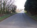
 Halsall Lane - geograph.org.uk - 6137636.jpg 800 × 600; 93 KB
-
 Halsall Lane with the crops looking healthy - geograph.org.uk - 4120725.jpg 4,218 × 2,184; 6.18 MB
-
 Halsall Lane, Halsall - geograph.org.uk - 4552674.jpg 1,024 × 681; 176 KB
-
 Halsall Parish Church - geograph.org.uk - 4552689.jpg 1,024 × 863; 185 KB
-
 Halsall Parish Church - geograph.org.uk - 4552939.jpg 1,024 × 681; 128 KB
-
 Halsall Road looking north - geograph.org.uk - 2920857.jpg 640 × 481; 91 KB
-
 Halsall Road near Gesterfeld Farm - geograph.org.uk - 2920856.jpg 640 × 481; 80 KB
-

-
 Halsall War Memorial - geograph.org.uk - 4639549.jpg 640 × 480; 80 KB
-

-
 Halsall Warehouse Bridge - geograph.org.uk - 3353108.jpg 640 × 427; 382 KB
-
 Halsall Warehouse Bridge and The Saracen's Head - geograph.org.uk - 4271933.jpg 1,600 × 1,200; 462 KB
-
-
 Halsall Wildlife and Nature Area - geograph.org.uk - 4552932.jpg 1,024 × 681; 323 KB
-
-
 Halsall, Summerwood Lane - geograph.org.uk - 3353106.jpg 640 × 481; 449 KB
-
 Harker's Bridge No 23 - geograph.org.uk - 5933583.jpg 640 × 457; 110 KB
-
 Harridge Lane (track) - geograph.org.uk - 5440704.jpg 1,600 × 1,200; 669 KB
-
 Haybales, Carr Moss Lane, Halsall - geograph.org.uk - 4556395.jpg 1,024 × 681; 105 KB
-
 Headbolt Farm - geograph.org.uk - 3348256.jpg 640 × 480; 190 KB
-
 Headbolt Lane, a track on Halsall Moss - geograph.org.uk - 4556433.jpg 1,024 × 681; 148 KB
-
 Heather Farm - geograph.org.uk - 5394052.jpg 4,128 × 2,322; 4.51 MB
-
 Heathey Lane (B5243) - geograph.org.uk - 4221118.jpg 640 × 480; 57 KB
-
 Heathey Lane - geograph.org.uk - 3562334.jpg 640 × 480; 52 KB
-
 Horse in a field, near Shirdley Hill - geograph.org.uk - 4740485.jpg 1,024 × 681; 137 KB
-
 Houses on Morris Lane - geograph.org.uk - 5686172.jpg 640 × 427; 387 KB
-

-
 Hulme's Bridge No 26 - geograph.org.uk - 5933412.jpg 640 × 429; 88 KB
-
 Hulme's Bridge, Leeds ^ Liverpool Canal - geograph.org.uk - 4271927.jpg 1,600 × 1,200; 725 KB
-
 I think they fly model aeroplanes here - geograph.org.uk - 5072328.jpg 4,366 × 2,906; 7.69 MB
-
 Is this some kind of launch pad^ - geograph.org.uk - 5080239.jpg 3,474 × 2,204; 6.38 MB
-
 Jackson's Common from North Moor Pit - geograph.org.uk - 5440681.jpg 1,600 × 903; 444 KB
-
 Kennet - geograph.org.uk - 5165159.jpg 1,000 × 750; 187 KB
-
 King's Covert - geograph.org.uk - 873588.jpg 640 × 480; 56 KB
-
 Lady Kathleen, Halsall - geograph.org.uk - 4858310.jpg 1,200 × 899; 615 KB
-
 Large field of curly kale - geograph.org.uk - 2800952.jpg 481 × 640; 135 KB
-
 Leeds and Liverpool Canal - geograph.org.uk - 1394240.jpg 640 × 480; 60 KB
-
 Leeds and Liverpool Canal - geograph.org.uk - 4221183.jpg 640 × 480; 68 KB
-
 Leeds and Liverpool Canal - geograph.org.uk - 4221185.jpg 640 × 480; 75 KB
-
 Leeds and Liverpool Canal - geograph.org.uk - 4828407.jpg 640 × 480; 355 KB
-
 Leeds and Liverpool Canal - geograph.org.uk - 5129418.jpg 4,881 × 3,305; 1.97 MB


_-_geograph.org.uk_-_4221111.jpg)


_near_Barn_House_Farm_-_geograph.org.uk_-_3990962.jpg)


_-_geograph.org.uk_-_4916168.jpg)


_-_geograph.org.uk_-_5440704.jpg)


_-_geograph.org.uk_-_4221118.jpg)


