Category:Hale Barns
Jump to navigation
Jump to search
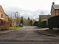
English: Hale Barns is a village and ward in the Metropolitan Borough of Trafford. Historically part of Cheshire, Hale Barns lies about south of Manchester city centre, 2 miles west of Manchester Airport and close to the River Bollin. According to the 2001 census, the village had a population of 9,143.
village in United Kingdom .jpg) | |||||
| Upload media | |||||
| Instance of | |||||
|---|---|---|---|---|---|
| Location | Trafford, Greater Manchester, North West England, England | ||||
 | |||||
Subcategories
This category has the following 8 subcategories, out of 8 total.
A
B
- The Bulls Head, Hale Barns (6 F)
H
- Hale Chapel (4 F)
- Halecroft (1 F)
S
- St Ambrose College, Hale Barns (23 F)
Media in category "Hale Barns"
The following 200 files are in this category, out of 278 total.
(previous page) (next page)-
 'Brookdale', Hale Road - geograph.org.uk - 3739286.jpg 4,000 × 3,000; 4.84 MB
-
 'The Greens', Hale Barns - geograph.org.uk - 3736732.jpg 3,886 × 2,915; 2.54 MB
-
 'Woodeaves' in the snow - geograph.org.uk - 3729576.jpg 5,905 × 3,937; 7.44 MB
-
 'Woodeaves', Hale Barns - geograph.org.uk - 4857598.jpg 1,596 × 1,047; 911 KB
-
 15th April, 2015 ... Hale Barns - geograph.org.uk - 4579511.jpg 5,606 × 3,788; 7.22 MB
-
 1980s housing on Hale Road - geograph.org.uk - 3743772.jpg 640 × 480; 95 KB
-
 A bright future^ - geograph.org.uk - 4117377.jpg 5,641 × 3,847; 6.71 MB
-
 A lot of Therapy^ - geograph.org.uk - 4116879.jpg 3,614 × 5,652; 5.27 MB
-
 A path in Halecroft Park - geograph.org.uk - 5568534.jpg 3,056 × 4,592; 7.68 MB
-
 A rare thatched cottage in Hale Barns, Cheshire - geograph.org.uk - 2331829.jpg 3,784 × 2,860; 4.78 MB
-
 A sylvan roundabout - geograph.org.uk - 4975870.jpg 3,768 × 2,792; 4.43 MB
-
 Afternoon sun in Hale Barns - geograph.org.uk - 4847110.jpg 1,463 × 1,055; 901 KB
-
 Airport intruders - geograph.org.uk - 5307934.jpg 4,000 × 3,000; 5.93 MB
-
 Along Hale Road - geograph.org.uk - 6377655.jpg 1,024 × 768; 220 KB
-
 Along Melrose Crescent - geograph.org.uk - 6377661.jpg 1,024 × 768; 142 KB
-
 Ambitious DIY ^ - geograph.org.uk - 4117066.jpg 5,829 × 3,886; 4.94 MB
-
 An Autumn kaleidoscope - geograph.org.uk - 4227311.jpg 5,370 × 3,549; 6.06 MB
-
 Ancient Beech Trees - geograph.org.uk - 4857957.jpg 1,075 × 1,612; 1.61 MB
-
 Approaching Hale Barns - geograph.org.uk - 4861344.jpg 3,883 × 2,796; 2.24 MB
-
 Art meets Shopping in Hale Barns - geograph.org.uk - 4579183.jpg 1,540 × 1,015; 849 KB
-
 Ash Lane at Tintern Drive - geograph.org.uk - 4040084.jpg 640 × 481; 77 KB
-
 Ashmeade - geograph.org.uk - 144087.jpg 640 × 480; 149 KB
-
 At a red light - geograph.org.uk - 4198513.jpg 5,234 × 3,626; 7.17 MB
-
 Autumn in Hale Barns - geograph.org.uk - 4830576.jpg 1,508 × 1,041; 1.05 MB
-
 Autumn in the woods - geograph.org.uk - 3735488.jpg 3,873 × 2,905; 4.17 MB
-
 Awaiting the builders - geograph.org.uk - 3750243.jpg 4,000 × 3,000; 4.16 MB
-
 Back of the Pavilion - geograph.org.uk - 3738863.jpg 3,839 × 2,920; 2.5 MB
-
 Barns Place - geograph.org.uk - 5899606.jpg 3,000 × 2,000; 1.07 MB
-
 Beginning the job - geograph.org.uk - 4117380.jpg 5,788 × 3,980; 5.85 MB
-
 Behind bars - geograph.org.uk - 3723269.jpg 3,947 × 2,960; 4.05 MB
-
 Bollinway, Hale Barns, Cheshire - geograph.org.uk - 2331806.jpg 3,940 × 2,955; 6.51 MB
-
 Booths, Hale Barns - geograph.org.uk - 5606567.jpg 6,000 × 4,000; 4.85 MB
-
 Boundary of Winmarith Drive, Hale Barns - geograph.org.uk - 3736725.jpg 3,796 × 2,944; 3.78 MB
-
 Bowling Green - geograph.org.uk - 4859341.jpg 1,588 × 1,032; 620 KB
-
 Broad Lane - geograph.org.uk - 4842525.jpg 1,692 × 1,114; 1.54 MB
-
 Broadway, Hale Barns, Cheshire - geograph.org.uk - 2330047.jpg 3,784 × 2,842; 4.34 MB
-
 Brooks Drive - geograph.org.uk - 6377475.jpg 1,024 × 768; 270 KB
-
 Buck Hall Farm, Hale Barns - geograph.org.uk - 4598906.jpg 1,528 × 1,015; 718 KB
-
 Buck Hall, Hale Road - geograph.org.uk - 4859334.jpg 1,688 × 1,122; 1.43 MB
-
 Building construction - geograph.org.uk - 4117009.jpg 5,631 × 3,784; 6.86 MB
-
 Building progresses in Hale Barns - geograph.org.uk - 4198527.jpg 5,508 × 3,841; 6.47 MB
-
 Building site entrance to St Ambrose College from Hale Road - geograph.org.uk - 2329385.jpg 3,926 × 2,944; 5.34 MB
-
 Bulls Head Hotel, Hale Barns - geograph.org.uk - 4861351.jpg 3,533 × 2,818; 1.95 MB
-
 Bus stop and shelter on Broad Lane - geograph.org.uk - 5182996.jpg 640 × 480; 112 KB
-
 Bus stop on Hale Road (A538) - geograph.org.uk - 5182979.jpg 640 × 480; 134 KB
-
 Bus Stops on Shay Lane - geograph.org.uk - 3973125.jpg 640 × 481; 337 KB
-
 Car park for Hale Barns Cricket Club - geograph.org.uk - 3738715.jpg 4,000 × 3,000; 4.86 MB
-
 Cattle near Well Green - geograph.org.uk - 5606593.jpg 6,000 × 4,000; 4.65 MB
-
 Centre of The Square, Hale Barns - geograph.org.uk - 3724086.jpg 3,641 × 2,726; 3.85 MB
-
 Cheshire grapes - geograph.org.uk - 4727506.jpg 2,698 × 1,897; 2.53 MB
-
 Church car park in snow - geograph.org.uk - 3747348.jpg 5,764 × 3,957; 7.09 MB
-
 Church of the Holy Angels - geograph.org.uk - 4836102.jpg 1,603 × 1,040; 872 KB
-
 Climate Change^ - geograph.org.uk - 6184101.jpg 3,094 × 4,375; 4.93 MB
-
 College car park - geograph.org.uk - 3728387.jpg 3,976 × 2,982; 3.74 MB
-
 Construction site, Wicker Lane - geograph.org.uk - 4707386.jpg 3,065 × 2,117; 2.34 MB
-
 Contractor's building site, St Ambrose - geograph.org.uk - 3728032.jpg 3,895 × 2,921; 4.32 MB
-
 Corner house - Winmarith Drive - geograph.org.uk - 3736722.jpg 3,922 × 2,942; 4.43 MB
-
 Cottage, Hale Road - geograph.org.uk - 5270311.jpg 3,602 × 2,540; 1.28 MB
-
 Demise of The Square (2) - geograph.org.uk - 3744581.jpg 3,756 × 2,688; 2.78 MB
-
 Demise of The Square (3) - geograph.org.uk - 3744589.jpg 3,725 × 2,789; 3.81 MB
-
 Demise of The Square (4) - geograph.org.uk - 3744592.jpg 4,000 × 3,000; 4.9 MB
-
 Demise of The Square - geograph.org.uk - 3744576.jpg 3,873 × 2,790; 5.07 MB
-
 Detached residence on Hale Road - geograph.org.uk - 3736720.jpg 3,919 × 2,940; 4.99 MB
-
 Don't post a letter here^ - geograph.org.uk - 3750254.jpg 3,918 × 2,938; 4.18 MB
-
 Doomsday comes to Hale Barns - geograph.org.uk - 3723263.jpg 3,955 × 2,966; 4.17 MB
-
 Driveway in the snow - geograph.org.uk - 3747363.jpg 5,919 × 3,946; 7.16 MB
-
 Driveway to St Ambrose - geograph.org.uk - 3729546.jpg 1,018 × 1,543; 550 KB
-
 Elizabeth II postbox on Booth Lane - geograph.org.uk - 5185101.jpg 1,307 × 2,033; 503 KB
-
 Enclosed footpath from Winmarith Drive - geograph.org.uk - 3736818.jpg 3,895 × 2,922; 4.5 MB
-
 Entrance sign H.B.C.C. - Brooks' Drive - geograph.org.uk - 3738861.jpg 3,932 × 2,949; 2.46 MB
-
 Entrance to Brooks' Drive, Hale Road - geograph.org.uk - 3739273.jpg 3,890 × 2,902; 4.6 MB
-
 Entrance to Hale Barns C.C. - geograph.org.uk - 3738705.jpg 3,743 × 2,636; 3.9 MB
-
 Entrance to Holy Angels and St Ambrose - geograph.org.uk - 3747328.jpg 5,909 × 3,939; 7.79 MB
-
 Fallen Blossom - geograph.org.uk - 5347279.jpg 3,602 × 2,457; 5.61 MB
-
 Fields off Hasty Lane - geograph.org.uk - 6376985.jpg 1,024 × 768; 203 KB
-
 Footpath joining Broad Lane to Wicker Lane - geograph.org.uk - 3728335.jpg 4,000 × 3,000; 4.66 MB
-
 Footpath leading to Wicker Lane - geograph.org.uk - 3728351.jpg 3,848 × 2,886; 4.71 MB
-
 Former farmhouse of Elm Farm, Hale Road - geograph.org.uk - 3743757.jpg 3,776 × 2,811; 5.02 MB
-
 Former farmhouse, Hale Barns - geograph.org.uk - 4599575.jpg 1,536 × 1,018; 859 KB
-
 Former front driveway of 'Woodeaves' - geograph.org.uk - 3727761.jpg 3,875 × 2,907; 4.3 MB
-
 Former Unicorn Hotel, Hale Barns - geograph.org.uk - 3723615.jpg 3,632 × 2,673; 3.04 MB
-
 Framing the future - geograph.org.uk - 4117375.jpg 5,383 × 3,707; 5.39 MB
-
 Front entrance, St Ambrose - geograph.org.uk - 3728372.jpg 4,000 × 3,000; 4.49 MB
-
 Front view of 'Woodeaves', Hale Barns - geograph.org.uk - 3728314.jpg 3,559 × 2,669; 2.49 MB
-
 Gardens at Prospect Drive - geograph.org.uk - 4859504.jpg 1,508 × 1,052; 940 KB
-
 Gates of St Ambrose College, Hale Barns - geograph.org.uk - 3728434.jpg 1,599 × 1,051; 1.35 MB
-
 Grazing, Davenport Green - geograph.org.uk - 5182959.jpg 640 × 480; 58 KB
-
 Hale Barns (Trafford Council Ward).png 1,400 × 1,270; 276 KB
-
 Hale Barns at sunset - geograph.org.uk - 4117379.jpg 5,683 × 3,964; 5.57 MB
-
 Hale Barns Booths - geograph.org.uk - 6377657.jpg 1,024 × 768; 164 KB
-
 Hale Barns Cricket Ground - geograph.org.uk - 3738723.jpg 3,779 × 2,814; 3.69 MB
-
 Hale Barns in happier times (1980s) - geograph.org.uk - 3729659.jpg 1,473 × 1,051; 739 KB
-
 Hale Barns reaches Ground Zero - geograph.org.uk - 3744569.jpg 3,914 × 2,936; 3.03 MB
-
 Hale Barns reconstructed - geograph.org.uk - 4117372.jpg 5,430 × 3,682; 7.53 MB
-
 Hale Barns resurrected - geograph.org.uk - 4116859.jpg 5,188 × 3,461; 5.8 MB
-
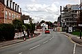
 Hale Barns roadworks 1 - geograph.org.uk - 4198917.jpg 6,000 × 4,000; 7.27 MB
-
 Hale Barns roadworks 2 - geograph.org.uk - 4198921.jpg 5,421 × 3,624; 7.04 MB
-
 Hale Barns roadworks 3 - geograph.org.uk - 4198929.jpg 5,310 × 3,561; 6.61 MB
-
 Hale Barns roadworks 4 - geograph.org.uk - 4198934.jpg 5,686 × 3,831; 5.34 MB
-
 Hale Barns roadworks 5 - geograph.org.uk - 4198945.jpg 5,248 × 3,372; 7.39 MB
-
 Hale Barns Village - geograph.org.uk - 4820648.jpg 1,574 × 1,045; 1,005 KB
-
 Hale Barns, Broad Lane - geograph.org.uk - 3973112.jpg 640 × 480; 324 KB
-
 Hale Barns, Broad Lane - geograph.org.uk - 3973114.jpg 640 × 481; 340 KB
-
 Hale Barns, Ringway Golf Club - geograph.org.uk - 3973192.jpg 640 × 482; 267 KB
-
 Hale Barns, Shay Lane - geograph.org.uk - 3973194.jpg 640 × 481; 324 KB
-
 Hale Chapel Hall, Hale Barns (geograph 2603675).jpg 1,280 × 960; 571 KB
-
 Hale Road (A538), Hale Barns - geograph.org.uk - 2603699.jpg 640 × 480; 171 KB
-
 Hale Road near Hasty Lane - geograph.org.uk - 6377012.jpg 1,024 × 768; 243 KB
-
 Hale Road near Rydal Drive - geograph.org.uk - 6377656.jpg 1,024 × 768; 175 KB
-
 Hale Road passing Halecroft Park - geograph.org.uk - 5605810.jpg 5,760 × 3,840; 7.17 MB
-
 Hale Road, Hale Barns - geograph.org.uk - 3738387.jpg 3,597 × 2,632; 4.98 MB
-
 Hale Road, Hale Barns - geograph.org.uk - 3744701.jpg 3,635 × 2,841; 2.41 MB
-
 Hale Road, Hale Barns - geograph.org.uk - 4198519.jpg 5,787 × 3,858; 5.9 MB
-
 Hale Road, Hale Barns - geograph.org.uk - 4608268.jpg 1,516 × 992; 1,023 KB
-
 Hale Road, Hale Barns - geograph.org.uk - 4608271.jpg 1,528 × 1,013; 841 KB
-
 Hale Road, Hale barns - geograph.org.uk - 4707464.jpg 3,444 × 2,135; 2.65 MB
-
 Hale Road, Hale Barns - geograph.org.uk - 4836104.jpg 1,516 × 1,072; 746 KB
-
 Hale Road, Hale Barns - geograph.org.uk - 4838312.jpg 1,684 × 1,102; 1.17 MB
-
 Halebank Farm, Hale Barns, Cheshire - geograph.org.uk - 2325080.jpg 3,565 × 2,718; 3.91 MB
-
 Halecroft Park - geograph.org.uk - 5568546.jpg 4,494 × 2,991; 7.87 MB
-
 Halecroft Park - geograph.org.uk - 6377659.jpg 1,024 × 768; 193 KB
-
 Hanging on^ - geograph.org.uk - 3723279.jpg 3,841 × 2,881; 4.24 MB
-
 Hasty Lane from the underpass - geograph.org.uk - 6376979.jpg 1,024 × 768; 369 KB
-
 Hawley House - geograph.org.uk - 4841322.jpg 1,692 × 1,114; 745 KB
-
 Hawley Lane - geograph.org.uk - 5606546.jpg 6,000 × 4,000; 5.83 MB
-
 High Elm Road at Longsides Road - geograph.org.uk - 4040136.jpg 640 × 480; 43 KB
-
 Holy Angels at evening - geograph.org.uk - 4841100.jpg 1,639 × 1,052; 1.03 MB
-
 Holy Angels Catholic Church, Hale Barns - geograph.org.uk - 4707448.jpg 3,504 × 2,336; 3.87 MB
-

-
 Home improvements - geograph.org.uk - 3744708.jpg 3,893 × 2,905; 4.83 MB
-
 Hotel and car park on a wet morning - geograph.org.uk - 4358211.jpg 4,608 × 3,456; 3.29 MB
-
 Hotel, Hale Barns - geograph.org.uk - 4861361.jpg 3,806 × 2,766; 2.61 MB
-
 House in Broad Lane - geograph.org.uk - 4851608.jpg 1,671 × 1,096; 1.17 MB
-
 House in Brooks Drive, Hale Barns - geograph.org.uk - 4600482.jpg 1,348 × 900; 722 KB
-
 House Inflation, Hale Barns - geograph.org.uk - 4861363.jpg 4,000 × 3,000; 2.9 MB
-
 Houses on Brooks' Drive, Hale Barns - geograph.org.uk - 3738694.jpg 3,877 × 2,908; 2.65 MB
-
 Houses on Hale Road, Hale Barns - geograph.org.uk - 4857637.jpg 1,615 × 1,089; 988 KB
-
 In Hale Barns village - geograph.org.uk - 4836109.jpg 1,470 × 1,088; 1.11 MB
-
 Junction of Barns Place and Tithebarn Road - geograph.org.uk - 5899603.jpg 3,000 × 2,000; 1.24 MB
-
 Junction of Broad Lane and Bankhall Lane - geograph.org.uk - 5147107.jpg 1,600 × 1,067; 432 KB
-
 Junction of Broad Lane and Bankhall Lane, Hale Barns - geograph.org.uk - 1921508.jpg 1,826 × 1,047; 804 KB
-
 Junction of Hale Road with High Elm Road - geograph.org.uk - 3739118.jpg 4,000 × 3,000; 4.79 MB
-
 Large detached residence in Hale Barns - geograph.org.uk - 2330081.jpg 3,726 × 2,798; 4.21 MB
-
 Large private residence - geograph.org.uk - 4598931.jpg 1,522 × 1,017; 710 KB
-
 Last man standing^ - geograph.org.uk - 3744599.jpg 3,770 × 2,822; 2.31 MB
-
 Last post^ - geograph.org.uk - 3723683.jpg 4,000 × 3,000; 4.3 MB
-
 Laurel in bloom - geograph.org.uk - 4749221.jpg 1,673 × 1,185; 1.35 MB
-
 Listed but disappearing - geograph.org.uk - 4975915.jpg 3,766 × 2,661; 3.5 MB
-
 Lone survivor - geograph.org.uk - 3723289.jpg 3,795 × 2,780; 4.02 MB
-
 Looking good but tasting awful - geograph.org.uk - 4727509.jpg 2,565 × 1,946; 1.78 MB
-
 Loyalty rewarded - geograph.org.uk - 4579513.jpg 6,000 × 4,000; 6.1 MB
-
 Luxury transport for College boys - geograph.org.uk - 3728438.jpg 3,829 × 2,872; 2.81 MB
-
 Majestic Wine Warehouse - geograph.org.uk - 5606557.jpg 6,000 × 4,000; 4.8 MB
-

-
 Mature trees at the edge of Flaxhigh Covert - geograph.org.uk - 3747304.jpg 3,769 × 2,827; 6.09 MB
-
 Melrose Crescent - geograph.org.uk - 6377660.jpg 1,024 × 768; 152 KB
-
 Melrose Crescent junction with Winchester Road - geograph.org.uk - 6378408.jpg 1,024 × 768; 145 KB
-
 Metal gate - edge of Ringway Golf Course - geograph.org.uk - 3738326.jpg 3,939 × 2,955; 6.92 MB
-
 Mini roundabout in Hale Barns - geograph.org.uk - 5606533.jpg 6,000 × 4,000; 7.31 MB
-
 Minor road junction on Thorley Lane - geograph.org.uk - 5182963.jpg 640 × 480; 139 KB
-
 Mobile covers ... uncovered - geograph.org.uk - 3738735.jpg 3,833 × 2,872; 3.96 MB
-
 Modern house in Bollinway, Hale Barns - geograph.org.uk - 2331814.jpg 3,775 × 2,831; 4.96 MB
-
 Modern townhouses in Hale Barns - geograph.org.uk - 3735086.jpg 3,733 × 2,958; 3.09 MB
-
 More wrought iron gates in Hale Barns - geograph.org.uk - 2331823.jpg 3,847 × 2,837; 4.81 MB
-
 Motorway Bridge, Hale Barns - geograph.org.uk - 4975874.jpg 3,987 × 2,990; 4.61 MB
-
 Near the end of Winmarith Drive - geograph.org.uk - 3736775.jpg 3,830 × 2,873; 4.19 MB
-
 New eatery in Hale Barns - geograph.org.uk - 3735457.jpg 3,615 × 2,709; 1.84 MB
-
 New home, Hale Barns - geograph.org.uk - 4861368.jpg 3,922 × 2,844; 4.66 MB
-
 New shop on the block - geograph.org.uk - 3735502.jpg 3,556 × 2,731; 2.25 MB
-
 No shops, no shoppers^ - geograph.org.uk - 3750247.jpg 3,336 × 2,474; 3.3 MB
-

-
 October leaves leaves - geograph.org.uk - 4227350.jpg 5,657 × 3,857; 5.6 MB
-
 On the fringes of Hale Barns - geograph.org.uk - 3739457.jpg 2,828 × 1,924; 1.02 MB
-
 On Tithebarn Road - geograph.org.uk - 4117051.jpg 6,000 × 4,000; 5.44 MB
-
 One of the few remaining cottages in Hale Barns - geograph.org.uk - 2330038.jpg 3,904 × 2,854; 5.25 MB
-
 Only half a square - geograph.org.uk - 3723284.jpg 3,472 × 2,625; 2.99 MB
-
 Open Air Art (1) - geograph.org.uk - 4841400.jpg 1,637 × 1,007; 1.39 MB
-
 Open Air Art (2) - geograph.org.uk - 4841407.jpg 1,674 × 1,093; 1.31 MB
-
 Open Air Art (3) - geograph.org.uk - 4841414.jpg 1,346 × 971; 1.14 MB
-
 Open Air Art (4) - geograph.org.uk - 4841425.jpg 1,700 × 1,126; 1.46 MB
-
 Open Air Art (5) - geograph.org.uk - 4841435.jpg 1,696 × 1,110; 1.41 MB
-
 Original building of St Ambrose College, Hale Barns - geograph.org.uk - 2329362.jpg 3,554 × 2,710; 3.88 MB
-
 Parkland off Shay Lane - geograph.org.uk - 5182966.jpg 640 × 480; 75 KB
-
 Path in Halecroft Park - geograph.org.uk - 5606576.jpg 5,358 × 3,572; 7.39 MB
-
 Pavement beside Hale Road - geograph.org.uk - 6377013.jpg 1,024 × 768; 225 KB
-
 Playing Field, Hale Barns - geograph.org.uk - 4838855.jpg 1,688 × 1,106; 1.1 MB
-
 Playing fields in snow - geograph.org.uk - 3747317.jpg 5,808 × 3,873; 6.16 MB
-
 Private residence, Hale Road - geograph.org.uk - 4598945.jpg 1,512 × 1,014; 732 KB
-
 Prospect Drive, Hale Barns - geograph.org.uk - 4838863.jpg 1,688 × 1,122; 1.55 MB
-
 Prospect Drive, Hale Barns - geograph.org.uk - 4857948.jpg 1,688 × 1,122; 1.73 MB
-
 Prospect House, Hale Barns - geograph.org.uk - 3735153.jpg 601 × 443; 205 KB
-
 Public footpath south of St Ambrose - geograph.org.uk - 3728340.jpg 3,907 × 2,930; 3.87 MB
-
 Ravenwood Drive, Hale Barns - geograph.org.uk - 3738294.jpg 3,747 × 2,827; 4.25 MB
-
 Rear view of 'Woodeaves', Hale Barns - geograph.org.uk - 3727732.jpg 3,931 × 2,949; 4.15 MB
-
 Recreation Ground, Hale Barns - geograph.org.uk - 4600454.jpg 1,517 × 1,017; 667 KB
-
 Ring before entering^ - geograph.org.uk - 3739301.jpg 3,662 × 2,907; 4.73 MB
-
 Ringway Golf Club - geograph.org.uk - 3735475.jpg 3,882 × 2,912; 2.7 MB
-
 Ringway Golf Club - geograph.org.uk - 5606490.jpg 6,000 × 4,000; 4.23 MB
-
 Ringway Golf Clubhouse, Hale Barns - geograph.org.uk - 3973186.jpg 640 × 481; 265 KB
-
 Road junction in Well Green - geograph.org.uk - 5608086.jpg 6,000 × 4,000; 4.09 MB


_-_geograph.org.uk_-_5182979.jpg)


_-_geograph.org.uk_-_3744581.jpg)
_-_geograph.org.uk_-_3744589.jpg)
_-_geograph.org.uk_-_3744592.jpg)


.png)


_-_geograph.org.uk_-_3729659.jpg)


.jpg)
,_Hale_Barns_-_geograph.org.uk_-_2603699.jpg)


_-_geograph.org.uk_-_4841400.jpg)
_-_geograph.org.uk_-_4841407.jpg)
_-_geograph.org.uk_-_4841414.jpg)
_-_geograph.org.uk_-_4841425.jpg)
_-_geograph.org.uk_-_4841435.jpg)


