Category:Hale Bank
Jump to navigation
Jump to search

English: Hale Bank is a settlement and (as Halebank) a civil parish in the borough of Halton, Cheshire, England. It was created by the Halton (Parish Electoral Arrangements) Order 2008. The parish lies in the western part of the town of Widnes.
village and civil parish in Halton, Cheshire, England, UK  | |||||
| Upload media | |||||
| Instance of | |||||
|---|---|---|---|---|---|
| Location | Halton, Cheshire, North West England, England | ||||
 | |||||
Subcategories
This category has the following 17 subcategories, out of 17 total.
- Benchmarks in Halebank (4 F)
B
- Beehive Inn, Halebank (7 F)
C
- Clap Gate Hotel (4 F)
- Cock & Trumpet, Halebank (4 F)
H
- Halebank Park (3 F)
- Halebank Terrace (3 F)
L
- Lovel Field, Halebank (7 F)
M
- Mersey View, Halebank (4 F)
O
- Oddfellows Hall, Halebank (6 F)
R
- Ramsbrook Farm, Hale Bank (4 F)
- Ramsbrook Lane bridge (5 F)
W
Media in category "Hale Bank"
The following 128 files are in this category, out of 128 total.
-
 A bend in Hale Road - geograph.org.uk - 2852205.jpg 4,454 × 2,964; 6.19 MB
-
 At first glance these cliffs look natural - geograph.org.uk - 2852230.jpg 4,592 × 3,056; 6.81 MB
-
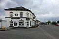
 Beehive Inn - geograph.org.uk - 1835186.jpg 640 × 480; 62 KB
-

-
 Burnt Mill Cottages - geograph.org.uk - 5354489.jpg 640 × 480; 431 KB
-
 Burnt Mill House at Hale Bank - geograph.org.uk - 226551.jpg 640 × 480; 118 KB
-
 Burnt Mill Lane - geograph.org.uk - 2866655.jpg 640 × 480; 63 KB
-
 Carr Lane from Carr Lane crossroads.jpg 4,972 × 3,224; 10.08 MB
-
 Chemical works, Hale Bank - geograph.org.uk - 2864584.jpg 640 × 480; 54 KB
-
 Closed gate to a field track - geograph.org.uk - 1368730.jpg 640 × 425; 100 KB
-
 Co-operative, Hale Road, Halebank.jpg 5,184 × 3,456; 6.38 MB
-
 Container in sidings - geograph.org.uk - 4948726.jpg 640 × 426; 57 KB
-
 Containers in sidings - geograph.org.uk - 4948730.jpg 640 × 426; 70 KB
-
 Crop field, Hale Gate Farm - geograph.org.uk - 2864532.jpg 640 × 480; 82 KB
-

-
 Ditton Brook - geograph.org.uk - 24431.jpg 640 × 480; 125 KB
-
 Ditton Brook - geograph.org.uk - 2864571.jpg 640 × 480; 39 KB
-

-
 Entrance to sewage works - geograph.org.uk - 2864546.jpg 640 × 480; 67 KB
-
 Farmland by the railway - geograph.org.uk - 4944249.jpg 640 × 317; 37 KB
-
 Farmland off Higher Road - geograph.org.uk - 2866654.jpg 640 × 480; 68 KB
-
 Farmland, Hale Bank - geograph.org.uk - 2864542.jpg 640 × 480; 63 KB
-
 Fields at Hale Bank - geograph.org.uk - 1888048.jpg 4,224 × 3,168; 2.17 MB
-
 Footbridge over Ditton Brook - geograph.org.uk - 2864574.jpg 480 × 640; 80 KB
-
 Footbridge over Ditton Brook and Steward's Brook - geograph.org.uk - 3960150.jpg 4,320 × 3,240; 4.13 MB
-
 Foundry Road roundabout - geograph.org.uk - 1835212.jpg 640 × 480; 64 KB
-

-
 Goldmine Bar and Grill, Hale Bank - geograph.org.uk - 5354477.jpg 640 × 427; 311 KB
-

-
-
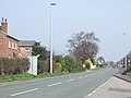
 Hale Bank Road heading west - geograph.org.uk - 2866652.jpg 640 × 480; 68 KB
-
 Hale Bank, River Mersey - geograph.org.uk - 2864551.jpg 640 × 480; 80 KB
-
 Hale Court - geograph.org.uk - 2829935.jpg 2,350 × 2,355; 3.55 MB
-
 Hale Gate Road - geograph.org.uk - 2864539.jpg 640 × 480; 63 KB
-
 Hale Gate Road - geograph.org.uk - 5354471.jpg 640 × 480; 427 KB
-
 Hale Gate Road and Hale Gate Farm. - geograph.org.uk - 1722481.jpg 640 × 480; 45 KB
-
 Hale Gate Road towards Hale Bank - geograph.org.uk - 2864536.jpg 640 × 480; 121 KB
-
 Hale Road Co-Op - geograph.org.uk - 1835201.jpg 640 × 480; 53 KB
-
 Hale Road heading south - geograph.org.uk - 2866647.jpg 640 × 480; 92 KB
-
 Hale Road, Halebank.JPG 4,320 × 3,240; 2.98 MB
-
 Halebank Primary School - geograph.org.uk - 330335.jpg 640 × 480; 82 KB
-
 Halebank Road from Carr Lane crossroads.jpg 5,016 × 3,260; 10.18 MB
-
 Halebank, Widnes, Cheshire (10).JPG 4,320 × 3,240; 5.02 MB
-
 Halebank, Widnes, Cheshire (11).JPG 4,320 × 3,240; 4.95 MB
-
 Halebank, Widnes, Cheshire (12).JPG 4,320 × 3,240; 3.72 MB
-
 Halebank, Widnes, Cheshire (13).JPG 4,320 × 3,240; 3.69 MB
-
 Halebank, Widnes, Cheshire (23).JPG 4,320 × 3,240; 3.07 MB
-
 Halebank, Widnes, Cheshire (24).JPG 4,320 × 3,240; 3.14 MB
-
 Halebank, Widnes, Cheshire (28).JPG 4,320 × 3,240; 3.67 MB
-
 Halebank, Widnes, Cheshire (29).JPG 4,320 × 3,240; 3.14 MB
-
 Halebank, Widnes, Cheshire (3).JPG 4,320 × 3,240; 3.95 MB
-
 Halebank, Widnes, Cheshire (36).JPG 4,320 × 3,240; 3.96 MB
-
 Halebank, Widnes, Cheshire (37).JPG 4,320 × 3,240; 2.63 MB
-
 Halebank, Widnes, Cheshire (38).JPG 4,320 × 3,240; 3.87 MB
-
 Halebank, Widnes, Cheshire (39).JPG 4,320 × 3,240; 4.52 MB
-
 Halebank, Widnes, Cheshire (4).JPG 4,320 × 3,240; 5.03 MB
-
 Halebank, Widnes, Cheshire (40).JPG 4,320 × 3,240; 3.52 MB
-
 Halebank, Widnes, Cheshire (41).JPG 4,320 × 3,240; 2.95 MB
-
 Halebank, Widnes, Cheshire (42).JPG 4,320 × 3,240; 2.72 MB
-
 Halebank, Widnes, Cheshire (43).JPG 4,320 × 3,240; 4.21 MB
-
 Halebank, Widnes, Cheshire (46).JPG 4,320 × 3,240; 3.62 MB
-
 Halebank, Widnes, Cheshire (47).JPG 4,320 × 3,240; 2.78 MB
-
 Halebank, Widnes, Cheshire (48).JPG 4,320 × 3,240; 3.64 MB
-
 Halebank, Widnes, Cheshire (49).JPG 4,320 × 3,240; 4.02 MB
-
 Halebank, Widnes, Cheshire (5).JPG 4,320 × 3,240; 4.92 MB
-
 Halebank, Widnes, Cheshire (50).JPG 4,320 × 3,240; 2.96 MB
-
 Halebank, Widnes, Cheshire (51).JPG 4,320 × 3,240; 3.1 MB
-
 Halebank, Widnes, Cheshire (52).JPG 4,320 × 3,240; 4.4 MB
-
 Halebank, Widnes, Cheshire (53).JPG 4,320 × 3,240; 3.38 MB
-
 Halebank, Widnes, Cheshire (6).JPG 4,320 × 3,240; 5.16 MB
-
 Halebank, Widnes, Cheshire (7).JPG 4,320 × 3,240; 4.84 MB
-
 Halebank, Widnes, Cheshire (8).JPG 4,320 × 3,240; 2.27 MB
-
 Halebank, Widnes, Cheshire (9).JPG 4,320 × 3,240; 4.12 MB
-
 Higher Road - geograph.org.uk - 2829968.jpg 4,592 × 3,056; 4.28 MB
-
 Hope Farm and Riding School, Halebank - geograph.org.uk - 330328.jpg 640 × 480; 62 KB
-
 Houses, Old Higher Rd - geograph.org.uk - 4948708.jpg 640 × 341; 29 KB
-
 Jaguar Land Rover Halewood motor factory, Speke - geograph.org.uk - 6194913.jpg 1,024 × 768; 160 KB
-
 Layby at the side of Higher Road - geograph.org.uk - 5354484.jpg 640 × 427; 416 KB
-

-
 Lower Road from Carr Lane crossroads.jpg 5,036 × 3,052; 7.79 MB
-
 Manor Farm - geograph.org.uk - 4944250.jpg 640 × 291; 30 KB
-
 Mersey View pub, Hale Bank - geograph.org.uk - 3960165.jpg 4,320 × 3,240; 3.67 MB
-
 Mouth of Ditton Brook - geograph.org.uk - 4936841.jpg 640 × 356; 45 KB
-
 No birds from the bird hide, but I did get a rabbit - geograph.org.uk - 2852389.jpg 1,451 × 967; 1.19 MB
-
 Obelisk next to Trans Pennine Trail - geograph.org.uk - 2056567.jpg 1,600 × 1,198; 588 KB
-
 Old Yugo Garage - Hale Bank - geograph.org.uk - 1888068.jpg 4,224 × 3,168; 2.2 MB
-
 Path off the Trans Pennine Trail - geograph.org.uk - 2864562.jpg 640 × 480; 163 KB
-
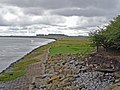
 Pickering's Pasture - geograph.org.uk - 2786504.jpg 640 × 480; 44 KB
-
 Pickering's Pasture - geograph.org.uk - 4972103.jpg 2,784 × 1,568; 2.13 MB
-
 Pickering's Pasture, Hale Bank - geograph.org.uk - 2785154.jpg 640 × 480; 92 KB
-
 Pickerings Pasture - geograph.org.uk - 24420.jpg 640 × 480; 124 KB
-
 Pickerings Pasture car park. - geograph.org.uk - 1722473.jpg 640 × 480; 97 KB
-
 Railway towards Liverpool - geograph.org.uk - 2866646.jpg 480 × 640; 100 KB
-
 Ramsbrook Lane - geograph.org.uk - 2111020.jpg 640 × 480; 59 KB
-
 Ramsbrook Lane-Higher Road junction - geograph.org.uk - 1835177.jpg 640 × 480; 57 KB
-
 Rivers Mersey and Weaver from height - geograph.org.uk - 6199957.jpg 1,024 × 768; 145 KB
-
 Rough grassland - geograph.org.uk - 4948714.jpg 640 × 404; 55 KB
-
 Runcorn Docks - geograph.org.uk - 2072790.jpg 640 × 426; 39 KB
-

-
 Shore House, Hale Bank - geograph.org.uk - 330371.jpg 640 × 480; 172 KB
-
 The Beehive Inn - geograph.org.uk - 2829946.jpg 4,083 × 2,659; 6.19 MB
-
 The Beehive Inn - geograph.org.uk - 2866650.jpg 640 × 480; 67 KB
-
 The Beehive Inn, Halebank Road - geograph.org.uk - 5354479.jpg 640 × 427; 393 KB
-

-
 The Co-op on Hale Road, Hale Bank - geograph.org.uk - 2786505.jpg 640 × 480; 58 KB
-
 The entrance to Pickering's Pasture and Pennine Way - geograph.org.uk - 2056473.jpg 1,600 × 1,198; 630 KB
-
 The Mersey View at Hale Bank - geograph.org.uk - 2056469.jpg 1,600 × 1,198; 402 KB
-
 The Mersey Way at Halebank - geograph.org.uk - 2504713.jpg 800 × 600; 140 KB
-

-

-
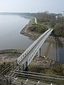
 The Runcorn Bridge - geograph.org.uk - 2852161.jpg 4,549 × 2,299; 5.65 MB
-
 The track by Little Boar's Wood to Big Boar's Wood - geograph.org.uk - 2852879.jpg 4,460 × 2,973; 6.84 MB
-
 The Trans Pennine Trail at Hale Bank - geograph.org.uk - 2056477.jpg 1,600 × 1,198; 406 KB
-

-

-
 The Trans Pennine Trail at the start of Pickering Pasture - geograph.org.uk - 2851757.jpg 4,319 × 2,875; 5.59 MB
-
 The view down river from the hide - geograph.org.uk - 2852183.jpg 4,522 × 3,010; 7.42 MB
-
 The zig zag steps down to the bridge over Ditton Brook - geograph.org.uk - 2056572.jpg 1,600 × 1,198; 510 KB
-

-

-
 Trans Pennine Trail, Hale Bank - geograph.org.uk - 2864555.jpg 640 × 480; 132 KB
-

-
 Trans-Pennine Trail - geograph.org.uk - 2072780.jpg 640 × 426; 78 KB
-

-
 Post box on Mersey View Road.jpg 3,240 × 4,866; 8.99 MB
-
 Post box at the Beehive, Halebank Road.jpg 3,375 × 5,144; 14.35 MB
-
 Post box at Old Higher Road.jpg 3,456 × 5,184; 11.11 MB
-
 Post box at the Co-op, Hale Road.jpg 3,102 × 4,224; 7.17 MB


.JPG)
.JPG)
.JPG)
.JPG)
.JPG)
.JPG)
.JPG)
.JPG)
.JPG)
.JPG)
.JPG)
.JPG)
.JPG)
.JPG)
.JPG)
.JPG)
.JPG)
.JPG)
.JPG)
.JPG)
.JPG)
.JPG)
.JPG)
.JPG)
.JPG)
.JPG)
.JPG)
.JPG)
.JPG)
.JPG)
.JPG)


