Category:Halde Hoppenbruch
Jump to navigation
Jump to search
| Object location | | View all coordinates using: OpenStreetMap |
|---|
This is the category of the protected area listed at WDPA under the ID 321325
|
 | |||||
| Upload media | |||||
| Instance of | |||||
|---|---|---|---|---|---|
| Located in protected area | |||||
| Location | Herten, Recklinghausen, Münster Government Region, North Rhine-Westphalia, Germany | ||||
| Elevation above sea level |
| ||||
 | |||||
Subcategories
This category has the following 3 subcategories, out of 3 total.
S
- Skulpturengarten Windkraft (12 F)
V
- Views from Halde Hoppenbruch (9 F)
W
- Windkraftanlage Hoppenbruch (7 F)
Media in category "Halde Hoppenbruch"
The following 24 files are in this category, out of 24 total.
-
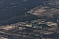 Flug -Rom-Düsseldorf-Hamburg 2013 by-RaBoe 285.jpg 3,666 × 2,435; 1.56 MB
-
 Gladbeck-Gelsenkirchen-Herten - Veltins-Arena + Hoheward+Hoppenbruch (Halde 22) 01 ies.jpg 5,616 × 3,744; 8.01 MB
-
 Gladbeck-Gelsenkirchen-Herten - Veltins-Arena + Hoheward+Hoppenbruch (Halde 22) 02 ies.jpg 5,616 × 3,744; 10.54 MB
-
 Halde Hoppenbruch Geländemodell.jpg 1,920 × 1,080; 1.59 MB
-
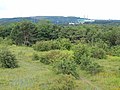
 Halde Hoppenbruch view to.jpg 3,264 × 2,448; 993 KB
-
 Herne Pluto Haldenlandschaft 02.jpg 4,032 × 3,024; 6.82 MB
-
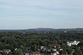 Herten - Halde Hoheward+Halde Hoppenbruch (Halde Rungenberg) 01 ies.jpg 5,616 × 3,744; 9.19 MB
-
 Herten - Halde Hoppenbruch (Balkon 1) 01 ies.jpg 3,888 × 2,592; 1.26 MB
-
 Herten - Halde Hoppenbruch (Ewald-Empore) 01 ies.jpg 3,888 × 2,592; 1.77 MB
-
 Herten - Halde Hoppenbruch (Halde Hoheward) 01 ies.jpg 5,616 × 3,744; 10.89 MB
-
 Herten - Halde Hoppenbruch (Halde Hoheward) 02 ies.jpg 5,616 × 3,744; 10.63 MB
-
 Herten - Halde Hoppenbruch (Halde Hoheward) 03 ies.jpg 5,616 × 3,744; 13.73 MB
-
 Herten - Halde Hoppenbruch (Halde Hoheward) 04 ies.jpg 5,616 × 3,744; 16.08 MB
-
 Herten - Halde Hoppenbruch 01 ies.jpg 2,592 × 3,888; 2.57 MB
-
 Herten - Halde Hoppenbruch 02 ies.jpg 3,888 × 2,592; 2.18 MB
-
 Herten - Halde Hoppenbruch 03 ies.jpg 3,888 × 2,592; 2.87 MB
-
 Herten - Halde Hoppenbruch 04 ies.jpg 3,888 × 2,592; 2.96 MB
-
 Herten - Halde Hoppenbruch 05 ies.jpg 3,888 × 2,592; 3.17 MB
-
 Herten - Halde Hoppenbruch 06 ies.jpg 3,888 × 2,592; 3.79 MB
-
 Herten - Halde Hoppenbruch 07 ies.jpg 3,888 × 2,592; 3.24 MB
-

-
 Herten Emscherbruch Halde Hoppenbruch Brücke.jpg 800 × 1,068; 176 KB
-
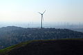
 Hoheward-DSCI0489.jpg 3,072 × 2,304; 2.84 MB
-
 Hoheward-DSCI0492.jpg 3,072 × 2,304; 3.37 MB

_01_ies.jpg)
_02_ies.jpg)


_01_ies.jpg)
_01_ies.jpg)
_01_ies.jpg)
_01_ies.jpg)
_02_ies.jpg)
_03_ies.jpg)
_04_ies.jpg)


_01_ies.jpg)


